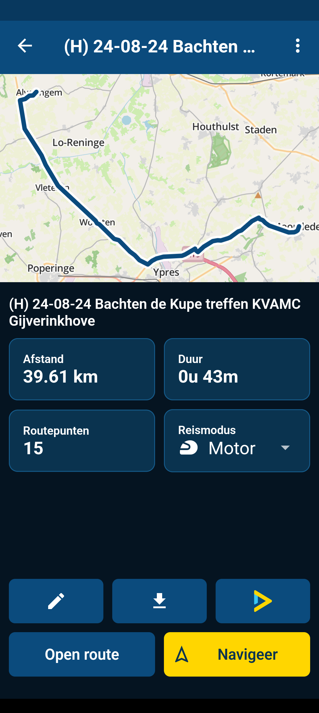
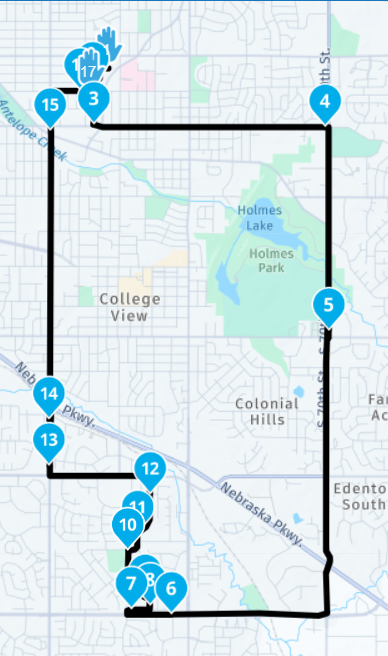
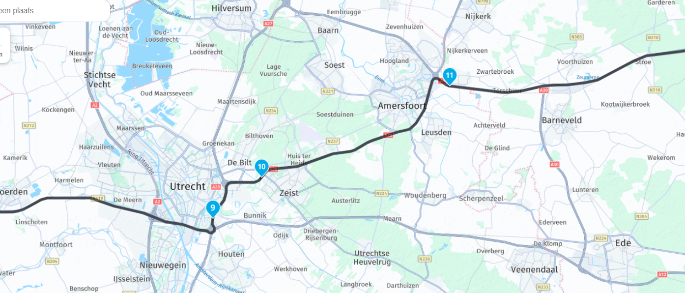
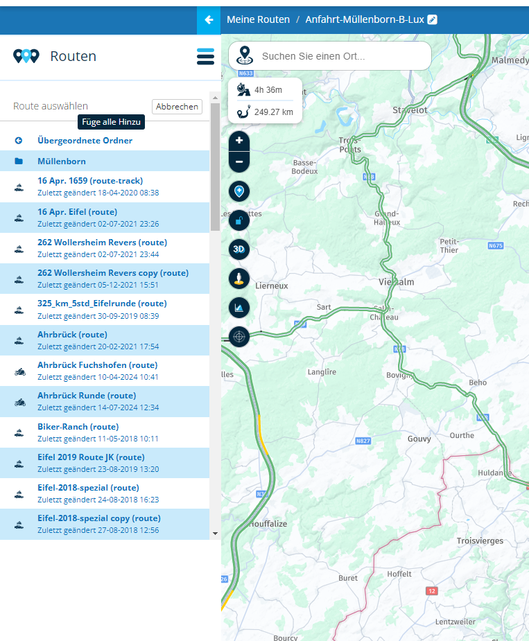
Skip to content

[Web] Problems, Bugs and other Issues

538 Topics 3.9k Posts
  • 0 Votes
    8 Posts
    748 Views
    @Peter-Schiefer, I see. Well then, it is up to the devs if they choose to make that adjustment
  • VIA punten en Tomtom

    15
    0 Votes
    15 Posts
    1k Views
    Garmin maakt onderscheid tussen vormings- en waypoints. Dit zie aan de symbolen. TomTom niet. Of je hebt 100 vlaggetjes in je scherm. Of je hebt niets. Mijn voorkeur is het laatste. Houd mijn scherm en rechterzijbalk overzichtelijk. Bij TomTom betekent ieder vlaggetje ook nog eens extra meldingen in je headset. Als verantwoordelijke voor een route, dien je rekening te houden met het niveau van de groep en de routes zo te maken dat iedereen dus wel stopt bij je lunch, koffie of wat dan ook. Bij MRA kan je extra info aan je punten hangen. Hier maak ik dan ook gebruik van. Als dit niet kon, had MRA weinig meerwaarde voor mij en bleef ik gewoon met TomTom GO met track als basis. Alleen een begin- en eindpunt en zie onderweg wel waar ik stop. TomTom Go is veruit de meest stabiele navigatiesoftware waar ik mee gereden heb. B.T.W Ik maak geen routes voor anderen. Gaan anderen ze wel gebruiken, wordt het ook hun probleem om een goede route te rijden. Soms wel voor mijn buurmijn of een paar collega's maar dan rij ik eigenlijk altijd voorop.
  • maps not loading properly

    3
    0 Votes
    3 Posts
    445 Views
    @Phil-Stiver Hi Phil, I am using the HERE algorithm an my default landing map in the browser is OSM. I don't have any issues. No idea, why you are experiencing this issues. I can change to and from any map and my loading speed is absolutely fine. You might have heard that several times and think it isn't worth trying it, but anyway: Sometimes it is related to your current browser and it can help to reset the browser caches and/or cookies. This helped me from time to time using other web apps. Greetings Tom
  • Route completely messed up when creating route from tracklog

    16
    0 Votes
    16 Posts
    942 Views
    @Guzt thanks for the info on adding the tracklog, I was unaware of that function! Very useful!
  • 0 Votes
    4 Posts
    276 Views
    @RoodSter007 deel de route eens zou ik zeggen...
  • Changing maps

    11
    0 Votes
    11 Posts
    717 Views
    @michael-rello said in Changing maps: @Hans-van-de-Ven-MR-MRA I’m not looking to compare different routes. I’m wanting to take the route I meticulously planed on open streets my Yamaha motorcycle gps) and have my wife see it in Here map(iphone nav next app). When you change the map, it changes the entire planned route. Shaping points are VITAL to force any route to take certain roads. Otherwise, the "other software" will not follow the same route to get to destination. Different software may not respect the shaping points you created with another application. Have you tried creating the route with MyRoute-app then exporting it to your Yamaha GPS? For me, that works amazingly well exporting MyRoute-app (website) to Garmin Zumo. It is possible one of the export options will work for your Yamaha GPS.
  • Minor bug: Calculator text displaying the wrong unit

    2
    0 Votes
    2 Posts
    190 Views
    @Jorge-del-Valle Thanks. I've updated this and will be reflected in the next website update cycle
  • HERE Map slow to load on Website using Windows 10 Chrome browser

    9
    0 Votes
    9 Posts
    1k Views
    I always use the Google Maps layer. More speed. More information. More fun.
  • Hätte gedacht das MRA besser anschneiden würde

    9
    0 Votes
    9 Posts
    634 Views
    @RideOnWithFriends Einfach ignorieren. Ich verstehe software auch nicht, aber das passt in die heutige Zeit: Ein Bekannter von mir hat in einer Facebook-Gruppe mal nach einer leiseren Auspuff-Altenative für seine 1200er GS gefragt und wurde auf das übelste beschimpft und angegriffen. Tom
  • Different and missing information in a PDF vs the web interface

    8
    0 Votes
    8 Posts
    499 Views
    Thank you for your help. Renaming the waypoints did help with the missing items. It didn't help with the incorrect distances though. Up to point 10 it's fine then it becomes incorrect. This to me is a bigger problem than the missing names. If anyone has an idea how to correct it, I would be grateful. As far as it being one route. I will divide the route into dailies, once I have decided the final route. I like to keep it one long route while planning as I find it easier to change and it gives me the total distance and time. [image: 1711874172564-screenshot-2024-03-31_web.png] [image: 1711874172451-screenshot-2024-03-31_pdf.png]
  • Istruzioni

    2
    0 Votes
    2 Posts
    199 Views
    @Giancarlo-Dognini Clic!
  • Fail to use ferry in Here

    5
    0 Votes
    5 Posts
    346 Views
    @Stephan-de-Bie Hi Stephan, the description as TomOnTour works perfect for me since many years, just try it out, i never found a different way of overcoming this topic! Jos
  • Autoveer Maassluis Rozenburg

    16
    0 Votes
    16 Posts
    905 Views
    @Nomko-Nomden Dan heb jij toch ergens een krom voltje in je instellingen staan. Met de reismodus auto en kortste route gaat hij bij mij echt over het veer.
  • Foutmelding bij vergelijken route's

    13
    0 Votes
    13 Posts
    475 Views
    @Huibertus Bedankt voor jullie hulp. Ik ga met jullie oplossingen en adviezen aan de gang.
  • Sharing Route via Email issue?

    8
    0 Votes
    8 Posts
    550 Views
    @Lenny-O on my Android tablet, when I share via email, I'm asked which app I want to use. I select one and it opens fine.
  • Andere layout taakbalk

    5
    0 Votes
    5 Posts
    317 Views
    @Con-Hennekens Helemaal top. Het werkt zo uitstekend. Bedankt voor de snelle reacties
  • Groups function - messaging members

    1
    1 Votes
    1 Posts
    162 Views
    No one has replied
  • Hand vs. drop

    10
    0 Votes
    10 Posts
    715 Views
    @Nick-Carthew Zumo XT2, 50 points is no problem. But in the group we also have a Zumo XT and there I have to make only 29 points (hand) and the rest of the points as a drop. It would be good to set somewhere to make points (hand) in the base.
  • This topic is deleted!

    1
    0 Votes
    1 Posts
    3 Views
    No one has replied
  • Byway Open To All Traffic unrecognized.

    6
    0 Votes
    6 Posts
    386 Views
    @Ben-Lewis Rhiwnant to Claerwen (On and Off Road) If you are serious about riding BOAT's in the UK (And probably the UK TET Routes also) you may want to consider using the OS Maps Software. You can still use MRA to run the routes as Tracklogs which includes the Off-Road and On-Road sections. You simply follow the line. https://www.myrouteapp.com/en/social/track/568605?mode=share
ACTIVE USERS POPULAR TOPICS MY GROUPS