function EXPAND
-
I’ve looked at your route.
You’ve got a couple restrictions active and most important you’ve set the OSM to use the curvy road option
You Said the route was a gpx file to start with.
What does the original gpx route look like.
If you expand while use curvy road is active you’ll get a different route -
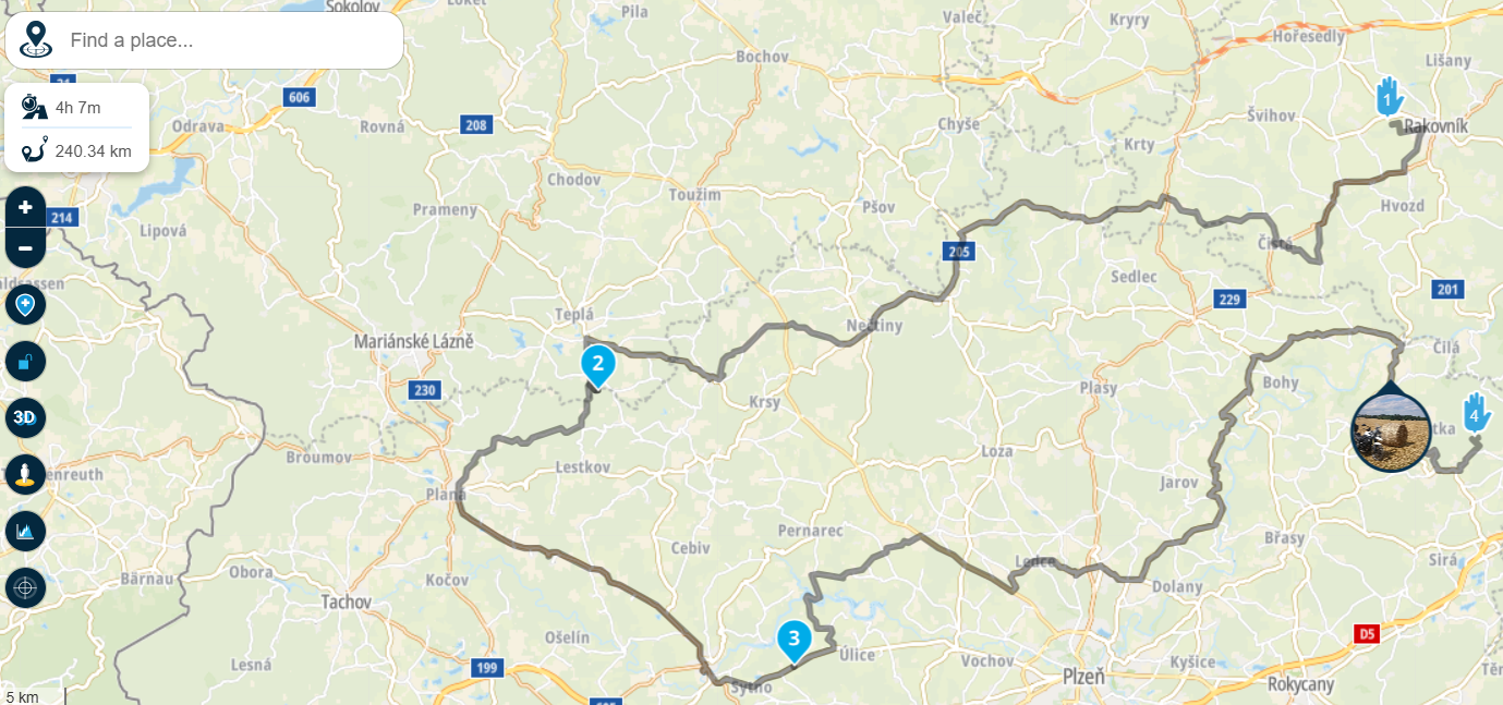
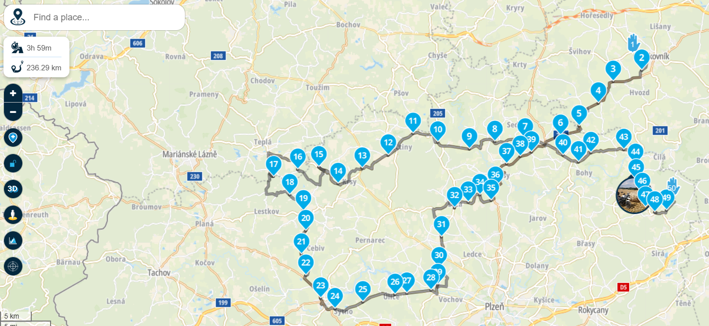
I did not create it directly in OSM, but in MRA through the OSM layer, see picture. Yes in the settings it was zigzag, out of town, off highway. I liked the route and that's why I wanted to add more waypoints, so that the navigation (MRA) would navigate me exactly along this route, because I know that MRA follows HERE and it has a different algorithm for creating routes and would guide me differently. Unfortunately after adding 50 points it created a completely different route. I kindly assumed that it would add the points to my original route. Now I hastily made a second route and the same result.
-
there is link on second route
https://www.myrouteapp.com/en/social/route/11665201?mode=share -
there is video for example how created route
https://k00.fr/kvxz2d3t -
2 possibilitys
When you’re done like in the first video, try to export that as a gpx track
Then upload that gpx to MRA and open it while Here is your standard map
2 put a lot shapingpoints, I mean a lot, by hand in that first route and then change the map to HereHonda Goldwing GL1500,
Honda Silverwing GL 650
DMD2 T865X 8 inch Android tablet using MRA next for navigation
Garmin XT sold
Samsung S24FE mounted on a Quadlock and using Android Auto in my car -
I am a bit confused? I usually use the same process with open street maps. I have no idea why you get a totally different route when you expand with more waypoints.
Hardware
iPhone 12 pro (iOS 26.2.1)
iPad (7.Gen.) 18.7.3
Oukitel RT3 Pro (Andr. 14)
Wireless CarPlay mit (Elebest C650)
Wired CarPlay (SEAT Arona - 2021)
MRA Workshops in Deutsch sind hier zu finden -
2 possibilitys
When you’re done like in the first video, try to export that as a gpx track
Then upload that gpx to MRA and open it while Here is your standard map
2 put a lot shapingpoints, I mean a lot, by hand in that first route and then change the map to Here@Marinus-van-Deudekom said in function EXPAND:
2 possibilitys
When you’re done like in the first video, try to export that as a gpx track
Then upload that gpx to MRA and open it while Here is your standard map
2 put a lot shapingpoints, I mean a lot, by hand in that first route and then change the map to HereI tried this as well and was surprised that the gpx file (the track) is different when you export (save) it from the original.
Whats wrong here?
I made routes with open street maps by using sections and curvy roads and filled it as well with waypoints to use it for navigation with Here map. I can't remember having this problem.
-
So probably a bug, because I used this feature once and it worked as it should. Now it's unusable. Thank you for your efforts. Is there any way to send this bug to the developers?
-
Yes, contact the support.
-
I am a bit confused? I usually use the same process with open street maps. I have no idea why you get a totally different route when you expand with more waypoints.
@Jörgen said in function EXPAND:
I am a bit confused? I usually use the same process with open street maps. I have no idea why you get a totally different route when you expand with more waypoints.
I am not so sure. This is not my method of creating routes, but isn't it so that Curvy options have some kind of randomness in it, exactly to prevent always getting the same roads? I am not surprised that this happens, I would be surprised about how it worked before when it did not change the route
")
I am just an enthusiastic MRA user, and hope you will be one too!
Most motorcycle problems are caused by the nut that connects the handlebar to the saddle.
Check out RideSleepRepeat.eu, a biker community for sharing stays across Europe
-
@Jörgen said in function EXPAND:
I am a bit confused? I usually use the same process with open street maps. I have no idea why you get a totally different route when you expand with more waypoints.
I am not so sure. This is not my method of creating routes, but isn't it so that Curvy options have some kind of randomness in it, exactly to prevent always getting the same roads? I am not surprised that this happens, I would be surprised about how it worked before when it did not change the route
@Con-Hennekens I've created a route using that tool in the TomTom map and couldn't get rid of the algorithms when I extended the route with a piece of highway. The way out was then to export the curvy part as a gpx track with I then uploaded in MRA. Yep a bit complicated
-
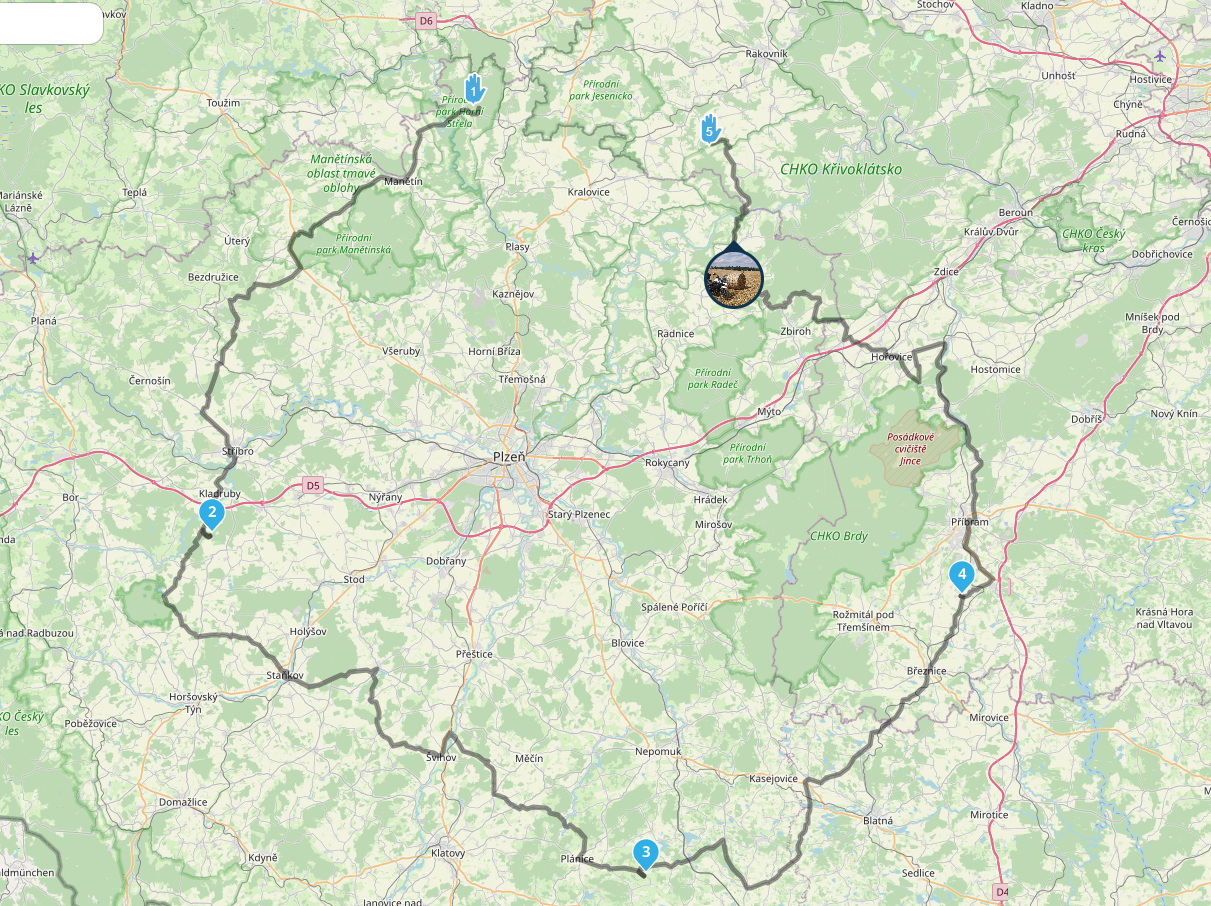
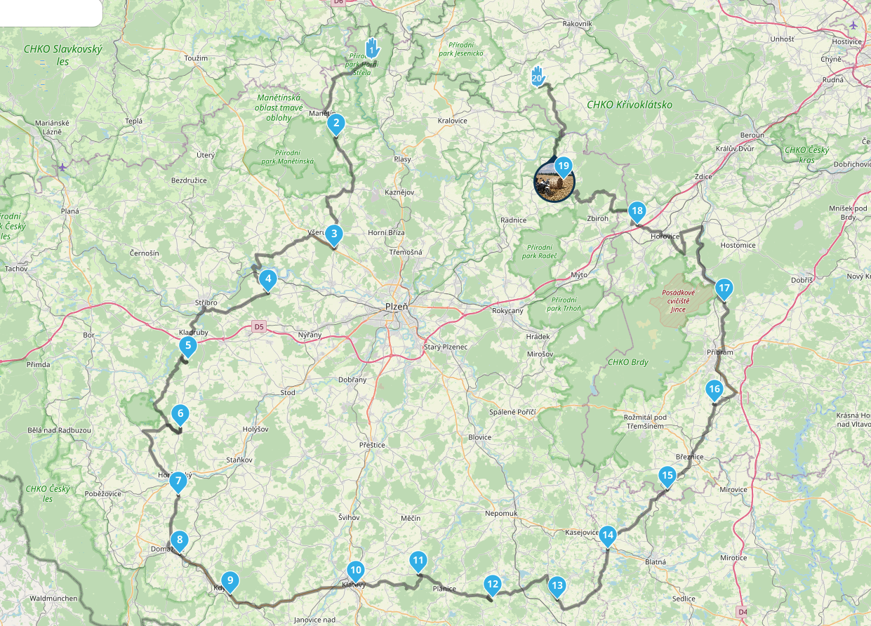
So I found a bug. when I perform the same action on the base of TOM TOM maps, the "EXPAND" function works as I want. On the OSM base it generates a different route. I attach a video of the creation on TOM TOM
video TOM TOM (there is OK):
https://k00.fr/n1vrs605video OSM (wrong route):
https://k00.fr/kvxz2d3t -
@Con-Hennekens that is also not my usually method.
But when I create a curvy route (with what ever map) it should be possible to use them in MRA navigation as created.
So, why is the exported gpx file already total different to what was seen on the screen?
And why do I get a totally different route, when I expand what I see on the screen? -
So I found a bug. when I perform the same action on the base of TOM TOM maps, the "EXPAND" function works as I want. On the OSM base it generates a different route. I attach a video of the creation on TOM TOM
video TOM TOM (there is OK):
https://k00.fr/n1vrs605video OSM (wrong route):
https://k00.fr/kvxz2d3t@Karel76 said in function EXPAND:
So I found a bug. when I perform the same action on the base of TOM TOM maps, the "EXPAND" function works as I want. On the OSM base it generates a different route. I attach a video of the creation on TOM TOM
video TOM TOM (there is OK):
https://k00.fr/n1vrs605video OSM (wrong route):
https://k00.fr/kvxz2d3tThat is not a bug. TomTom and OSM use different card material and different algorythms for calculation of the route. Compared with different setting like cury route, restrictions like don´t use highways, etc. that behaviour is absolutely normal.
-
@erdna, you may be right. But this is not the point. Why is MRA making a totally different route when waypoints are added (with openstreet map)?
WP should be added to the route that was created with OPM as well as it is done with TT map.Hardware
iPhone 12 pro (iOS 26.2.1)
iPad (7.Gen.) 18.7.3
Oukitel RT3 Pro (Andr. 14)
Wireless CarPlay mit (Elebest C650)
Wired CarPlay (SEAT Arona - 2021)
MRA Workshops in Deutsch sind hier zu finden -
@erdna, you may be right. But this is not the point. Why is MRA making a totally different route when waypoints are added (with openstreet map)?
WP should be added to the route that was created with OPM as well as it is done with TT map.@Jörgen said in function EXPAND:
Why is MRA making a totally different route when waypoints are added (with openstreet map)?
Seemingly that is due to a randomize function in the automatic creation of scenic routes. A curvy route between 2 points can be different from a curvy route between three points, even when the middle point is on the original 2-point route. That does not sound completely illogical to me.
WP should be added to the route that was created with OPM as well as it is done with TT map.
Remember that routes are calculated by the map-providers, not by MRA. Each map provider does things differently. That is nothing new.
I am just an enthusiastic MRA user, and hope you will be one too!
Most motorcycle problems are caused by the nut that connects the handlebar to the saddle.
Check out RideSleepRepeat.eu, a biker community for sharing stays across Europe
-
OK,
I'll leave MRA and a software problem aside for now.
Adding loads of shaping points seems impractical to me.
There is <Compare route calculation with>.
Then you set shaping points to make the routes congruent. Incidentally, that was one of the parts involved in the creation of MRA")
Or you can display the route as an overlay (on the left side of the menu). This would also work with a track log. Or simply the desired route. And on this basis, you then create a new route with the route engine of your choice.
I find the first alternative nicer and faster.
Interesting topic, maybe I'll add it to my to-do list for the next video conference.
RTTranslated with DeepL.com (free version)
-
@Jörgen said in function EXPAND:
Why is MRA making a totally different route when waypoints are added (with openstreet map)?
Seemingly that is due to a randomize function in the automatic creation of scenic routes. A curvy route between 2 points can be different from a curvy route between three points, even when the middle point is on the original 2-point route. That does not sound completely illogical to me.
WP should be added to the route that was created with OPM as well as it is done with TT map.
Remember that routes are calculated by the map-providers, not by MRA. Each map provider does things differently. That is nothing new.
@Con-Hennekens said in function EXPAND:
@Jörgen said in function EXPAND:
Why is MRA making a totally different route when waypoints are added (with openstreet map)?
Seemingly that is due to a randomize function in the automatic creation of scenic routes. A curvy route between 2 points can be different from a curvy route between three points, even when the middle point is on the original 2-point route. That does not sound completely illogical to me.
WP should be added to the route that was created with OPM as well as it is done with TT map.
Remember that routes are calculated by the map-providers, not by MRA. Each map provider does things differently. That is nothing new.
Ok, I understand that different maps generate different routes. The curvy function in OSM and TT are fine. And with TT generated routes, I can take them nearly 1:1 when I add WP to use with HERE (and navigation).
But why does it not work with OSM (nearly like in TT)?
If I can not use the generated route, what sens does this function make?
Or, how to solve this issue easily? (ok, you could add WP manually -
@Jörgen said in function EXPAND:
Why is MRA making a totally different route when waypoints are added (with openstreet map)?
Seemingly that is due to a randomize function in the automatic creation of scenic routes. A curvy route between 2 points can be different from a curvy route between three points, even when the middle point is on the original 2-point route. That does not sound completely illogical to me.
WP should be added to the route that was created with OPM as well as it is done with TT map.
Remember that routes are calculated by the map-providers, not by MRA. Each map provider does things differently. That is nothing new.
@Con-Hennekens said in function EXPAND:
@Jörgen said in function EXPAND:
Why is MRA making a totally different route when waypoints are added (with openstreet map)?
Seemingly that is due to a randomize function in the automatic creation of scenic routes. A curvy route between 2 points can be different from a curvy route between three points, even when the middle point is on the original 2-point route. That does not sound completely illogical to me.
Sorry Con, but it is totally illogical. With this tool, one expects MRA maintains the route. The route is already calculated, why not put the new added points on the route "as is", that would be logical. There is no use of a "new calculation" because the parameters for calculating the route didn't change.
Met andere apps maak je een route, met MRA componeer je een route!
Ducati Monster 1200 met Garmin Zümo XT
Fiat 124 Spider/Camper Dethleffs met Navigation-App op Samsung Tab Active4 Pro
MRA Lifetime Gold -
By the way, I was there in that area, it is very nice!
https://routes.lexwill.cyou/cabriotour-tsjechie-2025/Met andere apps maak je een route, met MRA componeer je een route!
Ducati Monster 1200 met Garmin Zümo XT
Fiat 124 Spider/Camper Dethleffs met Navigation-App op Samsung Tab Active4 Pro
MRA Lifetime Gold
Hello! It looks like you're interested in this conversation, but you don't have an account yet.
Getting fed up of having to scroll through the same posts each visit? When you register for an account, you'll always come back to exactly where you were before, and choose to be notified of new replies (either via email, or push notification). You'll also be able to save bookmarks and upvote posts to show your appreciation to other community members.
With your input, this post could be even better 💗
Register Login-
71045.0k
-
0483
-
744598
-
1643
-
09290
-
04237
-
011176
-
06197
