Discrepancy between Planner and NavigationApp
-

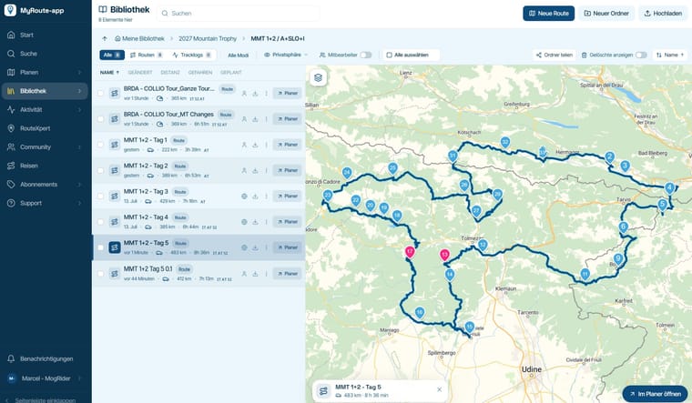
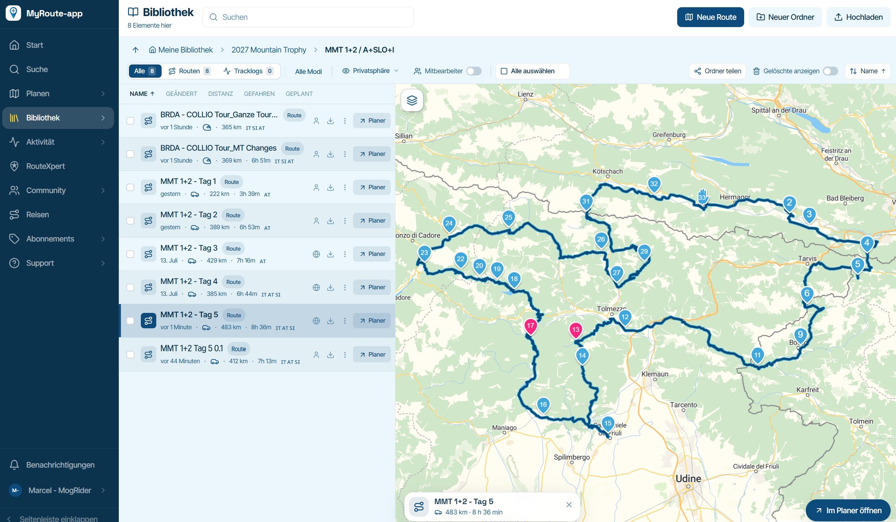
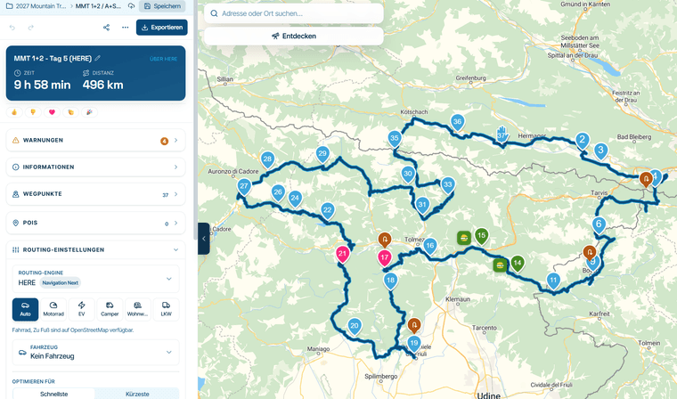
I planned a route with a total of 33 route points in beta Planner (see screenshot).
When I open this route on the mobile phone app (upgraded to beta already), it shows 97 waypoints and a totally different duration and km´s , although the map overview shows the same route (see 2nd screenshot).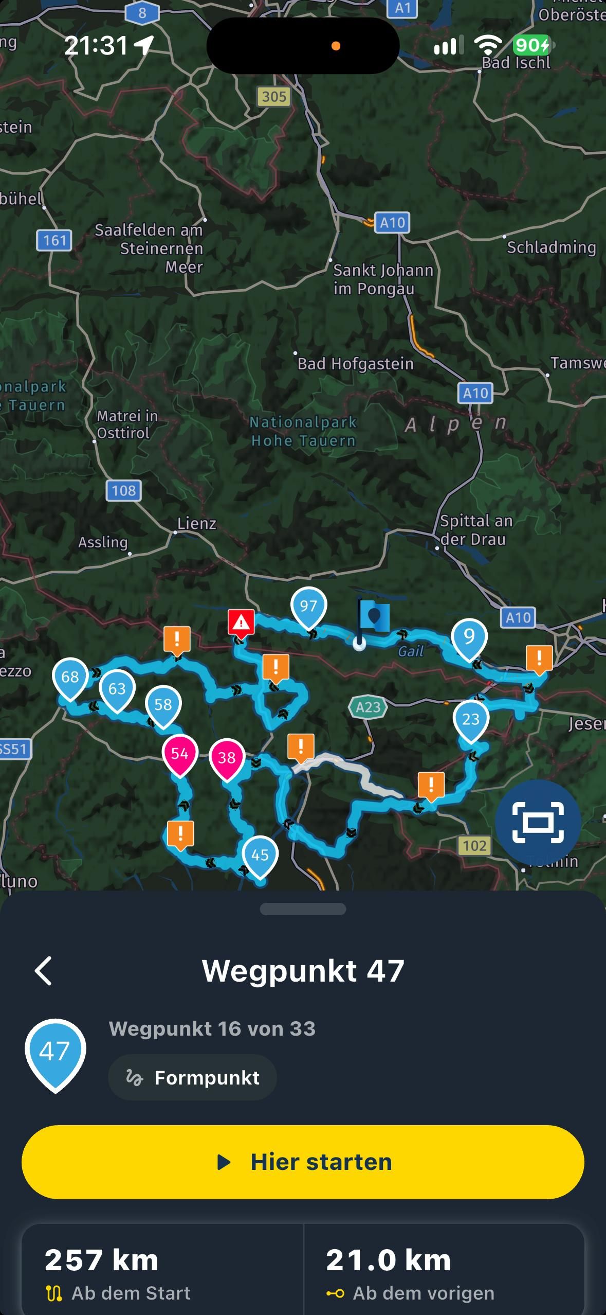
Help needed - suspect a bug, or is it a layer 7 problem?
-

Probably not a HERE route so you’d have seen a warning that it was converted to a navigable route. That changes some numbering.
Create routes in HERE when navigating with our app
-
Thanks, Corjan. This creates the next questions: I copied the route, and took 1x OSM as engine, and 1x HERE.
While in view, the km and hours/duration differs (especially time by over 1 hr), but after save, it still shows OSM data, also when re-opening the HERE version.
So, the routing engine setting is not consistant when closing planning.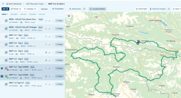
-
BTW: I had to force HERE to follow a small street by placing 3 extra route points, which were not necessary with OSM. Then, it was possible, without it made a detour of 40 km.
-

Did you switch on Traffic (upper right corner?) Maybe there is a road block e.g. reconstruction site, one-way etc.
-
I reported a similar discrepancy between routeplanner estimate and navigation estimate (both using HERE) in the beta forum - I wasn’t sure whether this was a beta routeplanner issue but perhaps it belongs here.
Here’s what I found:
-
bigger than expected difference between beta routeplanner’s duration estimate (1h29) and the estimate I got when I started navigating (2h15 inc 18 min traffic, ie 1h57). What causes such a big divergence? (Actual duration when driven: about 2h 10 with little traffic).
-
mid journey the duration suddenly leapt to over 4h, including 2h of traffic. This was completely phantom - there was no 2h traffic jam
-
when I pulled over to look I saw that it had also invented a series of seasonal road closures which don’t exist as far as I know (this is southern England between Hungerford and Inkpen, not the alps). Bizarrely, it had allocated 11 minutes delay to each point. (this still didn’t add up to 2 hours jam either). As I drove the route these disappeared again, and there was of course also no closure or delay - eventually the estimate returned to normal.
Beta forum post has more info: https://forum.myrouteapp.com/topic/12365/carplay-oddities
-
-
 Nick Carthew moved this topic from [App] Problems, Bugs and other Issues
-
It is good idea to plan on the Here map and use the OSM map to compare the route. This method reduces the discrepancy a lot. Every map uses it own algortimes and because of that the course of the route can differ.
In screenshot of the phone i see a lot of orange and red warning signs. I suspect this also affect the course of the actual route.When i make a route between point 11 and 12 i see there are more option to ride from 11 to 12. The shape on the phone is an alternative route.
Simply put. Use more points to force the navigation to take the direction you planned.
Hello! It looks like you're interested in this conversation, but you don't have an account yet.
Getting fed up of having to scroll through the same posts each visit? When you register for an account, you'll always come back to exactly where you were before, and choose to be notified of new replies (either via email, or push notification). You'll also be able to save bookmarks and upvote posts to show your appreciation to other community members.
With your input, this post could be even better 💗
Register Login-
 01585
-
 01385
-
 0728
-
Website update - Keyboard shortcuts, route status, every Discover category and more of your feedback
 6786
-
0841
-
06133
-
11083
-
1537