No info for the route
-
Using a route for a ride I planned on famaliar roads, Immediately, next wants to take me on an alternate route, my original route was 230Kms and close to 3 hours of riding.
Almost right away, this jumps to 600Kms and 8 hrs of riding, and showing me 2 or 3 alternate routes although I dont see a destination.
after a coffee stop, and 90mins later, it is still trying to take me off my route, time to destination has jumped to 11 hours still 600Kms, the info on screen is not showing a countdown of time or mileage for the route I am using, just to the mystery destination, my tom tom that I am using for a comparison is working perfectly, showing me the turns I need to make, and time and distance to go.
Next was showing my route that I downloaded but gave me no navigation info, around 2 thirds the way through my trip, the info for time and distance stopped updating and stayed at 14+hrs to go, 636 Kms. at this point I cant trust the info NEXT is giving me. -
Using a route for a ride I planned on famaliar roads, Immediately, next wants to take me on an alternate route, my original route was 230Kms and close to 3 hours of riding.
Almost right away, this jumps to 600Kms and 8 hrs of riding, and showing me 2 or 3 alternate routes although I dont see a destination.
after a coffee stop, and 90mins later, it is still trying to take me off my route, time to destination has jumped to 11 hours still 600Kms, the info on screen is not showing a countdown of time or mileage for the route I am using, just to the mystery destination, my tom tom that I am using for a comparison is working perfectly, showing me the turns I need to make, and time and distance to go.
Next was showing my route that I downloaded but gave me no navigation info, around 2 thirds the way through my trip, the info for time and distance stopped updating and stayed at 14+hrs to go, 636 Kms. at this point I cant trust the info NEXT is giving me.@Paul-Foster, Where were you riding? Can you share a link to the route (make it public too!). Is it possible that you have seasonal road closures in your route?
-
It indeeds sounds like a routing issue.
There is a minor mismatch between the map versions of the website and the app. Therefore things like this can happen at this point. This issue will be resolved before eventual public release.
-
@Paul-Foster, Where were you riding? Can you share a link to the route (make it public too!). Is it possible that you have seasonal road closures in your route?
@Con-Hennekens The route is public, the route is in the alicante area of spain, there are no seasonal closures in this area.
-
@Con-Hennekens The route is public, the route is in the alicante area of spain, there are no seasonal closures in this area.
@Paul-Foster, that may well be, but you didn't link it here

-
-
@Paul-Foster, I cannot really try your route in the mobile app since I suffer the appcrashes constantly, maybe someone else can. But I do see you stored your route with the TomTom Map. Navigation (Next) uses the Here map. Open it, convert to Here map and try again. I cannot image that it can lead to such a big difference in route distance, but it's worth a try.
-
@Paul-Foster The first thing that I noticed with the route that you shared is it is planned using the TomTom map. Now I'm not saying that by converting it to the Here map the problem will be solved, but it would at least eliminate one possibility. MRA Navigation uses the Here map.
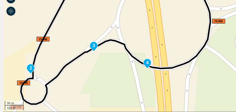
When I open your route using the Here planning map I notice that several route points are too close to junctions, roundabouts and viaducts. It is advisable to avoid placing route points too close to these to allow for any discrepancies in the accuracy of the map when made and the satellite signal that you are receiving when navigating. I would suggest no closer than 20m. Again, this might not solve the problem but it is best practice when creating routes. As is fully zooming in to accurately position route points on the track line.
