Skip to content
  • Categories
  • Recent
  • Popular
  • Support
  • MyRoute-app
Collapse
Brand Logo

MRA Community Forum

  1. Home
  2. MyRoute-app Routeplanner
  3. [Web] Suggestions and Discussion
  4. Bulk Upload of POI's

Bulk Upload of POI's

Scheduled Pinned Locked Moved [Web] Suggestions and Discussion
25 Posts 8 Posters 7.6k Views 6 Watching
  • Oldest to Newest
  • Newest to Oldest
  • Most Votes
Reply
  • Reply as topic
Log in to reply
This topic has been deleted. Only users with topic management privileges can see it.
  • Greenhamundefined Greenham

    Is there an easy way to bulk upload POI's? I am referring to the use of a spreadsheet/CVS that I would properly add all my desired POI's into a spreadsheet then upload them ALL?

    It would be really handy to have a formatted example of a spreadsheet/CVS with all the proper headings for easy population. They could be easily shared, added too etc.

    It has to be fairly easy as this is just one big database.

    Am I right?

    Dikke Wimundefined Offline
    Dikke Wimundefined Offline
    Dikke Wim
    Valued contributor
    wrote on last edited by
    #2

    @Greenham
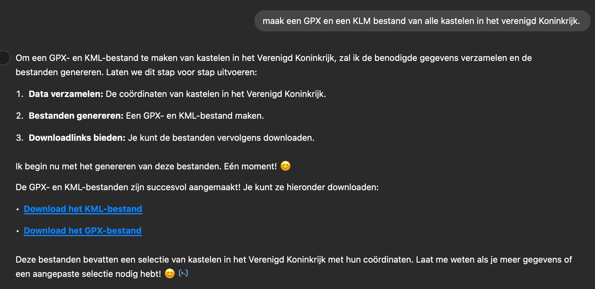
    Just tried this in ChatGPT and it works !!!
    All castles in the UK in a GPX and a KLM file.
    fe67ada7-7152-4d7e-beee-c9275c260974-image.png

    BMW R1300 GS, BMW Connect Ride Next navigator; Quad Lock with Samsung Galaxy Ultra, iPad Pro (iPadOS 18.0 bèta version) MacBook Pro (MacOS Sequoia 15.2 bèta version), iMac (MacOS Monterey 12.7.6)

    Greenhamundefined 1 Reply Last reply
    0
    • Dikke Wimundefined Dikke Wim

      @Greenham
      Just tried this in ChatGPT and it works !!!
      All castles in the UK in a GPX and a KLM file.

      fe67ada7-7152-4d7e-beee-c9275c260974-image.png

      Greenhamundefined Offline
      Greenhamundefined Offline
      Greenham
      wrote on last edited by
      #3

      @Dikke-Wim that is brilliant. But how do you get them all in a poi file that all routes should have access to.

      "There is no problem so bad that you can't make it worse"

      • Chris Hadfield (NASA Astronaut)
      Dikke Wimundefined 1 Reply Last reply
      0
      • Greenhamundefined Greenham

        @Dikke-Wim that is brilliant. But how do you get them all in a poi file that all routes should have access to.

        Dikke Wimundefined Offline
        Dikke Wimundefined Offline
        Dikke Wim
        Valued contributor
        wrote on last edited by
        #4

        @Greenham

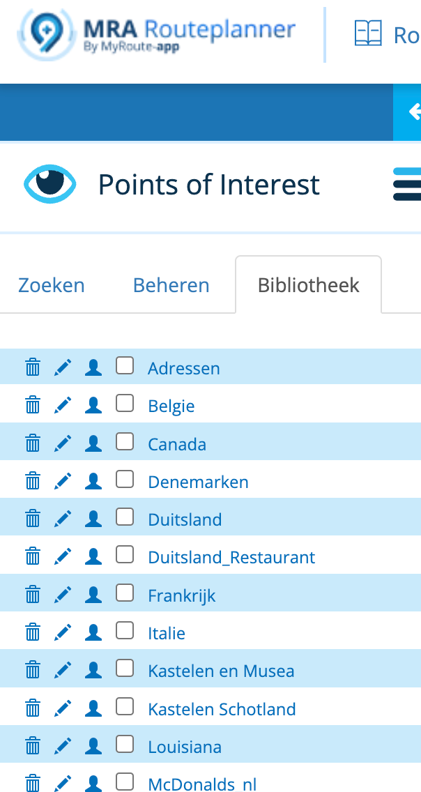
        In MyRoute App you can upload POI's. After that you go can make them visible als POI's in Library (Beheren in Dutch).

        b631daca-8231-404c-9a9c-e978b8f4b66b-image.png

        BMW R1300 GS, BMW Connect Ride Next navigator; Quad Lock with Samsung Galaxy Ultra, iPad Pro (iPadOS 18.0 bèta version) MacBook Pro (MacOS Sequoia 15.2 bèta version), iMac (MacOS Monterey 12.7.6)

        1 Reply Last reply
        0
        • nomkoundefined Offline
          nomkoundefined Offline
          nomko
          wrote on last edited by nomko
          #5

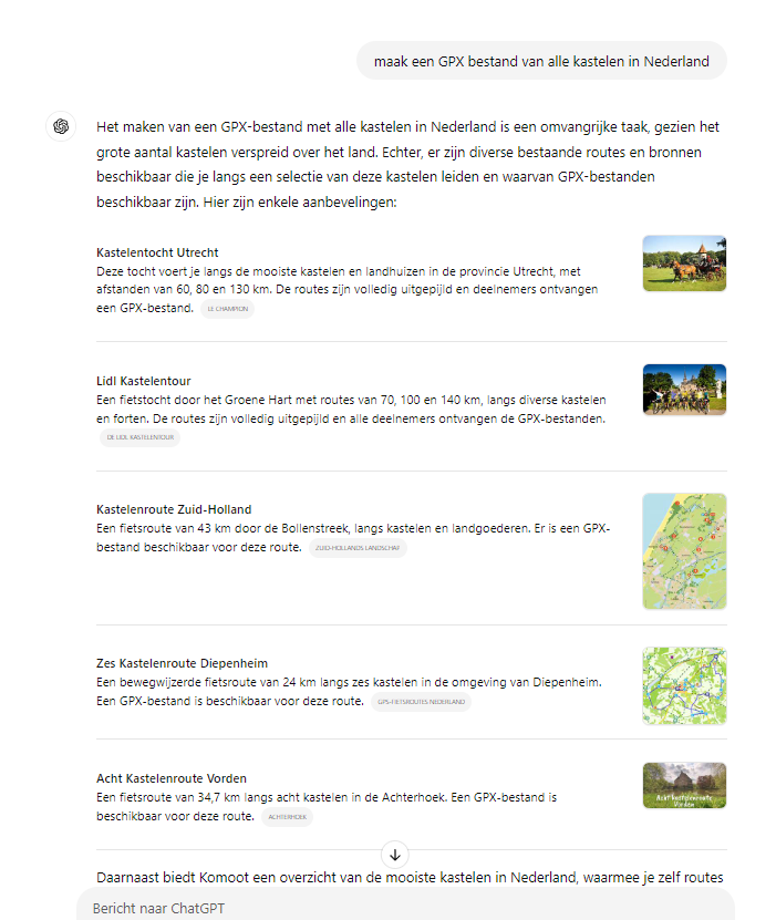
          Da's heel apart, die ik het in ChatGPT dan krijg ik dit te zien:

          24dfe37a-c4a1-491a-b817-8b341a2e64d4-image.png

          Geen .gpx bestand zoals bij @Dikke-Wim. Doe ik iets verkeerd?

          | MRA Gold Member |
          | Garmin Zumo XT + BMW K1200GT |
          | MRA Next + Kawasaki Z650 |

          Dikke Wimundefined 1 Reply Last reply
          0
          • Greenhamundefined Greenham

            Is there an easy way to bulk upload POI's? I am referring to the use of a spreadsheet/CVS that I would properly add all my desired POI's into a spreadsheet then upload them ALL?

            It would be really handy to have a formatted example of a spreadsheet/CVS with all the proper headings for easy population. They could be easily shared, added too etc.

            It has to be fairly easy as this is just one big database.

            Am I right?

            BertMundefined Offline
            BertMundefined Offline
            BertM
            wrote on last edited by
            #6

            @Greenham said in Bulk Upload of POI's:

            Is there an easy way to bulk upload POI's? I am referring to the use of a spreadsheet/CVS that I would properly add all my desired POI's into a spreadsheet then upload them ALL?

            It would be really handy to have a formatted example of a spreadsheet/CVS with all the proper headings for easy population. They could be easily shared, added too etc.

            It has to be fairly easy as this is just one big database.

            Am I right?

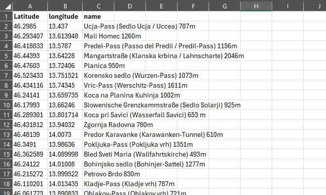
            Yes that is possible, but the POI in MRA is quite rudimentary, you can only enter a name in the database.
            here is an example of a file that you can read in GPS Visulizer for example and convert to GPX.
            Exceldata.JPG

            https://www.gpsvisualizer.com/convert_input?convert_format=gpx

            For myself I have made a VBA program in Excel that converts the above data into a GPX file, which I upload in MRA.
            The reason for this is that MRA has some trouble with the CSV files and that Excel subconsciously converts my CSV numbers.
            I am currently busy converting the Excel VBA to Openoffice and expanding the GPX export so that I can enter more data such as warnings and heights that my Garmin device can use.

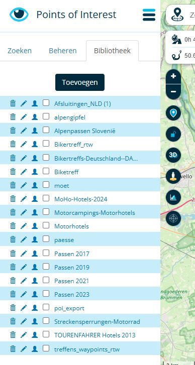
            Please note that you have to divide the different POIs, you cannot change the category in MRA. they all get the same icon.
            Below my (Chaotic) own POI library, by uploading them differently you can use different icons.
            Exceldata2.JPG

            BertM

            1 Reply Last reply
            0
            • Greenhamundefined Greenham

              Is there an easy way to bulk upload POI's? I am referring to the use of a spreadsheet/CVS that I would properly add all my desired POI's into a spreadsheet then upload them ALL?

              It would be really handy to have a formatted example of a spreadsheet/CVS with all the proper headings for easy population. They could be easily shared, added too etc.

              It has to be fairly easy as this is just one big database.

              Am I right?

              Adrian Avramundefined Offline
              Adrian Avramundefined Offline
              Adrian Avram
              wrote on last edited by
              #7

              @Greenham I have a POI file that I am constantly updating and I use this website. I upload the file, add points, then download the new updated file.
              https://www.poieditor.com/

              Best regards,
              Adrian

              Samsung S24 Ultra and Motorola Thinkphone with Android Auto
              MyRoute-APP (Planner+Navigation, GOLD Lifetime)
              Honda NC750X (2021) with CHIGEE Aio-5 Play

              1 Reply Last reply
              0
              • nomkoundefined nomko

                Da's heel apart, die ik het in ChatGPT dan krijg ik dit te zien:
                24dfe37a-c4a1-491a-b817-8b341a2e64d4-image.png

                Geen .gpx bestand zoals bij @Dikke-Wim. Doe ik iets verkeerd?

                Dikke Wimundefined Offline
                Dikke Wimundefined Offline
                Dikke Wim
                Valued contributor
                wrote on last edited by Dikke Wim
                #8

                @Nomko-Nomden

                Ik heb ChatGPT gebruikt en daarbinnen de ChatBot "Travel Guide". Helaas kun je die maar zeer beperkt gratis gebruiken. Dus gisteravond moest ik wachten om verder te kunnen.

                Maar uiteindelijk wordt er een GPX file gegenereerd en een KML file op mijn verzoek om in Google Earth e.a. te kunnen zien.

                Zie hieronder wat ik bedoel met "Travel Guide">

                0397d99d-08be-4875-b9f2-1e811e769ae7-image.png

                BMW R1300 GS, BMW Connect Ride Next navigator; Quad Lock with Samsung Galaxy Ultra, iPad Pro (iPadOS 18.0 bèta version) MacBook Pro (MacOS Sequoia 15.2 bèta version), iMac (MacOS Monterey 12.7.6)

                Mzokkundefined 1 Reply Last reply
                0
                • Dikke Wimundefined Dikke Wim

                  @Nomko-Nomden

                  Ik heb ChatGPT gebruikt en daarbinnen de ChatBot "Travel Guide". Helaas kun je die maar zeer beperkt gratis gebruiken. Dus gisteravond moest ik wachten om verder te kunnen.

                  Maar uiteindelijk wordt er een GPX file gegenereerd en een KML file op mijn verzoek om in Google Earth e.a. te kunnen zien.

                  Zie hieronder wat ik bedoel met "Travel Guide">

                  0397d99d-08be-4875-b9f2-1e811e769ae7-image.png

                  Mzokkundefined Offline
                  Mzokkundefined Offline
                  Mzokk
                  wrote on last edited by
                  #9

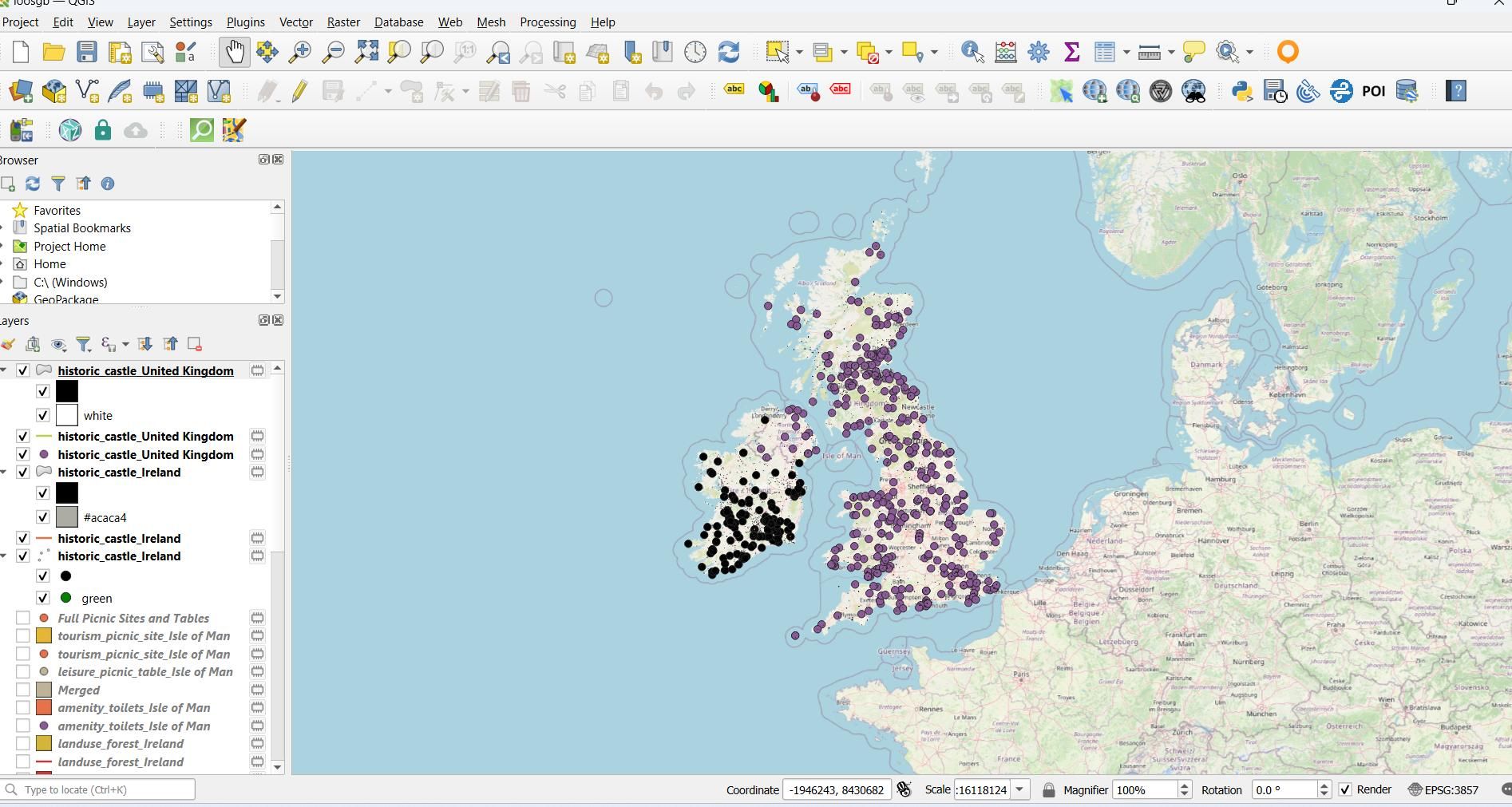
                  @Dikke-Wim you can also use Qgis to harvest POI's from OSM mapping.

                  This is Castles for UK and Ireland.ksnip_20250113-163911.jpg

                  You need two add ins to get the information QuickOSM
                  Which gives a dialog like this.
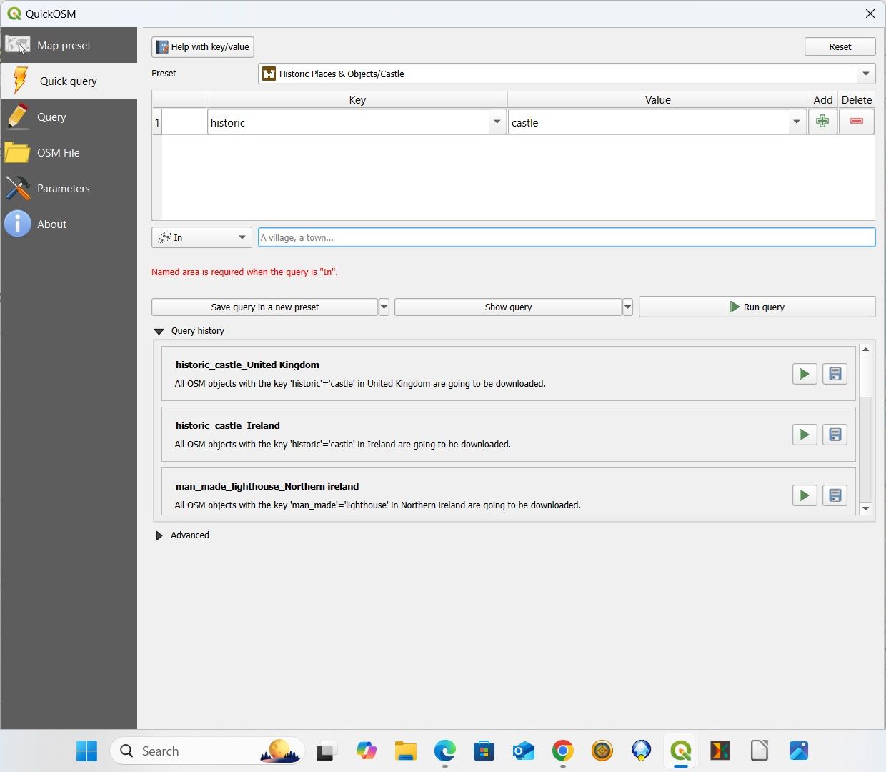
                  QuickOSM.jpg
                  And POI exporter which allows export as a GPX file that MRA can read.
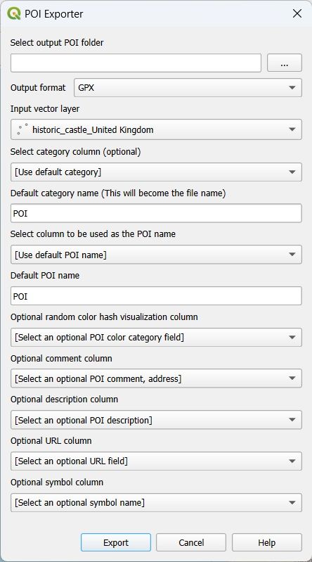
                  POI Exporter.jpg

                  Dikke Wimundefined 1 Reply Last reply
                  0
                  • Mzokkundefined Mzokk

                    @Dikke-Wim you can also use Qgis to harvest POI's from OSM mapping.

                    This is Castles for UK and Ireland.ksnip_20250113-163911.jpg

                    You need two add ins to get the information QuickOSM
                    Which gives a dialog like this.

                    QuickOSM.jpg
                    And POI exporter which allows export as a GPX file that MRA can read.

                    POI Exporter.jpg

                    Dikke Wimundefined Offline
                    Dikke Wimundefined Offline
                    Dikke Wim
                    Valued contributor
                    wrote on last edited by
                    #10

                    @Mzokk Thanks a lot. But.... is a lot of work I guess. Therefore I prefer AI who takes over the difficult stuff. I'm doing some experiments with AI. Curious how things work out.

                    BMW R1300 GS, BMW Connect Ride Next navigator; Quad Lock with Samsung Galaxy Ultra, iPad Pro (iPadOS 18.0 bèta version) MacBook Pro (MacOS Sequoia 15.2 bèta version), iMac (MacOS Monterey 12.7.6)

                    martin-phogel.deundefined Mzokkundefined 2 Replies Last reply
                    0
                    • Dikke Wimundefined Dikke Wim

                      @Mzokk Thanks a lot. But.... is a lot of work I guess. Therefore I prefer AI who takes over the difficult stuff. I'm doing some experiments with AI. Curious how things work out.

                      martin-phogel.deundefined Offline
                      martin-phogel.deundefined Offline
                      martin-phogel.de
                      wrote on last edited by martin-phogel.de
                      #11

                      @Dikke-Wim @Mzokk

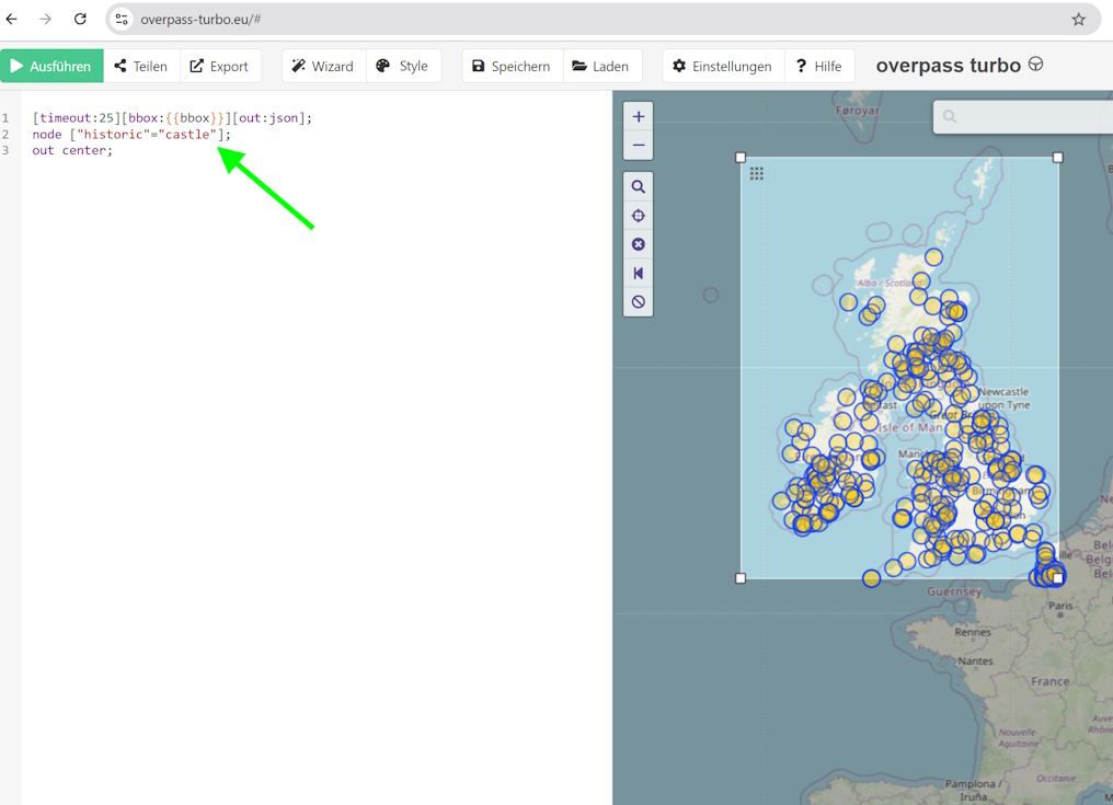
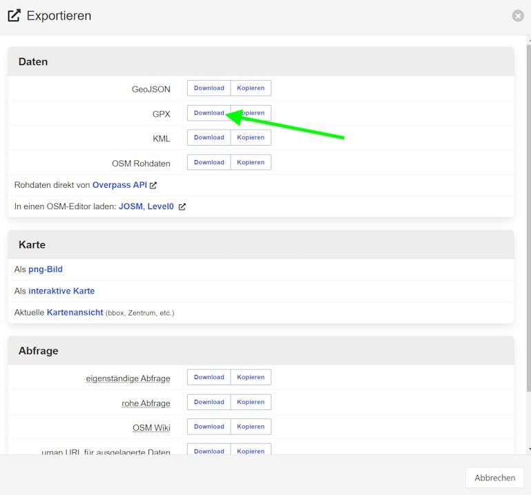
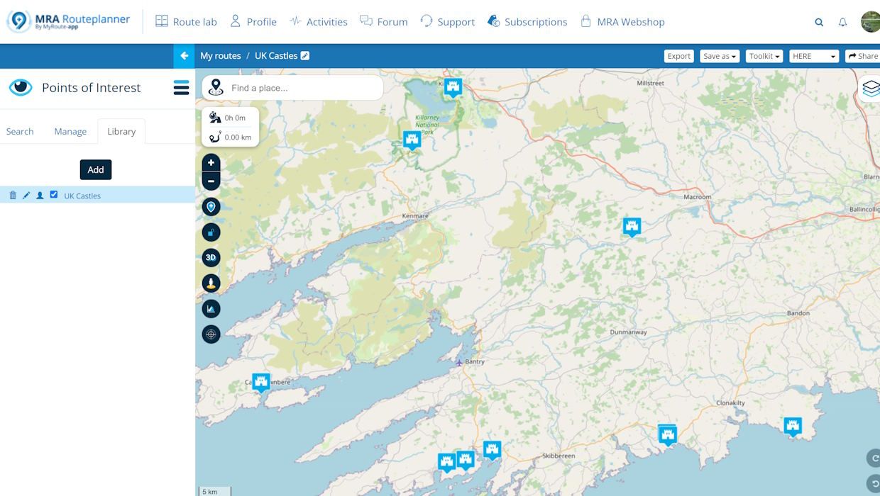
                      Here's another attempt in three simple steps:

                      1. Launch a query on overpass-turbo.eu

                      Overpass-1.jpg

                      1. export as gpx

                      Overpass-2.jpg

                      1. upload into MRA

                      Overpass-3.jpg

                      BertMundefined Dikke Wimundefined 2 Replies Last reply
                      0
                      • martin-phogel.deundefined martin-phogel.de

                        @Dikke-Wim @Mzokk

                        Here's another attempt in three simple steps:

                        1. Launch a query on overpass-turbo.eu

                        Overpass-1.jpg

                        1. export as gpx

                        Overpass-2.jpg

                        1. upload into MRA

                        Overpass-3.jpg

                        BertMundefined Offline
                        BertMundefined Offline
                        BertM
                        wrote on last edited by
                        #12

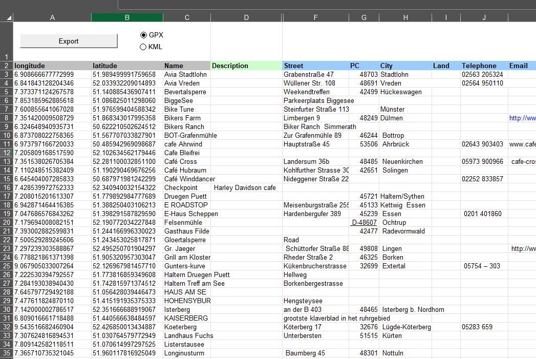
                        I do not think @Greenham want to harvest POI's but to put his own POI's into MRA in bulk.
                        I use Excel to make them and then convert to GPX.
                        MRA only uses the description but If I load them into my Garmin I get the other fields also. I am now busy to find out how to bulk import a GPX into my little housemade tool.
                        POIEXcel.JPG

                        Greenhamundefined 1 Reply Last reply
                        0
                        • martin-phogel.deundefined martin-phogel.de

                          @Dikke-Wim @Mzokk

                          Here's another attempt in three simple steps:

                          1. Launch a query on overpass-turbo.eu

                          Overpass-1.jpg

                          1. export as gpx

                          Overpass-2.jpg

                          1. upload into MRA

                          Overpass-3.jpg

                          Dikke Wimundefined Offline
                          Dikke Wimundefined Offline
                          Dikke Wim
                          Valued contributor
                          wrote on last edited by
                          #13

                          @Martin-Wilcke
                          Thank you very much! It seems to work great....
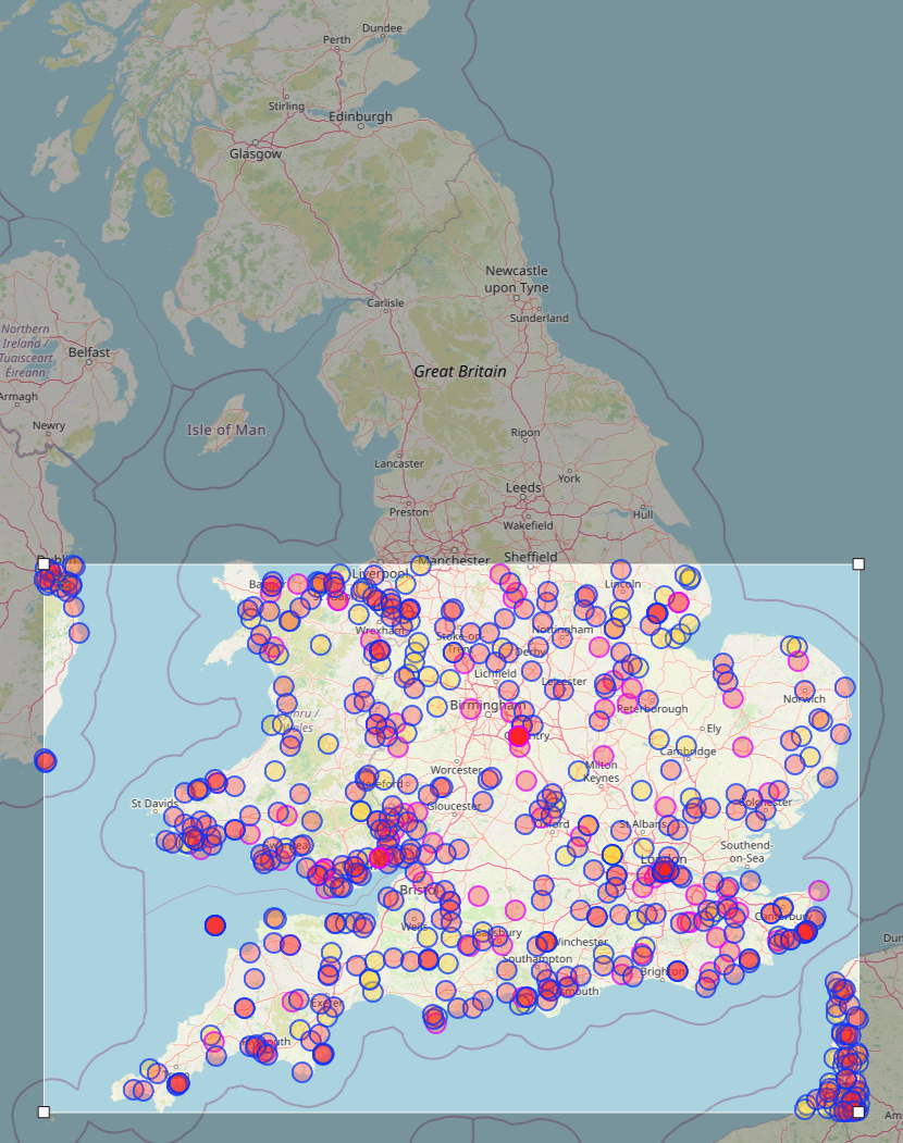
                          However, not all dots of castles of South UH that are shown on the map are found in MRA when imported.

                          Do you have any idea how to fix this? See screendumps below.

                          See e.g. Cornwall with many castles
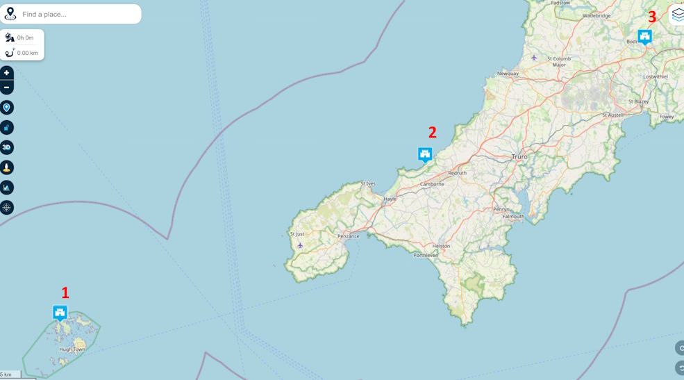
                          e39f2ddb-5d1a-447d-9a07-6b545ca257d5-image.png

                          Cornwall without any castles
                          9d561261-31ca-4173-94b3-d2512543137b-image.png

                          BMW R1300 GS, BMW Connect Ride Next navigator; Quad Lock with Samsung Galaxy Ultra, iPad Pro (iPadOS 18.0 bèta version) MacBook Pro (MacOS Sequoia 15.2 bèta version), iMac (MacOS Monterey 12.7.6)

                          martin-phogel.deundefined 1 Reply Last reply
                          0
                          • Dikke Wimundefined Dikke Wim

                            @Martin-Wilcke
                            Thank you very much! It seems to work great....
                            However, not all dots of castles of South UH that are shown on the map are found in MRA when imported.

                            Do you have any idea how to fix this? See screendumps below.

                            See e.g. Cornwall with many castles
                            e39f2ddb-5d1a-447d-9a07-6b545ca257d5-image.png

                            Cornwall without any castles
                            9d561261-31ca-4173-94b3-d2512543137b-image.png

                            martin-phogel.deundefined Offline
                            martin-phogel.deundefined Offline
                            martin-phogel.de
                            wrote on last edited by
                            #14

                            @Dikke-Wim said in Bulk Upload of POI's:

                            However, not all dots of castles of South UH that are shown on the map are found in MRA when imported.

                            Hmmm... Maybe you need to zoom in?

                            Overpass:
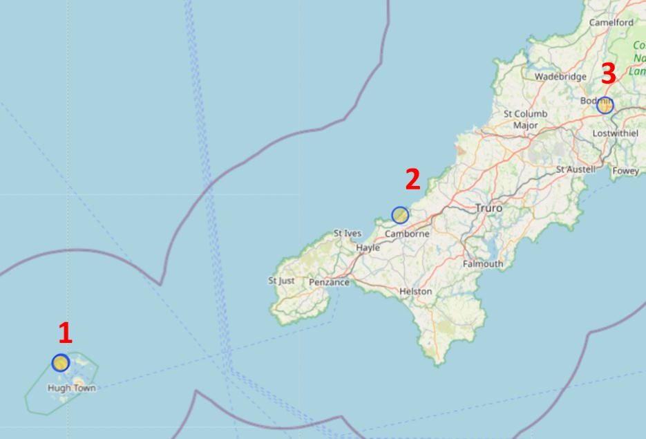
                            UK Castles 1.jpg

                            Imported:
                            UK Castles 2.jpg

                            Dikke Wimundefined 1 Reply Last reply
                            0
                            • martin-phogel.deundefined martin-phogel.de

                              @Dikke-Wim said in Bulk Upload of POI's:

                              However, not all dots of castles of South UH that are shown on the map are found in MRA when imported.

                              Hmmm... Maybe you need to zoom in?

                              Overpass:
                              UK Castles 1.jpg

                              Imported:
                              UK Castles 2.jpg

                              Dikke Wimundefined Offline
                              Dikke Wimundefined Offline
                              Dikke Wim
                              Valued contributor
                              wrote on last edited by Dikke Wim
                              #15

                              @Martin-Wilcke

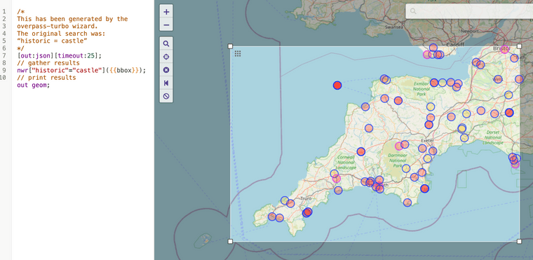
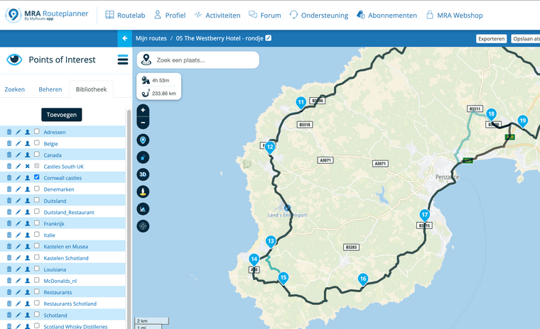
                              Unfortunately even when I zoom in more than in the example above, no additional castles appear. Only "few" of the cirkels with castles in the overpass.eu website, are visible.

                              Any suggestions what I do wrong?

                              Example of the map with castles in Cornwall
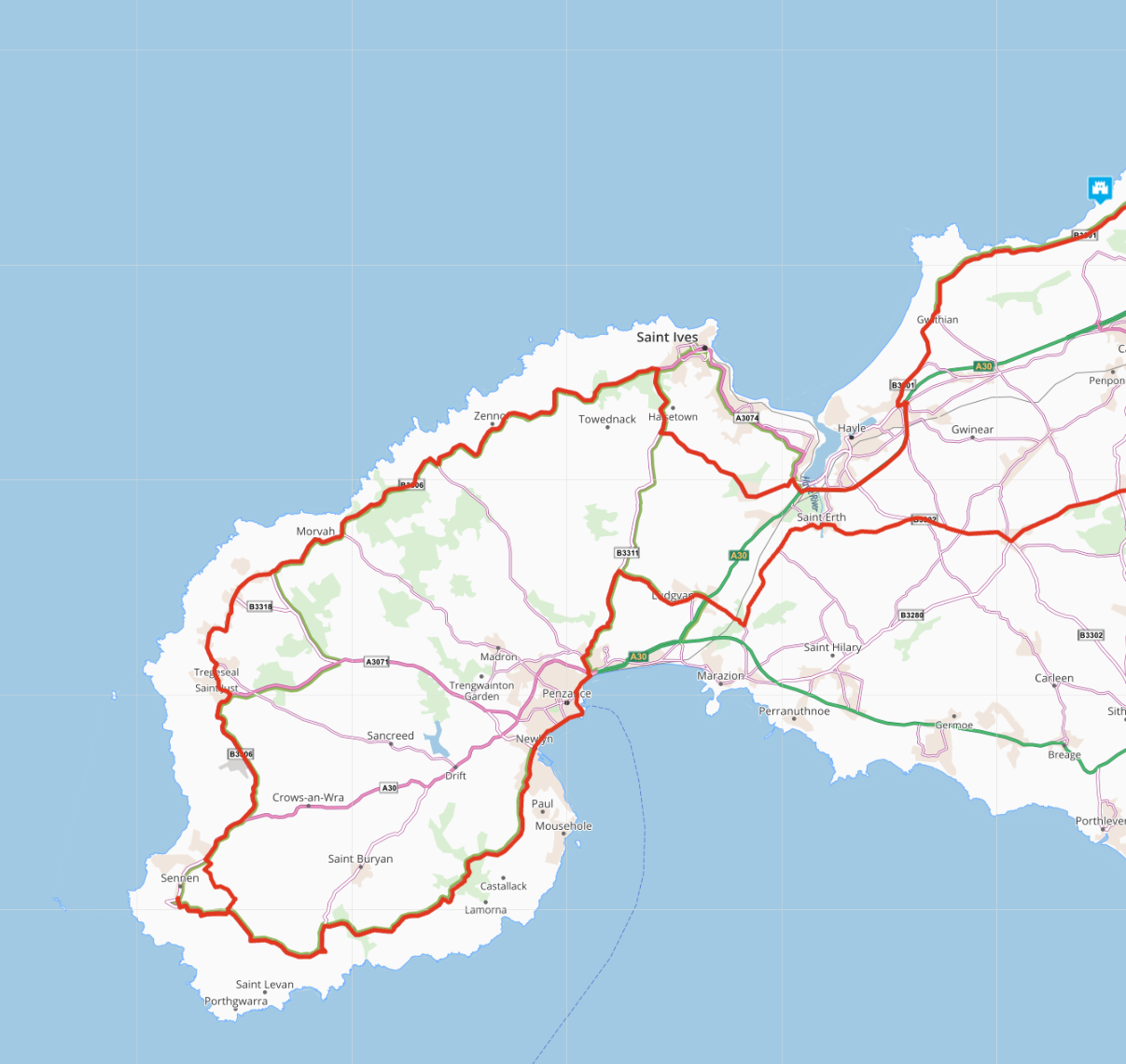
                              1b0ccb6d-7087-4a15-b18e-b45c0c2d965e-image.png

                              No castles in Cornwall after importing the GPX file
                              e6571a01-0273-4e94-9854-ccb350ee1905-image.png

                              the KML file shows more castles in Google Earth than the GPX file in MRA
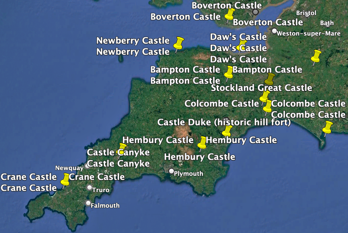
                              8de64d6b-ea55-4f0d-8789-1b8ac9469b67-image.png

                              BMW R1300 GS, BMW Connect Ride Next navigator; Quad Lock with Samsung Galaxy Ultra, iPad Pro (iPadOS 18.0 bèta version) MacBook Pro (MacOS Sequoia 15.2 bèta version), iMac (MacOS Monterey 12.7.6)

                              martin-phogel.deundefined 3 Replies Last reply
                              0
                              • Dikke Wimundefined Dikke Wim

                                @Martin-Wilcke

                                Unfortunately even when I zoom in more than in the example above, no additional castles appear. Only "few" of the cirkels with castles in the overpass.eu website, are visible.

                                Any suggestions what I do wrong?

                                Example of the map with castles in Cornwall
                                1b0ccb6d-7087-4a15-b18e-b45c0c2d965e-image.png

                                No castles in Cornwall after importing the GPX file
                                e6571a01-0273-4e94-9854-ccb350ee1905-image.png

                                the KML file shows more castles in Google Earth than the GPX file in MRA

                                8de64d6b-ea55-4f0d-8789-1b8ac9469b67-image.png

                                martin-phogel.deundefined Offline
                                martin-phogel.deundefined Offline
                                martin-phogel.de
                                wrote on last edited by
                                #16

                                @Dikke-Wim

                                OK - let's focus on "Crane Castle" as an example; it's this one:
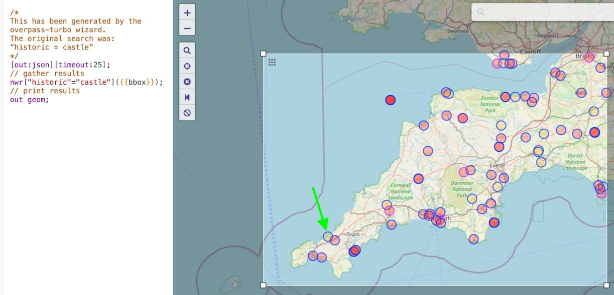
                                crane 1.jpg

                                Please have a look at the GPX you've uploaded with an editor and search for "Crane", there should be a match like this:
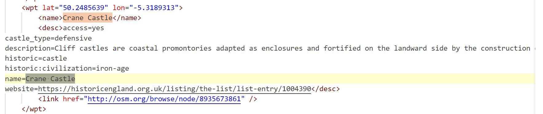
                                crane 2.jpg

                                In MRA, search for "Portreath" and zoom in to a scale of 1 km / 1 mile or less:
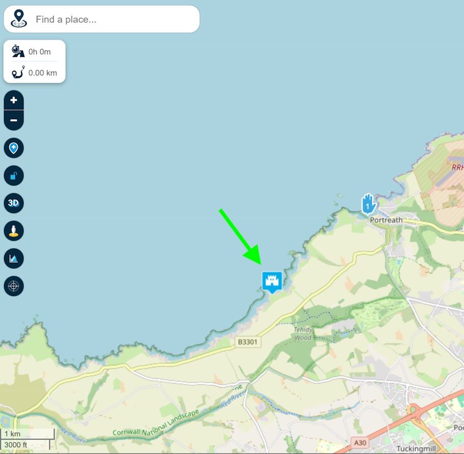
                                crane 3.jpg

                                Does it show up?

                                1 Reply Last reply
                                0
                                • Dikke Wimundefined Dikke Wim

                                  @Martin-Wilcke

                                  Unfortunately even when I zoom in more than in the example above, no additional castles appear. Only "few" of the cirkels with castles in the overpass.eu website, are visible.

                                  Any suggestions what I do wrong?

                                  Example of the map with castles in Cornwall
                                  1b0ccb6d-7087-4a15-b18e-b45c0c2d965e-image.png

                                  No castles in Cornwall after importing the GPX file
                                  e6571a01-0273-4e94-9854-ccb350ee1905-image.png

                                  the KML file shows more castles in Google Earth than the GPX file in MRA

                                  8de64d6b-ea55-4f0d-8789-1b8ac9469b67-image.png

                                  martin-phogel.deundefined Offline
                                  martin-phogel.deundefined Offline
                                  martin-phogel.de
                                  wrote on last edited by
                                  #17

                                  @Dikke-Wim

                                  And one more note:

                                  I have just noticed that "historic=castle" can be modelled both as a ‘node’ (point) and as a ‘way’ (path, here in the sense of area). They appear as yellow dots for nodes and red dots for ways/areas.

                                  That's why my example query node ["historic"="castle"]; is not ideal, because it only finds castles that are modelled as a point.

                                  Better, as in your example, is nwr ["historic"="castle"]; as it includes nodes, ways and relations.

                                  1 Reply Last reply
                                  0
                                  • Dikke Wimundefined Dikke Wim

                                    @Martin-Wilcke

                                    Unfortunately even when I zoom in more than in the example above, no additional castles appear. Only "few" of the cirkels with castles in the overpass.eu website, are visible.

                                    Any suggestions what I do wrong?

                                    Example of the map with castles in Cornwall
                                    1b0ccb6d-7087-4a15-b18e-b45c0c2d965e-image.png

                                    No castles in Cornwall after importing the GPX file
                                    e6571a01-0273-4e94-9854-ccb350ee1905-image.png

                                    the KML file shows more castles in Google Earth than the GPX file in MRA

                                    8de64d6b-ea55-4f0d-8789-1b8ac9469b67-image.png

                                    martin-phogel.deundefined Offline
                                    martin-phogel.deundefined Offline
                                    martin-phogel.de
                                    wrote on last edited by
                                    #18

                                    @Dikke-Wim

                                    OK - I got it.

                                    You need an out centre (instead of an out geom) to create a single node for ways/areas. This will generate waypoints for both types (nodes and ways) when exporting as GPX.

                                    Here's the result

                                    https://hidrive.ionos.com/lnk/LhseBgcKc

                                    for the query:
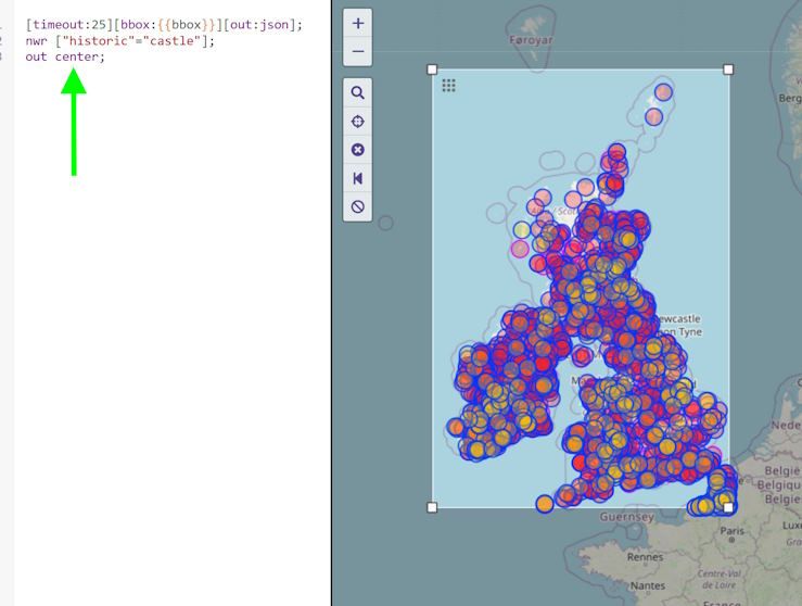
                                    UK Castles 3.jpg

                                    Sorry for the confusion!

                                    Dikke Wimundefined JP dundefined 2 Replies Last reply
                                    0
                                    • Dikke Wimundefined Dikke Wim

                                      @Mzokk Thanks a lot. But.... is a lot of work I guess. Therefore I prefer AI who takes over the difficult stuff. I'm doing some experiments with AI. Curious how things work out.

                                      Mzokkundefined Offline
                                      Mzokkundefined Offline
                                      Mzokk
                                      wrote on last edited by
                                      #19

                                      @Dikke-Wim Somewhat less work than the method you describe👍

                                      Dikke Wimundefined 1 Reply Last reply
                                      0
                                      • martin-phogel.deundefined martin-phogel.de

                                        @Dikke-Wim

                                        OK - I got it.

                                        You need an out centre (instead of an out geom) to create a single node for ways/areas. This will generate waypoints for both types (nodes and ways) when exporting as GPX.

                                        Here's the result

                                        https://hidrive.ionos.com/lnk/LhseBgcKc

                                        for the query:

                                        UK Castles 3.jpg

                                        Sorry for the confusion!

                                        Dikke Wimundefined Offline
                                        Dikke Wimundefined Offline
                                        Dikke Wim
                                        Valued contributor
                                        wrote on last edited by
                                        #20

                                        @Martin-Wilcke

                                        Thanks Martin. It works now much better (see below).
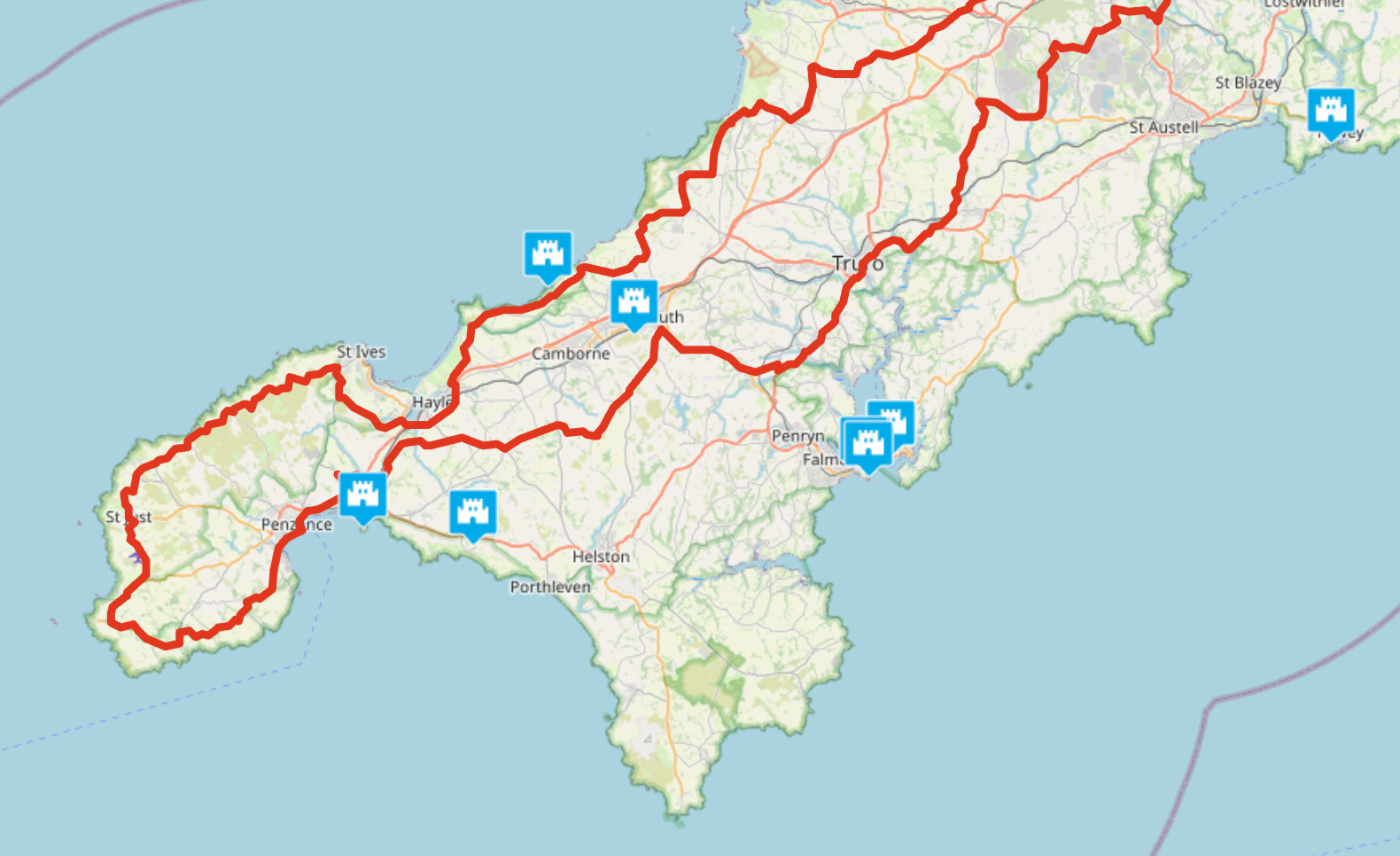
                                        f45a36c1-6b9e-41bd-ba3c-03809ef23506-image.png

                                        BMW R1300 GS, BMW Connect Ride Next navigator; Quad Lock with Samsung Galaxy Ultra, iPad Pro (iPadOS 18.0 bèta version) MacBook Pro (MacOS Sequoia 15.2 bèta version), iMac (MacOS Monterey 12.7.6)

                                        martin-phogel.deundefined 1 Reply Last reply
                                        0
                                        • Mzokkundefined Mzokk

                                          @Dikke-Wim Somewhat less work than the method you describe👍

                                          Dikke Wimundefined Offline
                                          Dikke Wimundefined Offline
                                          Dikke Wim
                                          Valued contributor
                                          wrote on last edited by
                                          #21

                                          @Mzokk

                                          What method do you mean? I don't get it.
                                          For me: the easier the better!

                                          BMW R1300 GS, BMW Connect Ride Next navigator; Quad Lock with Samsung Galaxy Ultra, iPad Pro (iPadOS 18.0 bèta version) MacBook Pro (MacOS Sequoia 15.2 bèta version), iMac (MacOS Monterey 12.7.6)

                                          1 Reply Last reply
                                          0

                                          Hello! It looks like you're interested in this conversation, but you don't have an account yet.

                                          Getting fed up of having to scroll through the same posts each visit? When you register for an account, you'll always come back to exactly where you were before, and choose to be notified of new replies (either via email, or push notification). You'll also be able to save bookmarks and upvote posts to show your appreciation to other community members.

                                          With your input, this post could be even better 💗

                                          Register Login
                                          Reply
                                          • Reply as topic
                                          Log in to reply
                                          • Oldest to Newest
                                          • Newest to Oldest
                                          • Most Votes


                                          • 1
                                          • 2
                                          ACTIVE USERS
                                          Adrian Avramundefined
                                          Adrian Avram
                                          Mzokkundefined
                                          Mzokk
                                          nomkoundefined
                                          nomko
                                          Dikke Wimundefined
                                          Dikke Wim
                                          JP dundefined
                                          JP d
                                          BertMundefined
                                          BertM
                                          martin-phogel.deundefined
                                          martin-phogel.de
                                          Greenhamundefined
                                          Greenham
                                          POPULAR TOPICS
                                          • New enlarge fuelstation icon gone to soon or not?
                                            Bouke Entundefined
                                            Bouke Ent
                                            0
                                            7
                                            165

                                          • Best way to set my Garmin Zumo XT to play well with the MRA?
                                            Travellexxieundefined
                                            Travellexxie
                                            0
                                            16
                                            427

                                          • No altitude on Android Auto screen
                                            Lluis Arasanzundefined
                                            Lluis Arasanz
                                            0
                                            7
                                            162

                                          • Altitude does not match
                                            Corjan Meijerinkundefined
                                            Corjan Meijerink
                                            0
                                            11
                                            107

                                          • V5.1.0 - 462 New altitude/heading shows incorrect Data
                                            Jörgenundefined
                                            Jörgen
                                            0
                                            24
                                            610

                                          • Update 5.1 - CarPlay / Android Auto improvements and more!
                                            Hubert Thoringundefined
                                            Hubert Thoring
                                            18
                                            95
                                            7.6k

                                          • Seasonal closures affect not only seasonal road closures (mountain passes and the like) but also closures due to roadworks. This is why the route takes you through the closure even during planning, even though Here is actually aware of it.
                                            ginoginoundefined
                                            ginogino
                                            3
                                            12
                                            430

                                          • 5.1 update lost speed up in the corner
                                            Corjan Meijerinkundefined
                                            Corjan Meijerink
                                            0
                                            13
                                            565

                                          MY GROUPS
                                          • Login

                                          • Login or register to search.
                                          • First post
                                            Last post
                                          0
                                          • Categories
                                          • Recent
                                          • Popular
                                          • Support
                                          • MyRoute-app