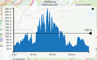
FEATURE RELEASE: Height profile (available for everyone!)


-
Very nice feature. I like this very much!
-
Great addition to MRA. Is it possible to have a feature that would allow the user to switch from Meters to Feet. This would help some of us in the USA as we are not as familiar with the metric measurements used internationally. Thanks
-
And, as already suggested by me, have the ability to see estmated gardients at the intersection ot the vertical line, particulalry of interest for cyclists.
-
If there a way to display Height in feet?
-
Very cool feature as you can find the highest points on your route moving the slider up and down and it shows them on the map in red. we have one in our group that gets elevation sickness so we can avoid these areas in planning. Would love to have a setting to change into feet or meters. keep up the good work MR team!
-
@David-McCoy @TL-Donnelly @Scuba-Steve
Thank you for your suggestion. In close cooperation with one of our developers we've now added this feature to the height profile.
-
Very nice and wanted feature, thanks.
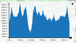
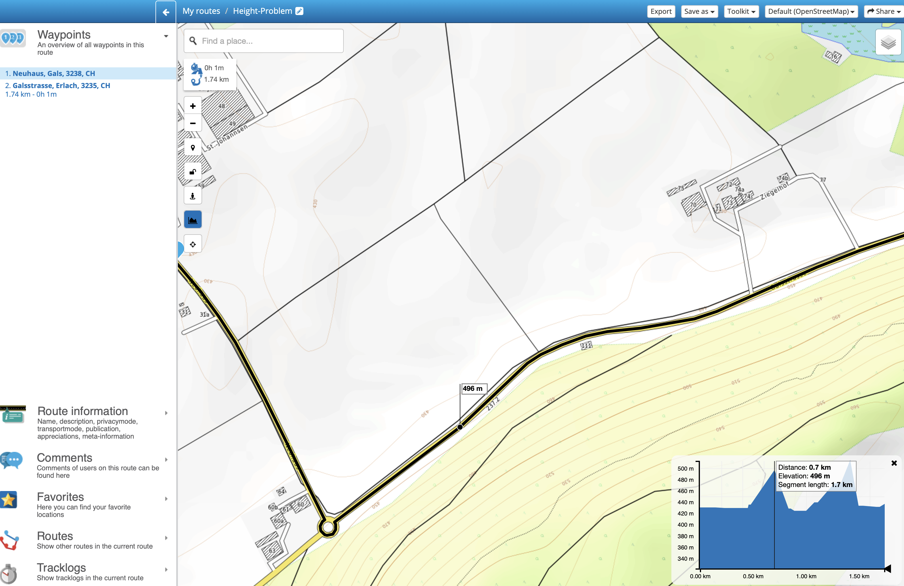
But I see some problems with the height. Two many non existant peaks of 10 to 90 meters on my tracks. For example on a flat road near my home 2 points very near show height of 429 meter and 20 meters further height of 496 meters. That's quite a difference, at least for a bicycle point of view.
Can this problem be avoided ? -
Hi Claude, I'm not perceiving these problems myself. However, I've listed the problem as a possible bug.
-
Hi Claude, I'm not perceiving these problems myself. However, I've listed the problem as a possible bug.
@Timo-Martosatiman-MRA
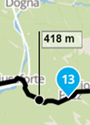
Hi Timo, thanks for your answer. To try to better show the problem I have created a short, flat road (altitude 430m) that runs along a hill. In the height profile some altitudes are not correct and make it look like there are 2 hills with altitude of about 500m on the route itself. I used the OpenTopoMap maps in this example because these maps clearly show the altitude lines and show that the route is really flat. Here is a link which shows a screen copy of the problem:
screencopy of the problem -
I'm really liking this feature - especially for cycling. The only thing I'd like to see added is a way to see the total elevation change of a route.
Hello! It looks like you're interested in this conversation, but you don't have an account yet.
Getting fed up of having to scroll through the same posts each visit? When you register for an account, you'll always come back to exactly where you were before, and choose to be notified of new replies (either via email, or push notification). You'll also be able to save bookmarks and upvote posts to show your appreciation to other community members.
With your input, this post could be even better 💗
Register Login-
910112
-
-328744
-
017338
-
011158
-
0460
-
0573
-
0344
-
0357