Expert Review of route
-
Many have helped me understand the Garmin Zumo XT and GPX 1.1 vs 1.2 which has been very helpful.
A few helped me through a "seasonal closures" routing issue.
I have completed the Day 1 of what will be a 3 day trip in June. Would anyone be willing to review it and offer any suggestions? Good, Bad or indifferent?
"There is no problem so bad that you can't make it worse"
- Chris Hadfield (NASA Astronaut)
-
Many have helped me understand the Garmin Zumo XT and GPX 1.1 vs 1.2 which has been very helpful.
A few helped me through a "seasonal closures" routing issue.
I have completed the Day 1 of what will be a 3 day trip in June. Would anyone be willing to review it and offer any suggestions? Good, Bad or indifferent?
Use maximum 28 via points in a route otherwise the XT will split the route
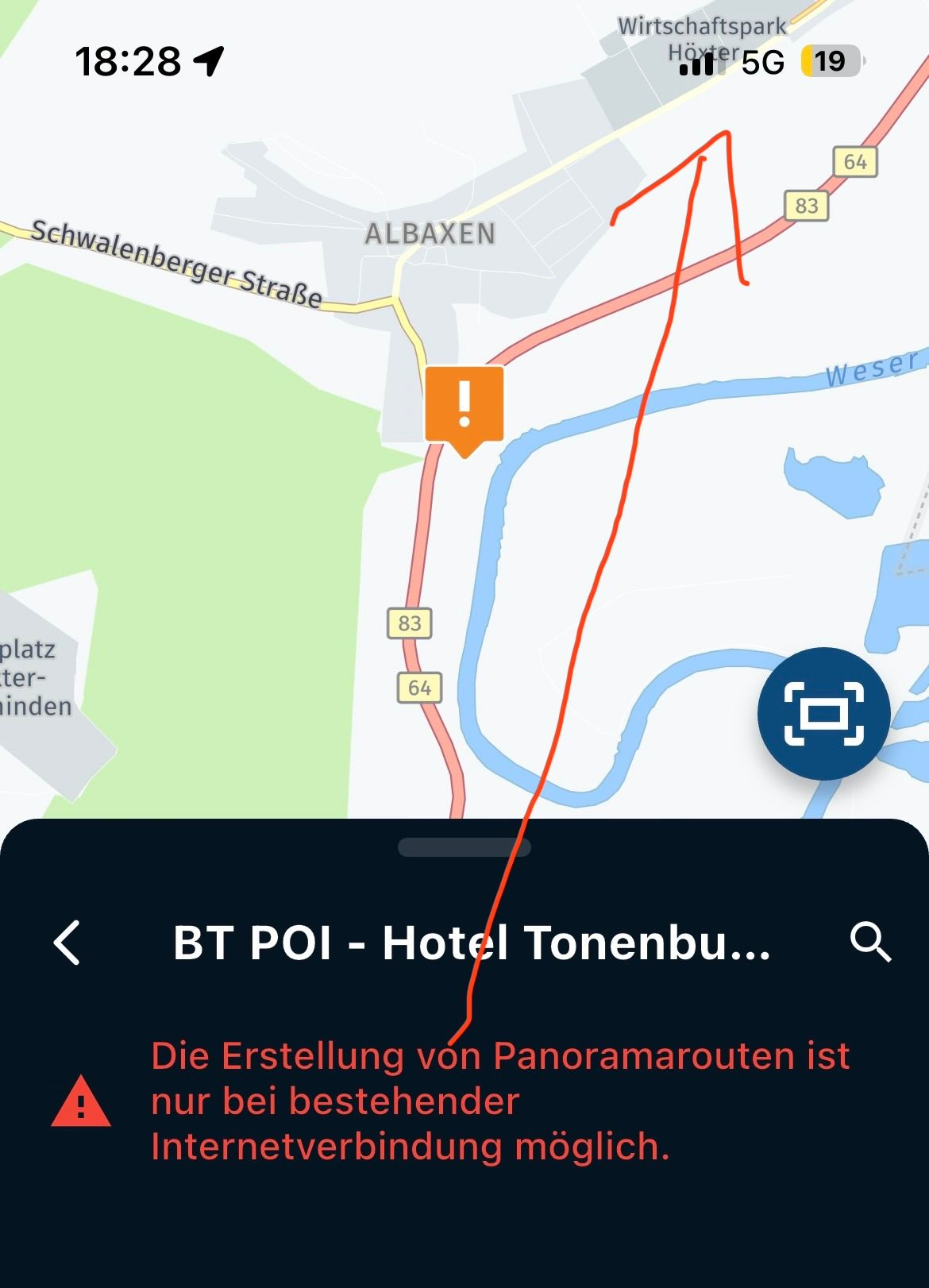
Why all green points?
Garmin Zumo XT3/XT2/XT/BMW Connected Ride Navigator/Tourstart/ MyRouteapp (The App)/...
Een dag niet gelachen is een dag niet geleefd / Een route is net zo goed als deze uitgezet is. -
Many have helped me understand the Garmin Zumo XT and GPX 1.1 vs 1.2 which has been very helpful.
A few helped me through a "seasonal closures" routing issue.
I have completed the Day 1 of what will be a 3 day trip in June. Would anyone be willing to review it and offer any suggestions? Good, Bad or indifferent?
@Greenham Try and use other colors and icons for different activities. Use less via points and more droplets (shaping points).
This is how I did one of the touring days for this summer in the Swiss Alps: https://www.myrouteapp.com/en/social/route/10178038?mode=share -
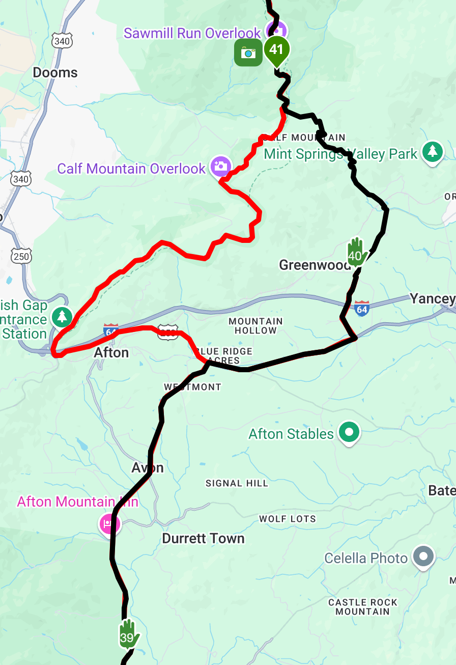
[not an expert, but like to give an opinion...
 ]
]What happened to lunch?!

Points look nice and accurate, and not positioned too close to junctions, etc. Good work there.
If you set a realistic start time like 9:00 that always helps gauge progress, and when you might want to stop for a rest/petrol, etc.
If you're riding with others then check around point 40 for TomTom users - they may get sent a different way (west towards Afton and then north to McCormick Gap Overlook Calf Mountain Overlook - which could be a nicer alternative route, but I don't know the area).
-
[not an expert, but like to give an opinion...
]What happened to lunch?!
Points look nice and accurate, and not positioned too close to junctions, etc. Good work there.
If you set a realistic start time like 9:00 that always helps gauge progress, and when you might want to stop for a rest/petrol, etc.
If you're riding with others then check around point 40 for TomTom users - they may get sent a different way (west towards Afton and then north to McCormick Gap Overlook Calf Mountain Overlook - which could be a nicer alternative route, but I don't know the area).
@richtea999
Thanks for looking at what I had.This is just day 1 of the trip. Day 2 I stay and do some sightseeing , and day 3 I haven't posted yet. I wanted to use the advice on this segment.
I thought about the route you highlighted. But this goes through some of the hard hit areas from last years Hurricane. Thats why I avoided getting onto the BRP sooner.
I'm traveling solo and basically any fuel stations after 100 miles is getting a visit
-
Use maximum 28 via points in a route otherwise the XT will split the route
Why all green points?
@Hans-van-de-Ven-MR-MRA
This brings me back to the GARMIN ZUMO XT and how it reacts to these routes.
When you import the route and then start the route it "calculates" the route based on its own Garmin algorithms.
As I understand Via vs Shaping points. Garmin IGNORS Shaping points and ONLY cares about VIA points during its calculations when importing the route. That why so many VIA points.
I'm trying to stay on a fairly specific set of roads. If I reduce VIA points won't/can't Garmin then pick the roads that will most quickly get me to the next VIA point.?
Maybe I have it wrong
"There is no problem so bad that you can't make it worse"
- Chris Hadfield (NASA Astronaut)
-
@Hans-van-de-Ven-MR-MRA
This brings me back to the GARMIN ZUMO XT and how it reacts to these routes.
When you import the route and then start the route it "calculates" the route based on its own Garmin algorithms.
As I understand Via vs Shaping points. Garmin IGNORS Shaping points and ONLY cares about VIA points during its calculations when importing the route. That why so many VIA points.
I'm trying to stay on a fairly specific set of roads. If I reduce VIA points won't/can't Garmin then pick the roads that will most quickly get me to the next VIA point.?
Maybe I have it wrong
Shaping points (soft points) can be skipped without the Garmin sending you back to a skipped shaping point.
You must visit via points (hard points) or skip them manually.
Only start a route if you:
Have a connection with at least 3 satellites,
Are on the route or are close to the route.
Never start a route in the garage or at the kitchen table, because then the Zumo has to calculate to your starting point.
Again, use a maximum of 28 via points and place them at critical points or where you want to stop. For the rest, just use shaping points. I myself use a maximum of 7 via points in my route and form the route with sufficient shaping points.Garmin Zumo XT3/XT2/XT/BMW Connected Ride Navigator/Tourstart/ MyRouteapp (The App)/...
Een dag niet gelachen is een dag niet geleefd / Een route is net zo goed als deze uitgezet is. -
Shaping points (soft points) can be skipped without the Garmin sending you back to a skipped shaping point.
You must visit via points (hard points) or skip them manually.
Only start a route if you:
Have a connection with at least 3 satellites,
Are on the route or are close to the route.
Never start a route in the garage or at the kitchen table, because then the Zumo has to calculate to your starting point.
Again, use a maximum of 28 via points and place them at critical points or where you want to stop. For the rest, just use shaping points. I myself use a maximum of 7 via points in my route and form the route with sufficient shaping points.@Hans-van-de-Ven-MR-MRA
Thank you,
I can reduce the hard points and use more soft points.
But
QUESTION .... Does the Zumo XT use the soft points when its calculating the route using the route I want to take.
"There is no problem so bad that you can't make it worse"
- Chris Hadfield (NASA Astronaut)
-
@Hans-van-de-Ven-MR-MRA
Thank you,
I can reduce the hard points and use more soft points.
But
QUESTION .... Does the Zumo XT use the soft points when its calculating the route using the route I want to take.
@Greenham
Yes -
@Hans-van-de-Ven-MR-MRA
Thank you,
I can reduce the hard points and use more soft points.
But
QUESTION .... Does the Zumo XT use the soft points when its calculating the route using the route I want to take.
@Greenham The XT has a nasty habbit of thinking it can make a better route then the one you planned. To force the XT to do what YOU want add extra shapingpoints. Use the compare function in the planning mode to see what TomTom and OSM do whit your route. It gives you a small inside of what might happen to your route if you didn't put in enough shapingpoints
Honda Goldwing GL1500,
Honda Silverwing GL 650
DMD2 T865X 8 inch Android tablet using MRA next for navigation
Garmin XT sold
Samsung S24FE mounted on a Quadlock and using Android Auto in my car -
- only use shaping points (hands) where relevant (fuel stop, coffee stop, lunch stop etc...) and use different colours accordingly.
- once your route finished with the car activity profile using the HERE map set, optimise it by changing route calculation from fastest (standard) to shortest and adjust to original. Switch back to fastest and adjust again if necessary.
- if wanted, now you may switch to the TT map set and do the same.
- use the gpx 1.1 (route, track poi) for your XT.
- you can leave the recalculation mode on your Garmin device to automatic without any problem.
SP2820, 550, 660, 590, XT. Mapsource, Tyre (met de nodige conversaties tot hierboven), Kurviger, Routeyou, MRA Gold sinds het begin, MRA Next app, App68studio,.. en BC natuurlijk
-
- only use shaping points (hands) where relevant (fuel stop, coffee stop, lunch stop etc...) and use different colours accordingly.
- once your route finished with the car activity profile using the HERE map set, optimise it by changing route calculation from fastest (standard) to shortest and adjust to original. Switch back to fastest and adjust again if necessary.
- if wanted, now you may switch to the TT map set and do the same.
- use the gpx 1.1 (route, track poi) for your XT.
- you can leave the recalculation mode on your Garmin device to automatic without any problem.
@Guzt
Just for clarity, Via points are hand shaped not shaping points. -
- only use shaping points (hands) where relevant (fuel stop, coffee stop, lunch stop etc...) and use different colours accordingly.
- once your route finished with the car activity profile using the HERE map set, optimise it by changing route calculation from fastest (standard) to shortest and adjust to original. Switch back to fastest and adjust again if necessary.
- if wanted, now you may switch to the TT map set and do the same.
- use the gpx 1.1 (route, track poi) for your XT.
- you can leave the recalculation mode on your Garmin device to automatic without any problem.
@Guzt If you use recalculate on on the XT you're in for trouble. sooner or later the thing will for shure mess up your carefully planned route. The XT has a will of its own. So my advise is leave it of.
when using the 1.2 export using the Drive app. The route, witch must have some viapoints in it, will be shown on your XT. I alway project the track witch comes automaticly with the 1.2 export under the route so if you deviate dfrom the route you can still come back to the route using your eyes. If you have recalculate on, that would bee the chance for the XT to mess up your route and believe me it will for shure.
have funHonda Goldwing GL1500,
Honda Silverwing GL 650
DMD2 T865X 8 inch Android tablet using MRA next for navigation
Garmin XT sold
Samsung S24FE mounted on a Quadlock and using Android Auto in my car -
- only use shaping points (hands) where relevant (fuel stop, coffee stop, lunch stop etc...) and use different colours accordingly.
- once your route finished with the car activity profile using the HERE map set, optimise it by changing route calculation from fastest (standard) to shortest and adjust to original. Switch back to fastest and adjust again if necessary.
- if wanted, now you may switch to the TT map set and do the same.
- use the gpx 1.1 (route, track poi) for your XT.
- you can leave the recalculation mode on your Garmin device to automatic without any problem.
@Guzt said in Expert Review of route:
- only use shaping points (hands) where relevant (fuel stop, coffee stop, lunch stop etc...) and use different colours accordingly.
- once your route finished with the car activity profile using the HERE map set, optimise it by changing route calculation from fastest (standard) to shortest and adjust to original. Switch back to fastest and adjust again if necessary.
- if wanted, now you may switch to the TT map set and do the same.
- use the gpx 1.1 (route, track poi) for your XT.
- you can leave the recalculation mode on your Garmin device to automatic without any problem.
#1 Shaping vs Via points. Got that. Only use VIA points where you actually want to stop.
#2 Heres where I get confused by your comment, I started with the motorcycle profile and the (Here) default. How do I optimize changing from fastest to shortest
I don't understand the back and forth of fastest and shortest
I have compared the route with TT in the past
#3 I just learned from you guys recently to use GPX 1.1
#4 I understand the Leave recalculation on the Zumo to automatic
"There is no problem so bad that you can't make it worse"
- Chris Hadfield (NASA Astronaut)
-
@Guzt said in Expert Review of route:
- only use shaping points (hands) where relevant (fuel stop, coffee stop, lunch stop etc...) and use different colours accordingly.
- once your route finished with the car activity profile using the HERE map set, optimise it by changing route calculation from fastest (standard) to shortest and adjust to original. Switch back to fastest and adjust again if necessary.
- if wanted, now you may switch to the TT map set and do the same.
- use the gpx 1.1 (route, track poi) for your XT.
- you can leave the recalculation mode on your Garmin device to automatic without any problem.
#1 Shaping vs Via points. Got that. Only use VIA points where you actually want to stop.
#2 Heres where I get confused by your comment, I started with the motorcycle profile and the (Here) default. How do I optimize changing from fastest to shortest
I don't understand the back and forth of fastest and shortest
I have compared the route with TT in the past
#3 I just learned from you guys recently to use GPX 1.1
#4 I understand the Leave recalculation on the Zumo to automatic
@Greenham download this document from my google drive for full explanation
[link text]https://drive.google.com/file/d/1Zwt-5yrJSFWJCLw-997z3XFbFyAUY6en/view?usp=drive_link(link url) -
@Guzt If you use recalculate on on the XT you're in for trouble. sooner or later the thing will for shure mess up your carefully planned route. The XT has a will of its own. So my advise is leave it of.
when using the 1.2 export using the Drive app. The route, witch must have some viapoints in it, will be shown on your XT. I alway project the track witch comes automaticly with the 1.2 export under the route so if you deviate dfrom the route you can still come back to the route using your eyes. If you have recalculate on, that would bee the chance for the XT to mess up your route and believe me it will for shure.
have fun@Marinus-van-Deudekom Did I mentioned to use 1.2? Don't think so.
SP2820, 550, 660, 590, XT. Mapsource, Tyre (met de nodige conversaties tot hierboven), Kurviger, Routeyou, MRA Gold sinds het begin, MRA Next app, App68studio,.. en BC natuurlijk
-
Many have helped me understand the Garmin Zumo XT and GPX 1.1 vs 1.2 which has been very helpful.
A few helped me through a "seasonal closures" routing issue.
I have completed the Day 1 of what will be a 3 day trip in June. Would anyone be willing to review it and offer any suggestions? Good, Bad or indifferent?
This is great. I won't pretend to understand why you have to save as a track, then load it and compare with the Route, but I will do it.
In the Motorcycle profile it does allow me to route optimize. Or is it doing nothing.
I used Chat GPT to create an English version if you want it.
THANK YOU AGAIN
-
@Marinus-van-Deudekom Did I mentioned to use 1.2? Don't think so.
You say in the doc when downloading to Garmin to do it in. 1.1 format
-
@Guzt said in Expert Review of route:
- only use shaping points (hands) where relevant (fuel stop, coffee stop, lunch stop etc...) and use different colours accordingly.
- once your route finished with the car activity profile using the HERE map set, optimise it by changing route calculation from fastest (standard) to shortest and adjust to original. Switch back to fastest and adjust again if necessary.
- if wanted, now you may switch to the TT map set and do the same.
- use the gpx 1.1 (route, track poi) for your XT.
- you can leave the recalculation mode on your Garmin device to automatic without any problem.
#1 Shaping vs Via points. Got that. Only use VIA points where you actually want to stop.
#2 Heres where I get confused by your comment, I started with the motorcycle profile and the (Here) default. How do I optimize changing from fastest to shortest
I don't understand the back and forth of fastest and shortest
I have compared the route with TT in the past
#3 I just learned from you guys recently to use GPX 1.1
#4 I understand the Leave recalculation on the Zumo to automatic
@Greenham In the toolkit under optimize you have the possibility to change the route calculation. That option is only available in the HERE map set when you make your route using the car/auto mobile profile.
You can either add a copy of the route (hamburger menu - routes - add) or make the track underlying (which I prefer) visible as reference (I already have an uploaded track of the route as I make all my routes mostly in Basecamp).
When one recalculates with shorter distance e.g. the route will differ from the original. By dragging the recalculated route to the track or reference route, you force the route to follow the original as intended. Hence the reason that one can leave auto-calculation to on on the gps when using gpx 1.1SP2820, 550, 660, 590, XT. Mapsource, Tyre (met de nodige conversaties tot hierboven), Kurviger, Routeyou, MRA Gold sinds het begin, MRA Next app, App68studio,.. en BC natuurlijk
-
@Greenham In the toolkit under optimize you have the possibility to change the route calculation. That option is only available in the HERE map set when you make your route using the car/auto mobile profile.
You can either add a copy of the route (hamburger menu - routes - add) or make the track underlying (which I prefer) visible as reference (I already have an uploaded track of the route as I make all my routes mostly in Basecamp).
When one recalculates with shorter distance e.g. the route will differ from the original. By dragging the recalculated route to the track or reference route, you force the route to follow the original as intended. Hence the reason that one can leave auto-calculation to on on the gps when using gpx 1.1Thank you again. I finally did it. I used your steps and saw 1 or 2 places that the track and the rote did not align. Fixed that, changed to shortest, no issues, exported to my Garmin in 1.1 Route.Track.POI
I've learned a much from you. Thank you
Mike
Here is the English version of your instructions
https://drive.google.com/drive/folders/1khcVV8Wp56ploC0WzzSaf3bm-no57mve?usp=drive_link
Hello! It looks like you're interested in this conversation, but you don't have an account yet.
Getting fed up of having to scroll through the same posts each visit? When you register for an account, you'll always come back to exactly where you were before, and choose to be notified of new replies (either via email, or push notification). You'll also be able to save bookmarks and upvote posts to show your appreciation to other community members.
With your input, this post could be even better 💗
Register Login-
014201
-
1926.2k
-
0606.5k
-
0541
-
011186
-
17438.6k
-
0359
-
255613.0k