Waypoints similar to Google MyMaps ?
-
I am a new user and am missing a feature that I rely on extensively.. and that is WayPoints similar to what you can have in Googles MyMaps. These are, I guess, similar to Points of Interest, although I dont see how I can use the MRA version of POI for this purpose.
Essentially, while the route planning is great, It doesnt seem like I can enter places I want to perhaps, or perhaps not, see along my itinerary. When I put in a waypoint MRA immediately want to route me to that place. But I dont want to change my route, I just want to record places along the way that might be interesting.
In My Maps I can do that, even add a photo or several, record notes, and use custom icons.
So for my trips I usually have my main intended route, and then in the same MyMap, I record all the cool places people have recommended to me, or posted about on Social Media.. I can even add a link to that post to refresh my memory as to why I added it.
If this feature exists in MRA then I haven't found it. And i find it to be an almost crippling downside of the map as I now have to record all those possible places somewhere else, and cannot have them show up in MRA.
@Stephan-Dornberg Hi Stephan go to https://www.myrouteapp.com/support and read the section on Manual POI's perhaps that might guide you?
-
@Stephan-Dornberg said in Waypoints similar to Google MyMaps ?:
These are, I guess, similar to Points of Interest, although I dont see how I can use the MRA version of POI for this purpose.
Why you couldn't use your own POI for this purpose? Trere is a possibility to select an icon, enter description and it is visible in the navigation mode. Unfortunately I cannot see the option to add pictures here.
@Stanisław I am on a basic membership as I evaluate the program so I may not be seeing all the options, but from the description it seems that the POIs are pretty limited in function. For example the following in the support article: "A POI will only be exported if it has been added to the route (see chapter 1 > Add as route point). Just showing POIs in the Route lab is not enough to export them" seems to indicate that the POI must be part of the route, which is exactly what I don't want. I want it to be there, but not be part of the route.
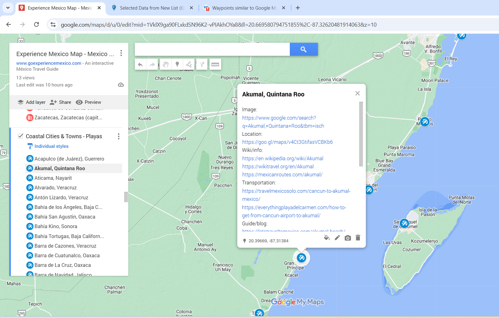
If you haven't worked with Google MyMaps do yourself a favor and play with it. The layers and Waypoints features are very very useful. I know of one guy who has created a waypoints file for Mexico that lists hundreds of places with descriptions and directions and links grouped into multiple categories (eg Aztec Ruins, Pueblas Magicas etc)
Anytime I read about a place that sounds interesting I add it to a google MyMap (USA Destinations, grouped by US States) so I am aware of it a year from now when I might be in that place.
-
@Stanisław I am on a basic membership as I evaluate the program so I may not be seeing all the options, but from the description it seems that the POIs are pretty limited in function. For example the following in the support article: "A POI will only be exported if it has been added to the route (see chapter 1 > Add as route point). Just showing POIs in the Route lab is not enough to export them" seems to indicate that the POI must be part of the route, which is exactly what I don't want. I want it to be there, but not be part of the route.
If you haven't worked with Google MyMaps do yourself a favor and play with it. The layers and Waypoints features are very very useful. I know of one guy who has created a waypoints file for Mexico that lists hundreds of places with descriptions and directions and links grouped into multiple categories (eg Aztec Ruins, Pueblas Magicas etc)
Anytime I read about a place that sounds interesting I add it to a google MyMap (USA Destinations, grouped by US States) so I am aware of it a year from now when I might be in that place.
@Stephan-Dornberg @Stephan-Dornberg you are right, manual added POI must be added to the selected route. Anyway there is a possibility to import a list of POI and it is then visible during navigation by default - see the topic:
POI improvements -
@Stanisław I am on a basic membership as I evaluate the program so I may not be seeing all the options, but from the description it seems that the POIs are pretty limited in function. For example the following in the support article: "A POI will only be exported if it has been added to the route (see chapter 1 > Add as route point). Just showing POIs in the Route lab is not enough to export them" seems to indicate that the POI must be part of the route, which is exactly what I don't want. I want it to be there, but not be part of the route.
If you haven't worked with Google MyMaps do yourself a favor and play with it. The layers and Waypoints features are very very useful. I know of one guy who has created a waypoints file for Mexico that lists hundreds of places with descriptions and directions and links grouped into multiple categories (eg Aztec Ruins, Pueblas Magicas etc)
Anytime I read about a place that sounds interesting I add it to a google MyMap (USA Destinations, grouped by US States) so I am aware of it a year from now when I might be in that place.
@Stephan-Dornberg This is a screenshot of picnic sites beside a route.
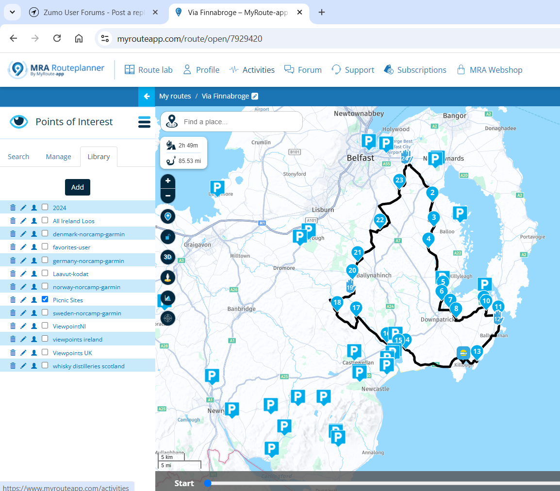 is that the type of arrangement you are trying to achieve?
 -
that is exactly what I am looking for.
can you show/explain how you did that
thank you -
that is exactly what I am looking for.
can you show/explain how you did that
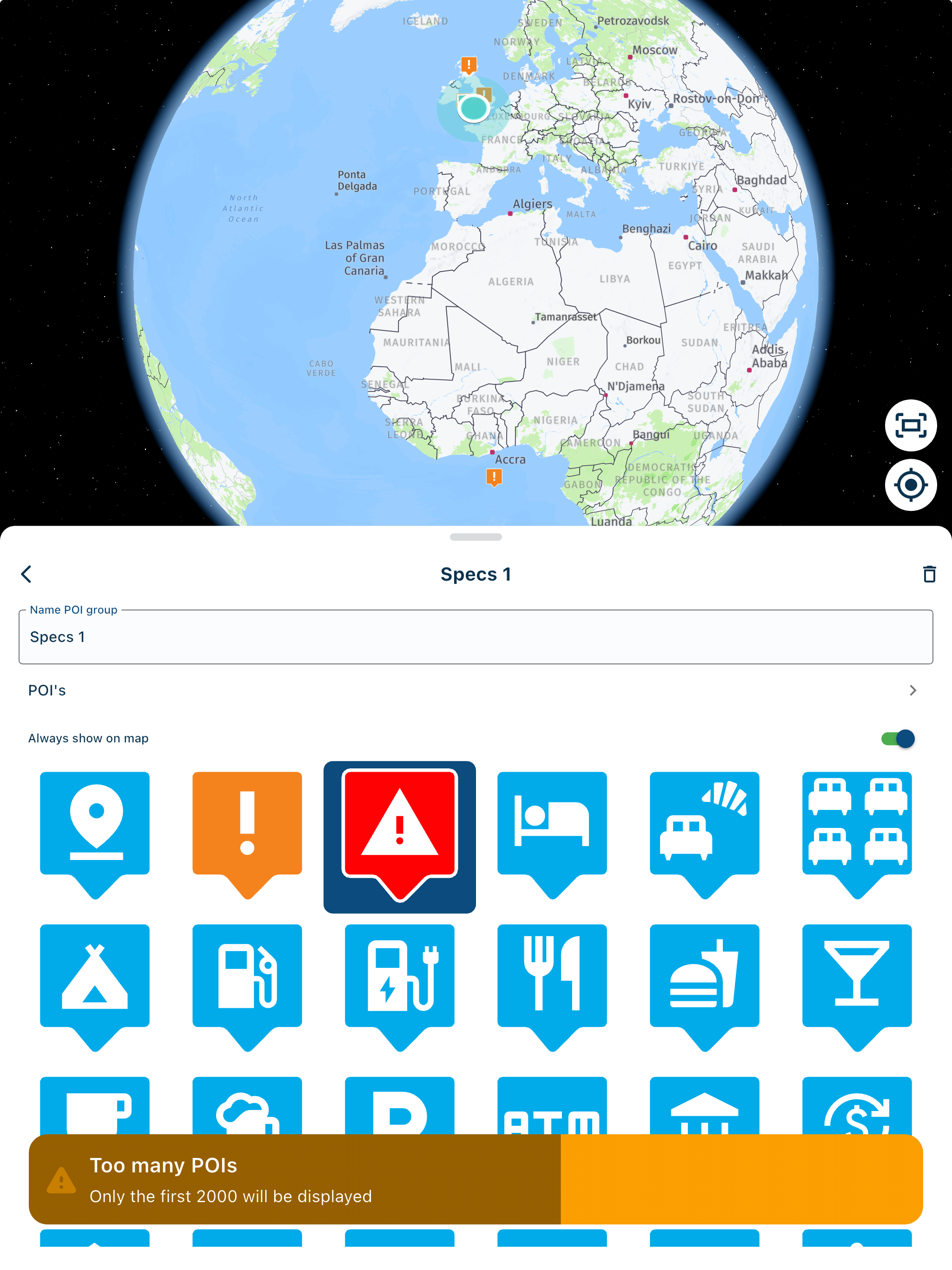
thank you1.Firstly go to routelab on the website
2.Select upload
3.Select POI far right of 4 tabs
4.Select a file from your computer supported formats for POI are OV2, GPX, CSV.
5.When the file is uploaded go to routes and open any route
6.The route will open with the waypoints displayed click the three line hamburger to the left of "Waypoints
7. When you select POI in the Drop down menu and library then the POI's that you have loaded will appear. as in this example

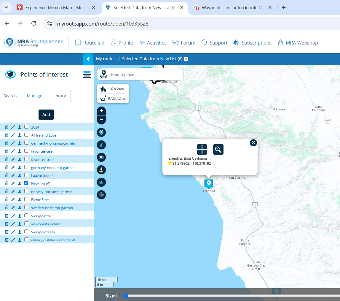
This is a list of my Custom POI'sTo use the POI in a route open the route and make sure the POI's that you want displayed on the map by ticking them and zoom in until they become visible.
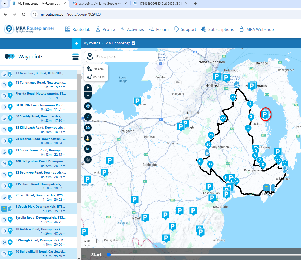
If I want to add the circled POI to the route.
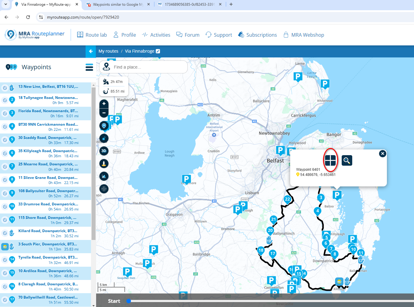
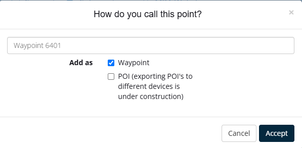
Click on it and hit the little cross and add as a waypoint
It will add the point at the end of the route
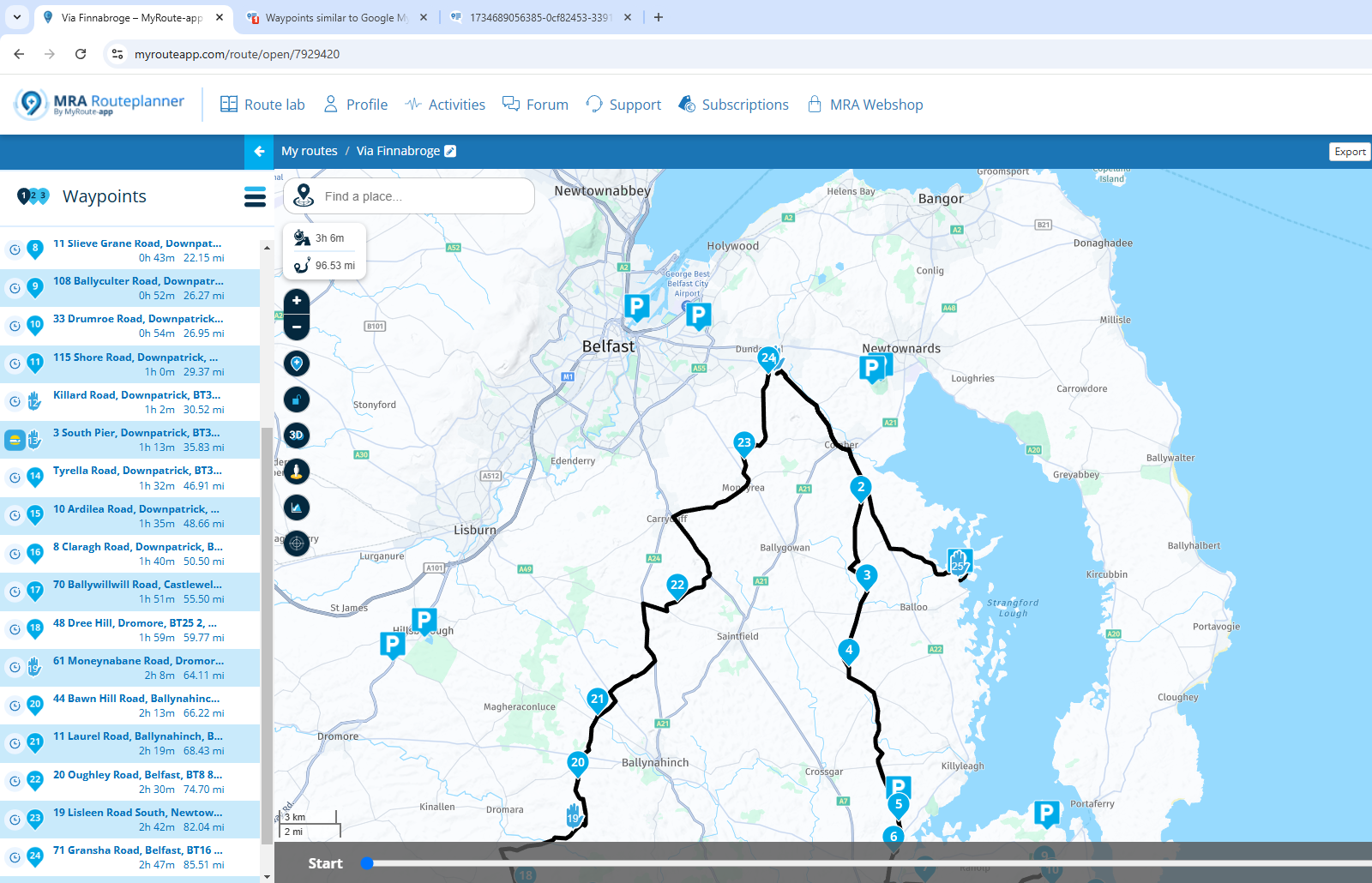
Just move point 25 below point 2 on the waypoints list. And the point is on your route.
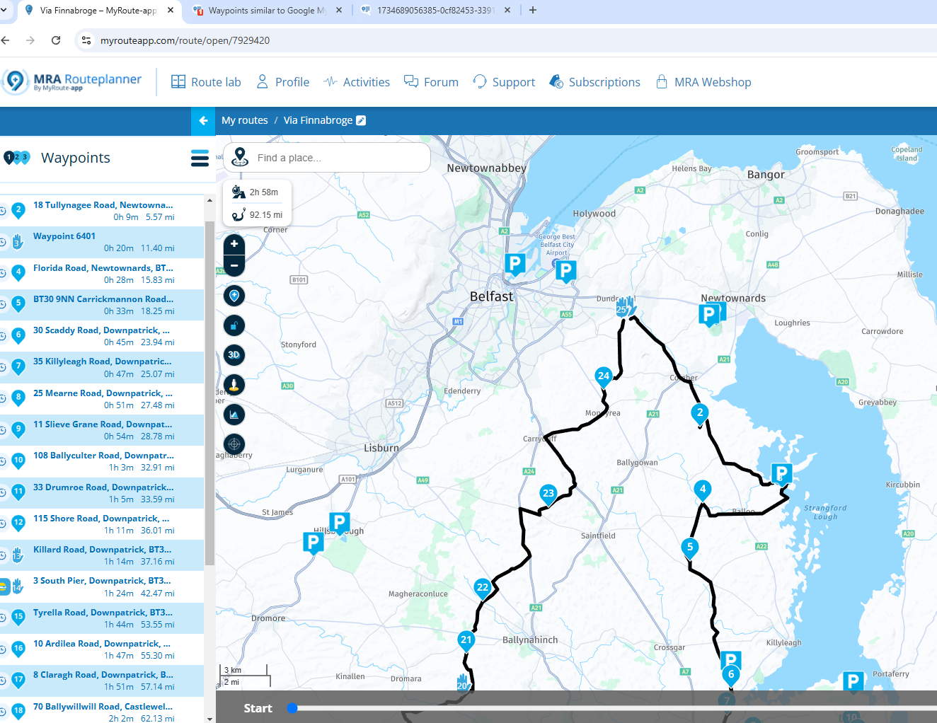
In this case you would then need to go and tidy up point 2 and 4 which are now slightly off route.
-
that is exactly what I am looking for.
can you show/explain how you did that
thank you@randy-etheridge You don't mention what you are using for Navigation I use a Garmin Zumo XT and the App via AA on my Africa twin.
On the Zumo the POI's downloaded with the routes are loaded into Favourites and this is fine if you are dealing with a small number of POI's like the 27 points of the Irish Photo rally. If you are dealing with large datasets like picnic sites or public toilets for Ireland (I'm 63 :D) then these are better dealt with as a .gpi file using Garmins POI loader.
-
@Stephan-Dornberg This is a screenshot of picnic sites beside a route.
is that the type of arrangement you are trying to achieve?@Mzokk Thank you very much for this detailed reply and tutorial. I am going to have to experiment with it and see, but at first glance it does look like it might accomplish what I want. THe time and effort you put into documenting this in this thread is appreciated !
That said, the developers should really take a look at the functionality of Waypoints as used in google MyMpas because it really is brilliant. The "Waypoints" in MRA have some of that functionality, but not all. And the way MyMaps allows you to toggle layers (of waypoints or routes) on and off is extremely useful.
As an example of this, take a look at this MyMap:
With one click you can show or hide a huge number of POIs arranged in categories. Each POI has more detailed information available (similar to MRA Waypoints).
Quite frankly, for me, if MyMaps had the ability to do routing (turn by turn) it would be the premier app.. for some bizarre reason you cannot take a route from MyMaps and navigate it. Its blindingly stupid why this is not possible.
Anyway, thank you again for showing me a possible solution.
-
@Mzokk Thank you very much for this detailed reply and tutorial. I am going to have to experiment with it and see, but at first glance it does look like it might accomplish what I want. THe time and effort you put into documenting this in this thread is appreciated !
That said, the developers should really take a look at the functionality of Waypoints as used in google MyMpas because it really is brilliant. The "Waypoints" in MRA have some of that functionality, but not all. And the way MyMaps allows you to toggle layers (of waypoints or routes) on and off is extremely useful.
As an example of this, take a look at this MyMap:
With one click you can show or hide a huge number of POIs arranged in categories. Each POI has more detailed information available (similar to MRA Waypoints).
Quite frankly, for me, if MyMaps had the ability to do routing (turn by turn) it would be the premier app.. for some bizarre reason you cannot take a route from MyMaps and navigate it. Its blindingly stupid why this is not possible.
Anyway, thank you again for showing me a possible solution.
@Stephan-Dornberg No problem, unfortunately no single routing or mapping programme does everything. I too use google MyMaps , and also still use Garmin Basecamp. For POI's I quite often harvest these from openstreetmaps using QGIS. Like most things its horses for courses. Good luck.
-
@Mzokk Thank you very much for this detailed reply and tutorial. I am going to have to experiment with it and see, but at first glance it does look like it might accomplish what I want. THe time and effort you put into documenting this in this thread is appreciated !
That said, the developers should really take a look at the functionality of Waypoints as used in google MyMpas because it really is brilliant. The "Waypoints" in MRA have some of that functionality, but not all. And the way MyMaps allows you to toggle layers (of waypoints or routes) on and off is extremely useful.
As an example of this, take a look at this MyMap:
With one click you can show or hide a huge number of POIs arranged in categories. Each POI has more detailed information available (similar to MRA Waypoints).
Quite frankly, for me, if MyMaps had the ability to do routing (turn by turn) it would be the premier app.. for some bizarre reason you cannot take a route from MyMaps and navigate it. Its blindingly stupid why this is not possible.
Anyway, thank you again for showing me a possible solution.
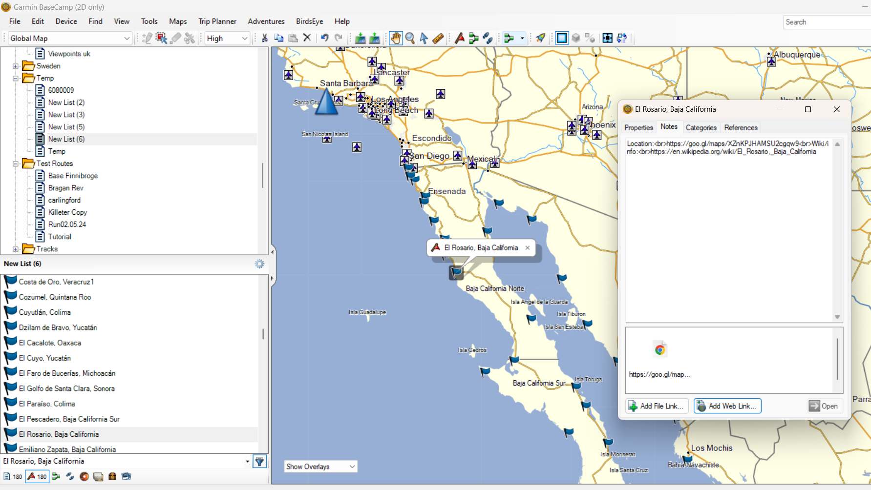
@Stephan-Dornberg Hi Stephan, i had a look at this and if you use the POI's in a route in MyRoute app the URL's for extra information are retained but are no longer hyperlinks as the are in Google MyMaps.
If you bring the points in as POI's then only the location information is retained.
Basecamp can bring the information in as text but allows you to create hyperlinks to the URL's. I'm not sure how this would work with any of the Garmin devices as they don't have browsers.
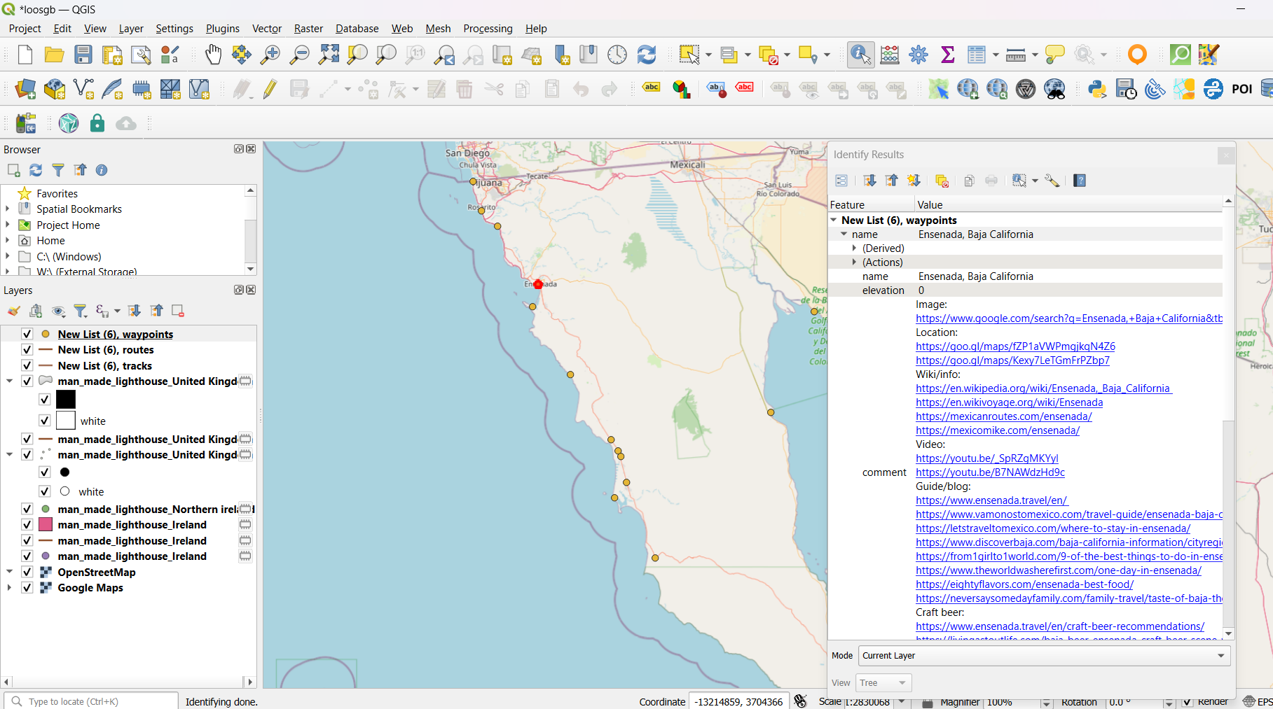
Finally QGIS brings all of the data and URL's in as hyperlinks but it's not a routing programme.
I know that the dev's are looking at ways to enhance MRA route planning (which is already very good and simple to use for on the fly route planning when on tour) and have suggested that handling of POI's requires improvement. Perhaps a way to link URL's to imported POI's for enriched information would be one such improvement. I enjoyed looking at your POI's for Mexico you've done a lot of good work on those

-
@Stephan-Dornberg Hi Stephan, i had a look at this and if you use the POI's in a route in MyRoute app the URL's for extra information are retained but are no longer hyperlinks as the are in Google MyMaps.
If you bring the points in as POI's then only the location information is retained.
Basecamp can bring the information in as text but allows you to create hyperlinks to the URL's. I'm not sure how this would work with any of the Garmin devices as they don't have browsers.
Finally QGIS brings all of the data and URL's in as hyperlinks but it's not a routing programme.
I know that the dev's are looking at ways to enhance MRA route planning (which is already very good and simple to use for on the fly route planning when on tour) and have suggested that handling of POI's requires improvement. Perhaps a way to link URL's to imported POI's for enriched information would be one such improvement. I enjoyed looking at your POI's for Mexico you've done a lot of good work on those
@Mzokk Thanks. How did you get the info into MRA as Waypoints, simple cut and paste ?
BTW, to be clear, I did not create that MyMap for Mexico, someone else has spent countless hours creating it and keeping it updated. I simply added it to my personal Maps collection for future reference and I thought it iullustrated really well what POIs can/should look like.
-
@Mzokk Thanks. How did you get the info into MRA as Waypoints, simple cut and paste ?
BTW, to be clear, I did not create that MyMap for Mexico, someone else has spent countless hours creating it and keeping it updated. I simply added it to my personal Maps collection for future reference and I thought it iullustrated really well what POIs can/should look like.
@Stephan-Dornberg The handling of POI's in the MRA route planner is a bit odd at the moment. If you bring in a number of waypoints from Google MyMaps to form a route it will accept : GPX, ITN, TRF, TPF, KML, KMZ, TAR.GZ.
Files and the enhanced information for the waypoints (but not the hyperlinks) are retained. To do this you just export the relevant Waypoints from MyMaps (you can select just the waypoints you want in mymaps it does not have to be the whole dataset) and download them to your computer as KML and then upload them directly as KML to MRA route planner. They will come in as a route joined by roads.POI's can only be uploaded as OV2, GPX, CSV. MyMaps can export waypoints as CSV but for that data set the location information was not coming over correctly. I'm sure you could correct this in the CSV file using Excel or Google Sheets. However, in this case I took a shortcut as Basecamp can import KML/KMZ files from MyMaps directly then export them as GPX. When I imported the GPX file created by Basecamp to the POI library of MRA routeplanner the spatial/location information was correctly read and displayed in MRA. This takes much longer to explain than to do
 If MRA could import POI's directly from MyMaps KML/KMZ files it would be helpful.
 -
@Stephan-Dornberg Hi Stephan, i had a look at this and if you use the POI's in a route in MyRoute app the URL's for extra information are retained but are no longer hyperlinks as the are in Google MyMaps.
If you bring the points in as POI's then only the location information is retained.
Basecamp can bring the information in as text but allows you to create hyperlinks to the URL's. I'm not sure how this would work with any of the Garmin devices as they don't have browsers.
Finally QGIS brings all of the data and URL's in as hyperlinks but it's not a routing programme.
I know that the dev's are looking at ways to enhance MRA route planning (which is already very good and simple to use for on the fly route planning when on tour) and have suggested that handling of POI's requires improvement. Perhaps a way to link URL's to imported POI's for enriched information would be one such improvement. I enjoyed looking at your POI's for Mexico you've done a lot of good work on those
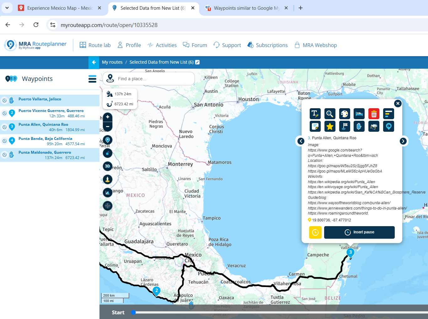
@Mzokk, That's true. However when navigating a route and tapping the waypoint to see the info, it actually does get displayed as a hyperlink:

I think that is where it counts most
")
Hello! It looks like you're interested in this conversation, but you don't have an account yet.
Getting fed up of having to scroll through the same posts each visit? When you register for an account, you'll always come back to exactly where you were before, and choose to be notified of new replies (either via email, or push notification). You'll also be able to save bookmarks and upvote posts to show your appreciation to other community members.
With your input, this post could be even better 💗
Register Login-
07100
-
07038.4k
-
0348
-
019596
-
0486.3k
-
0727
-
0215
-
6276