Waypoints (Again!)
-
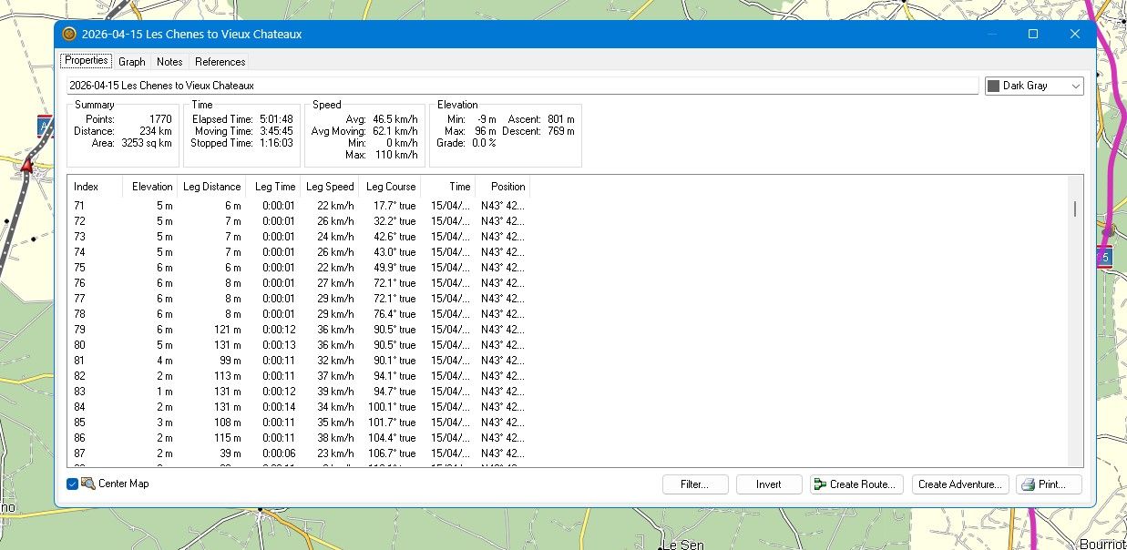
I've been using MRA for years and have successfully used waypoints to shape my routes, which I then export as tracks and navigate these.
I would now like my waypoints to appear in my exported file. I read that tracks can only display the start and end waypoints. Is this correct? If so, why?
I've tried exporting as 1.1 with & without track as well as 1.2.
I've just moved to DMD2 which I believe can show an imported track and route at the same time.
I've scanned many threads here but can't find a definite answer as to if it is possible, and if so, how?
Thanks
-
I've been using MRA for years and have successfully used waypoints to shape my routes, which I then export as tracks and navigate these.
I would now like my waypoints to appear in my exported file. I read that tracks can only display the start and end waypoints. Is this correct? If so, why?
I've tried exporting as 1.1 with & without track as well as 1.2.
I've just moved to DMD2 which I believe can show an imported track and route at the same time.
I've scanned many threads here but can't find a definite answer as to if it is possible, and if so, how?
Thanks
@Stephen-Moriarty gpx 1.2 IS a route based on tracks, with the advantage of having waypoints (not shapingpoints!) between the beginging and the end. Both 1.1 and 1.2 export track and route in the gpx-file.
What kind of device did you use before the dmd2?Met andere apps maak je een route, met MRA componeer je een route!
Ducati Monster 1200 met Garmin Zümo XT
Fiat 124 Spider/Camper Dethleffs met Navigation-App op Samsung Tab Active4 Pro
MRA Lifetime Gold -
I've been using MRA for years and have successfully used waypoints to shape my routes, which I then export as tracks and navigate these.
I would now like my waypoints to appear in my exported file. I read that tracks can only display the start and end waypoints. Is this correct? If so, why?
I've tried exporting as 1.1 with & without track as well as 1.2.
I've just moved to DMD2 which I believe can show an imported track and route at the same time.
I've scanned many threads here but can't find a definite answer as to if it is possible, and if so, how?
Thanks
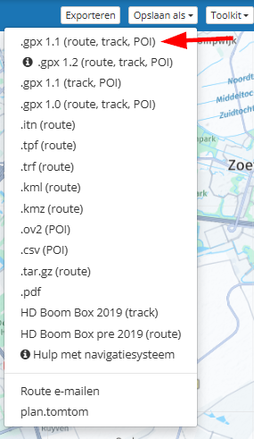
@Stephen-Moriarty if you save your MRA-ROUTEPLANNER route as gpx, please be carefully, because in the list of possible formats for download, there are gpx options "only track" as well as "track and route".
Next, you need to know about the "nature" of a track: it's typically, navigation devices populates only start point and end point on screen. The "nature" of a route is: additionally to start- and end point, there can be more dedicated route points, which will be populated on screen of navi devices.
If you are using DMD device / DMD2 app, you can load a gpx 1.1 file, which contains track and route. In DMD2 App, you can select the track and choose a color (I'm using light green for tracks). Then select the route and choose a different color (I'm using purple for routes). And set the option, to make both - track and route - visible on screen.
By this, you can see, if routing algorithm of DMD2 App is really following your planned route. If purple route line is exactly on light green track line.At least: DMD devices are based on Android, means: you can additionally to DMD2 App also MyRoute-App run on the device. For MyRoute-App, it's not necessary to handle with gpx files, because there is an option you can select, to activate a ongoing synchronisation between MRA-Routeplanner and MyRouteApp.
Nothing is impossible ;-)
In past: GARMIN Zumo 210->GARMIN Zumo 395->GARMIN XT=> now: DMD T865-X + MyRoute-App, LocusMaps, OsmAnd.
In past: GARMIN MapSource ->GARMIN BaseCamp->Tyre->Kurviger->Calimoto=> now: MRA-Routplanner. -
@Stephen-Moriarty gpx 1.2 IS a route based on tracks, with the advantage of having waypoints (not shapingpoints!) between the beginging and the end. Both 1.1 and 1.2 export track and route in the gpx-file.
What kind of device did you use before the dmd2?@Lex.Kloet.RX said in Waypoints (Again!):
@Stephen-Moriarty gpx 1.2 IS a route based on tracks, with the advantage of having waypoints (not shapingpoints!) between the beginging and the end. Both 1.1 and 1.2 export track and route in the gpx-file.
Please keep in mind that the gpx 1.2 format is not an official format! It is made by MRA to add some extra features whch is not included in the official 1.1 format. So, best is to use the gpx 1.1 format since this is the official format. Read here more about the gpx 1.1 format: https://www.topografix.com/gpx.asp
You can save your route as a 1.1 format gpx file includin routte, track and POI.
| MRA Gold Member |
| Garmin Zumo XT + BMW K1200GT |
| MRA Next + Kawasaki Z650 | -
@Lex.Kloet.RX said in Waypoints (Again!):
@Stephen-Moriarty gpx 1.2 IS a route based on tracks, with the advantage of having waypoints (not shapingpoints!) between the beginging and the end. Both 1.1 and 1.2 export track and route in the gpx-file.
Please keep in mind that the gpx 1.2 format is not an official format! It is made by MRA to add some extra features whch is not included in the official 1.1 format. So, best is to use the gpx 1.1 format since this is the official format. Read here more about the gpx 1.1 format: https://www.topografix.com/gpx.asp
You can save your route as a 1.1 format gpx file includin routte, track and POI.
@Nomko-Nomden where did I write, that the 1.2 is an official gpx format? I just mentioned it, because TS mentioned, that he wanted to navigate on tracks with waypoints between start and finish and already downloaded 1.2. And that is exactly what the 1.2 export does for the Garmin Zumo's (that's why I asked what his last device was). And therefore it is, in my opnion, the finest choice for my XT.
-
I've been using MRA for years and have successfully used waypoints to shape my routes, which I then export as tracks and navigate these.
I would now like my waypoints to appear in my exported file. I read that tracks can only display the start and end waypoints. Is this correct? If so, why?
I've tried exporting as 1.1 with & without track as well as 1.2.
I've just moved to DMD2 which I believe can show an imported track and route at the same time.
I've scanned many threads here but can't find a definite answer as to if it is possible, and if so, how?
Thanks
@Stephen-Moriarty of you have a DMD device you can also run MRA from that device. Works beter voor on road routes
-
@Stephen-Moriarty gpx 1.2 IS a route based on tracks, with the advantage of having waypoints (not shapingpoints!) between the beginging and the end. Both 1.1 and 1.2 export track and route in the gpx-file.
What kind of device did you use before the dmd2?@Lex.Kloet.RX Many thanks. I will experiment with this. I was previously using a Montana 680 which is a brilliant device and will remain my backup device. Looking forward to see what the DMD2 T665 can deliver.
-
@Lex.Kloet.RX said in Waypoints (Again!):
@Stephen-Moriarty gpx 1.2 IS a route based on tracks, with the advantage of having waypoints (not shapingpoints!) between the beginging and the end. Both 1.1 and 1.2 export track and route in the gpx-file.
Please keep in mind that the gpx 1.2 format is not an official format! It is made by MRA to add some extra features whch is not included in the official 1.1 format. So, best is to use the gpx 1.1 format since this is the official format. Read here more about the gpx 1.1 format: https://www.topografix.com/gpx.asp
You can save your route as a 1.1 format gpx file includin routte, track and POI.
@Nomko-Nomden Many thanks. Your comments are well noted.
-
@Stephen-Moriarty if you save your MRA-ROUTEPLANNER route as gpx, please be carefully, because in the list of possible formats for download, there are gpx options "only track" as well as "track and route".
Next, you need to know about the "nature" of a track: it's typically, navigation devices populates only start point and end point on screen. The "nature" of a route is: additionally to start- and end point, there can be more dedicated route points, which will be populated on screen of navi devices.
If you are using DMD device / DMD2 app, you can load a gpx 1.1 file, which contains track and route. In DMD2 App, you can select the track and choose a color (I'm using light green for tracks). Then select the route and choose a different color (I'm using purple for routes). And set the option, to make both - track and route - visible on screen.
By this, you can see, if routing algorithm of DMD2 App is really following your planned route. If purple route line is exactly on light green track line.At least: DMD devices are based on Android, means: you can additionally to DMD2 App also MyRoute-App run on the device. For MyRoute-App, it's not necessary to handle with gpx files, because there is an option you can select, to activate a ongoing synchronisation between MRA-Routeplanner and MyRouteApp.
@Guzzist Thanks for your advice. I will look further into these options shortly.
Hello! It looks like you're interested in this conversation, but you don't have an account yet.
Getting fed up of having to scroll through the same posts each visit? When you register for an account, you'll always come back to exactly where you were before, and choose to be notified of new replies (either via email, or push notification). You'll also be able to save bookmarks and upvote posts to show your appreciation to other community members.
With your input, this post could be even better 💗
Register Login-
-118303
-
09127
-
08167
-
0583
-
0330
-
0312
-
0232
-
011211