Problem with "Expand" function and Garmin Sat Navs
-
When using the expand function to add extra shaping points, I have come across an issue when using a Garmin Sat Nav ( it does not affect Tom Tom Navs). If the one of the expand shaping points is automatically placed , for instance on a a motorway, at the point another minor road passes under the motorway, the Garmin assumes that I want to route onto the minor road, and will then route me off the motorway onto the minor road, then back onto the motorway! Yet the Tom Tom ignores this. Can anything be done, other than laboriously going over the whole route to check no shaping points are positioned in this way?
Hi Steve, always check the position off your waypoints before you send it to your satnav.
-
When using the expand function to add extra shaping points, I have come across an issue when using a Garmin Sat Nav ( it does not affect Tom Tom Navs). If the one of the expand shaping points is automatically placed , for instance on a a motorway, at the point another minor road passes under the motorway, the Garmin assumes that I want to route onto the minor road, and will then route me off the motorway onto the minor road, then back onto the motorway! Yet the Tom Tom ignores this. Can anything be done, other than laboriously going over the whole route to check no shaping points are positioned in this way?
When using the Expand function in MRA, I specifically go looking for Expanded Waypoints that are on or near Junctions or Roundabouts (Including Underpasses or Overpasses) and then I manually move them to avoid this issue.
In my opinion this is a small inconvenience compared to manually creating all your waypoints, particularly for long routes and tours. -
When using the expand function to add extra shaping points, I have come across an issue when using a Garmin Sat Nav ( it does not affect Tom Tom Navs). If the one of the expand shaping points is automatically placed , for instance on a a motorway, at the point another minor road passes under the motorway, the Garmin assumes that I want to route onto the minor road, and will then route me off the motorway onto the minor road, then back onto the motorway! Yet the Tom Tom ignores this. Can anything be done, other than laboriously going over the whole route to check no shaping points are positioned in this way?
And just for further clarification the Tom Tom Windy Routes option is prone to the same issue the way I use it.
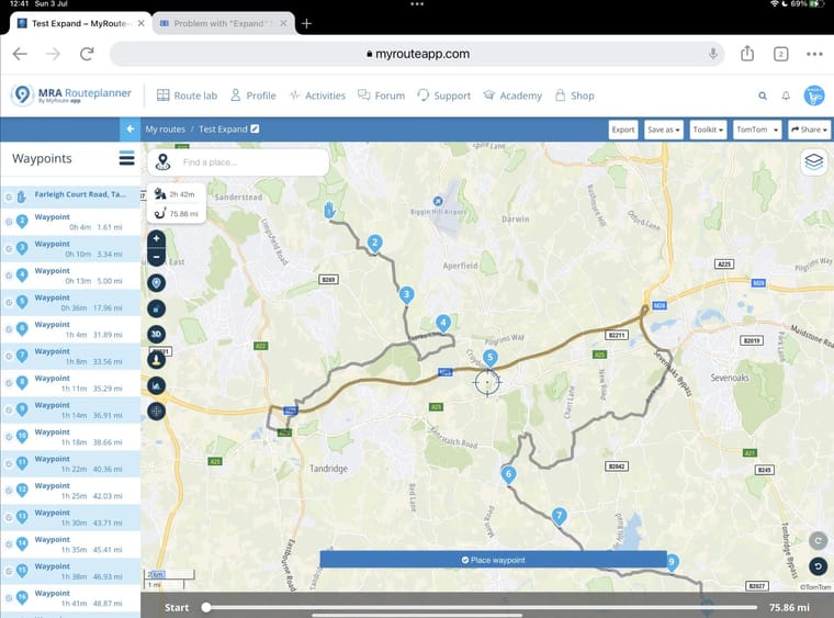
I have a Garmin XT as my main Sat Nav but in my opinion the Tom Tom Windy Routes is the best because it will take me on the twistiest country roads, those roads with the grass in the middle.Here’s an example of the issue in the Tom Tom Map that is clearly not what I intended at “Extended” Waypoint 5.

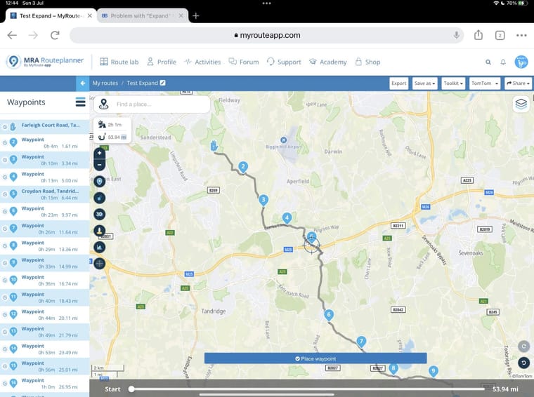
And here I corrected Waypoint 5 to solve the issue by manually moving it.

Obviously, when I switch to the Here map I have to check every waypoint for differences between the TT and Here map.
For me the end result is worth the extra effort and another example of MRA giving us the tools to do things that may not be the intended use. -
When using the Expand function in MRA, I specifically go looking for Expanded Waypoints that are on or near Junctions or Roundabouts (Including Underpasses or Overpasses) and then I manually move them to avoid this issue.
In my opinion this is a small inconvenience compared to manually creating all your waypoints, particularly for long routes and tours.@Steve-Lynch Yes, I understand what you are saying, it is just a right pain in the ar*e having constructed a route that is fine, then adding extra shaping points via the expand function - to then have to go back and check every single shaping point. Also bit of a mystery when the same route loaded onto a Tom Tom runs perfectly.
-
Hi Steve, always check the position off your waypoints before you send it to your satnav.
@Hans-van-de-Ven-MRA-Master Yep, got that - but you totally missed my point, i.e. "Can anything be done, other than laboriously going over the whole route to check no shaping points are positioned in this way?" Also bit of a mystery as to why the Tom Tom ignores this issue.
-
@Steve-Lynch Yes, I understand what you are saying, it is just a right pain in the ar*e having constructed a route that is fine, then adding extra shaping points via the expand function - to then have to go back and check every single shaping point. Also bit of a mystery when the same route loaded onto a Tom Tom runs perfectly.
@Steve-Dean it appears to me that MRA routeplanner (or any other tool for that matter) cannot (and should not) assume (and take decisions) where you want to go.
This is why I am quite reluctant about auto generating routes whether these are windy or not.
The expand function is a real timesaver to increase the number of points but as last step in the route building process you should always check if all points are on the road and not in the middle of a field, on the correct side of the highway, etc... and indeed this is costing some time...
-
@Hans-van-de-Ven-MRA-Master Yep, got that - but you totally missed my point, i.e. "Can anything be done, other than laboriously going over the whole route to check no shaping points are positioned in this way?" Also bit of a mystery as to why the Tom Tom ignores this issue.
@Steve-Dean said in Problem with "Expand" function and Garmin Sat Navs:
@Hans-van-de-Ven-MRA-Master Yep, got that - but you totally missed my point, i.e. "Can anything be done, other than laboriously going over the whole route to check no shaping points are positioned in this way?" Also bit of a mystery as to why the Tom Tom ignores this issue.
Hi @Steve-Dean. It really isn’t laborious if you go about it like this: Click on the first route point, fully zoom in using the magnifying glass and adjust if necessary, then use the right arrow > to move to the next route point (still fully zoomed) and adjust. A route with 100 route points can be checked and adjusted in just 2 minutes.
