The Dingle Peninsula route
-
Sorry if this is in the wrong section.
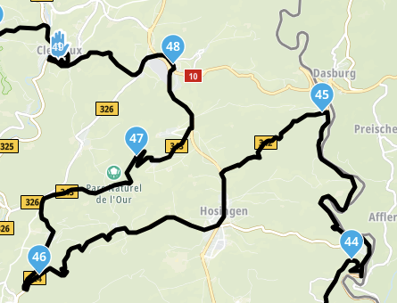
I'm trying to do a route following the costal route around this area, and no matter what way I do the route, clockwise or anti clockwise, it will not let me complete the route at the southern end. The route fly's off up north, and no matter what I try it won't complete it. It's the same in all the maps I use, I'm just a basic member, but have had no trouble doing other routes in Eire. What am I doing wrong.
This is where the problem is
Fahan, IE
52.105451, -10.410576
to
R559, Coumeenoole South, IE
52.104818, -10.455208
It won't stay on the costal road, it goes up north to here
Ballintemple, IE
52.141667, -10.424137
Thank you for your help in advance. -
Sorry if this is in the wrong section.
I'm trying to do a route following the costal route around this area, and no matter what way I do the route, clockwise or anti clockwise, it will not let me complete the route at the southern end. The route fly's off up north, and no matter what I try it won't complete it. It's the same in all the maps I use, I'm just a basic member, but have had no trouble doing other routes in Eire. What am I doing wrong.
This is where the problem is
Fahan, IE
52.105451, -10.410576
to
R559, Coumeenoole South, IE
52.104818, -10.455208
It won't stay on the costal road, it goes up north to here
Ballintemple, IE
52.141667, -10.424137
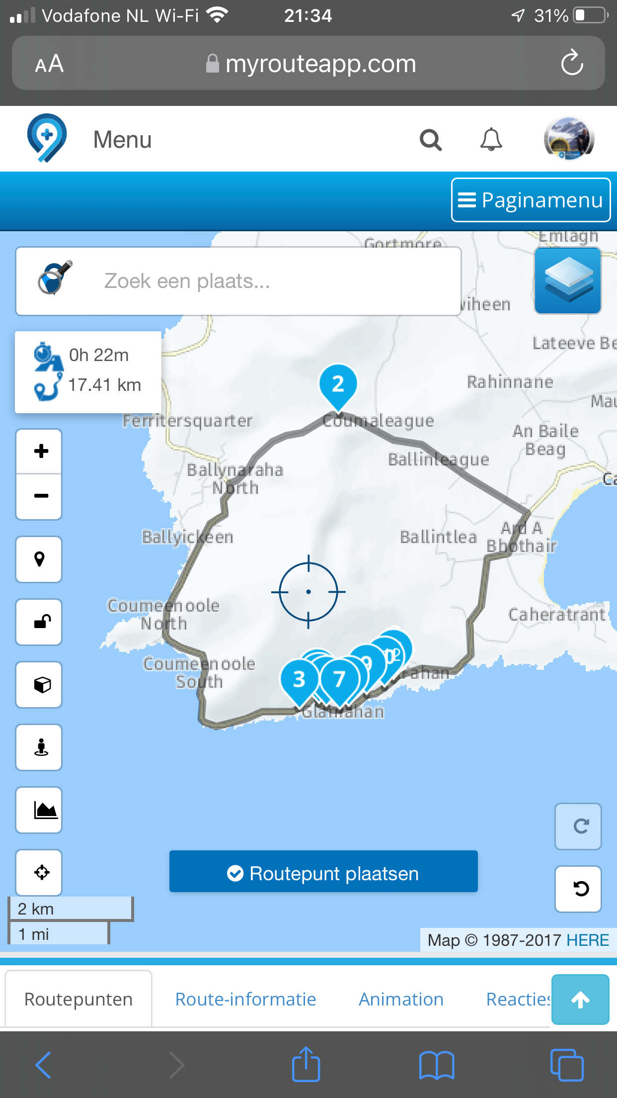
Thank you for your help in advance.Set your route public please and share the url here, so we can take a look
Garmin Zumo XT3/XT2/XT/BMW Connected Ride Navigator/MyRouteapp (The App)/...
Een dag niet gelachen is een dag niet geleefd / Een route is net zo goed als deze uitgezet is. -
Set your route public please and share the url here, so we can take a look
@Hans-van-de-Ven-MRA-Master OK will do.
It's now Public. Thank you for your help.
https://www.myrouteapp.com/route/open/5397656 -
@Hans-van-de-Ven-MRA-Master OK will do.
It's now Public. Thank you for your help.
https://www.myrouteapp.com/route/open/5397656 -
@Garry-Davis For some reason the OpenStreetMap that is the default map for basic membership doesn’t want to complete the loop. The OpenStreetMap is the map that you are planning on, the other available maps are just overlays that carry different information, if you choose an overlay map, you will still be planning on the OSM. With a gold membership you can choose between OSM, TomTom or Here (Garmin) planning maps. Both the TT and Here planning maps successfully close the loop as @Hans-van-de-Ven-MRA-Master example shows.
I can’t see what the problem with the OSM map is.I’ve looked for road closures but cannot see any. -
Sorry if this is in the wrong section.
I'm trying to do a route following the costal route around this area, and no matter what way I do the route, clockwise or anti clockwise, it will not let me complete the route at the southern end. The route fly's off up north, and no matter what I try it won't complete it. It's the same in all the maps I use, I'm just a basic member, but have had no trouble doing other routes in Eire. What am I doing wrong.
This is where the problem is
Fahan, IE
52.105451, -10.410576
to
R559, Coumeenoole South, IE
52.104818, -10.455208
It won't stay on the costal road, it goes up north to here
Ballintemple, IE
52.141667, -10.424137
Thank you for your help in advance.@Garry-Davis You are getting exactly what you have asked for there. I replicated your route and added a final point close to the starting point to get a circular route. This worked for me regardless of the map layer used, including OSM.
-
@Garry-Davis You are getting exactly what you have asked for there. I replicated your route and added a final point close to the starting point to get a circular route. This worked for me regardless of the map layer used, including OSM.
@PAD-0 Map layers or overlay maps will have no effect on how the route is mapped. The planning map dictates this and the OSM planning map, for some unknown reason does not complete the loop in this example.
Always willing to help if I can.
Triumph Tiger 1200 XRT called Tina.
MRA Navigation Next and SilverFox BJ8 -
@PAD-0 Map layers or overlay maps will have no effect on how the route is mapped. The planning map dictates this and the OSM planning map, for some unknown reason does not complete the loop in this example.
@Nick-Carthew Thanks for your help. Take care
-
@Garry-Davis You are getting exactly what you have asked for there. I replicated your route and added a final point close to the starting point to get a circular route. This worked for me regardless of the map layer used, including OSM.
@PAD-0. Sorry but I'm not. If I got what I asked for, then why the hell am I asking for help then ??.
Doesn't really make much sense does it. -
@PAD-0. Sorry but I'm not. If I got what I asked for, then why the hell am I asking for help then ??.
Doesn't really make much sense does it.@Garry-Davis My bad! Apologies. I looked at what you seemed to be doing but, while I’d changed the map layer, I neglected to change the default map in my settings!🤭 As a result, I couldn’t make happen what you couldn’t stop from happening. Doh!
As @Hans-van-de-Ven-MRA-Master has shown, in these kind of situations it’s usually possible to force the mapping into submission by throwing shed loads of waypoints at it! Other times, for subscribers at least, turning off ‘seasonal closures’ can work (these closures cover a multitude of sins - often not so much seasonal as temporary).
In this case, I wasn’t able to identify any particular cause. However, I messaged a friend who lives near Dingle and he says that a decision was taken ‘a while back’ to make some tourist routes one way and that the one around Slea Head runs clockwise from Dingle - counter to the anti-clockwise Ring of Kerry. I can’t see why in particular, but it seems that these one way systems have been causing havoc for sat nav users.
Also, there have been very heavy rains and winds recently, with some landslips and local road closures, though not on the Slea Head road as far as he’s aware. But maybe there could be some connected data in OSM?
Incidentally, I have found subscribing to the MRA Route Planner app well worthwhile as it does broaden your scope in some very useful ways.
I hope some of this helps following my cock up!
-
@Garry-Davis My bad! Apologies. I looked at what you seemed to be doing but, while I’d changed the map layer, I neglected to change the default map in my settings!🤭 As a result, I couldn’t make happen what you couldn’t stop from happening. Doh!
As @Hans-van-de-Ven-MRA-Master has shown, in these kind of situations it’s usually possible to force the mapping into submission by throwing shed loads of waypoints at it! Other times, for subscribers at least, turning off ‘seasonal closures’ can work (these closures cover a multitude of sins - often not so much seasonal as temporary).
In this case, I wasn’t able to identify any particular cause. However, I messaged a friend who lives near Dingle and he says that a decision was taken ‘a while back’ to make some tourist routes one way and that the one around Slea Head runs clockwise from Dingle - counter to the anti-clockwise Ring of Kerry. I can’t see why in particular, but it seems that these one way systems have been causing havoc for sat nav users.
Also, there have been very heavy rains and winds recently, with some landslips and local road closures, though not on the Slea Head road as far as he’s aware. But maybe there could be some connected data in OSM?
Incidentally, I have found subscribing to the MRA Route Planner app well worthwhile as it does broaden your scope in some very useful ways.
I hope some of this helps following my cock up!
@PAD-0 That's very kind of you, but no apology was necessary. I'm new to all this computer stuff and I totally understand that compared to a lot of people here, I don't even get out of the starting blocks.
I've done the route in Basecamp, and I just wanted to replicate it on MyRoute -app, so I could give the route to my friend who uses a Tom-tom. I guess when I go I'll find out which way I'll be going.
Thanks again and take care.
 ️
️ -
@PAD-0 That's very kind of you, but no apology was necessary. I'm new to all this computer stuff and I totally understand that compared to a lot of people here, I don't even get out of the starting blocks.
I've done the route in Basecamp, and I just wanted to replicate it on MyRoute -app, so I could give the route to my friend who uses a Tom-tom. I guess when I go I'll find out which way I'll be going.
Thanks again and take care.️@Garry-Davis Be sure to use the ‘compare with TomTom tool’ if you share to TomTom users.
With the compare tool on, if there are any discrepancies, you’ll see a red line, this is TomTom’s interpretation of the route. Add additional route points to force the TT to follow the same route.Always willing to help if I can.
Triumph Tiger 1200 XRT called Tina.
MRA Navigation Next and SilverFox BJ8 -
@Garry-Davis Be sure to use the ‘compare with TomTom tool’ if you share to TomTom users.
With the compare tool on, if there are any discrepancies, you’ll see a red line, this is TomTom’s interpretation of the route. Add additional route points to force the TT to follow the same route.@Nick-Carthew Will do, and again, Thanks for you help.
Hello! It looks like you're interested in this conversation, but you don't have an account yet.
Getting fed up of having to scroll through the same posts each visit? When you register for an account, you'll always come back to exactly where you were before, and choose to be notified of new replies (either via email, or push notification). You'll also be able to save bookmarks and upvote posts to show your appreciation to other community members.
With your input, this post could be even better 💗
Register Login-
024540
-
1472.5k
-
0458
-
2650
-
06163
-
0392
-
27402.8k
-
-15161