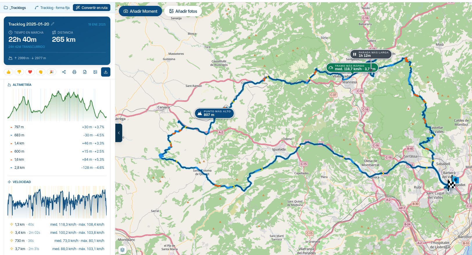
Some help required for providing a Walking Route saved as a Tracklog.
-
For Episode 6 of my YouTube Route Series, if the end user chooses, they can park the bike up in a Car Park in the Surrey Hills and then walk to a “secret” waterfall in the Wotton Estate in the Surrey Hills.
This is my first foray into the Walking category so I am a bit confused as to how this Tracklog can be saved to allow the end user to walk the Tracklog if they choose to?If the end user clicks “Use as Route” then obviously the the Walked Tracklog is lost as it tries to plot it on actual roads.
I presume therefore that the end user would need to use “Save As” but I am unsure which file format to use.
I presume the obvious choice is to use .kml (Track) but doesn’t the end user then have to login to google maps to be able to import the Tracklog?The options I presume are the following:
.gpx1.1 (Track)
.gpx1.0 (Track)
.kml (track)
.kmz (track)This is the link to the Public Tracklog.
https://www.myrouteapp.com/en/social/track/338501?mode=shareAny help given on the above file formats would be greatly received as I am a Walking Route newbie.
Thank you.
You don’t stop riding when you get old, you get old when you stop riding.
-
For Episode 6 of my YouTube Route Series, if the end user chooses, they can park the bike up in a Car Park in the Surrey Hills and then walk to a “secret” waterfall in the Wotton Estate in the Surrey Hills.
This is my first foray into the Walking category so I am a bit confused as to how this Tracklog can be saved to allow the end user to walk the Tracklog if they choose to?If the end user clicks “Use as Route” then obviously the the Walked Tracklog is lost as it tries to plot it on actual roads.
I presume therefore that the end user would need to use “Save As” but I am unsure which file format to use.
I presume the obvious choice is to use .kml (Track) but doesn’t the end user then have to login to google maps to be able to import the Tracklog?The options I presume are the following:
.gpx1.1 (Track)
.gpx1.0 (Track)
.kml (track)
.kmz (track)This is the link to the Public Tracklog.
https://www.myrouteapp.com/en/social/track/338501?mode=shareAny help given on the above file formats would be greatly received as I am a Walking Route newbie.
Thank you.
Hi Steve, If you have a GPS system that has walking and cycling routes in the map, you should be able to use this as .gpx 1.0 or 1.1.
I myself use the Garmin Edge 1030 for my cycling routes, which are created in MRA on the OSM map with the bicycle overlay. I then export the Track to the Garmin Edge and I can start it and the direction is indicated by an arrow on the track line.BMW BMW Connected Ride Navigator/Garmin Zumo XT3/XT2/XT//Tourstart/ MyRouteapp (The App)/...
Een dag niet gelachen is een dag niet geleefd / Een route is net zo goed als deze uitgezet is. -
Hi Steve, If you have a GPS system that has walking and cycling routes in the map, you should be able to use this as .gpx 1.0 or 1.1.
I myself use the Garmin Edge 1030 for my cycling routes, which are created in MRA on the OSM map with the bicycle overlay. I then export the Track to the Garmin Edge and I can start it and the direction is indicated by an arrow on the track line.
@Hans-van-de-Ven-MRA-Master
Thanks Hans,
As the main focus of the route is a motorcycle route I doubt that many of the end users will have a device that can track off road walking paths.
This is just a short 10 to 15 minute walk so I am going to provide it as an image on YouTube.
I used OSM to plot the route in Offroad mode using footpaths and used the Google overlay.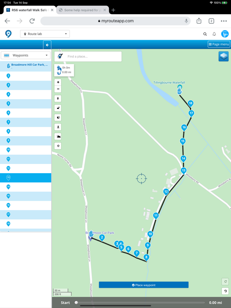
Hello! It looks like you're interested in this conversation, but you don't have an account yet.
Getting fed up of having to scroll through the same posts each visit? When you register for an account, you'll always come back to exactly where you were before, and choose to be notified of new replies (either via email, or push notification). You'll also be able to save bookmarks and upvote posts to show your appreciation to other community members.
With your input, this post could be even better 💗
Register Login-
 0518
0518
-
 0521
0521
-
 039
039
-
0312
-
 0746
0746
-
0311
-
034
-
1265