Track vs Route
-

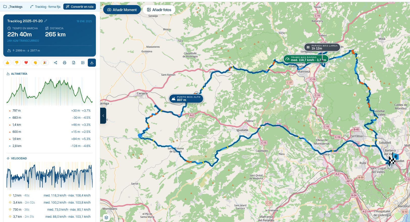
A friend of mine is planning to switch to MRA. Please can someone answer his question ; “Is it possible to show both the track and route from a .gpx file at the same time?”
His question got me thinking. Whenever I create a route, I just open it and navigate. Why do the two formats exist? If you’ve spent a while creating a detailed ‘must go this way’ route, what benefits does the simultaneous creation of a track provide?
-
A friend of mine is planning to switch to MRA. Please can someone answer his question ; “Is it possible to show both the track and route from a .gpx file at the same time?”
His question got me thinking. Whenever I create a route, I just open it and navigate. Why do the two formats exist? If you’ve spent a while creating a detailed ‘must go this way’ route, what benefits does the simultaneous creation of a track provide?
A friend of mine is planning to switch to MRA. Please can someone answer his question ; “Is it possible to show both the track and route from a .gpx file at the same time?”
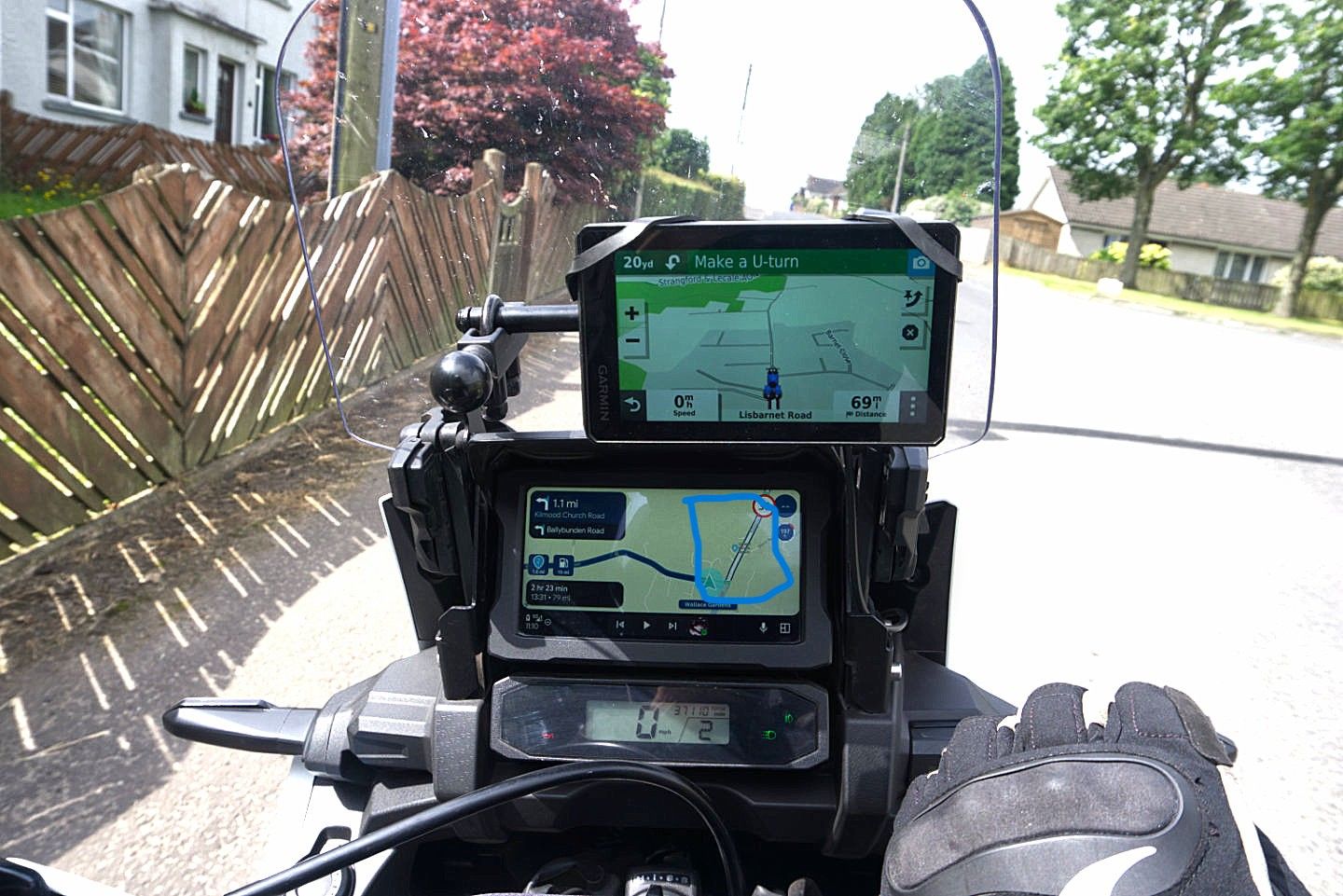
Yes, if he is using a Garmin Device up to the Zumo XT a track can be displayed by enabling it in the devices track manager. For the XT this can also be achieved by connecting to explore and managing "Collections" but I wouldn't recommend it. If using the MRA navigation when navigating the blue line becomes white indicating the intended route, if you go off route and are returning to the route you can see the white intended route on the map display as you approach it.
![4873[1].png](/assets/uploads/files/1785323722169-4873-1.png)
His question got me thinking. Whenever I create a route, I just open it and navigate. Why do the two formats exist? If you’ve spent a while creating a detailed ‘must go this way’ route, what benefits does the simultaneous creation of a track provide?
A track never changes so if you are riding a route or downloading it into a device if gives a reference in case the device creates a different route than that intended.
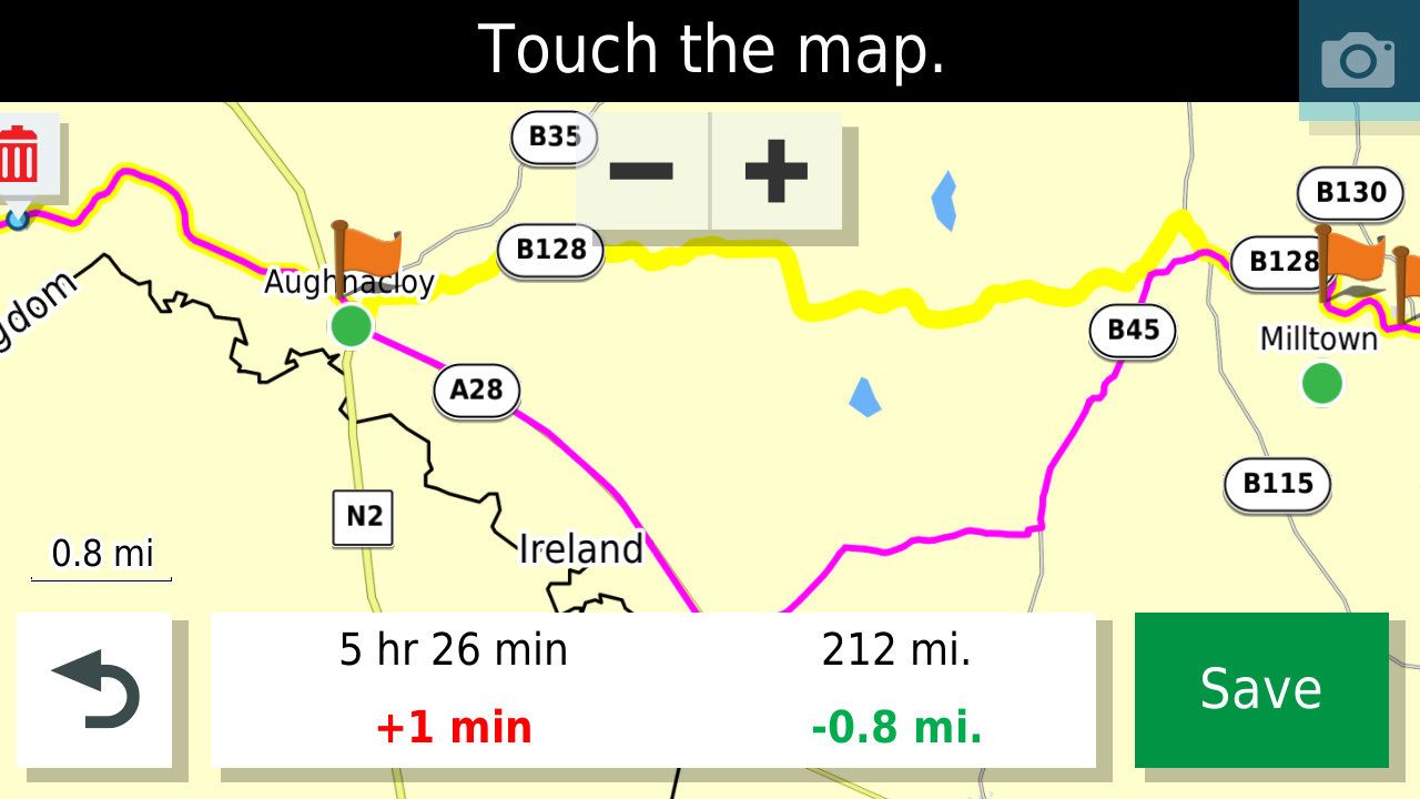
In this example, the track is in Yellow and the calculated route by a Garmin XT has taken a different route than the road intended (the Magenta line) so to correct this an additional shaping point would be required on the yellow line.
-
What device will he be using to navigate? I can answer up if it’s a Garmin.

@Carl-Lee, since his friend is "trying to switch to MRA" and this is in the [App] category of the forum, I think it is a safe bet to assume he's using the MRA app

@roger-needham-0, yes that's possible. every route or track that you navigate automatically shows the original route/track beneath the route line as a whit line that you will see if you deviate from the route/track. So you do not need to do anything about that, just enable that "show original route" option in the settings.
It will be different if you want to show another track beneath the route you are navigating. You can enable multiple routes or tracks to be visible on the map from within the route menu. Pick a route (or track) from the routes menu, tap the 3 dots menu en tap "Show on map". Now if you go back to the map view or start another route to navigate, the first route is shown on the map. You can do this with multiple routes, and even complete folders.
Actually, since the introduction of this feature, the app is WAY more flexible in this than a Zumo
-
-
@con-hennekens ah, that's why you're an alpha

@Carl-Lee, I am trying my best
-
Thx all, I accept I’m probably appearing rather dumb here, but this phrase threw me…” in case the device creates a different route than that intended.”
If I have created a precise route using specific points on specific roads, why would the above happen?
In reality I only go off that prescribed route, if there are for example, roadworks that force a detour.
Above comments are in my own case where I use MRA to create routes and the MRA Navigation on the road.
How can I select navigating by Track in order to always stick exactly to my chosen route?
-
Thx all, I accept I’m probably appearing rather dumb here, but this phrase threw me…” in case the device creates a different route than that intended.”
If I have created a precise route using specific points on specific roads, why would the above happen?
In reality I only go off that prescribed route, if there are for example, roadworks that force a detour.
Above comments are in my own case where I use MRA to create routes and the MRA Navigation on the road.
How can I select navigating by Track in order to always stick exactly to my chosen route?

@Roger-Needham-0 of your route is created correct and with enough shaping points that's exactly what MRA is going to do. In case you must you of that route caused by road works a white line will show you the intended route
-
Thx all, I accept I’m probably appearing rather dumb here, but this phrase threw me…” in case the device creates a different route than that intended.”
If I have created a precise route using specific points on specific roads, why would the above happen?
In reality I only go off that prescribed route, if there are for example, roadworks that force a detour.
Above comments are in my own case where I use MRA to create routes and the MRA Navigation on the road.
How can I select navigating by Track in order to always stick exactly to my chosen route?
How can I select navigating by Track in order to always stick exactly to my chosen route?
Open the app
Tap your profile picture in the top-right corner
Go to Navigation Settings
Select the first option, “Features”
Scroll all the way down... there you'll find the option “Navigate Route as Track”Please note... Your planned route will be followed exactly, even if there are road closures ahead; you'll then have to manually navigate around the construction zone.
-
Gotcha…thanks Peter

I know of a couple of local spots where MRA, Google etc ‘think’ there are roadworks. Either because there have been past roadworks now cleared away, or upcoming roadworks that have been announced, uploaded into planning software, but not yet physically introduced.In those cases I’d be happy to do as you suggest
Hello! It looks like you're interested in this conversation, but you don't have an account yet.
Getting fed up of having to scroll through the same posts each visit? When you register for an account, you'll always come back to exactly where you were before, and choose to be notified of new replies (either via email, or push notification). You'll also be able to save bookmarks and upvote posts to show your appreciation to other community members.
With your input, this post could be even better 💗
Register Login-
 0519
0519
-
 0521
0521
-
 0310
0310
-
0312
-
 0746
0746
-
0311
-
035
-
1265