Scotland - Ullapool to Durness routing double the distance vs Google Maps
-
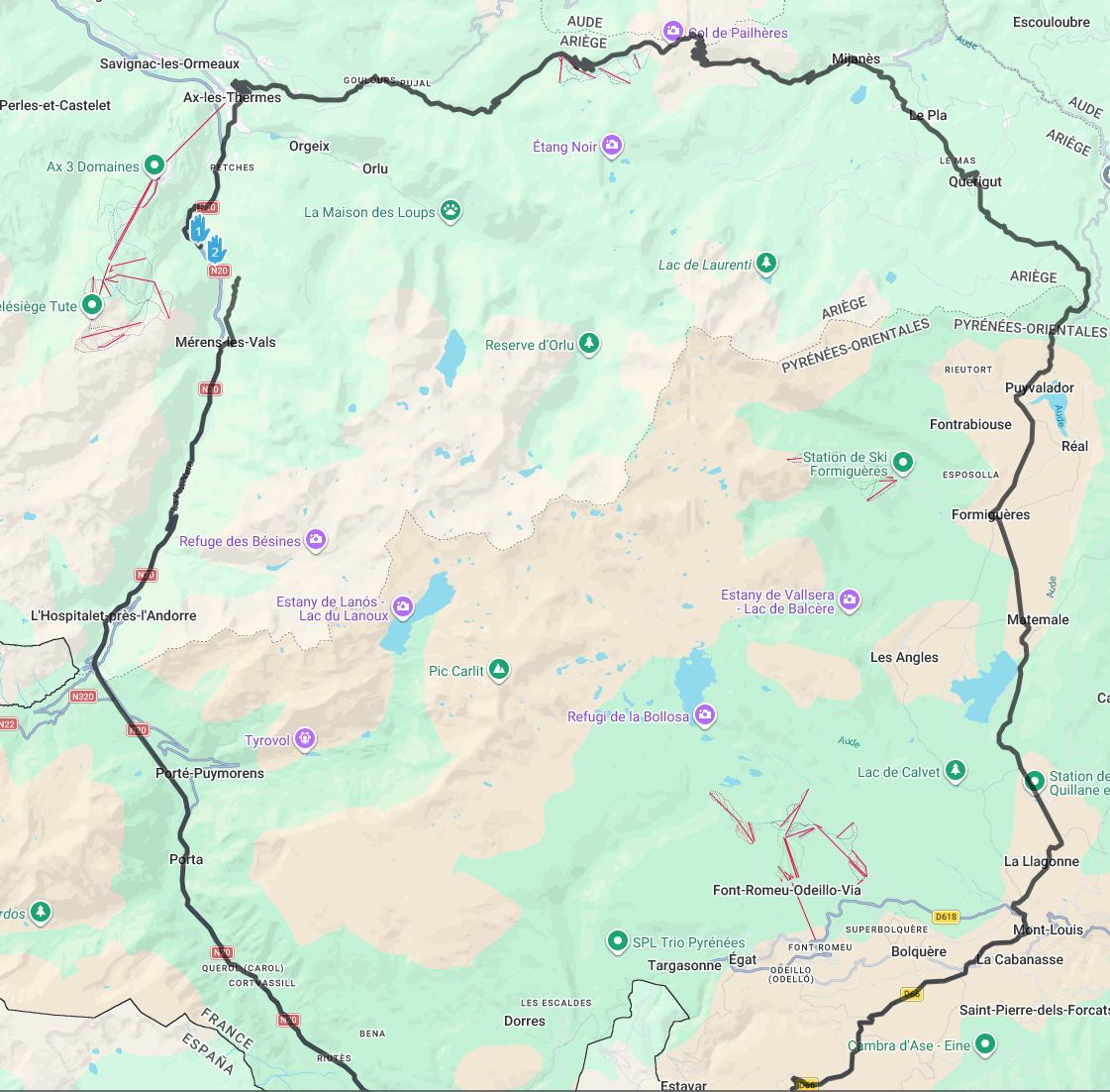
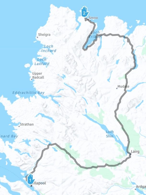
When I try and plan a route between Ullapool and Durness (Scotland) the route makes no sense using Here maps (112 miles), but looks fine using TomTom or Google Maps (67 Miles).
Can anyone try this and see if you get the same odd result?
-
When I try and plan a route between Ullapool and Durness (Scotland) the route makes no sense using Here maps (112 miles), but looks fine using TomTom or Google Maps (67 Miles).
Can anyone try this and see if you get the same odd result?
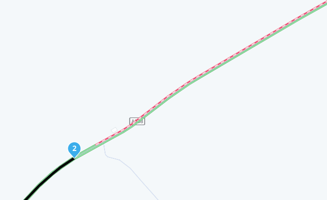
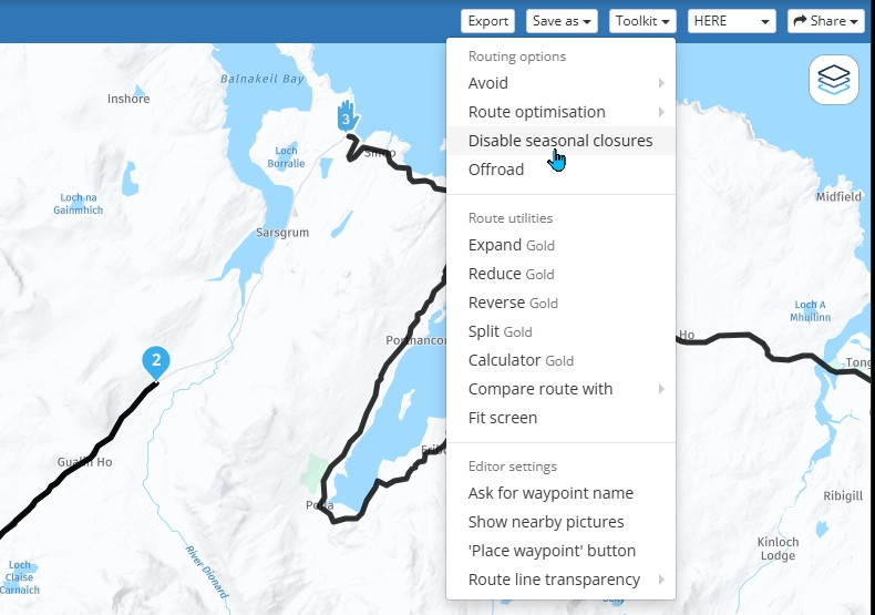
@Simon-Bannister The HERE map is showing a road closure on the A838 just south of thge Kyle of Durness. If you use the Disable seasonal closures tool in the HERE toolkit you can bypass it.
-
When I try and plan a route between Ullapool and Durness (Scotland) the route makes no sense using Here maps (112 miles), but looks fine using TomTom or Google Maps (67 Miles).
Can anyone try this and see if you get the same odd result?
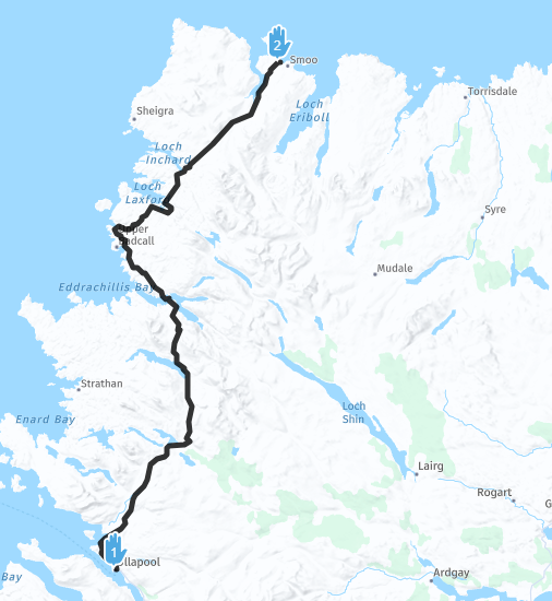
@Simon-Bannister The A838 appears to be clear today, no need to use the Disable seasonal closure tool.
-
Wouldn't it be neat if having found an exceptional* route blockage the app could display it in red, indicating to the user why the route is not as direct as expected.
The user would be informed, rather than confused.
Not sure if it's feasible, but it would certainly have helped me in the past!
Example:
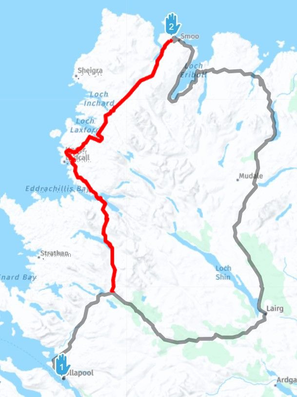
*closed road, serious jam, etc.
Hello! It looks like you're interested in this conversation, but you don't have an account yet.
Getting fed up of having to scroll through the same posts each visit? When you register for an account, you'll always come back to exactly where you were before, and choose to be notified of new replies (either via email, or push notification). You'll also be able to save bookmarks and upvote posts to show your appreciation to other community members.
With your input, this post could be even better 💗
Register Login-
09121
-
0646
-
16105
-
010174
-
310245
-
0544
-
06152
-
14362