Improvement request POI -> GPX
-

I would like to see the name of the POI symbol included in the GPX export.
For example "Summit", "Hotel", "Lodging" etc.
This according to the http://www.topografix.com/GPX/1/1/ schematic
standard. This way, the POI symbols are not all provided with the standard symbol when importing into a navigation system.Regards,
Bert -
I would like to see the name of the POI symbol included in the GPX export.
For example "Summit", "Hotel", "Lodging" etc.
This according to the http://www.topografix.com/GPX/1/1/ schematic
standard. This way, the POI symbols are not all provided with the standard symbol when importing into a navigation system.Regards,
Bert
@BertM That cannot be the case because in a GPX export POI's won't be exported
Honda Goldwing GL1500,
Honda Silverwing GL 650
DMD2 T865X 8 inch Android tablet using MRA next for navigation
Garmin XT sold
Samsung S24FE mounted on a Quadlock and using Android Auto in my car -
@BertM That cannot be the case because in a GPX export POI's won't be exported
@Marinus-van-Deudekom said in Improvement request POI -> GPX:
@BertM That cannot be the case because in a GPX export POI's won't be exported
I think you are wrong with this statement.
-
@Marinus-van-Deudekom said in Improvement request POI -> GPX:
@BertM That cannot be the case because in a GPX export POI's won't be exported
I think you are wrong with this statement.
-

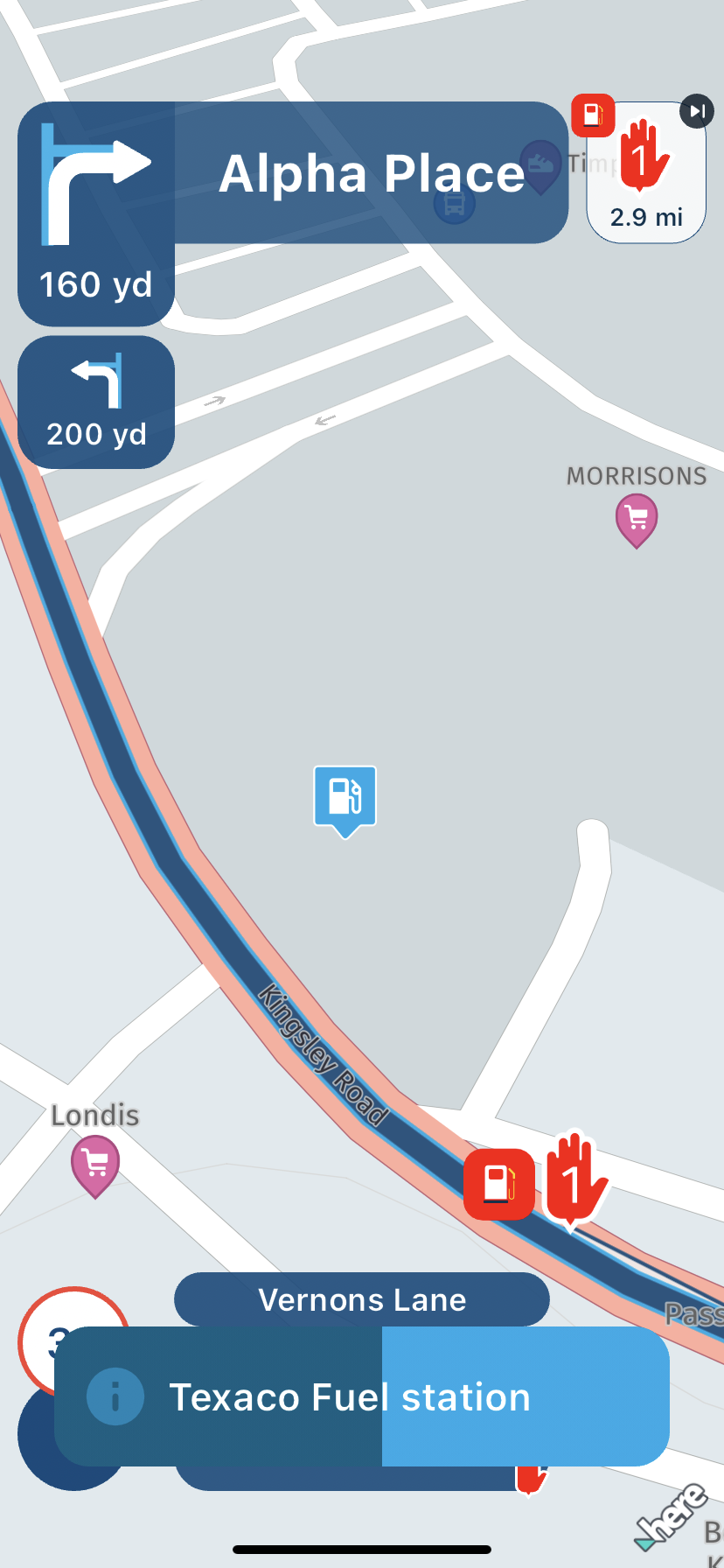
@BertM Just to be clear, the chosen icon and the given name of a POI can be seen when you tap it when navigating with MRA Navigation Next.
-
@BertM I présumée that you wanted to export a gpx file to be imported into a dedicated device. As long as you stay within MRA like on you picture there us no need to export anything
-
@BertM Just to be clear, the chosen icon and the given name of a POI can be seen when you tap it when navigating with MRA Navigation Next.
I am talking about GPX export, not the navigation app of MRA
-
@BertM I présumée that you wanted to export a gpx file to be imported into a dedicated device. As long as you stay within MRA like on you picture there us no need to export anything
@Marinus-van-Deudekom said in Improvement request POI -> GPX:
@BertM I présumée that you wanted to export a gpx file to be imported into a dedicated device. As long as you stay within MRA like on you picture there us no need to export anything
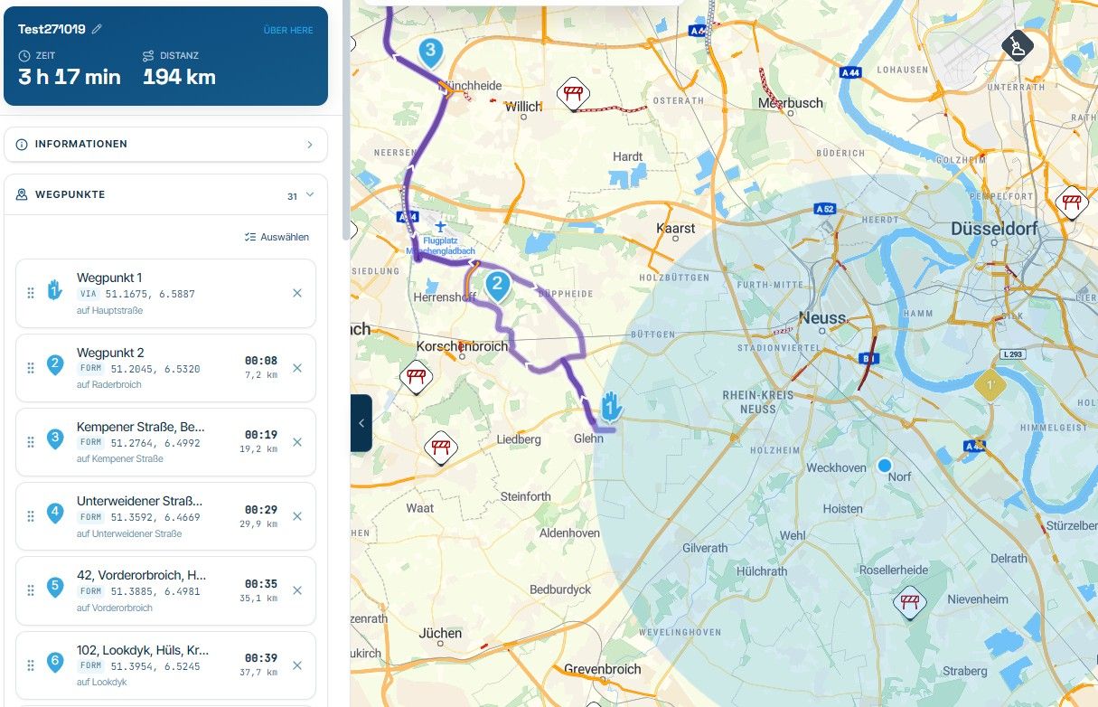
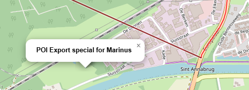
This is not a picture of the MRA app, but a simple javascript app in the webbrowser
I do not understand you all revert the Next app, I have the app but also some other devices.
I want to use GPX to export to other devices, mountain biking is difficult with a tablet on the steering wheel.
POI exported from MRA is complete useless as the POI imported from a GPX file ALL have the same symbol.
I do not think that is is rocket sience for the programmer to include the symbol in the XML parser, and it will be a big improvement.
-
I would like to see the name of the POI symbol included in the GPX export.
For example "Summit", "Hotel", "Lodging" etc.
This according to the http://www.topografix.com/GPX/1/1/ schematic
standard. This way, the POI symbols are not all provided with the standard symbol when importing into a navigation system.Regards,
Bert
@BertM said in Improvement request POI -> GPX:
I would like to see the name of the POI symbol included in the GPX export.
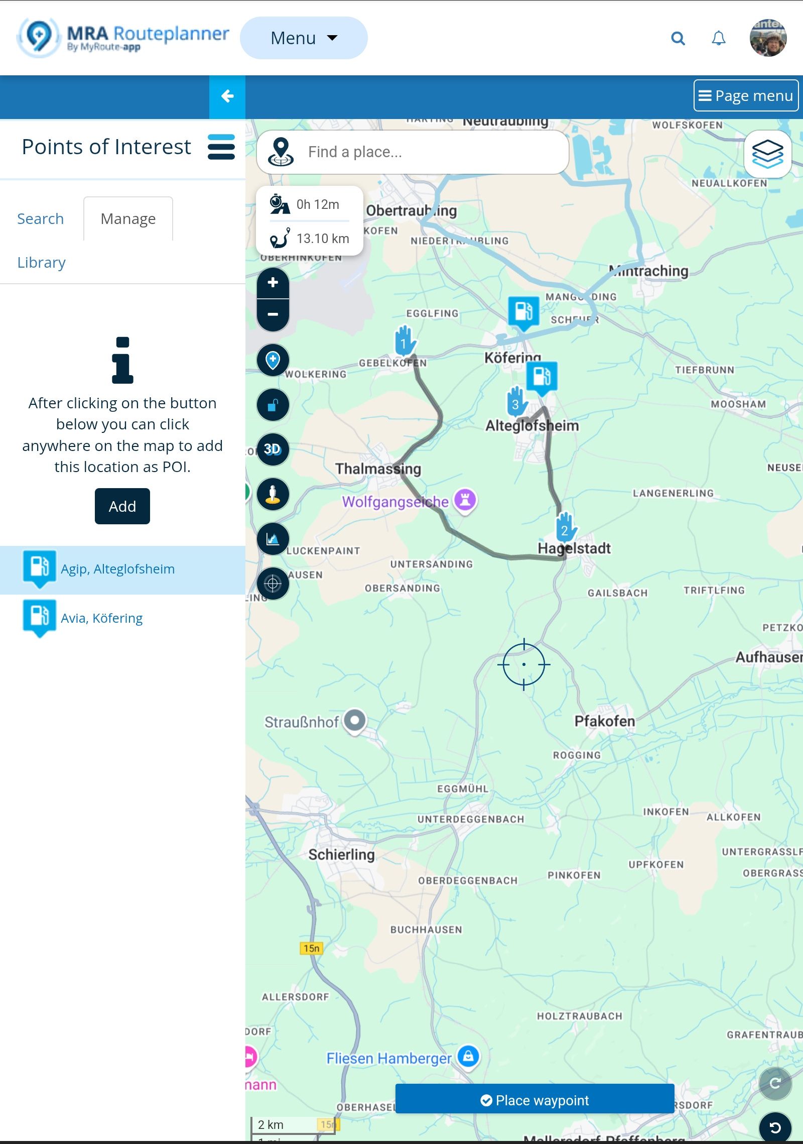
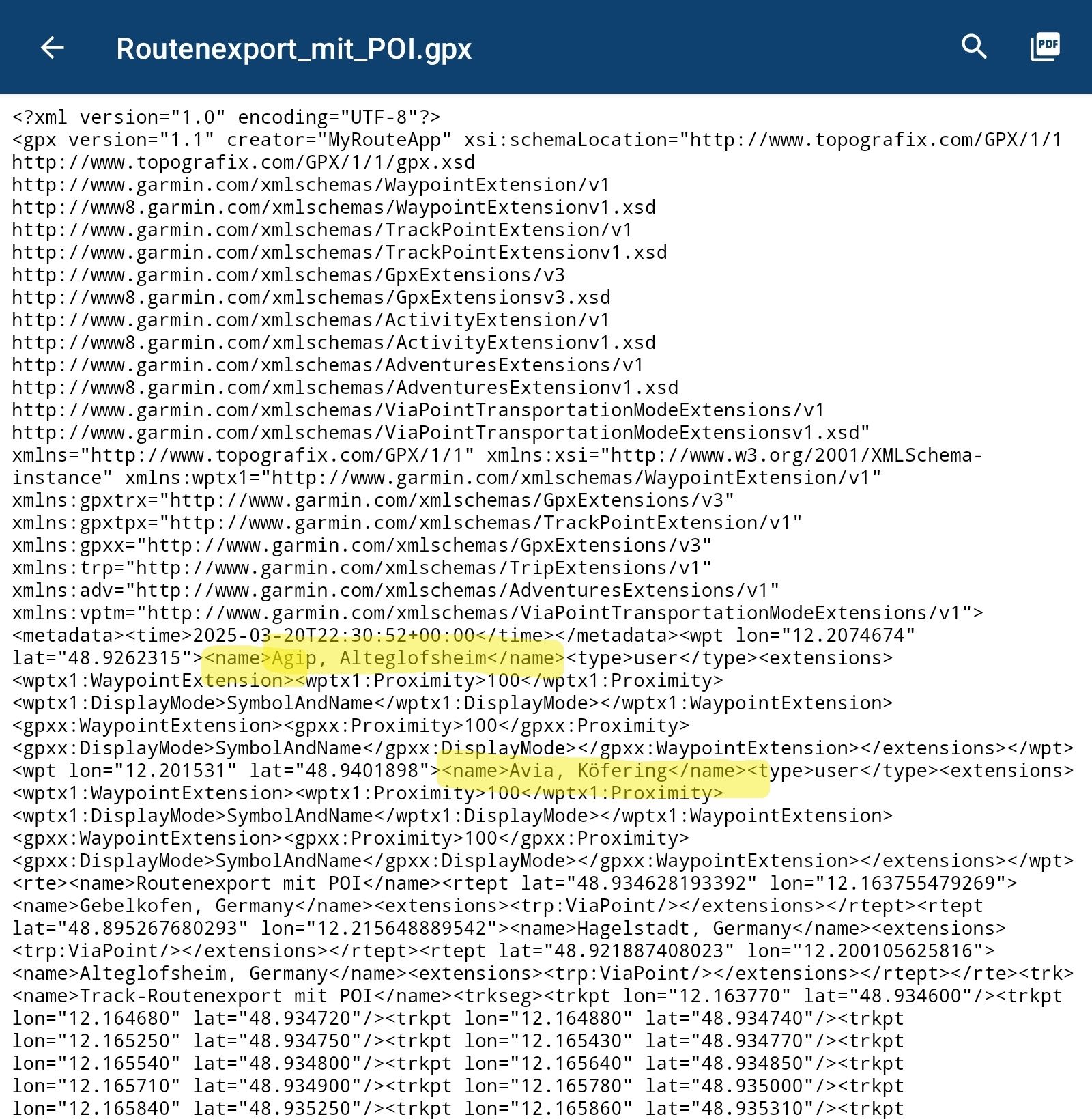
Not sure if I understand you right. But if I create a route and enter POI (no matter if included as Route Point, or just as POI). Then export it as gpx 1.1 (route, track, POI) and open the stored file by text editor. Now I can find the entered POI - inclusive the name I gave them during route planning.
If I import the file to my Garmin Nav, the POI will be visible as well as the route. If the transmitted name will be used by Garmin or other devices, that's not in the responsibility of MyRoute-App.
Nothing is impossible ;-)
In past: GARMIN Zumo 210->GARMIN Zumo 395->GARMIN XT=> now: DMD T865-X + MyRoute-App, LocusMaps, OsmAnd.
In past: GARMIN MapSource ->GARMIN BaseCamp->Tyre->Kurviger->Calimoto=> now: MRA-Routplanner. -
@BertM said in Improvement request POI -> GPX:
I would like to see the name of the POI symbol included in the GPX export.
Not sure if I understand you right. But if I create a route and enter POI (no matter if included as Route Point, or just as POI). Then export it as gpx 1.1 (route, track, POI) and open the stored file by text editor. Now I can find the entered POI - inclusive the name I gave them during route planning.
If I import the file to my Garmin Nav, the POI will be visible as well as the route. If the transmitted name will be used by Garmin or other devices, that's not in the responsibility of MyRoute-App.
@Guzzist said in Improvement request POI -> GPX:
@BertM said in Improvement request POI -> GPX:
I would like to see the name of the POI symbol included in the GPX export.
Not sure if I understand you right. But if I create a route and enter POI (no matter if included as Route Point, or just as POI). Then export it as gpx 1.1 (route, track, POI) and open the stored file by text editor. Now I can find the entered POI - inclusive the name I gave them during route planning.
I am talking about the symbol name not the description name.
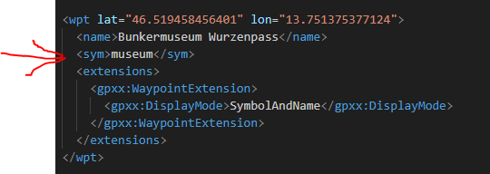
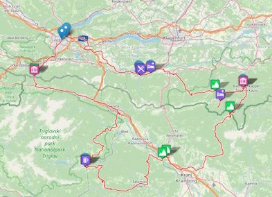
GPX from MRA with only the name:
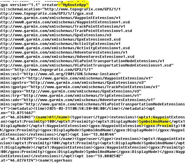
As the POI's in MRA already have different symbols, they have a symbol name, for example "Restaurant". These names are not transferred into the GPX file. As a result the GPX parser will use the default symbol when read by any other program following the topografix standard.
As the symbol is already present in MRA my request is to put it into the GPX exporter from MRA.
(I know it depends on what the GPX importer can read, but "Bar", "Hotel" and "Museum" will be in any Navigation program. Symbols not know will get the standard symbol by default.*Symbol name added to the GPX file: *
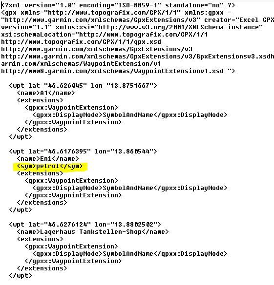
Example:
the following route from the Routelab:
https://www.myrouteapp.com/nl/social/route/10375140?mode=share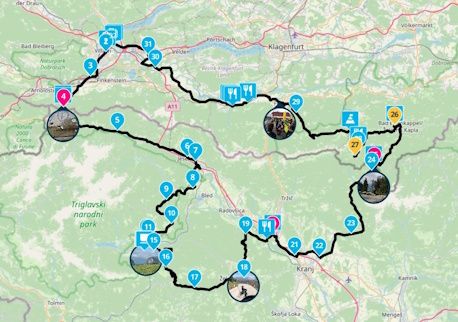
Exported GPX from MRA: all the POI's have the same symbol:
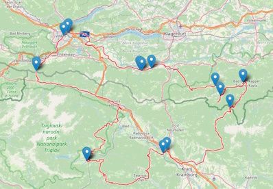
The same route imported with the symbol name added into the GPX:
If I import the file to my Garmin Nav, the POI will be visible as well as the route. If the transmitted name will be used by Garmin or other devices, that's not in the responsibility of MyRoute-App.
I am not talking about responsibilities, I only make an improvement request, it is on the developer team to take it into account or leave is as it is. As it is already in the MRA database and the Topografix scheme, it will be " low hanging fruit" to implement I presume.
-

I second this idea!
The GPX <sym> tag is commonly used to classify POIs (<wpt> in GPX terms) and is supported by various apps when importing (or exporting) GPX files.
As already pointed out by @BertM , there is no standard for the <sym> values, but with some copy and paste (or some scripting) this can be managed easily. -
I would like to see the name of the POI symbol included in the GPX export.
For example "Summit", "Hotel", "Lodging" etc.
This according to the http://www.topografix.com/GPX/1/1/ schematic
standard. This way, the POI symbols are not all provided with the standard symbol when importing into a navigation system.Regards,
Bert
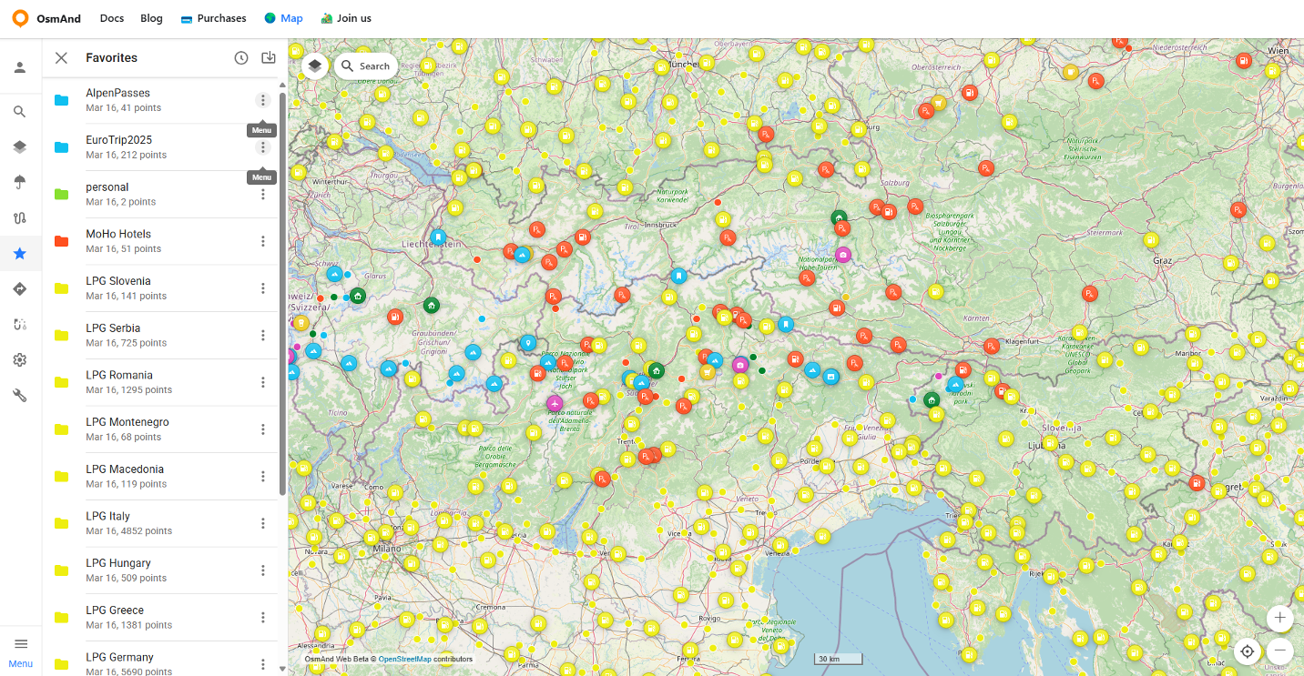
@BertMI it would be nice to be as customizable as Osmand is ...
Best regards,
Adrian📱Samsung S24 Ultra with MyRoute-APP (GOLD Lifetime)
🏍️Honda NC750X (2021) with AA/CarPlay by CHIGEE Aio-5
🚙Renault Duster with onboard AA/CarPlay Unit -
@BertMI it would be nice to be as customizable as Osmand is ...
Sorry, but I didn't get your point.
This is not about displaying POIs in an app but considering the classification in a GPX export. -
Sorry, but I didn't get your point.
This is not about displaying POIs in an app but considering the classification in a GPX export.
@Martin-Wilcke you can classify POIs in Osmand, and then export to GPX ...
Best regards,
Adrian📱Samsung S24 Ultra with MyRoute-APP (GOLD Lifetime)
🏍️Honda NC750X (2021) with AA/CarPlay by CHIGEE Aio-5
🚙Renault Duster with onboard AA/CarPlay Unit -
@Martin-Wilcke you can classify POIs in Osmand, and then export to GPX ...
Hmmm...
If I export OSMAnd "favorites", the GPX does not contain <sym> tags either. How do you manage this?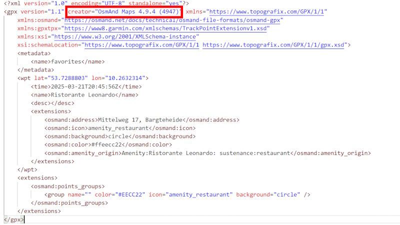
-
Hmmm...
If I export OSMAnd "favorites", the GPX does not contain <sym> tags either. How do you manage this? -
@Martin-Wilcke
Looking at the screenshot you made they not following the standard topografix schematic.
You can see that the symbol name is in extensions.
I wonder if the GPX will add the symbol when imported
@BertM said in Improvement request POI -> GPX:
Looking at the screenshot you made they not following the standard topografix schematic.
You can see that the symbol name is in extensions.OSMAnd does not export a <sym> tag, right. However, as they refer to a namespace/schema (xmlns:osmand), its extension complies with Topografic's GPX Spec.
Storing data in an individual extension is a clever way to keep and share information within an ecosystem. If this GPX is re-imported into OSMAnd, the category (and symbol) will be restored.
But I don't think any other app will parse this extension, identify "amenity:restaurant" as a category (even if it's pure OSM semantic) and transform this value into its terminology.
The <sym> tag is a far better option for sharing a category with other apps. It would be perfect if OSMAnd added a <sym> tag with "Restaurant" - and that's what MRA should do as well.
I wonder if the GPX will add the symbol when imported
What do you mean by "the GPX"? Any other app?
-
@BertM said in Improvement request POI -> GPX:
Looking at the screenshot you made they not following the standard topografix schematic.
You can see that the symbol name is in extensions.OSMAnd does not export a <sym> tag, right. However, as they refer to a namespace/schema (xmlns:osmand), its extension complies with Topografic's GPX Spec.
Storing data in an individual extension is a clever way to keep and share information within an ecosystem. If this GPX is re-imported into OSMAnd, the category (and symbol) will be restored.
But I don't think any other app will parse this extension, identify "amenity:restaurant" as a category (even if it's pure OSM semantic) and transform this value into its terminology.
The <sym> tag is a far better option for sharing a category with other apps. It would be perfect if OSMAnd added a <sym> tag with "Restaurant" - and that's what MRA should do as well.
I wonder if the GPX will add the symbol when imported
What do you mean by "the GPX"? Any other app?
@Martin-Wilcke said in Improvement request POI -> GPX:
@BertM said in Improvement request POI -> GPX:
Looking at the screenshot you made they not following the standard topografix schematic.
You can see that the symbol name is in extensions.OSMAnd does not export a <sym> tag, right. However, as they refer to a namespace/schema (xmlns:osmand), its extension complies with Topografic's GPX Spec.
Storing data in an individual extension is a clever way to keep and share information within an ecosystem. If this GPX is re-imported into OSMAnd, the category (and symbol) will be restored.
I agree, that is also what other applications do.
But as MRA is a platform that is used by a lot of other navigations app, I do not think you would look for an platform specific schema.Osmand pulls the POI from OSM and that is one way to do it.
On the other hand I like the MRA solution better. If they can safe the symbol by export ( and import) this will be an huge improvement.What do you mean by "the GPX"? Any other app?
Yes
Hello! It looks like you're interested in this conversation, but you don't have an account yet.
Getting fed up of having to scroll through the same posts each visit? When you register for an account, you'll always come back to exactly where you were before, and choose to be notified of new replies (either via email, or push notification). You'll also be able to save bookmarks and upvote posts to show your appreciation to other community members.
With your input, this post could be even better 💗
Register Login-
 17121
17121
-
 06119
06119
-
0489
-
 0414
0414
-
 06303
06303
-
 0316
0316
-
 0210
0210
-
0211