Quality of navigation
-
A quick follow up here: by default the toll road are disabled. This means that the app will not use them if an alternative is possible.
In a next update (not the upcoming) more routing preferences will be added

-
A quick follow up here: by default the toll road are disabled. This means that the app will not use them if an alternative is possible.
In a next update (not the upcoming) more routing preferences will be added
@Corjan-Meijerink
When I use the app to make a route somewhere I want to go in Canada it uses Toll roads before non toll on the route it makes. I hate this, I should be able to pick no tolls, dirt roads, etc. -
@Corjan-Meijerink
When I use the app to make a route somewhere I want to go in Canada it uses Toll roads before non toll on the route it makes. I hate this, I should be able to pick no tolls, dirt roads, etc.@Tumbleweed Yes, I completely understand. Therefore we are implementing it in another iteration
 No worries! It's still a Beta app and we need to prioritise what features we pick first.
 -
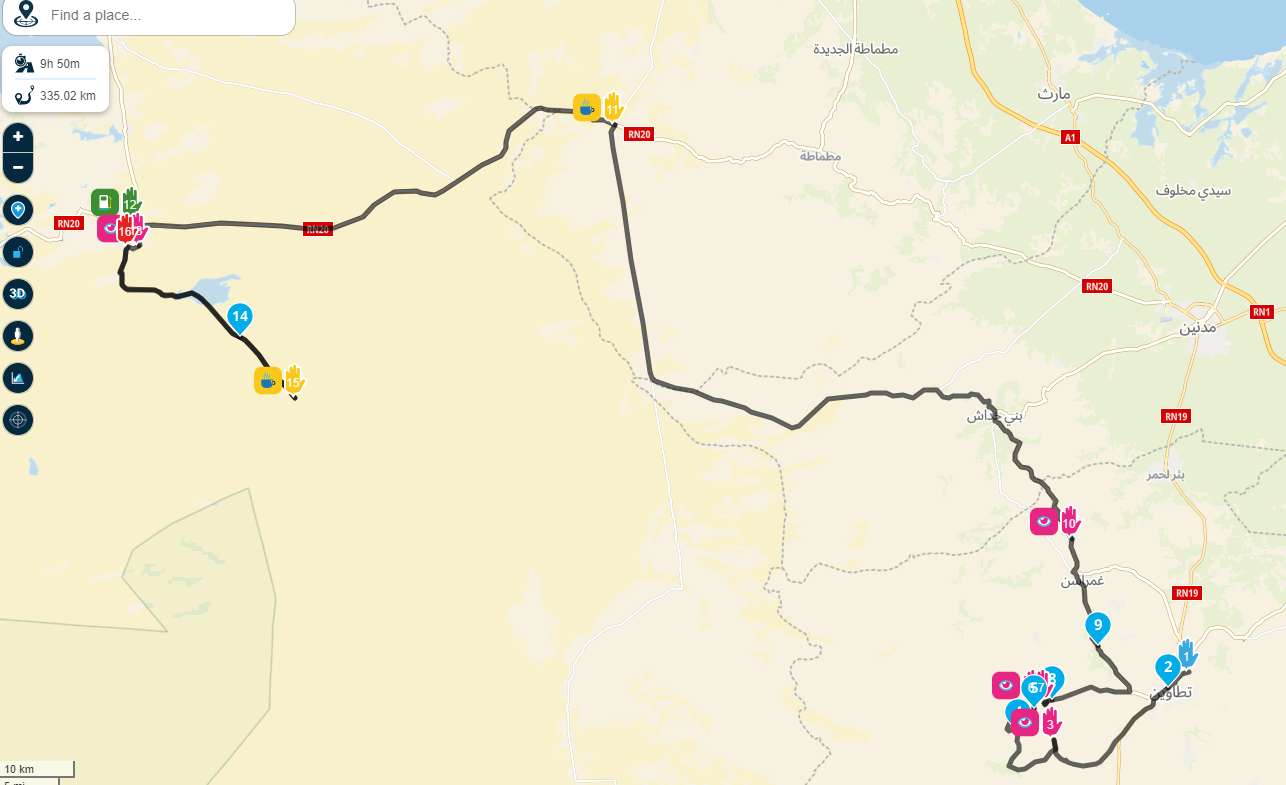
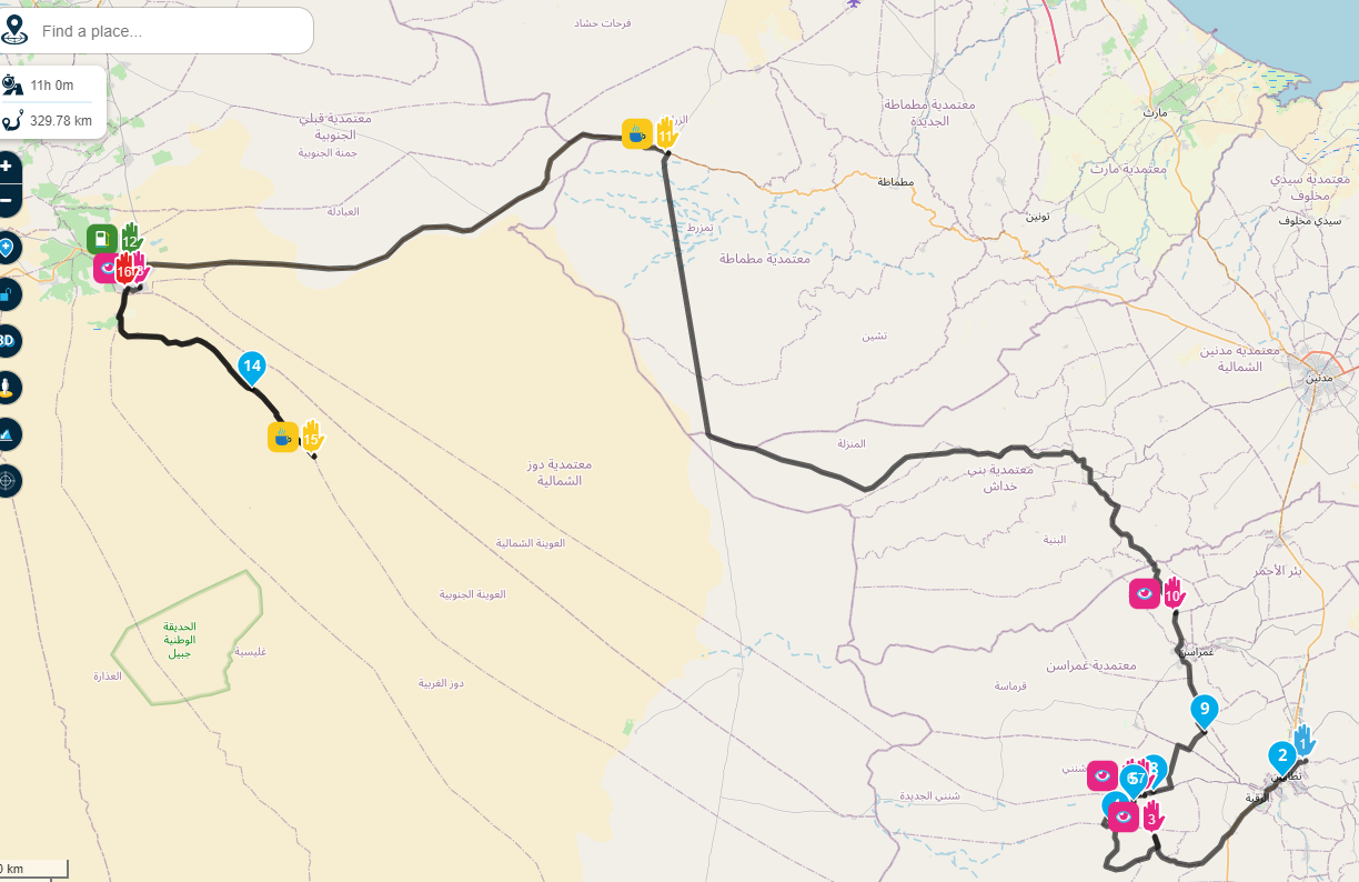
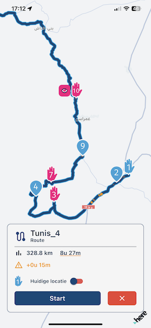
I prepared the routes for Tunisia, but I must say to my dissapointment I cannot use the app - and main reason is HERE maps.....from begining of this post I suspected the reason for bad navigation is in the HERE maps.
1.case (same route just changing maps)
When I create route, it takes me FAR FAR around between waypoint 10-11, because lots of MAIN roads are missing: HERE MAPS
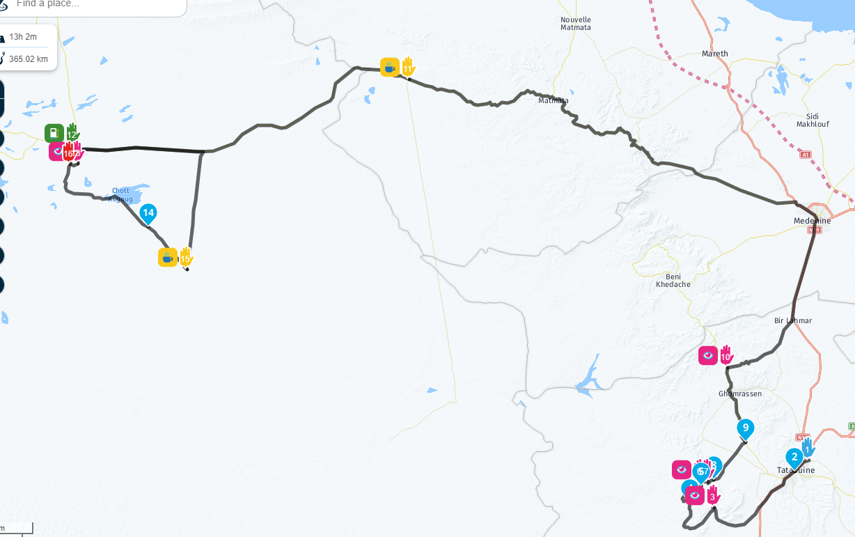
Tomtom maps (more then 3h less)
Openstreet maps
Comparing route on both maps
- case
Here maps is green, you can also see that it wants to take me straight through Sahara desert sand to waypoint 15....skipping points 12,13,14??
3.case
Between point 8 and 9 takes road that is not driveable...etc- case
from point 3 it takes unexisting road again
Since the MRA usas the wors map option - HERE I cant use the app on my trip....
And I noticed lots of this map errors driving in central Europe.
Time to invest in maps guys.... - case
-
I prepared the routes for Tunisia, but I must say to my dissapointment I cannot use the app - and main reason is HERE maps.....from begining of this post I suspected the reason for bad navigation is in the HERE maps.
1.case (same route just changing maps)
When I create route, it takes me FAR FAR around between waypoint 10-11, because lots of MAIN roads are missing: HERE MAPS
Tomtom maps (more then 3h less)
Openstreet maps
Comparing route on both maps
- case
Here maps is green, you can also see that it wants to take me straight through Sahara desert sand to waypoint 15....skipping points 12,13,14??
3.case
Between point 8 and 9 takes road that is not driveable...etc- case
from point 3 it takes unexisting road again
Since the MRA usas the wors map option - HERE I cant use the app on my trip....
And I noticed lots of this map errors driving in central Europe.
Time to invest in maps guys....Just zoom in and place some extra shaping points
The here map is good for navigating, or is it due to the route taken?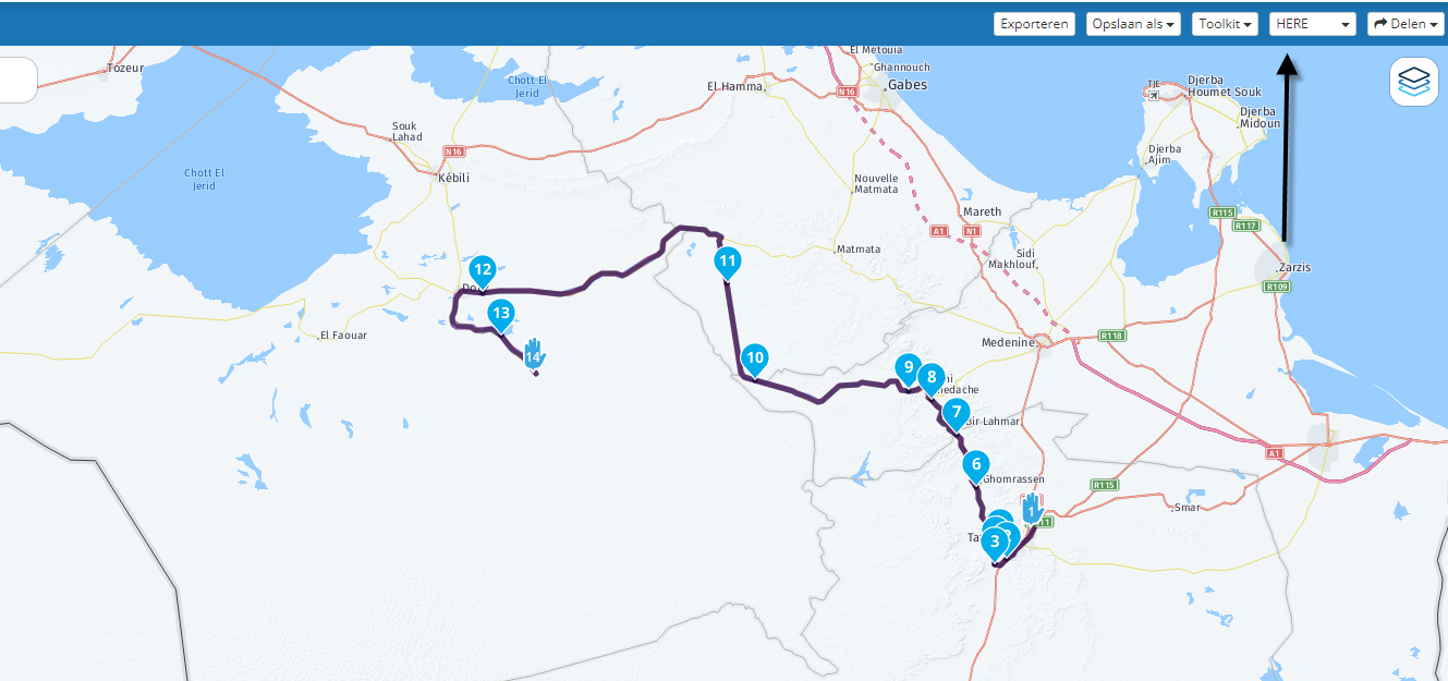
Garmin Zumo XT3/XT2/XT/BMW Connected Ride Navigator/Tourstart/ MyRouteapp (The App)/...
Een dag niet gelachen is een dag niet geleefd / Een route is net zo goed als deze uitgezet is. - case
-
Just zoom in and place some extra shaping points
The here map is good for navigating, or is it due to the route taken?@Hans-van-de-Ven-MRA-Master said in Quality of navigation:
Just zoom in and place some extra shaping points
The here map is good for navigating, or is it due to the route taken?What is the point if the user has to make route and not the tool? Will I always need to g oto other tools to see roads and manually create points for every wrong paths in routes? Sorry it does not work like that especially on not known terriotries.
Thats my original point - qiality of navigation. -
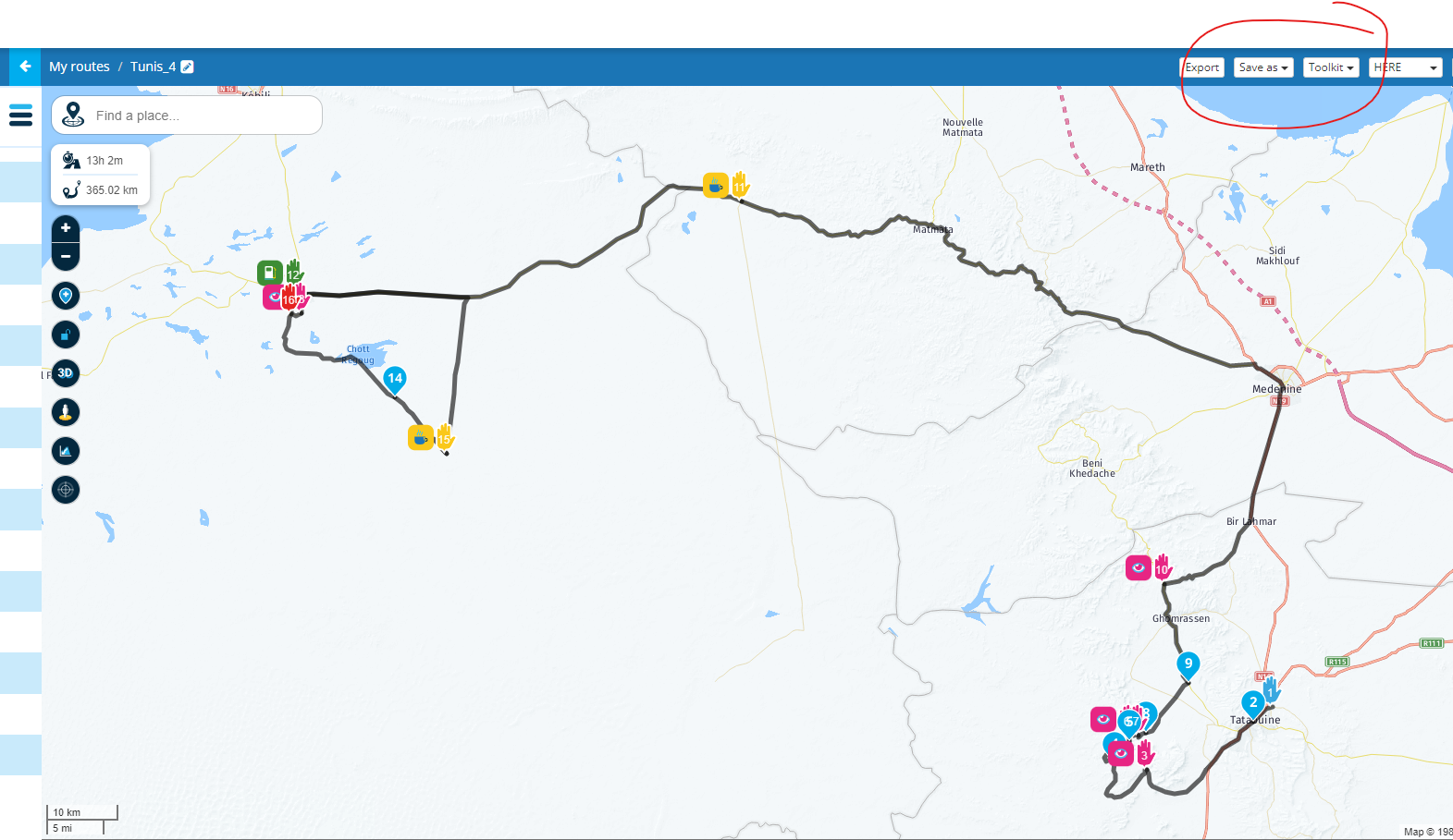
Of course it was HERE and no tool kits activated
-
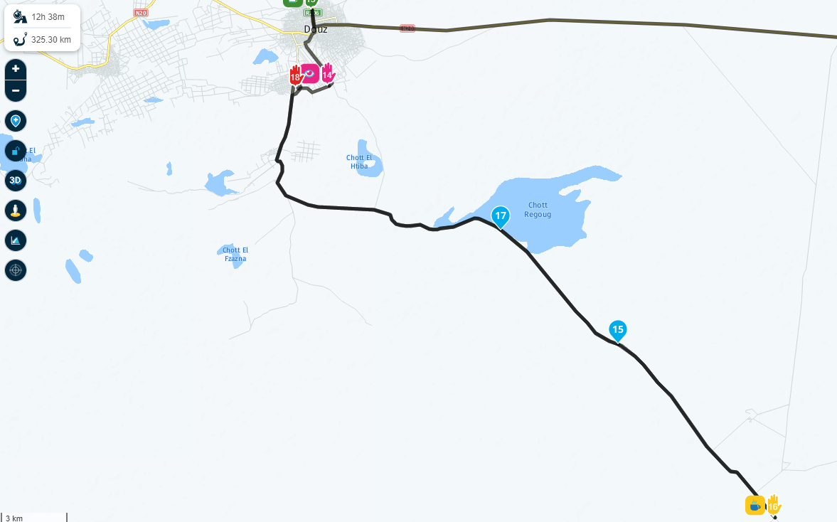
And the next stupid thing is - when I implement what you suggest time falls significantly. This way user is more smart then the tool. Tthe tool should do that!!
It was 13h2m at original route
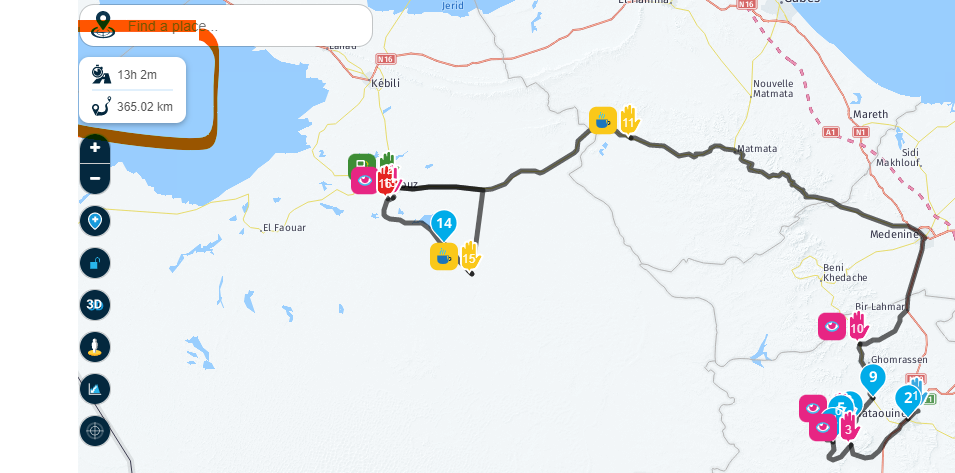
then time (and distance) drops for 30 min when i add points 11 and 17 to tell the tool that its giving me wrong direction....
This should net be happening, I loose complete faith in navigation

-
And even after doing that keeps insisting (HERE in green, TomTom or google in black) not to take main road that tomtom, google or even openstreet maps would
So now I should again manualy put a point to black line tell the HERE maps they are wrong. And if I would do that time and distance would fell again.
Maybe there is a hidden 'adrenalin' option in the tool
")
-
And even after doing that keeps insisting (HERE in green, TomTom or google in black) not to take main road that tomtom, google or even openstreet maps would
So now I should again manualy put a point to black line tell the HERE maps they are wrong. And if I would do that time and distance would fell again.
Maybe there is a hidden 'adrenalin' option in the tool
@Jure-Sirena-0, You must consider that different map-creators use different methods to qualify roads. The R114 is barely visible on the Here map. That could be an error on the map, or a deliberate advise to NOT take that road, that other map-creator oversee. Google Streetview is not available for that road, which could be a sign for it to be not much more than an unpaved road, I don't know. If I plot a route from Tatouine to Douz, it takes 4h27 over the R114 and only 4h16 taking the longer route (that differs not more than 10km). I think you have some misplaced waypoints in your route, that count for the increase in time and distance. You can search for even more different map manufacturers. That will all come up with different times and distances. That does not make one or more of them bad.
The essence of route-planning is to plan in the same map as your navigation device uses, to minimize differences (or use the track to navigate in third party device).
-
@Hans-van-de-Ven-MRA-Master said in Quality of navigation:
Just zoom in and place some extra shaping points
The here map is good for navigating, or is it due to the route taken?What is the point if the user has to make route and not the tool? Will I always need to g oto other tools to see roads and manually create points for every wrong paths in routes? Sorry it does not work like that especially on not known terriotries.
Thats my original point - qiality of navigation.@Jure-Sirena-0
As @Con-Hennekens also points out each map has its own data set and capabilities. Sometimes you have to force the route to take a certain road that you want by means of an extra waypoint.
Well, if that's too much work... Then you should indeed let your navigation system do the work. This works well for A to B routes, but if you want to drive a specific route, you will have to turn it off manually. That has nothing to do with the quality of the navigationGarmin Zumo XT3/XT2/XT/BMW Connected Ride Navigator/Tourstart/ MyRouteapp (The App)/...
Een dag niet gelachen is een dag niet geleefd / Een route is net zo goed als deze uitgezet is. -
@Jure-Sirena-0
As @Con-Hennekens also points out each map has its own data set and capabilities. Sometimes you have to force the route to take a certain road that you want by means of an extra waypoint.
Well, if that's too much work... Then you should indeed let your navigation system do the work. This works well for A to B routes, but if you want to drive a specific route, you will have to turn it off manually. That has nothing to do with the quality of the navigation@Hans-van-de-Ven-MRA-Master Its what I am saying categorization of maps is baseline for proper navigation.
And believe me guys this is ONE OF THE MOST visited roads in Tunisia, a must for motorcycle. I take tours as guid there regulary. The road also leads to one of the most visited Oasis for turists Ksar Ghilane , Saying this road is not advisable is not serious, every motorcycle trip goes to Ghilane oasis. This is by no means a specific route, this is main road and fastest option.
I dont know if my point was considered, I have a feeling the problem is not addressed properly or tried to be avoided because to solve it you need to pay for proper updated maps. What I am saying its not a case of app, its problem with maps, as this are generaly available maps. But problem is then related to app itself as it uses it.
You also dont understand me that I use same waypoints on same route so saying that I missplaced waypoints is also funny - I only change the maps top right, I dont shuffle any points.
So I close it here, no point discussing any more, what I am sure is that users will come back to this when season opens.
I rest my case:
Br -
@Hans-van-de-Ven-MRA-Master Its what I am saying categorization of maps is baseline for proper navigation.
And believe me guys this is ONE OF THE MOST visited roads in Tunisia, a must for motorcycle. I take tours as guid there regulary. The road also leads to one of the most visited Oasis for turists Ksar Ghilane , Saying this road is not advisable is not serious, every motorcycle trip goes to Ghilane oasis. This is by no means a specific route, this is main road and fastest option.
I dont know if my point was considered, I have a feeling the problem is not addressed properly or tried to be avoided because to solve it you need to pay for proper updated maps. What I am saying its not a case of app, its problem with maps, as this are generaly available maps. But problem is then related to app itself as it uses it.
You also dont understand me that I use same waypoints on same route so saying that I missplaced waypoints is also funny - I only change the maps top right, I dont shuffle any points.
So I close it here, no point discussing any more, what I am sure is that users will come back to this when season opens.
I rest my case:
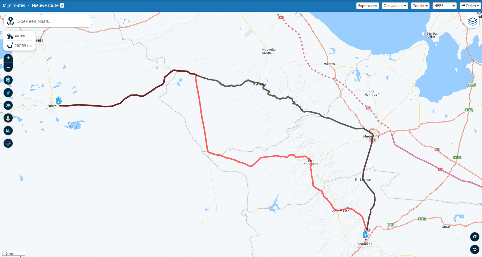
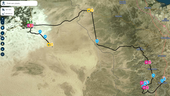
Br@Jure-Sirena-0, This part of your route
Is clearly something of a loop due to differences in route calculation between maps. I don't know where the enormous amount of driving time comes from, but also that is an indication for the route being driven almost twice.
And as I said, it could be an error in the Here map. Errors can be submitted here: https://mapfeedback.here.com/#/report
If you are a tourguide, Here will welcome your input. We improve Here together, it is not a responsibility of MRA, nor of the volunteers on this forum. Also a tourguide would have no problems adding a few WP's to guarantee the correctness of a route.
I am just an enthusiastic MRA user, and hope you will be one too!
Most motorcycle problems are caused by the nut that connects the handlebar to the saddle.
Check out RideSleepRepeat.eu, a biker community for sharing stays across Europe
-
@Jure-Sirena-0, This part of your route
Is clearly something of a loop due to differences in route calculation between maps. I don't know where the enormous amount of driving time comes from, but also that is an indication for the route being driven almost twice.
And as I said, it could be an error in the Here map. Errors can be submitted here: https://mapfeedback.here.com/#/report
If you are a tourguide, Here will welcome your input. We improve Here together, it is not a responsibility of MRA, nor of the volunteers on this forum. Also a tourguide would have no problems adding a few WP's to guarantee the correctness of a route.
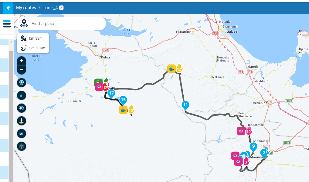
@Con-Hennekens you can see that I added point 17 telling the route not to go
Let me zoom in this part
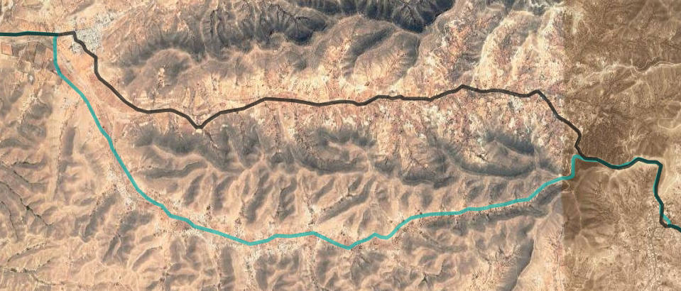
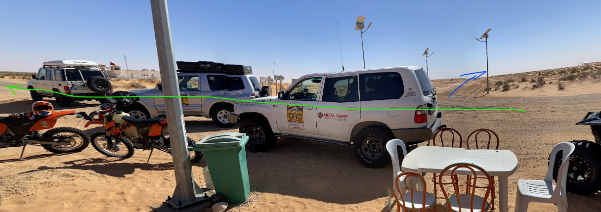
My original, I go from 14 over 15 to 16 - 14 to 16 is paved road in desert. At 16 there is a Cafe Desert, a popular stop for everyone. Then the hotel is at 17 - same way back, but the maps take me from 16 to 17 through different road (red arrows). This road does not exist, believe me. This are deep sand dunes special vehicles can go there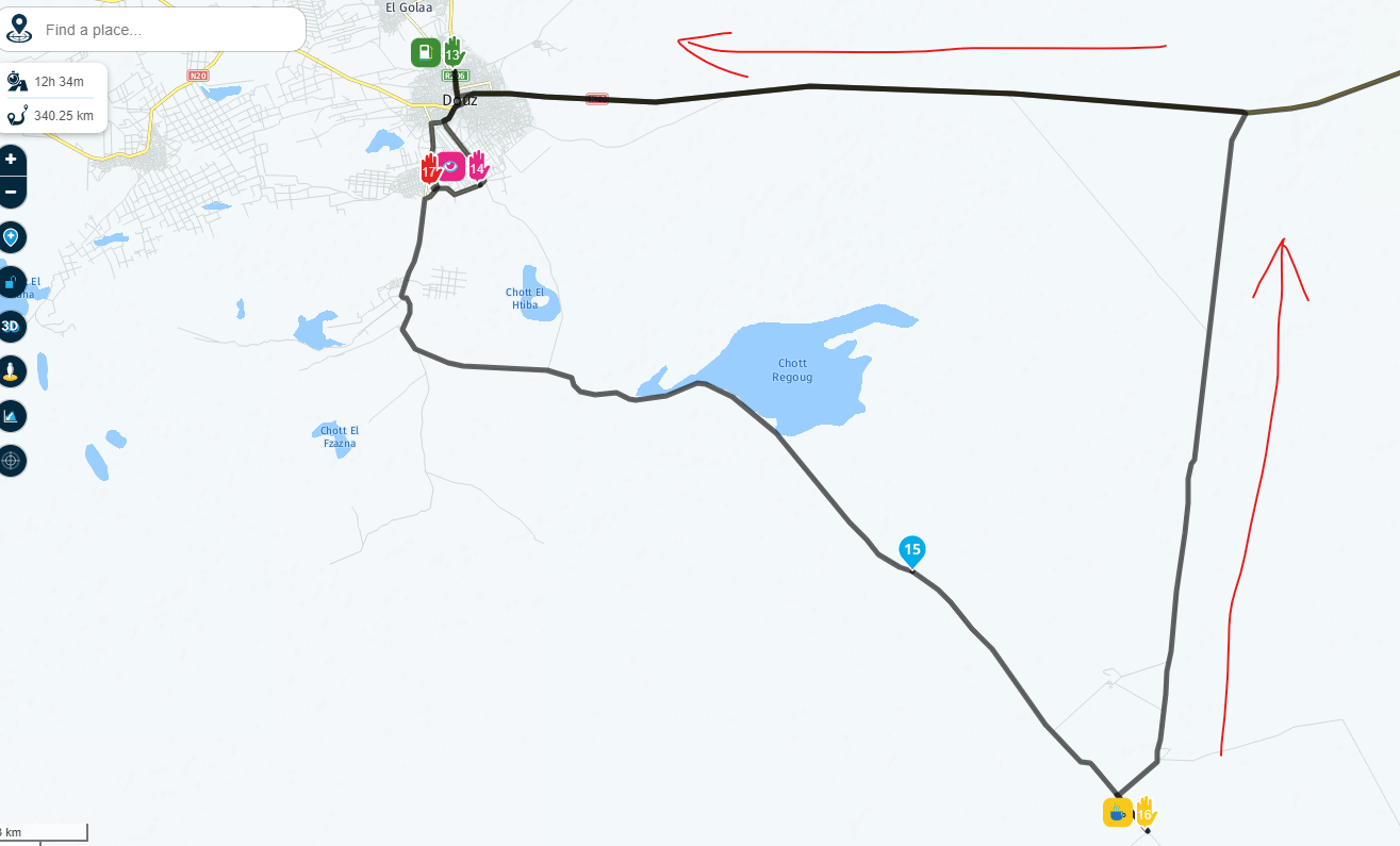
So it is the maps that give wrong picture/way not waypoints
And when I add point 17 (mandatory) in order to go back same-proper way to hotel without changing any of other waypoints
Then it reroutes correctly. Again if you dont know that you are f...
But the point is that google, tomtom, openstreet maps KNOW tha and will route you correctly, with no need of additional manual points, only when using HERE the paths are strange and you need to manualy corect it
Regarding google street view is from 2016....lots of roads are repaired, including this one with points 14-15-16 its paved now -
@Jure-Sirena-0, This part of your route
Is clearly something of a loop due to differences in route calculation between maps. I don't know where the enormous amount of driving time comes from, but also that is an indication for the route being driven almost twice.
And as I said, it could be an error in the Here map. Errors can be submitted here: https://mapfeedback.here.com/#/report
If you are a tourguide, Here will welcome your input. We improve Here together, it is not a responsibility of MRA, nor of the volunteers on this forum. Also a tourguide would have no problems adding a few WP's to guarantee the correctness of a route.
@Con-Hennekens a tourgide speaks from experience and this I think should be considered, and I never need to add any mid or way points when using garmin or tomtom rider, its why I immediatelly noticed wrong paths when using MRA and HERE maps.
actually there is a recent picture on google, green is where we arrive and leave same way. Blue is where HERE wants to go
 ,
,I can search for my pics, but I dont take pics of roads.....
-
@Jure-Sirena-0 I totally believe your local expertise and trust that way more than any other comments / input from map suppliers. Let's not try to escalate the issue any further.
As the actual developer, allow me to elaborate a bit
The routing algorithm by HERE as a lot of complex factors that determine road preference / estimated speeds etc. Therefore two 'issues' can now be seen:
- HERE prefers using another road. Either because it is way faster or it has no knowledge about the alternatives. I cannot help with this issue but the community can share feedback right here: https://mapfeedback.here.com/#/report
- Even if you force the use of that road using more waypoints, the estimated driving time is way longer than one would expect. Again, that is probably caused by the fact that the relative unknown road to HERE has a low (default) maximum / probable velocity.
Does MRA have nothing to do with this? Definitely not!
In a private environment, visible to only me, I have migrated the website to use the newest routing engine (v8) by HERE. If I use the exact same route, it does use the same road as TomTom / OSM. The public website (you are using) is still on v7.
It now goes over Beni Kedache rather than Medenine. The total driving time is estimated around 12h which is still significantly higher than TomTom. That difference is completely caused by estimated velocity and that I cannot change. You would have to submit feedback to HERE
Also, regarding the copyright dates. That is static information that we did not update so I made sure it will be changed in the next website update.
Long story short: thanks a lot for your feedback. Your local knowledge is extremely valuable and you are completely correct that the current version of HERE is not suitable for you in this region. I hope you are satisfied by the fact that the new HERE version will show significant improvements. We aim to release this early februari.
Side note: the Navigation Next Beta uses the newest HERE version so if you would open your original route in that app - it will route you over Beni Kedache. Also, please check the estimated driving time. This is way closer to what you expect.
Hope you are happy with my answer
-
@Corjan-Meijerink, Good answer! Here is not a bad map because of this single problem. All maps have defects. Many people see strange behavior on certain locations. Sometimes it is the Here map, sometimes it is a different map. The expertise of local guides is one of the few things that make maps better. I can only hope that people like @Jure-Sirena-0 take the effort to complement the map when they see there is a defect.
-
Ok, like I assumed better or updated maps explains it, thanks, guys I never pointed at the app, app is great. So today main features for me are waypoints, its naming on screen and distance to during navigation.
Riding solo or with group timing is cruical. Even if you already know the way.
I will try to bring as much to the beta as possible. Currently my setup is tomtomrider 550 and MRA on phone. MRA still needs time for traffic and mainly offline maps, in country like Tunisia, Morocco, you cant solo depend on online maps like for instance in EUSo I do also use the old navigation MRA app with offline maps.
Gretings and keep up the good work
Hello! It looks like you're interested in this conversation, but you don't have an account yet.
Getting fed up of having to scroll through the same posts each visit? When you register for an account, you'll always come back to exactly where you were before, and choose to be notified of new replies (either via email, or push notification). You'll also be able to save bookmarks and upvote posts to show your appreciation to other community members.
With your input, this post could be even better 💗
Register Login-
71044.8k
-
0481
-
744597
-
1643
-
09285
-
04236
-
011145
-
06192
