Quality of navigation
-
Wow! Thanks, this helps a lot
")
It might be as simple then that our app always prefers shorter over faster. Or it might be way more complex

Regardless, thanks a lot for these details.
@Corjan-Meijerink Its defenetely a map problem - you can see it in route planner already - its because categorization of roads in openstreet map is shitty..... Same route, openstreetmaps just wont use highway, and ETA is significantly higheras per tomtom or even HERE maps (almost 2 hours). With this unfortunatelly to me the app is useless as navigation is useless...:(
Tomtom is far superior here and trustworthy (using in paralele Tomtom Mobile GO and Tomtom rider 550 on the bike
-
@Corjan-Meijerink Its defenetely a map problem - you can see it in route planner already - its because categorization of roads in openstreet map is shitty..... Same route, openstreetmaps just wont use highway, and ETA is significantly higheras per tomtom or even HERE maps (almost 2 hours). With this unfortunatelly to me the app is useless as navigation is useless...:(
Tomtom is far superior here and trustworthy (using in paralele Tomtom Mobile GO and Tomtom rider 550 on the bike
@Jure-Sirena-0 MRA Navigation (Next) uses HERE maps, not OSM, so what you're saying doesn't make sense.
-
@Jure-Sirena-0 MRA Navigation (Next) uses HERE maps, not OSM, so what you're saying doesn't make sense.
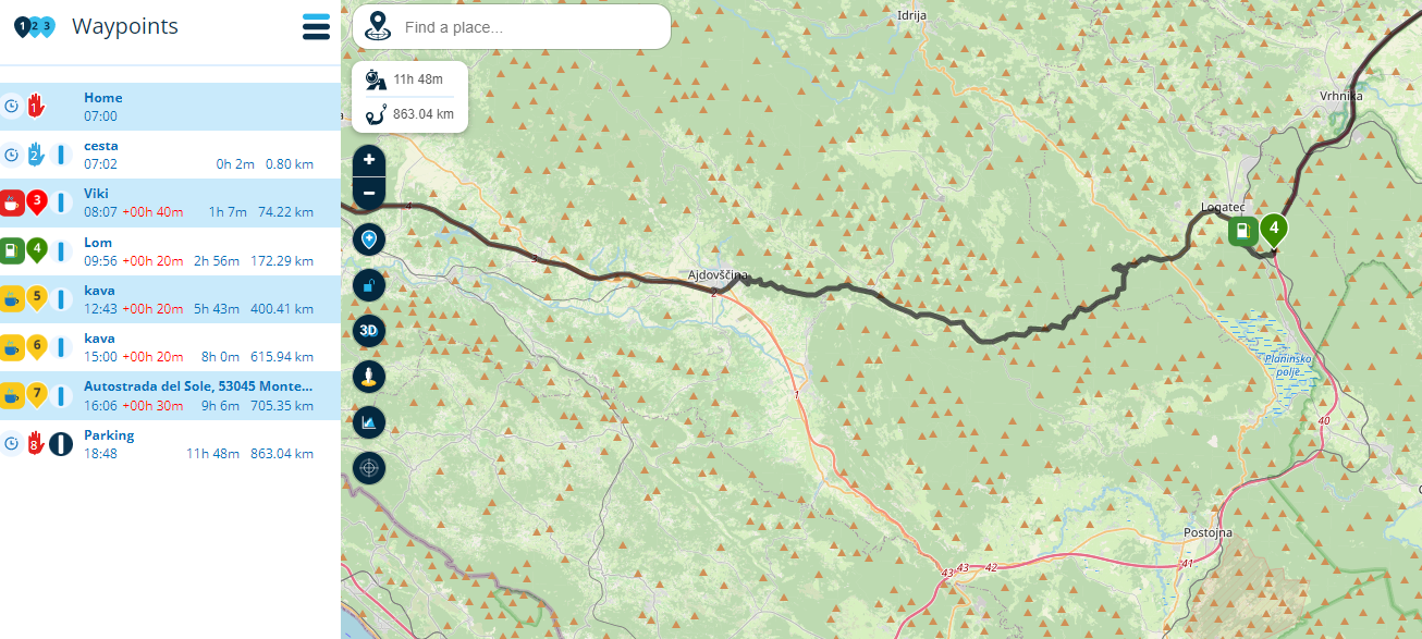
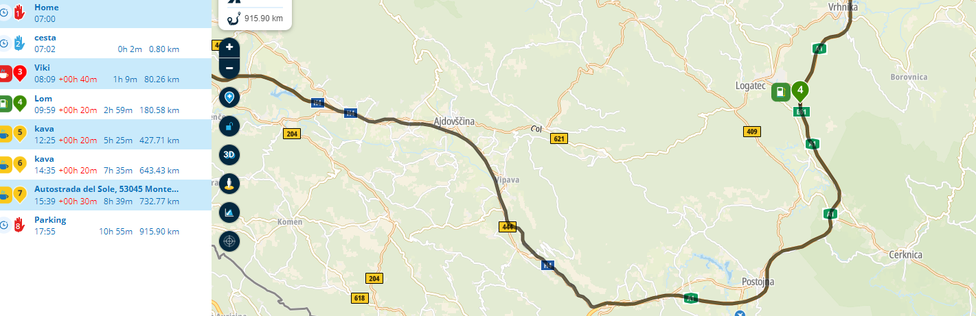
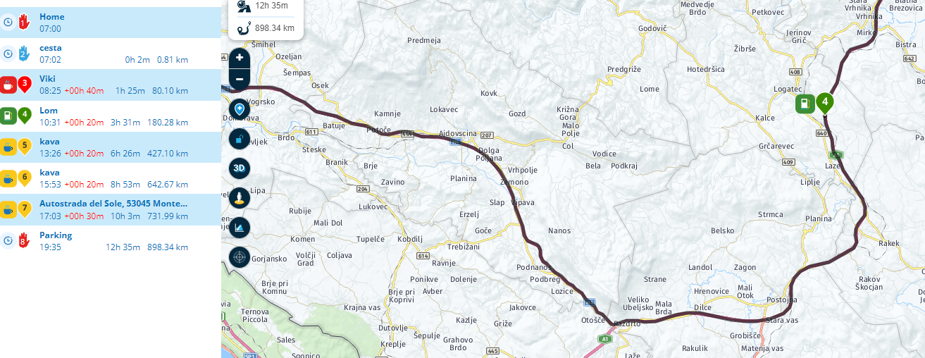
@Herko-ter-Horst Last picture in last post is Here maps:
898km and 12h:35min
tomtom is second picture
915km and 10h:55min
exactly same route, only changing maps in menu. On top of this MRA Next Beta application ALWAYS takes me off motorway through the back road - just like first picture with openstreetmaps does (app pic during navigation few pics higher), something is wrong....very wrong.Routing in MRA Next is same as in routeplanner with Openstreetmaps. While the most wrong thing is that it chooses it despite not being the fastest (when you decide not to take it, it recalculates and ETA drops signoificantly)
-
I have tested this weekend 3 other routes inland point to point A-B, no intermideatte waypoints, all cca 100km, MRA Next app took me (wanted to) all the time through back roads, through cities....and yes route planer is set to fastest on no curvines (you can see the signs beside each waypoint)
Same route with tomtom faultless and always cca 20-25min faster (including potential traffic slow downs, which are amazingly accurate in tomtom)
app is PERFECT when you exactly precise the route with your many waypoints, while navigation itself at the moment is lacking quality. Guys will look into it.
@Jure-Sirena-0
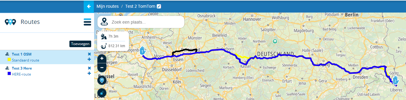
Hello @Jure-Sirena-0I'm curious if you recreated the routes (with the 8 points and 898 KM) from scratch on every map?
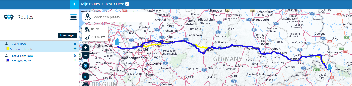
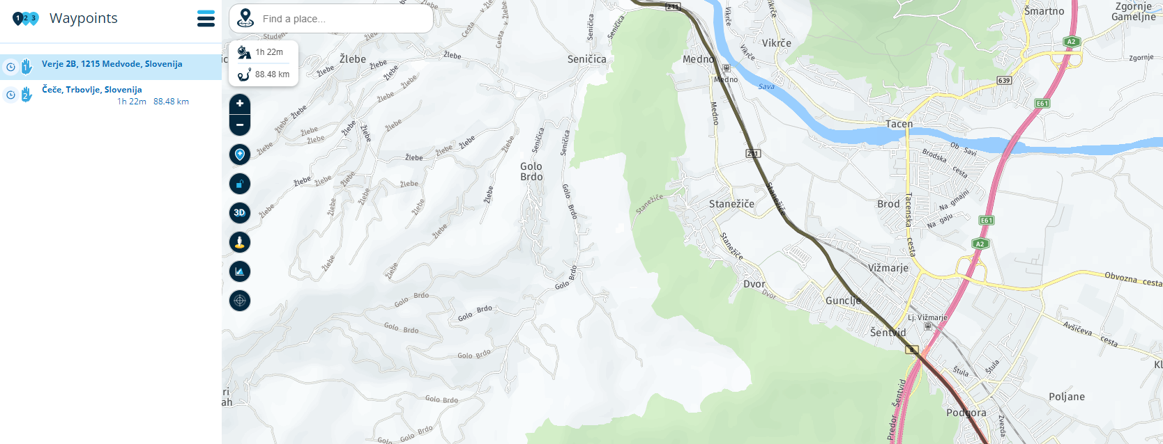
What options from the toolbox have you used in each map?I have made the following routes from scratch in every map.
Only used 2 points and didn't use options from the toolbox.

OSM:
TomTom:
Here:
Comparison of the 3 routes:
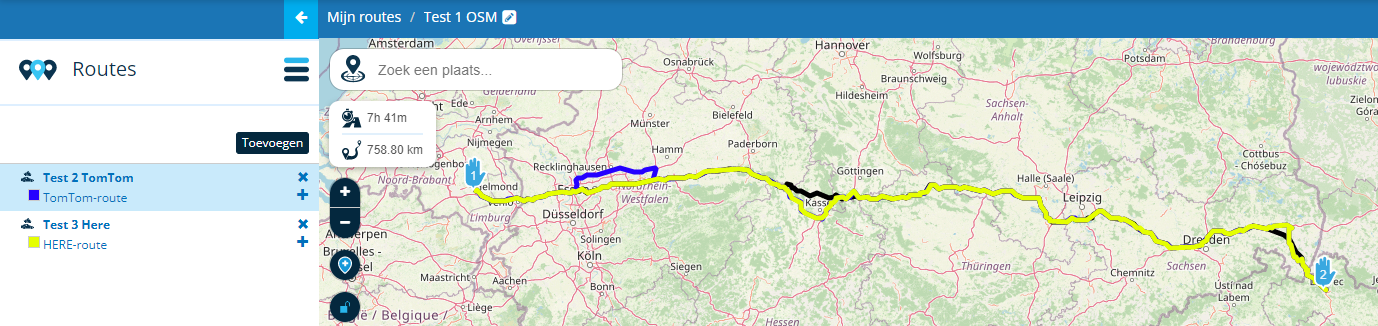
OSM route opened, it has a black line.
Here has the yellow line
TomTom has the blue line
Now you see that all 3 routes are generated differently on some parts.
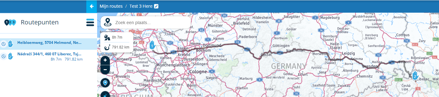
Tom route opened, it has a black line.
OSM has the yellow line
Here has the blue line
Now you see that all 3 routes are generated differently on some parts.
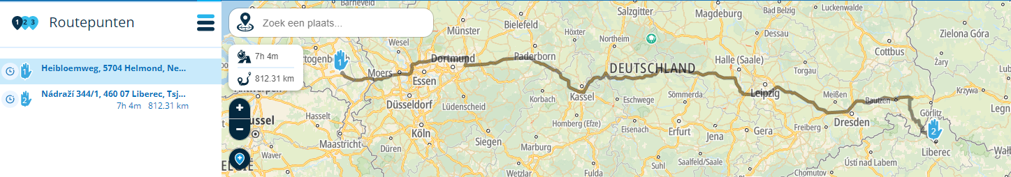
Here route opened, it has a black line.
OSM has the yellow line
TomTom has the blue line
Now you see that all 3 routes are generated differently on some parts.
Conclusion, so it depends on which map you make a route.
To use MRA Navigation (Next) it is best to plan your route in the Here map. With A to B routes (which you probably use) only in the app and therefore the Here map, you know for sure that you have the fastest route, because that's how the routing of the Here map is set.
That the times and distances differ slightly per map can therefore be explained. Because each card has its own routing settings.Garmin Zumo XT3/XT2/XT/BMW Connected Ride Navigator/Tourstart/ MyRouteapp (The App)/...
Een dag niet gelachen is een dag niet geleefd / Een route is net zo goed als deze uitgezet is. -
@Jure-Sirena-0
Hello @Jure-Sirena-0I'm curious if you recreated the routes (with the 8 points and 898 KM) from scratch on every map?
What options from the toolbox have you used in each map?I have made the following routes from scratch in every map.
Only used 2 points and didn't use options from the toolbox.
OSM:
TomTom:
Here:
Comparison of the 3 routes:
OSM route opened, it has a black line.
Here has the yellow line
TomTom has the blue line
Now you see that all 3 routes are generated differently on some parts.
Tom route opened, it has a black line.
OSM has the yellow line
Here has the blue line
Now you see that all 3 routes are generated differently on some parts.
Here route opened, it has a black line.
OSM has the yellow line
TomTom has the blue line
Now you see that all 3 routes are generated differently on some parts.
Conclusion, so it depends on which map you make a route.
To use MRA Navigation (Next) it is best to plan your route in the Here map. With A to B routes (which you probably use) only in the app and therefore the Here map, you know for sure that you have the fastest route, because that's how the routing of the Here map is set.
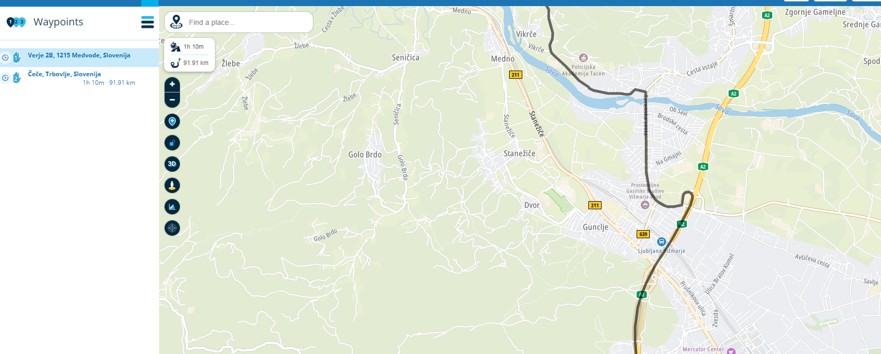
That the times and distances differ slightly per map can therefore be explained. Because each card has its own routing settings.@Hans-van-de-Ven-MRA-Master its what I am saying all the time, I know app uses Here maps, but the problem is that its navigatiing with big big errors - not taking / using the highways, taking you backroads etc, despite having used no special toolbox. I have settings to fastest and 0 curvines.
It happened again today - from A to B:
Same exact point but MRA Next map wanted to go right through the city, while tomtom took the most sensable way straight to Ljubljana ringroad. This are my everyday routes and I know you need to be crazy not to take ring road (no tool roads by the way on it) so MRA takes the crazy option througj the city.
In circles - it seems that MRA next ALWAYS takes the shortest option no matter what you choose.By taking shortest option you know what it happens. The app took me twice to strange roads and then I started to compare
BTW: Look closely to your test routes, tomtom is 1h faster on more km (!!) because it AVOIDS cities like essen, HERE takes you throuh city
This is my point, and if you will while driving choose to go where tomtom is navigationg you ETa in MRA will immediatelly drop by 10-20min! So I am absolutely 100% sure it is not navigating via FASTEST option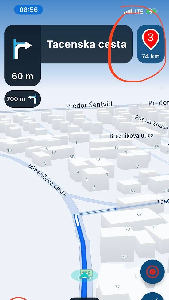
-
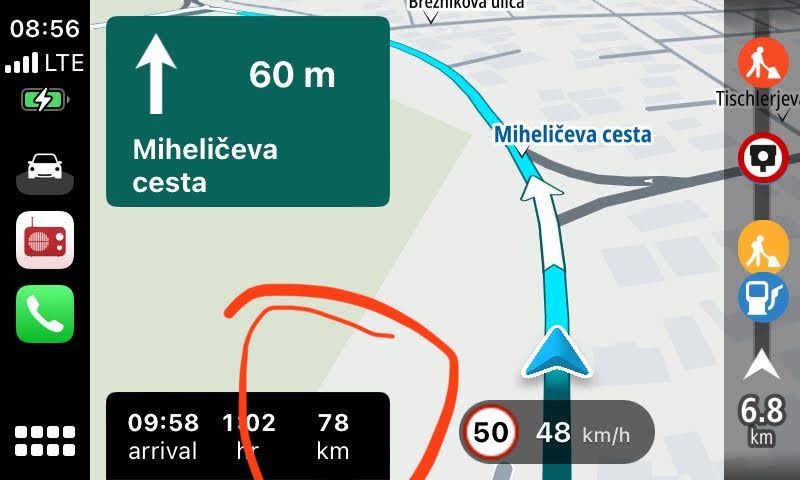
Todays case from route planner:
Here maps - as per MRA Next:
Tomtom (Tomtom mobile GO on phone choosed same option):
Secomd option is FAR FAR prefered, and FAR FAR fastest, its a ring road obviously.
First option through the center of city, also dictated by MRA app, second via ring road dicated by Tomtom. I refused to go via MRA, and when I reached ring road MRA recalculated and went where I wanted to go, and its ETA dropped by 14 min!
So my only point: MRA Next does not navigate via optimal route UNLESS you cleary set your waypoints where you want to go
In my car I can use phone for MRA app and Carplay for Tom tom simultaniously, when taking print screen it takes screen of both simultaniously
-
I can continue, I am planing big motorcycle trip in Tunisia in Feb 2023:
Same route, despite the fact that I set many many waypoints on path where I want to go:
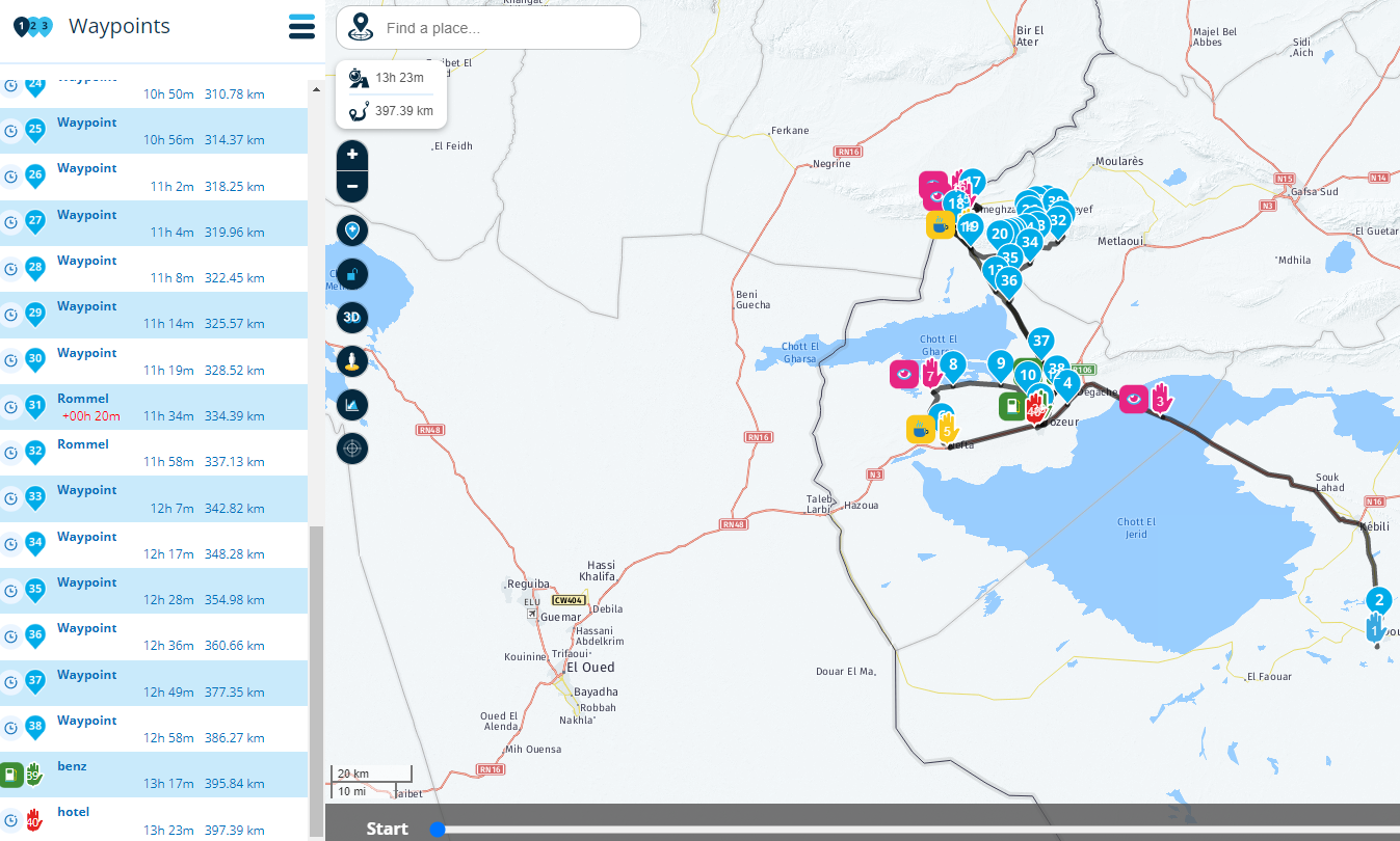
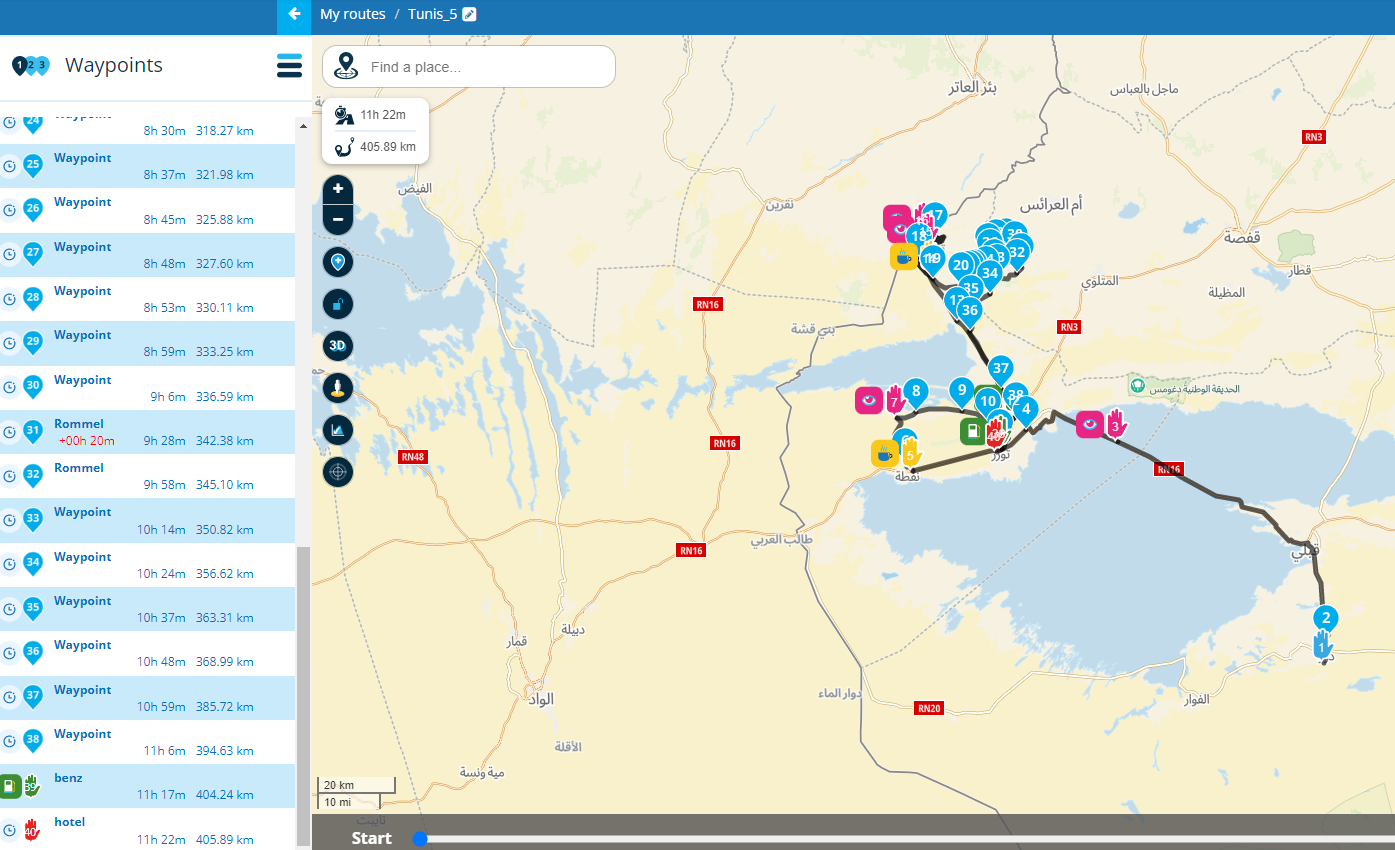
Tomtom is 2 hours (!!!!!!!!!!!!!!!!) faster despite more kmI am a motorcycle guide who travels cca 30-40.000km per year and I have real faith in tomtom navigation. I realyl like the MRA app because of features, especially regarding waypoints and segments, but navigation is not serious

To be clear - I am not blaming the app, but I do think reason is in map database, app is only using the info embeded in the maps (categorization of roads, positioning, etc etc) So I guess, having a serious navigation requires serious map database....
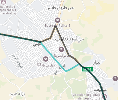
Segments like this make a difference - green is HERE maps, imagin going through center of busy tunis cities....
-
When you say
To use MRA Navigation (Next) it is best to plan your route in the Here map. With A to B routes (which you probably use) only in the app and therefore the Here map, you know for sure that you have the fastest route, because that's how the routing of the Here map is set.Everything in practice shows this is not true, it seems MRA N always chooses shortest route
@Jure-Sirena-0 Thanks for your input, MRA Navigation (Next) is still in the development phase, so things will definitely improve
Garmin Zumo XT3/XT2/XT/BMW Connected Ride Navigator/Tourstart/ MyRouteapp (The App)/...
Een dag niet gelachen is een dag niet geleefd / Een route is net zo goed als deze uitgezet is. -
@Jure-Sirena-0 Thanks for your input, MRA Navigation (Next) is still in the development phase, so things will definitely improve
@Hans-van-de-Ven-MRA-Master
Keep it up! -
A quick follow up here: by default the toll road are disabled. This means that the app will not use them if an alternative is possible.
In a next update (not the upcoming) more routing preferences will be added

-
A quick follow up here: by default the toll road are disabled. This means that the app will not use them if an alternative is possible.
In a next update (not the upcoming) more routing preferences will be added
@Corjan-Meijerink
When I use the app to make a route somewhere I want to go in Canada it uses Toll roads before non toll on the route it makes. I hate this, I should be able to pick no tolls, dirt roads, etc. -
@Corjan-Meijerink
When I use the app to make a route somewhere I want to go in Canada it uses Toll roads before non toll on the route it makes. I hate this, I should be able to pick no tolls, dirt roads, etc.@Tumbleweed Yes, I completely understand. Therefore we are implementing it in another iteration
No worries! It's still a Beta app and we need to prioritise what features we pick first. -
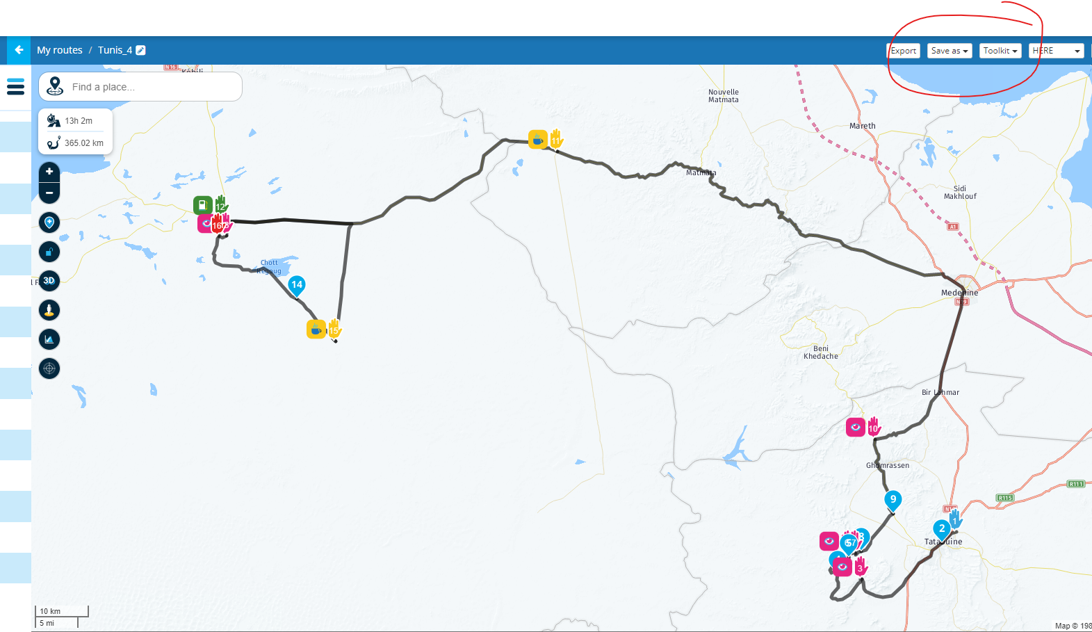
I prepared the routes for Tunisia, but I must say to my dissapointment I cannot use the app - and main reason is HERE maps.....from begining of this post I suspected the reason for bad navigation is in the HERE maps.
1.case (same route just changing maps)
When I create route, it takes me FAR FAR around between waypoint 10-11, because lots of MAIN roads are missing: HERE MAPS
Tomtom maps (more then 3h less)
Openstreet maps
Comparing route on both maps
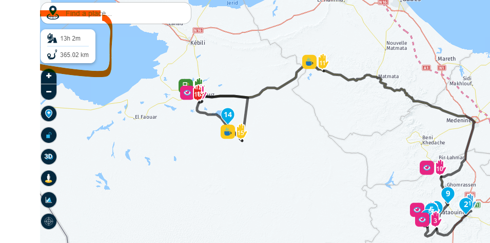
- case
Here maps is green, you can also see that it wants to take me straight through Sahara desert sand to waypoint 15....skipping points 12,13,14??
3.case
Between point 8 and 9 takes road that is not driveable...etc- case
from point 3 it takes unexisting road again
Since the MRA usas the wors map option - HERE I cant use the app on my trip....
And I noticed lots of this map errors driving in central Europe.
Time to invest in maps guys.... - case
-
I prepared the routes for Tunisia, but I must say to my dissapointment I cannot use the app - and main reason is HERE maps.....from begining of this post I suspected the reason for bad navigation is in the HERE maps.
1.case (same route just changing maps)
When I create route, it takes me FAR FAR around between waypoint 10-11, because lots of MAIN roads are missing: HERE MAPS
Tomtom maps (more then 3h less)
Openstreet maps
Comparing route on both maps
- case
Here maps is green, you can also see that it wants to take me straight through Sahara desert sand to waypoint 15....skipping points 12,13,14??
3.case
Between point 8 and 9 takes road that is not driveable...etc- case
from point 3 it takes unexisting road again
Since the MRA usas the wors map option - HERE I cant use the app on my trip....
And I noticed lots of this map errors driving in central Europe.
Time to invest in maps guys....Just zoom in and place some extra shaping points
The here map is good for navigating, or is it due to the route taken?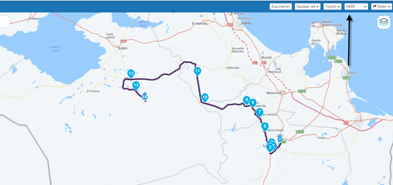
Garmin Zumo XT3/XT2/XT/BMW Connected Ride Navigator/Tourstart/ MyRouteapp (The App)/...
Een dag niet gelachen is een dag niet geleefd / Een route is net zo goed als deze uitgezet is. - case
-
Just zoom in and place some extra shaping points
The here map is good for navigating, or is it due to the route taken?@Hans-van-de-Ven-MRA-Master said in Quality of navigation:
Just zoom in and place some extra shaping points
The here map is good for navigating, or is it due to the route taken?What is the point if the user has to make route and not the tool? Will I always need to g oto other tools to see roads and manually create points for every wrong paths in routes? Sorry it does not work like that especially on not known terriotries.
Thats my original point - qiality of navigation. -
Of course it was HERE and no tool kits activated
-
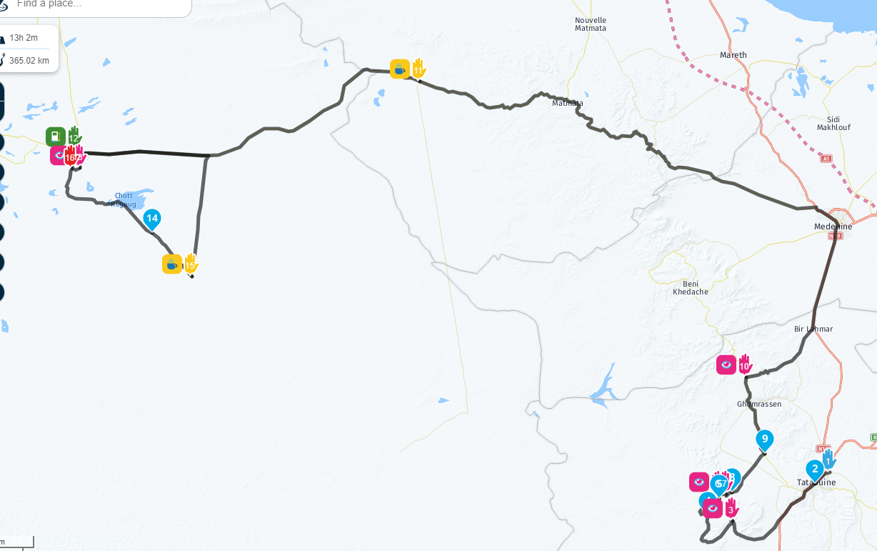
And the next stupid thing is - when I implement what you suggest time falls significantly. This way user is more smart then the tool. Tthe tool should do that!!
It was 13h2m at original route
then time (and distance) drops for 30 min when i add points 11 and 17 to tell the tool that its giving me wrong direction....
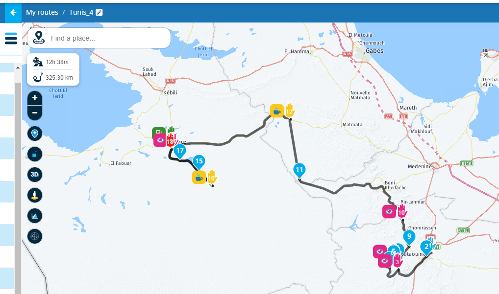
This should net be happening, I loose complete faith in navigation
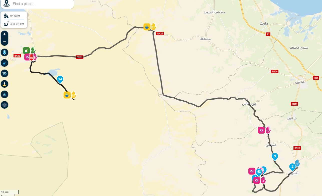
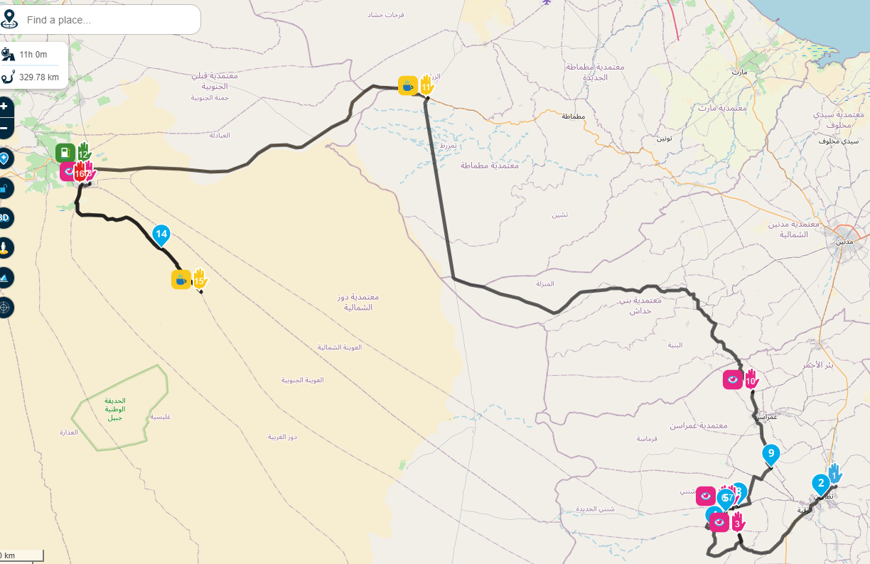
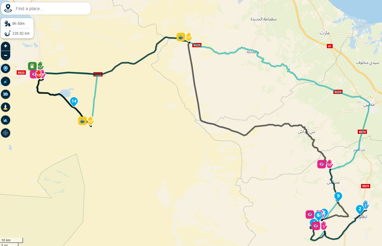
-
And even after doing that keeps insisting (HERE in green, TomTom or google in black) not to take main road that tomtom, google or even openstreet maps would
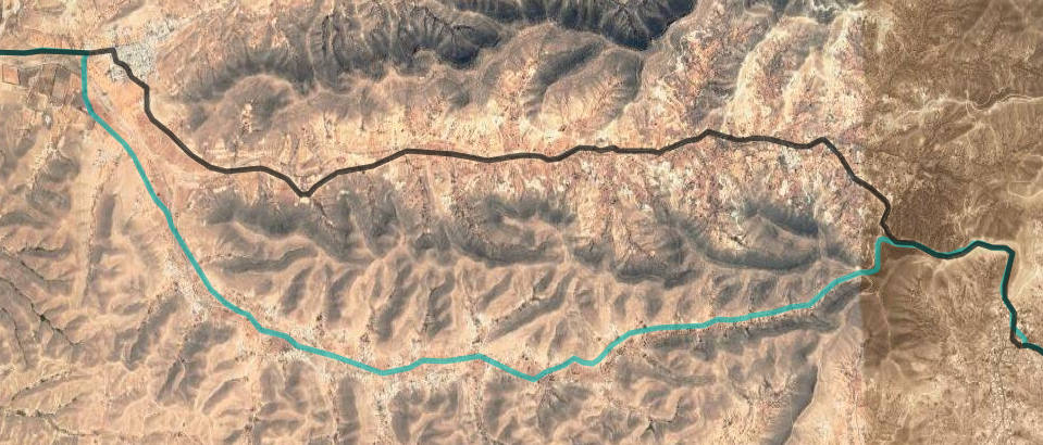
So now I should again manualy put a point to black line tell the HERE maps they are wrong. And if I would do that time and distance would fell again.
Maybe there is a hidden 'adrenalin' option in the tool
Hello! It looks like you're interested in this conversation, but you don't have an account yet.
Getting fed up of having to scroll through the same posts each visit? When you register for an account, you'll always come back to exactly where you were before, and choose to be notified of new replies (either via email, or push notification). You'll also be able to save bookmarks and upvote posts to show your appreciation to other community members.
With your input, this post could be even better 💗
Register Login-
71044.9k
-
0483
-
744598
-
1643
-
09288
-
04237
-
011160
-
06196
