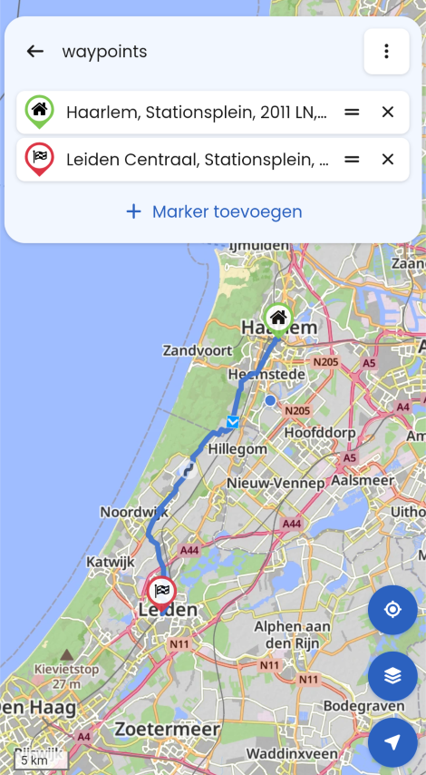
Is it possible to overlay a visualised route with other map data (like e.g. charging stations) ?
-
Even if MRA is originating from motorbike navigation (which don't need fastchargers - generally
 ), is there a way to plan a trip with EV charging stations visualised on the map (I have the Gold membership).
 -
Even if MRA is originating from motorbike navigation (which don't need fastchargers - generally
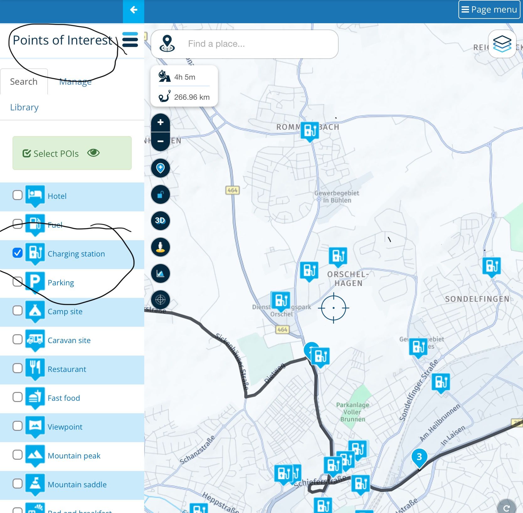
), is there a way to plan a trip with EV charging stations visualised on the map (I have the Gold membership).@sudolea There are POI‘s and E-Charging stations.
-
Even if MRA is originating from motorbike navigation (which don't need fastchargers - generally
), is there a way to plan a trip with EV charging stations visualised on the map (I have the Gold membership).@sudolea, @Reinhard-32 is correct, but even better would be to find your own accurate source of POI chargers and upload them regularly into your POI library. From there you can fix them, so they are always displayed on your map, in planning as well as while navigating.
-
Deze poi kun je wel zien in een route maar niet als je een route als track hebt opgeslagen zoals ik veelal doe. De reden dat ik bijna allemaal tracks heb is dat ik via een Garmin Edge 1040 fietstochten maak, dan heb je geen laadpalen nodig maar wel soms een parkeerplaats om de auto te stallen met aanhanger erachter voor de fietsen. Mijn vrouw heeft een 3wielfiets en die kan niet op een fietsen drager vandaar dat ik graag P plaatsen wil zien.
Of is er een mogelijkheid dat ook bij eet track de poi zichtbaar worden?
-
@Con-Hennekens
Yes, that would be better, and apparently it CAN be done. But do you know a help link somewhere, explaining how it's done ? It would be very helpful to filter only on fastchargers, for instance...@Peter-Bijnsdorp
In your use-case, I would convert the track into a route. -
Deze poi kun je wel zien in een route maar niet als je een route als track hebt opgeslagen zoals ik veelal doe. De reden dat ik bijna allemaal tracks heb is dat ik via een Garmin Edge 1040 fietstochten maak, dan heb je geen laadpalen nodig maar wel soms een parkeerplaats om de auto te stallen met aanhanger erachter voor de fietsen. Mijn vrouw heeft een 3wielfiets en die kan niet op een fietsen drager vandaar dat ik graag P plaatsen wil zien.
Of is er een mogelijkheid dat ook bij eet track de poi zichtbaar worden?
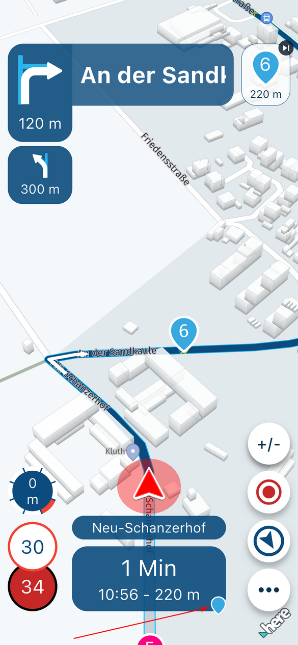
@Peter-Bijnsdorp, Jawel hoor, de POI die op die manier zijn aangezet, zie je ook terug op de OSM kaart die je gebruikt bij "Follow-the-Line" navigatie (fiets/wandel). Maar als je een parkeerplaats zoekt, navigeer je toch in het auto-profiel neem ik aan?
-
@Con-Hennekens
Yes, that would be better, and apparently it CAN be done. But do you know a help link somewhere, explaining how it's done ? It would be very helpful to filter only on fastchargers, for instance...@Peter-Bijnsdorp
In your use-case, I would convert the track into a route.@sudolea said in Is it possible to overlay a visualised route with other map data (like e.g. charging stations) ?:
do you know a help link somewhere, explaining how it's done ? It would be very helpful to filter only on fastchargers, for instance...
The POI manual is here: https://support.myrouteapp.com/en/support/solutions/articles/12000074553-manual-poi-s-
I think it is not completely up-2-date concerning the new feature of fixing the library to all your routes and navigation, but pressing the "head" icon does the trick:
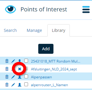
Now you only need to find a POI file with fastchargers
")
I am just an enthusiastic MRA user, and hope you will be one too!
Most motorcycle problems are caused by the nut that connects the handlebar to the saddle.
Check out RideSleepRepeat.eu, a biker community for sharing stays across Europe
-
@sudolea said in Is it possible to overlay a visualised route with other map data (like e.g. charging stations) ?:
do you know a help link somewhere, explaining how it's done ? It would be very helpful to filter only on fastchargers, for instance...
The POI manual is here: https://support.myrouteapp.com/en/support/solutions/articles/12000074553-manual-poi-s-
I think it is not completely up-2-date concerning the new feature of fixing the library to all your routes and navigation, but pressing the "head" icon does the trick:
Now you only need to find a POI file with fastchargers
@Con-Hennekens OK, that last step (i.e. the creation of POI files) was the one I was really after, I may not have expressed myself properly enough...
-
@Con-Hennekens OK, that last step (i.e. the creation of POI files) was the one I was really after, I may not have expressed myself properly enough...
@sudolea, hmm. I can't help you any further than this:
You might want to check openchargemap.org. It's a public worldwide database with an API which I think you could use to get the wanted data as KML file. You will however need to convert that into OV2, GPX or CSV.Many services seem to be commercial, it is not easy to find a ready to use POI for fast chargers I think.
Hello! It looks like you're interested in this conversation, but you don't have an account yet.
Getting fed up of having to scroll through the same posts each visit? When you register for an account, you'll always come back to exactly where you were before, and choose to be notified of new replies (either via email, or push notification). You'll also be able to save bookmarks and upvote posts to show your appreciation to other community members.
With your input, this post could be even better 💗
Register Login-
09111
-
310231
-
1690
-
0537
-
09216
-
08132
-
7281.8k
-
023