Make the default an option in the menu
-
Hi,
I never plan routes with unpaved roads, would it be possible to always make the choice active in the menu to avoid having to do it at each new planning with the risk of forgetting it?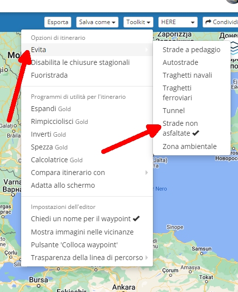
Thanks a lot
-
Hi,
I never plan routes with unpaved roads, would it be possible to always make the choice active in the menu to avoid having to do it at each new planning with the risk of forgetting it?Thanks a lot
@Corrado-Miniati-0 With the majority of users being car, campervan or motorbikers it does seem odd to have that enabled by default.
Although I've never had problems with it in the UK. Yet.
-
@Corrado-Miniati-0 With the majority of users being car, campervan or motorbikers it does seem odd to have that enabled by default.
Although I've never had problems with it in the UK. Yet.
@richtea999 said in Make the default an option in the menu:
seem odd to have that enabled by default.
Just to clarify, having this option "enabled" means that unpaved roads are avoided haha. Having this option "disabled" means allowing unpaved roads. This option is under the "avoid" menu and not in the "allow" menu.

I understand what you meant but specific wording is critical here haha and I definitely agree that allowing unpaved roads by default is "odd" considering the user base of MRA as you've already stated.
If these settings are "remembered/saved" so to say, we're already much better off!
-
@Peter-Schiefer said in Make the default an option in the menu:
Problem if you hit on on of these options you will not see what happens.
No hook for commitment nothingHi Peter, I think you mean there is no way of telling if the option has been activated or not, right?
Well, if you go back to the setting AFTER you've clicked it (activated the avoid option) then you'll see a checkmark as indication of the option being active:
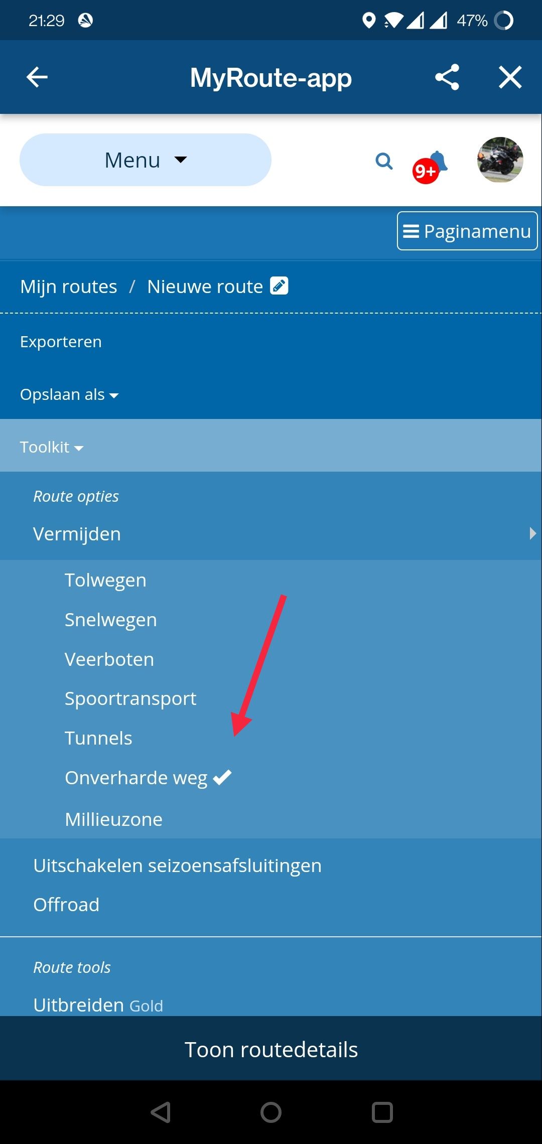
This checkmark appears at every toolkit option you've activated, and is disappears when default or deactivated.
-
@Peter-Schiefer said in Make the default an option in the menu:
I tried it on my fist iPad several times with no results.
You sure it is a true Apple iPad and not an Temu/AliExpress/Banggood aaipet? Haha Just kidding! I don't know what's causing your issue!

Manks bu'j te bange.
-
@Peter-Schiefer said in Make the default an option in the menu:
I tried it on my fist iPad several times with no results.
You sure it is a true Apple iPad and not an Temu/AliExpress/Banggood aaipet? Haha Just kidding! I don't know what's causing your issue!
@Stefan-Hummelink, I think you misspelled "do"
")
I am just an enthusiastic MRA user, and hope you will be one too!
Most motorcycle problems are caused by the nut that connects the handlebar to the saddle.
Check out RideSleepRepeat.eu, a biker community for sharing stays across Europe
-
@Stefan-Hummelink, I think you misspelled "do"
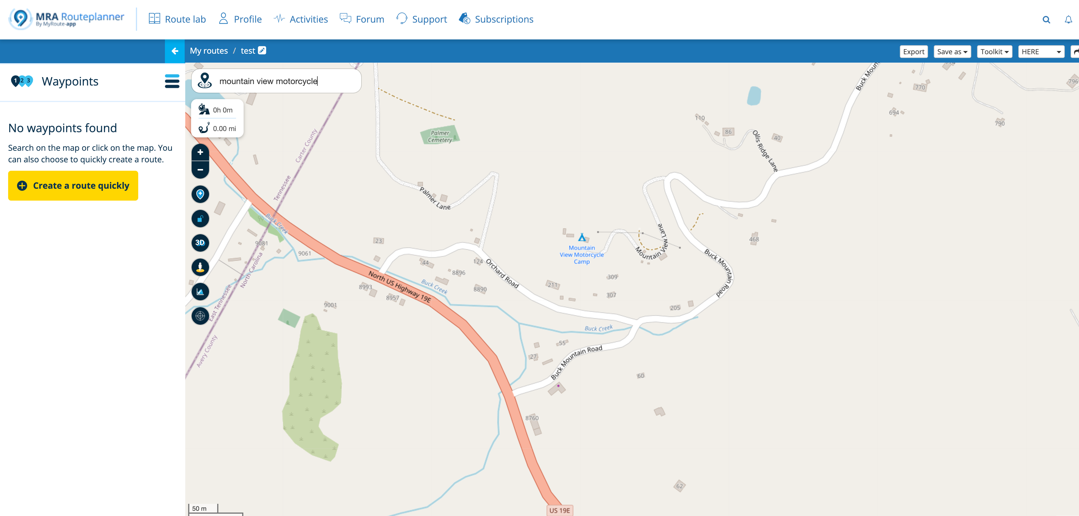
@Con-Hennekens The problem is that when you are planning the route you cannot see if the road is unpaved or not. The option "avoid unpaved roads" works fine as long you do not put a route point on that unpaved road. When you do you will navigate the unpaved road even when the option "avoid unpaved roads" is on.
-
@Con-Hennekens The problem is that when you are planning the route you cannot see if the road is unpaved or not. The option "avoid unpaved roads" works fine as long you do not put a route point on that unpaved road. When you do you will navigate the unpaved road even when the option "avoid unpaved roads" is on.
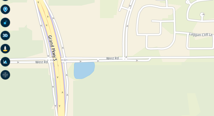
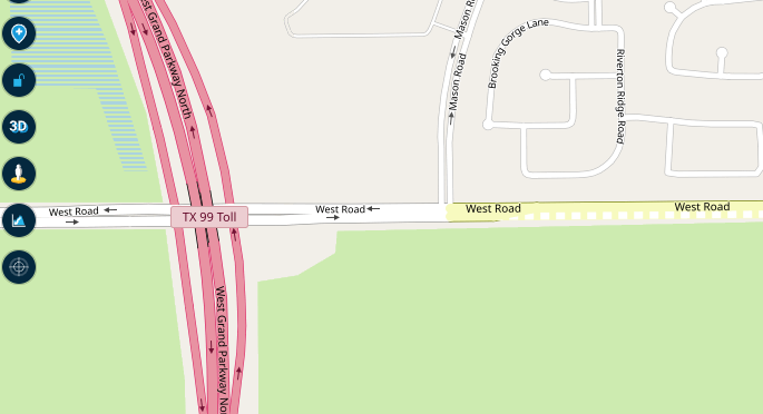
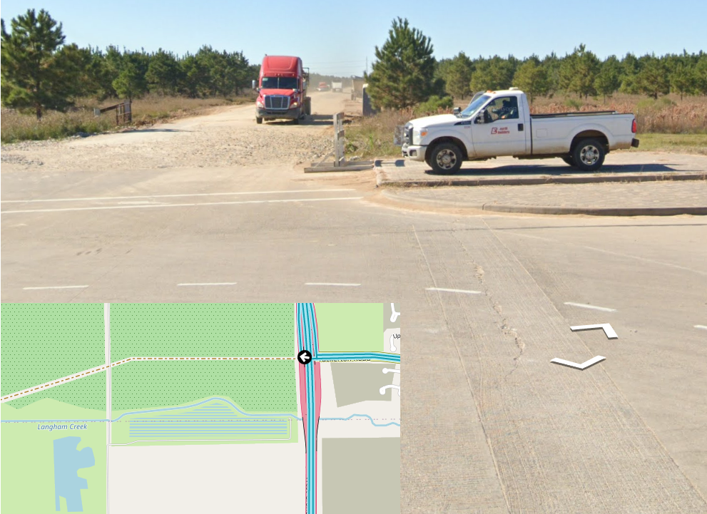
@C-A-Kielen not sure if this is actually the way it is meant to work or not, however, it seems to be pretty repeatable for me - for example, in the planner, without selecting 'avoid unpaved roads', if you click on the 'figure' symbol
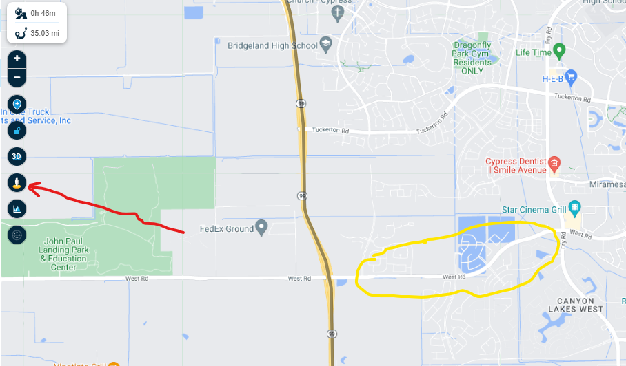
you will see the map 'change' from what you see above, to this
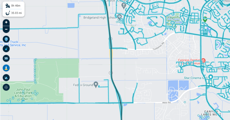
...and if you notice the yellow circled portion of 'West Rd', it did not change....this is an unpaved road.
Coicidence? 100% accurate? No idea, but it really gives me a good indication in the planning stages that I should avoid that portion if I can.
The same applies to the 'yellow man' in Google Maps...if you click, and hold, that symbol and drag it into the map (DO NOT LET GO), it will, iin essence, show you paved vs unpaved roads. If you drop the yellow man on the road and the road view comes up, spin it around and you will see this.

Again, coincidence? No idea - gives me a very good starting point. I have compared the MRA symbol to the Google Maps symbol to Google Earth - and they have matched up with amazing accuracy.
-
@Con-Hennekens The problem is that when you are planning the route you cannot see if the road is unpaved or not. The option "avoid unpaved roads" works fine as long you do not put a route point on that unpaved road. When you do you will navigate the unpaved road even when the option "avoid unpaved roads" is on.
@C-A-Kielen, True, but you can choose a different overlay map, like OSM or Michelin
-
@C-A-Kielen not sure if this is actually the way it is meant to work or not, however, it seems to be pretty repeatable for me - for example, in the planner, without selecting 'avoid unpaved roads', if you click on the 'figure' symbol
you will see the map 'change' from what you see above, to this
...and if you notice the yellow circled portion of 'West Rd', it did not change....this is an unpaved road.
Coicidence? 100% accurate? No idea, but it really gives me a good indication in the planning stages that I should avoid that portion if I can.
The same applies to the 'yellow man' in Google Maps...if you click, and hold, that symbol and drag it into the map (DO NOT LET GO), it will, iin essence, show you paved vs unpaved roads. If you drop the yellow man on the road and the road view comes up, spin it around and you will see this.
Again, coincidence? No idea - gives me a very good starting point. I have compared the MRA symbol to the Google Maps symbol to Google Earth - and they have matched up with amazing accuracy.
@GT-JWR Whilst I understand your rational regarding StreetView it really isn't the best tool to use, it is useful as you can see a visual image (blue line) of where the Google car has been able to drive and clicking on the blue line shows a photo.
In your example of West road the StreetView photo image that we see in MRA has no date to it and it shows a road construction site.
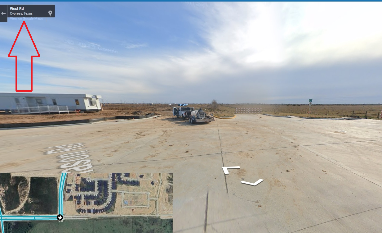
If you click the (hard to see) View on Google maps link the image appears on Google maps with the date of the StreetView photo, in this case Jan 2022.
The overlay maps all have different ideas too, here's the Michelin map:
And the HERE map:
TomTom map:
And OpenStreetMap:
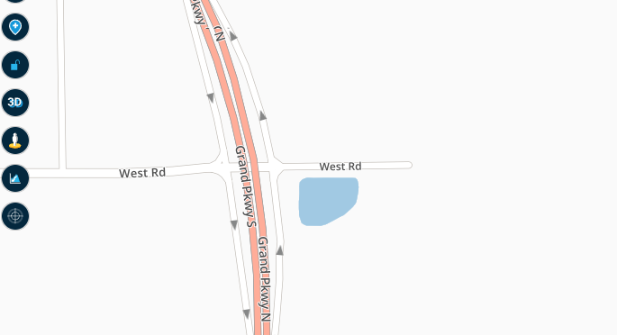
One image that is difficult to disagree with though is the satellite view:
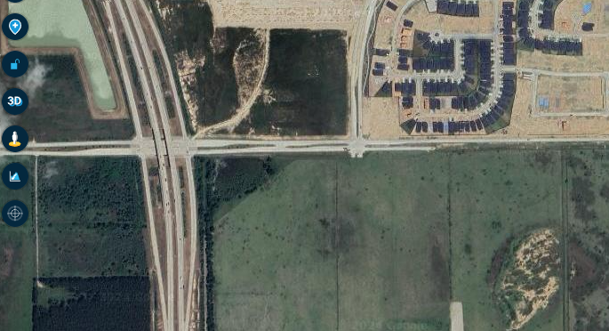
And if you zoom in close enough you can see a vehicle on the road.
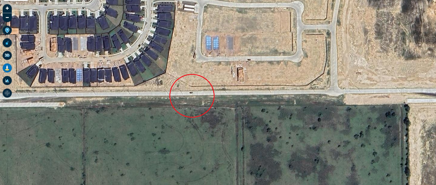
I don't know the date of the satellite image but it is clearly more recent than that of StreetView. Generally speaking, I find that TomTom and OSM are more up to date. If you zoom in on either of these maps you can see that they both agree with the satellite image and show a single carriageway on part of West road.
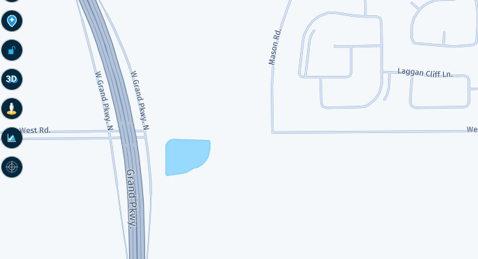
OpenStreetMaps do show non metaled or gravel roads as you can see from this nearby example. A brown dot and dash line with a truck thundering down it.
This is one of the great things about MRA, there are many tools that can be used and often it is best to use a combination of a few of them to find the answer.
Always willing to help if I can.
Triumph Tiger 1200 XRT called Tina.
MRA Navigation Next and SilverFox BJ8 -
@GT-JWR Whilst I understand your rational regarding StreetView it really isn't the best tool to use, it is useful as you can see a visual image (blue line) of where the Google car has been able to drive and clicking on the blue line shows a photo.
In your example of West road the StreetView photo image that we see in MRA has no date to it and it shows a road construction site.
If you click the (hard to see) View on Google maps link the image appears on Google maps with the date of the StreetView photo, in this case Jan 2022.
The overlay maps all have different ideas too, here's the Michelin map:
And the HERE map:
TomTom map:
And OpenStreetMap:
One image that is difficult to disagree with though is the satellite view:
And if you zoom in close enough you can see a vehicle on the road.
I don't know the date of the satellite image but it is clearly more recent than that of StreetView. Generally speaking, I find that TomTom and OSM are more up to date. If you zoom in on either of these maps you can see that they both agree with the satellite image and show a single carriageway on part of West road.
OpenStreetMaps do show non metaled or gravel roads as you can see from this nearby example. A brown dot and dash line with a truck thundering down it.
This is one of the great things about MRA, there are many tools that can be used and often it is best to use a combination of a few of them to find the answer.
@Nick-Carthew said in Make the default an option in the menu:
This is one of the great things about MRA, there are many tools that can be used and often it is best to use a combination of a few of them to find the answer.
couldn't agree more - to each their own and what seems to work best for them.
My particular example, while still quite a good indication, just happens to be under construction (that whole area is being built up, houses and roads going in every day), and yes, I would expect most map providers to eventually be updated.
-
A lot posts where people tell you how can identify unpaved roads.
But that is not what is asked.In the first post @Corrado-Miniati-0 stated that many people try to avoid unpaved road as standard. That is true in my opnion.
What @Corrado-Miniati-0 asked. Why not have the option to create a standard selection for yourself what to avoid on each route you create. Just like it is possible with the 3 maps (Google, Here and TomTom).
+1 from my side
(I use MRA Next only on Android Auto. Every comment, suggestion, etc will be based on my usage with Android Auto)
-
A lot posts where people tell you how can identify unpaved roads.
But that is not what is asked.In the first post @Corrado-Miniati-0 stated that many people try to avoid unpaved road as standard. That is true in my opnion.
What @Corrado-Miniati-0 asked. Why not have the option to create a standard selection for yourself what to avoid on each route you create. Just like it is possible with the 3 maps (Google, Here and TomTom).
+1 from my side
@M-Schrijver, yes, from my side too!
I think the planner will grow towards default settings per travel mode.
(but i can't be sure of course!)
Hello! It looks like you're interested in this conversation, but you don't have an account yet.
Getting fed up of having to scroll through the same posts each visit? When you register for an account, you'll always come back to exactly where you were before, and choose to be notified of new replies (either via email, or push notification). You'll also be able to save bookmarks and upvote posts to show your appreciation to other community members.
With your input, this post could be even better 💗
Register Login-
1572
-
08156
-
07151
-
08179
-
0425
-
0227
-
7221.4k
-
0341.6k