Incorrect mapversion of HERE in MRA
-
@Reinhard-32
Hello Reinhardt. That now explains why that part of the road is not present in Basecamp, because that TOPOActive map is not present in Basecamp.
I have the Topo Active Map installed and active on my Zumo XT.
I have now checked the situation again after having 'unticked' the TopoActive map and yes, that particular part then disappears on the map. Ticking the boxes again, the road is back. Thanks for letting me know the source of the problem. Riddle solved. Still; HERE has to make that correction for their regular map. Thanks a lot!@Rob-Veerman
Rob, connect your Zumo via USB with BaseCamp and wait for a while. Then you can select the TopoActive Map from the Map drop down menu. On my Maschine the south west part oft this map is visible only. That includes the Netherlands but not Germany. -
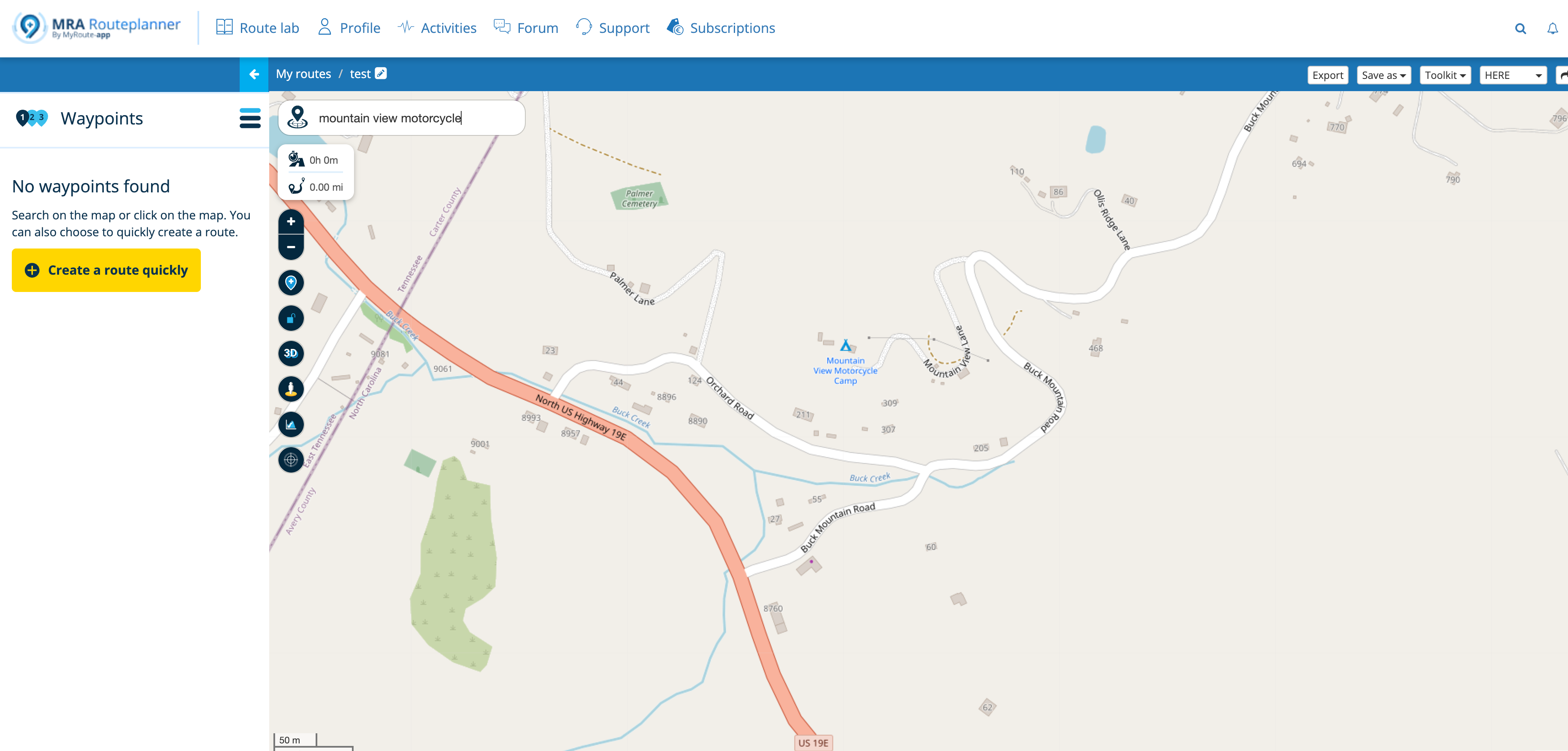
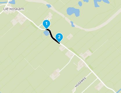
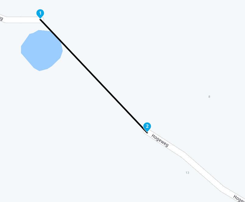
Using the HERE map in MRA (or in Basecamp) for crossing de 'Hogeweg' in Kamperveen (8278BA) tells us that that road is not an through road.
Using the HERE map in my Garmin Zumo XT shows the correct version of the ongoing road. The OSM map and the TomTom map in MRA also show the correct situation.Why is the HERE map that MRA uses not correct and not the same as on the Zumo XT? It looks different versions are being distributed.
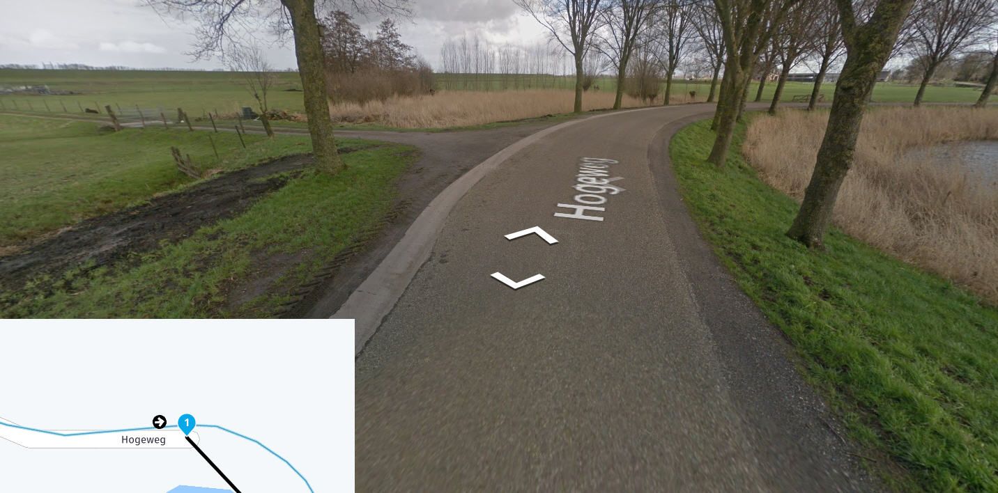
Hi Rob, this piece of road has already been mentioned on the forum once, it is true that there are several Here cards ...
What you can do is use the "skip route point" option
The different maps: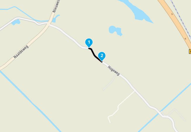
Garmin Zumo XT3/XT2/XT/BMW Connected Ride Navigator/MyRouteapp (The App)/...
Een dag niet gelachen is een dag niet geleefd / Een route is net zo goed als deze uitgezet is. -
@Rob-Veerman
Rob, connect your Zumo via USB with BaseCamp and wait for a while. Then you can select the TopoActive Map from the Map drop down menu. On my Maschine the south west part oft this map is visible only. That includes the Netherlands but not Germany.@Reinhard-32
Is there a way to download (copy) the TopoActive Map from the XT into Basecamp? Garmin Express doesn't show that (unlike the CityNavigator Map). I am using a MacBook -
@Reinhard-32
Is there a way to download (copy) the TopoActive Map from the XT into Basecamp? Garmin Express doesn't show that (unlike the CityNavigator Map). I am using a MacBookDid you looked at the Garmin website?
Garmin Zumo XT3/XT2/XT/BMW Connected Ride Navigator/MyRouteapp (The App)/...
Een dag niet gelachen is een dag niet geleefd / Een route is net zo goed als deze uitgezet is. -
Did you looked at the Garmin website?
This post is deleted! -
Did you looked at the Garmin website?
@Hans-van-de-Ven-MRA-Master
Not yet, but I will (and post my findings here). -
Hi Rob, this piece of road has already been mentioned on the forum once, it is true that there are several Here cards ...
What you can do is use the "skip route point" option
The different maps:
@Hans-van-de-Ven-MRA-Master
Hans,
Thanks for the tip, I know that one and used it to connect the 2 roads together (because I constructed a route taking this 'winding' road and that route will also be used by other members of an accompanying group I am making a day trip with) and do use that option regularly, mostly in case of ferries in case of not being part of the MRA-database. Anyhow, bedankt voor het meedenken. -
@Reinhard-32
Is there a way to download (copy) the TopoActive Map from the XT into Basecamp? Garmin Express doesn't show that (unlike the CityNavigator Map). I am using a MacBookThis post is deleted! -
Hi Reinhardt,
I was about 10 seconds too late to copy your deleted posting. I think you will understand what I mean. Could you send me the text by email:
rob.veerman@icloud.com -
Hi Reinhardt,
I was about 10 seconds too late to copy your deleted posting. I think you will understand what I mean. Could you send me the text by email:
rob.veerman@icloud.com@Rob-Veerman
Rob, I deleted this because it was not working correctly for the moment. I did this procedure with other Garmins and it worked well but with the XT there was a problem. I know there is a problem with BaseCamp in combination with the ZumoXT. When you connect your zumo to BaseCamp only one of the two ToPoMaps Parts are shown. Garmin will fix this with one of the next updates.
I will send you an E- Mail tomorrow with the instructions anyway.
Hello! It looks like you're interested in this conversation, but you don't have an account yet.
Getting fed up of having to scroll through the same posts each visit? When you register for an account, you'll always come back to exactly where you were before, and choose to be notified of new replies (either via email, or push notification). You'll also be able to save bookmarks and upvote posts to show your appreciation to other community members.
With your input, this post could be even better 💗
Register Login-
0786
-
08175
-
08187
-
07160
-
010411
-
0341.6k
-
1578
-
7221.4k