Base maps and POI's
-
I have been using the HERE base map for awhile, but now I have the BMW Connected TFT and have been told it uses Tom Tom maps, it has raised a couple of questions.
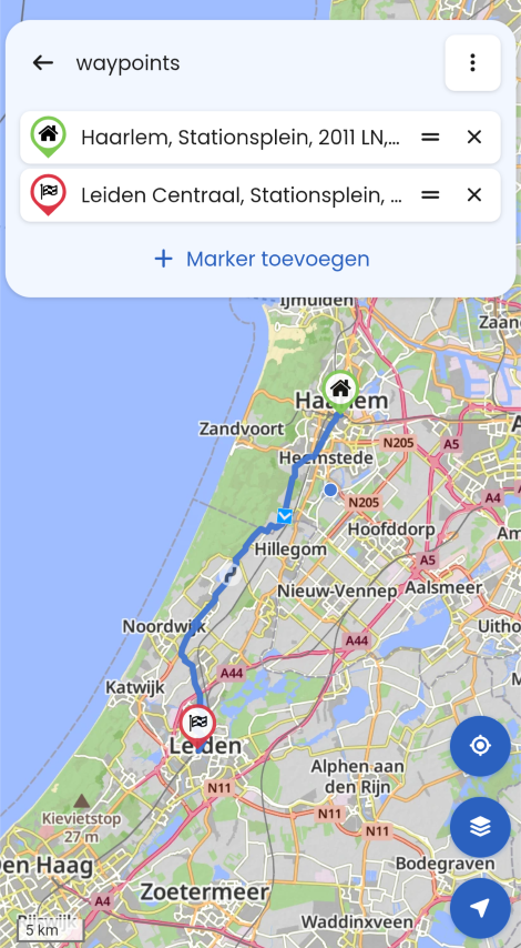
What is the difference between the different base maps when using them in different navigation devices, be it Garmin, phone, BMW's TFT? Will they not work or do they not really make a difference?And as for POI's I have been reading the manual/faq about adding POI's and get that bit. But on my TFT sat-nav all I get is the route I have planned, no visible waypoints etc. So I have no idea where the next cafe or fuel stop is until I reach it. If I use the Nav app on my phone (it wont let me have the trial as I used it a couple of years ago, so I can't test the new version) will it show me the waypoints/POIs makers as cafes/fuel stops? And if I go from a Garmin to the phone app, do I have to use a different base map?
-
I have been using the HERE base map for awhile, but now I have the BMW Connected TFT and have been told it uses Tom Tom maps, it has raised a couple of questions.
What is the difference between the different base maps when using them in different navigation devices, be it Garmin, phone, BMW's TFT? Will they not work or do they not really make a difference?And as for POI's I have been reading the manual/faq about adding POI's and get that bit. But on my TFT sat-nav all I get is the route I have planned, no visible waypoints etc. So I have no idea where the next cafe or fuel stop is until I reach it. If I use the Nav app on my phone (it wont let me have the trial as I used it a couple of years ago, so I can't test the new version) will it show me the waypoints/POIs makers as cafes/fuel stops? And if I go from a Garmin to the phone app, do I have to use a different base map?
@D-A-Wakefield In my opinion BMW uses satnav Navigator 6 wich is in fact a Garmin. Wich bike do you have?
🏍️ BMW K1600GT-P (2013) | Nolan N100-5 with Sena 30K
📱 iOS on iPhone 13 & 16 (mounted on Quadlock or AliExpress extention on BMW-cradle)
🚙 Apple CarPlay in VW T-Roc
💻 Routelab on MacBook Air & iMac (Tahoe & Ventura) -
@D-A-Wakefield In my opinion BMW uses satnav Navigator 6 wich is in fact a Garmin. Wich bike do you have?
@Rob-Verhoeff, the TFT screens with embedded navigation seem to use TT maps nowadays.
@D-A-Wakefield, the used map influences the way a routesegment between two waypoints gets calculated. So if you plan on a map that not equals the one on your device, there will occur differences between the planned route and the navigated route. MRA Gold offers features in the toolbox, the make routes for TT and HERE equal.
I am just an enthusiastic MRA user, and hope you will be one too!
Most motorcycle problems are caused by the nut that connects the handlebar to the saddle.
Check out RideSleepRepeat.eu, a biker community for sharing stays across Europe
-
I have been using the HERE base map for awhile, but now I have the BMW Connected TFT and have been told it uses Tom Tom maps, it has raised a couple of questions.
What is the difference between the different base maps when using them in different navigation devices, be it Garmin, phone, BMW's TFT? Will they not work or do they not really make a difference?And as for POI's I have been reading the manual/faq about adding POI's and get that bit. But on my TFT sat-nav all I get is the route I have planned, no visible waypoints etc. So I have no idea where the next cafe or fuel stop is until I reach it. If I use the Nav app on my phone (it wont let me have the trial as I used it a couple of years ago, so I can't test the new version) will it show me the waypoints/POIs makers as cafes/fuel stops? And if I go from a Garmin to the phone app, do I have to use a different base map?
How do you place the routes in the BMW Connected App?
You can navigate the route on your TFT screen in two ways with the BMW Connected App.
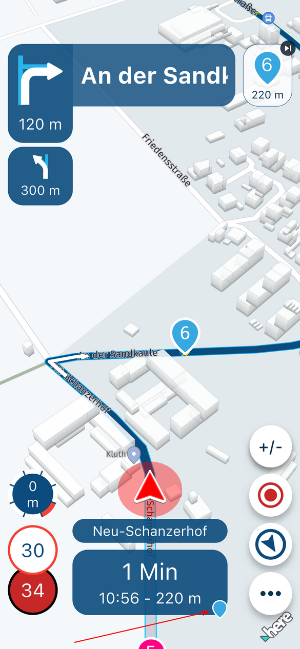
If you have made an export from the MRA App to the BMW Connected App, there will be two files in your route list. One with a lot of 'support points', that is the track with which you navigate the route exactly as you made it in the planner. And there is a file with several dozen 'support points. These are the via points that you have included in your route with the planner.
If you use this, the Connected app (TomTom) will generate a route via the support points. Note: that route may differ from the route created in the planner. And the app can handle a maximum of 50 such support points.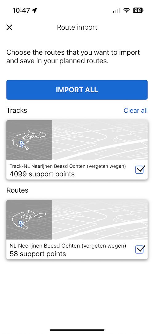
-
@D-A-Wakefield
Maybe this topic is helpful:
MRA and the BMW Connected App -
@D-A-Wakefield In my opinion BMW uses satnav Navigator 6 wich is in fact a Garmin. Wich bike do you have?
@Rob-Verhoeff Upto the 2021 models the K1600 used a Garmin, but from 2022 it now has a TFT display with built in sat-nav. Mine is a 2023 model.
-
@Rob-Verhoeff, the TFT screens with embedded navigation seem to use TT maps nowadays.
@D-A-Wakefield, the used map influences the way a routesegment between two waypoints gets calculated. So if you plan on a map that not equals the one on your device, there will occur differences between the planned route and the navigated route. MRA Gold offers features in the toolbox, the make routes for TT and HERE equal.
@Con-Hennekens I have tried both the Tom Tom and Here maps and don't see much difference in the routing.
I have read , mainly on this forum the BMW TFT system is based on the Tom Tom s/w. Is this a fact or an assumption? -
@D-A-Wakefield
Maybe this topic is helpful:
MRA and the BMW Connected App@Jack-van-Tilburg Thanks, I have read that. It doesn't really answer any of my questions.
-
@Rob-Verhoeff Upto the 2021 models the K1600 used a Garmin, but from 2022 it now has a TFT display with built in sat-nav. Mine is a 2023 model.
@D-A-Wakefield yep you're right

-
I have been using the HERE base map for awhile, but now I have the BMW Connected TFT and have been told it uses Tom Tom maps, it has raised a couple of questions.
What is the difference between the different base maps when using them in different navigation devices, be it Garmin, phone, BMW's TFT? Will they not work or do they not really make a difference?And as for POI's I have been reading the manual/faq about adding POI's and get that bit. But on my TFT sat-nav all I get is the route I have planned, no visible waypoints etc. So I have no idea where the next cafe or fuel stop is until I reach it. If I use the Nav app on my phone (it wont let me have the trial as I used it a couple of years ago, so I can't test the new version) will it show me the waypoints/POIs makers as cafes/fuel stops? And if I go from a Garmin to the phone app, do I have to use a different base map?
@D-A-Wakefield said in Base maps and POI's:
And as for POI's I have been reading the manual/faq about adding POI's and get that bit. But on my TFT sat-nav all I get is the route I have planned, no visible waypoints etc. So I have no idea where the next cafe or fuel stop is until I reach it.
I can only answer this as an ex TomTom user, I now exclusively use MRA Navigation.
When uploading a .gpx file to a TT you upload it as a track, the track has only the start and end route points visible. However; with a TT it is also possible to upload an .itn version of the route via a USB cable. An .itn route includes your route points and these are visible as you navigate.
Are you able to upload to the Nav6 via a USB cable?Always willing to help if I can.
Triumph Tiger 1200 XRT called Tina.
MRA Navigation Next and SilverFox BJ8 -
@D-A-Wakefield said in Base maps and POI's:
And as for POI's I have been reading the manual/faq about adding POI's and get that bit. But on my TFT sat-nav all I get is the route I have planned, no visible waypoints etc. So I have no idea where the next cafe or fuel stop is until I reach it.
I can only answer this as an ex TomTom user, I now exclusively use MRA Navigation.
When uploading a .gpx file to a TT you upload it as a track, the track has only the start and end route points visible. However; with a TT it is also possible to upload an .itn version of the route via a USB cable. An .itn route includes your route points and these are visible as you navigate.
Are you able to upload to the Nav6 via a USB cable?@Nick-Carthew said in Base maps and POI's:
Are you able to upload to the Nav6 via a USB cable?
It's not a Nav VI. That's a true Garmin. The new displays operate through a BMW-app with TomTom maps. There are still bikes with a seperate Nav VI device and the newest with only the TFT-screen with integrated TomTom-maps (according to my dealership).
-
@Con-Hennekens I have tried both the Tom Tom and Here maps and don't see much difference in the routing.
I have read , mainly on this forum the BMW TFT system is based on the Tom Tom s/w. Is this a fact or an assumption?@D-A-Wakefield said in Base maps and POI's:
I have tried both the Tom Tom and Here maps and don't see much difference in the routing.
I use them both. It doesn't matter which one because the BMW Connected App uses the track.
I have read , mainly on this forum the BMW TFT system is based on the Tom Tom s/w. Is this a fact or an assumption?
That is correct BMW Conneced App is TomTom based
The BMW TFT is just the screen that is used for the BMW Connected App on your smartphone -
I have been using the HERE base map for awhile, but now I have the BMW Connected TFT and have been told it uses Tom Tom maps, it has raised a couple of questions.
What is the difference between the different base maps when using them in different navigation devices, be it Garmin, phone, BMW's TFT? Will they not work or do they not really make a difference?And as for POI's I have been reading the manual/faq about adding POI's and get that bit. But on my TFT sat-nav all I get is the route I have planned, no visible waypoints etc. So I have no idea where the next cafe or fuel stop is until I reach it. If I use the Nav app on my phone (it wont let me have the trial as I used it a couple of years ago, so I can't test the new version) will it show me the waypoints/POIs makers as cafes/fuel stops? And if I go from a Garmin to the phone app, do I have to use a different base map?
@D-A-Wakefield said in Base maps and POI's:
What is the difference between the different base maps when using them in different navigation devices, be it Garmin, phone, BMW's TFT? Will they not work or do they not really make a difference?
Depending on the brand of navigation device used, you can use a certain base map to reduce deviations during the journey.
The Here map for Garmin (based) devices and TomTom for devices using the TomTom map (BMW Connected)The various map suppliers use different road data in some cases, for example a driving direction on site may differ per supplier. And sometimes Here gets it right and sometimes TomTom or OSM.
-
I have been using the HERE base map for awhile, but now I have the BMW Connected TFT and have been told it uses Tom Tom maps, it has raised a couple of questions.
What is the difference between the different base maps when using them in different navigation devices, be it Garmin, phone, BMW's TFT? Will they not work or do they not really make a difference?And as for POI's I have been reading the manual/faq about adding POI's and get that bit. But on my TFT sat-nav all I get is the route I have planned, no visible waypoints etc. So I have no idea where the next cafe or fuel stop is until I reach it. If I use the Nav app on my phone (it wont let me have the trial as I used it a couple of years ago, so I can't test the new version) will it show me the waypoints/POIs makers as cafes/fuel stops? And if I go from a Garmin to the phone app, do I have to use a different base map?
@D-A-Wakefield
I think all your questions have been answered above.
But if not, just ask the next question
-
I have been using the HERE base map for awhile, but now I have the BMW Connected TFT and have been told it uses Tom Tom maps, it has raised a couple of questions.
What is the difference between the different base maps when using them in different navigation devices, be it Garmin, phone, BMW's TFT? Will they not work or do they not really make a difference?And as for POI's I have been reading the manual/faq about adding POI's and get that bit. But on my TFT sat-nav all I get is the route I have planned, no visible waypoints etc. So I have no idea where the next cafe or fuel stop is until I reach it. If I use the Nav app on my phone (it wont let me have the trial as I used it a couple of years ago, so I can't test the new version) will it show me the waypoints/POIs makers as cafes/fuel stops? And if I go from a Garmin to the phone app, do I have to use a different base map?
@D-A-Wakefield said in Base maps and POI's:
What is the difference between the different base maps when using them in different navigation devices, be it Garmin, phone, BMW's TFT? Will they not work or do they not really make a difference?
In theory, there shouldn't be a big difference between the maps, as they all presumably attempt to have digital maps that accurately represent the real world and calculate routes in the "optimal" way.
However, in practice there can be quite a bit of deviation between different maps, depending on the circumstances and specific situation/location where you are planning.
These differences are mainly caused by 2 things:
- differences in the actual maps. Changes to roads are not instantly transferred from the real world to the map and each map provider has its own process to incorporate changes into their maps, so maps can deviate, both from the real world and each other (usually temporarily). Also, sometimes changes are reported erroneously, causing map errors.
- differences in the routing algorithms. Each map provider has its own definition of what constitutes an 'optimal' route and how to calculate it. For example, HERE is known to avoid (river) ferries (possibly just the ones that don't sail to a fixed schedule) and instead route its users over the nearest bridge, when "fastest" routing is used. TomTom doesn't do that.
For that reason, it is recommended to plan routes using the map (and routing settings) that best match the device or app your are going to use to do the actual navigation, to minimise these deviations.
An additional complication, specifically for systems that use downloaded maps (such as most navigation devices), is that the maps on the device may be older than what is available online, which can cause deviations even when using the same map provider.
Hello! It looks like you're interested in this conversation, but you don't have an account yet.
Getting fed up of having to scroll through the same posts each visit? When you register for an account, you'll always come back to exactly where you were before, and choose to be notified of new replies (either via email, or push notification). You'll also be able to save bookmarks and upvote posts to show your appreciation to other community members.
With your input, this post could be even better 💗
Register Login-
09116
-
310232
-
1696
-
0537
-
038
-
08132
-
09217
-
010360