
Skip to content
  • Categories
  • Recent
  • Popular
  • Support
  • MyRoute-app
Collapse
Brand Logo

MRA Community Forum

  1. Home
  2. Routes & Tracks
  3. GPX POI Editor

GPX POI Editor

Scheduled Pinned Locked Moved Routes & Tracks
3 Posts 2 Posters 88 Views 1 Watching
  • Oldest to Newest
  • Newest to Oldest
  • Most Votes
Reply
  • Reply as topic
Log in to reply
This topic has been deleted. Only users with topic management privileges can see it.
  • BertM
    BertM
    BertM
    wrote last edited by
    #1

    This weekend the first storm passed, and my back is telling me I am getting old, so it was time to do some things indoors:
    I have build me a POI converter in Google sheets to import data like KML en GPX and edit it.
    Problem is that is Google based, so not very flexible.(and it is Google...)

    As I wanted to learn more about Java Script, I ported a small part of my code to Javascript with the help of my new friend AI.
    This little tool is born because the POI interface of MRA is not the most flexible and sometimes you do not need a route and a track is all you want or have. I never liked Basecamp, so that is why I use MRA now to store my data
    I have different Garmins I use for cycling and walking and how cool would it be to have correct symbols after you made the route in MRA instead of the blue flags?
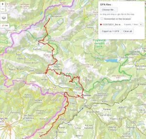
    With this little tool you can load your GPX file into a leaflet map and do the following:

    • Add symbols to your POI;
    • Add Notes to your POI
    • Move the POI, or add/delete one.
    • Geocode (get the address) with Openstreetmap Nominatum.
    • Merge tracks/POI files
    • Export it to an GPX file.
    • use different maps
    • Store your data in the browser cache.

    The tool is not storing your data on the internet, everything is handled inside the browser, also no API keys or other restrictions are used.
    I have uploaded the program into Github under the MIT license, so you are free to download and use it as you like. The program works with 3 files and can also be used on the computer ( you need internet for the Leaflet maps).

    If you do not want to download it, I have made a Github site, so you can use it from there:
    It can be that there are some Dutch words somewhere, so let me know if you find some.
    In the future I will also want to implement KML import, now it only works with GPX (1.1) files.
    Files on Github

    link to program on site

    1 Reply Last reply
    0
    • BertM
      BertM
      BertM
      wrote last edited by
      #2

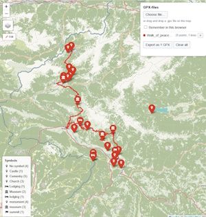
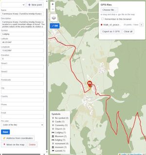
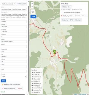
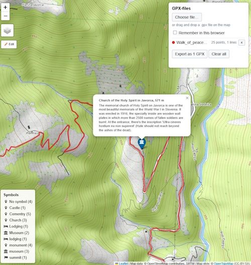
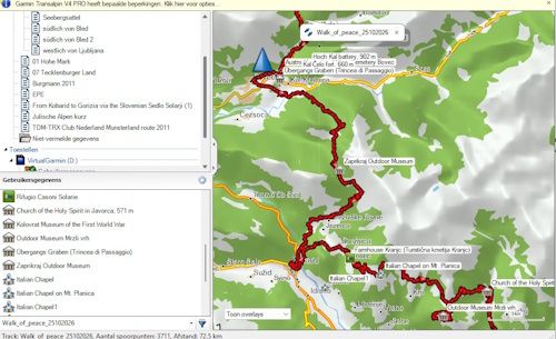
      some screenshots:

      track.jpg

      loaded track

      Loaded GPX.jpg

      Loaded GPX file

      edit POI.jpg

      POI without address data

      POI Adress.jpg
      with address from openstreetmap

      POI with data.jpg

      POI with data

      Route_Garmin.jpg

      imported in Garmin with symbols

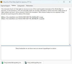
      Description.jpg
      notes in Garmin POI

      1 Reply Last reply
      0
      • RainerT
        RainerT
        RainerT
        wrote last edited by
        #3

        That is much more than a little program.
        Don't understand it completely at the moment.
        But anything that’s any good comes with a learning curve.
        Well done!
        RT

        1 Reply Last reply
        0

        Hello! It looks like you're interested in this conversation, but you don't have an account yet.

        Getting fed up of having to scroll through the same posts each visit? When you register for an account, you'll always come back to exactly where you were before, and choose to be notified of new replies (either via email, or push notification). You'll also be able to save bookmarks and upvote posts to show your appreciation to other community members.

        With your input, this post could be even better 💗

        Register Login
        Reply
        • Reply as topic
        Log in to reply
        • Oldest to Newest
        • Newest to Oldest
        • Most Votes


        ACTIVE USERS
        RainerT
        RainerT
        BertM
        BertM
        POPULAR TOPICS
        • Auto skipping in next version (6)
          a white mouse on the motorbike
          a white mouse on the motorbike
          0
          11
          805

        • F014 WP Numbering illogical
          Hubert Thoring
          Hubert Thoring
          0
          4
          18

        • Map colours and side roads
          M. Schrijver
          M. Schrijver
          0
          9
          116

        • GPX POI Editor
          RainerT
          RainerT
          0
          3
          88

        • F013 Facilities/POIs – A search function covering the entire map is unfortunately missing here.
          Hubert Thoring
          Hubert Thoring
          0
          3
          17

        • Route MRA importeren in Google Maps
          Adrian Avram
          Adrian Avram
          0
          2
          84

        • OSM Routing with MRA
          Brian McG
          Brian McG
          0
          5
          235

        • F016 Colors only change after leaving the planning
          0
          1
          5

        MY GROUPS
        • Login

        • Login or register to search.
        • First post
          Last post
        0
        • Categories
        • Recent
        • Popular
        • Support
        • MyRoute-app