How to export GPX files to Zumo XT without recalculation
-
These topics bashing the Garmin XT series devices will never stop. The units take some dedicated effort to understand, and frankly most riders don’t want to put in the effort. If it doesn’t work like Google right out of the box, there must be something wrong with it. In a world of simple phone app alternatives the motivation simply isn’t there to dig in. And that’s OK because phone apps are all that most riders need,
Regardless, MRA Routeplanner is the best available routing SW on the market. Garmin GPS devices have the most total core capabilities of any navigation options on the market. If you truly know how to use each, they 100% work well together. It’s not debatable.
I wish more who come on here would approach this from the standpoint of “what am I doing wrong?”. It would be a much more productive exchange.

@John-S-Parry interesting John, so why are we on a forum if its not debatable???

I’ve wasted hours trying to get most BMW nav’s and the XT range to follow routes and I fail and the annoying thing is I’ve no idea why, I have tried everything, was a little better with the XT and the drive app…. please don’t assume that people don't like to work a problem because I do…and in the end I gave up and went to another brand which simply follows the route you put on it.
Therefore if you have the time and you’re willing, can you please reply with exactly what you do from planning to exporting to using the device and I will attempt to replicate your guidance on Friday when we all go for a ride… don’t need war and peace just bullet points will do e.g file type, transfer wired or WiFi etc etc
Edited: to add a thank you in advance!!!!

 ️
-
@HABVEN-aka-MrMRA with the greatest of respect that is utter rubbish which is why so many people have been asking the same question for years… and it is literally years now, I can’t believe people are still parting with in excess of £500 for a device and as for that Tread app…
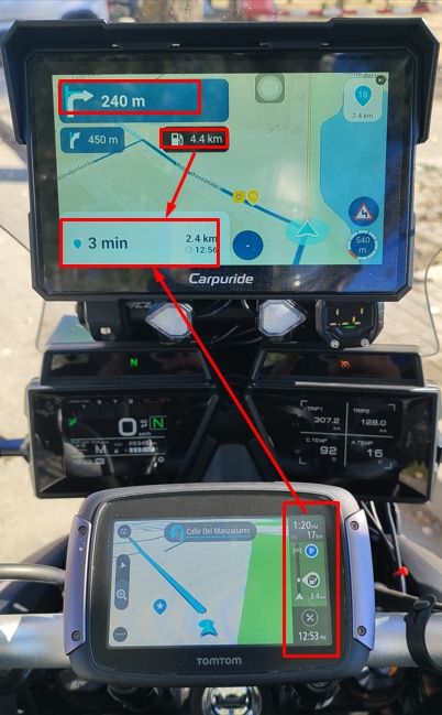
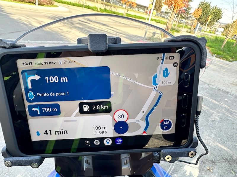
I have had pretty much every sat nav going on my motorcycle journey (forgive the pun) and its only DMD that doesn’t mess with the ‘planned route’ this is an important distinction to make, I’m talking about sitting down and planning a cracking ride for example in Spain not using the device to go from AtoB… I plan on here and export to DMD and not once have I had an issue, plan on here and export to the Zumo XT2 and nothing but issues, I could go and on with other examples... couple below for you.
Example: Last year we were having a cracking ride in the Saint Mere Eglis area of France, using Zumo XT2’s next thing we know we’re on a motorway for an hour and a half as the route had been changed, we should’ve been following the ‘planned’ coast road. Later in the year I had the same issues on a trip with my wife.
Regards,
Andy.
with the greatest of respect that is utter rubbish which is why so many people have been asking the same question for years… and it is literally years now, I can’t believe people are still parting with in excess of £500 for a device and as for that Tread app…
Andy, I was triggered when I read your original post above. The issue isn't the XT/XT2/XT3 devices -- they do work well. The issue is than many riders (most) who buy the devices never properly learn how to use them. In fairness, it's not easy. The official Garmin documentation isn't great (closer to terrible), and it takes a lot of dedication to experiment and piece things together over time. One of the best resources on the planet is the dedicated Zumo XT forum:
https://zumouserforums.co.uk/viewtopic.php?t=1464
Even there, the information can be overwhelming to absorb. I wish I could write a few paragraphs that would give you everything you need to know, but that's not possible. Especially by Friday.

If you're having that much trouble with an XT (or XT2/XT3), I'd recommend initially staying with MRA Desktop for route planning and the MRA Next app for navigation. The MRA documentation and learning resources are excellent, and there are many forum regulars more than willing to help. The learning curve is much less, and it can be a good entry point to advancing to the XT platforms in the future. Good luck.
-

It sounds to me that people who want to avoid their navigation device recalculating the route they planned are actually looking for turn-by-turn navigation on a track rather than on a route.
Unfortunately, very few navigation devices support this. Most devices that offer track-based turn-by-turn navigation are designed for running or hiking and rely on dedicated file formats that contain both the track and the navigation instructions.
For motorcycle navigation, the only solutions I know that provide true turn-by-turn navigation on a plain GPX track are DMD2 and OsmAnd. Of the two, DMD2 is much more intuitive and easier to use, whereas OsmAnd offers similar functionality but comes with a significantly steeper learning curve.
-
It sounds to me that people who want to avoid their navigation device recalculating the route they planned are actually looking for turn-by-turn navigation on a track rather than on a route.
Unfortunately, very few navigation devices support this. Most devices that offer track-based turn-by-turn navigation are designed for running or hiking and rely on dedicated file formats that contain both the track and the navigation instructions.
For motorcycle navigation, the only solutions I know that provide true turn-by-turn navigation on a plain GPX track are DMD2 and OsmAnd. Of the two, DMD2 is much more intuitive and easier to use, whereas OsmAnd offers similar functionality but comes with a significantly steeper learning curve.
It sounds to me that people who want to avoid their navigation device recalculating the route they planned are actually looking for turn-by-turn navigation on a track rather than on a route.
100% agree!
Another indicator: nailing down the route with plenty of obsolete SPs to make sure it keeps its original shape, even when it's recalculated.For motorcycle navigation, the only solutions I know that provide true turn-by-turn navigation on a plain GPX track are DMD2 and OsmAnd. Of the two, DMD2 is much more intuitive and easier to use, whereas OsmAnd offers similar functionality but comes with a significantly steeper learning curve.
I would add Stegra.io — it also offers two types of track navigation: either based on a route calculated on top of the track (similar to MRA’s approach), which provides TBTs like “turn left onto xyz street”, or purely based on the track data with simplified TBTs like “slightly left”.
Most users think track navigation is only suitable for off-road, but that's often based on a misunderstanding; it also works really well for on-road. -
@John-S-Parry interesting John, so why are we on a forum if its not debatable???
I’ve wasted hours trying to get most BMW nav’s and the XT range to follow routes and I fail and the annoying thing is I’ve no idea why, I have tried everything, was a little better with the XT and the drive app…. please don’t assume that people don't like to work a problem because I do…and in the end I gave up and went to another brand which simply follows the route you put on it.
Therefore if you have the time and you’re willing, can you please reply with exactly what you do from planning to exporting to using the device and I will attempt to replicate your guidance on Friday when we all go for a ride… don’t need war and peace just bullet points will do e.g file type, transfer wired or WiFi etc etc
Edited: to add a thank you in advance!!!!
️
@John-S-Parry interesting John, so why are we on a forum if its not debatable???
I’ve wasted hours trying to get most BMW nav’s and the XT range to follow routes and I fail and the annoying thing is I’ve no idea why, I have tried everything, was a little better with the XT and the drive app…. please don’t assume that people don't like to work a problem because I do…and in the end I gave up and went to another brand which simply follows the route you put on it.
Therefore if you have the time and you’re willing, can you please reply with exactly what you do from planning to exporting to using the device and I will attempt to replicate your guidance on Friday when we all go for a ride… don’t need war and peace just bullet points will do e.g file type, transfer wired or WiFi etc etc
Edited: to add a thank you in advance!!!!
️I must say I rarely have issues with my Zumo XT calculating a different route to the one I planned in MRA, but sometimes the XT will show a slightly different route so not 100% foolproof.
Here’s what I do:
• Plan my route in MRA. I generally use VIA points for thinks like fuel stops, café stops etc and using SHAPING points for all my other WPs
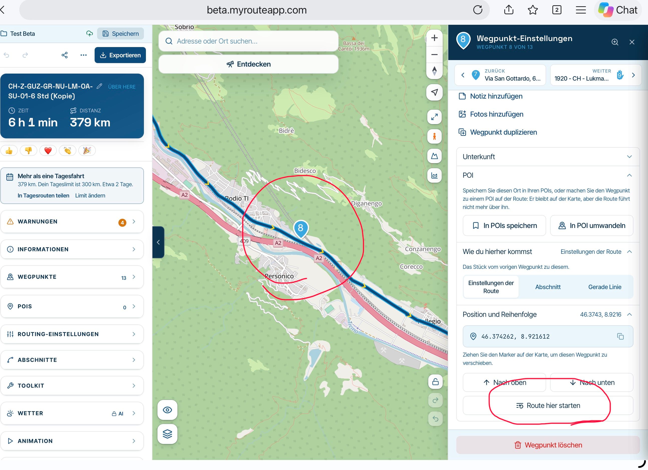
• I then tend to put a shaping point after every turn to force the XT to take the road I’m planning to use. That shaping point is placed 10-20m right after the turn
• If on a particular road for some distance I will judge whether the XT might want to divert me off to take a “faster” road and I will pop another shaping point in to force it to continue on the road I want.
• On round return routes I will normally split into two distinct “Outward” and “Return” legs, especially if the round route crosses over or does a figure of eight etc
• I will often pop in VIA points to mark quarter, half and three quarters into the route. This is belt and braces so if I have to detour and I prefer to keep off route calculation on and the XT goes haywire and I need to restart the route, I can use these as a reference for where I am on the route. Using the “closest entry point” prompt on the XT will normally get me back on my route no problem
• I then export the route as GPX 1.1 and I transfer it to my SD card on the XT via a usb connection from computer to XT – I don’t use the Drive app
• I will then import both the track and the route from the SD card into the main XT memory.
• I go into tracks, select my route and check the “visible on map” box and choose that to show in blue
• I then go into trips and select my route and load it as if I was going to start navigating. Before the final “Go” button to start navigation, I will click on the XT map and visually check the route. It is in magenta for me and because I’ve made the track visible I can see visually where the magenta and blue lines deviate. If this is a deviation I can’t live with I will go back into MRA and add some more shaping points on that area to force the route. Then I delete the route and track from the XT and go back to the export stage and repeat until I’m happy that my route and track match. -
@John-S-Parry interesting John, so why are we on a forum if its not debatable???
I’ve wasted hours trying to get most BMW nav’s and the XT range to follow routes and I fail and the annoying thing is I’ve no idea why, I have tried everything, was a little better with the XT and the drive app…. please don’t assume that people don't like to work a problem because I do…and in the end I gave up and went to another brand which simply follows the route you put on it.
Therefore if you have the time and you’re willing, can you please reply with exactly what you do from planning to exporting to using the device and I will attempt to replicate your guidance on Friday when we all go for a ride… don’t need war and peace just bullet points will do e.g file type, transfer wired or WiFi etc etc
Edited: to add a thank you in advance!!!!
️I must say I rarely have issues with my Zumo XT calculating a different route to the one I planned in MRA, but sometimes the XT will show a slightly different route so not 100% foolproof.
Here’s what I do:
• Plan my route in MRA. I generally use VIA points for thinks like fuel stops, café stops etc and using SHAPING points for all my other WPs
• I then tend to put a shaping point after every turn to force the XT to take the road I’m planning to use. That shaping point is placed 10-20m right after the turn
• If on a particular road for some distance I will judge whether the XT might want to divert me off to take a “faster” road and I will pop another shaping point in to force it to continue on the road I want.
• On round return routes I will normally split into two distinct “Outward” and “Return” legs, especially if the round route crosses over or does a figure of eight etc
• I will often pop in VIA points to mark quarter, half and three quarters into the route. This is belt and braces so if I have to detour and I prefer to keep off route calculation on and the XT goes haywire and I need to restart the route, I can use these as a reference for where I am on the route. Using the “closest entry point” prompt on the XT will normally get me back on my route no problem
• I then export the route as GPX 1.1 and I transfer it to my SD card on the XT via a usb connection from computer to XT – I don’t use the Drive app
• I will then import both the track and the route from the SD card into the main XT memory.
• I go into tracks, select my route and check the “visible on map” box and choose that to show in blue
• I then go into trips and select my route and load it as if I was going to start navigating. Before the final “Go” button to start navigation, I will click on the XT map and visually check the route. It is in magenta for me and because I’ve made the track visible I can see visually where the magenta and blue lines deviate. If this is a deviation I can’t live with I will go back into MRA and add some more shaping points on that area to force the route. Then I delete the route and track from the XT and go back to the export stage and repeat until I’m happy that my route and track match.
@Will-Brooks Hi Will many thanks for the reply...
See straight away you say 1.1 others say 1.2...
XT or XT2? I was specifically talking about the XT2... The XT was definitely better with the Drive app.
I'll give it a quick go tomorrow but can just see myself wiring in the DMD set up again as I don't have to second guess what's going to happen route wise on a holiday.
Thanks again.
-
It sounds to me that people who want to avoid their navigation device recalculating the route they planned are actually looking for turn-by-turn navigation on a track rather than on a route.
Unfortunately, very few navigation devices support this. Most devices that offer track-based turn-by-turn navigation are designed for running or hiking and rely on dedicated file formats that contain both the track and the navigation instructions.
For motorcycle navigation, the only solutions I know that provide true turn-by-turn navigation on a plain GPX track are DMD2 and OsmAnd. Of the two, DMD2 is much more intuitive and easier to use, whereas OsmAnd offers similar functionality but comes with a significantly steeper learning curve.
@Hans-Kremers Hi Hans, Not sure I understand your post, I've never mentioned tracks, I know that a track is followed correctly and I know that routes are where you get your guidance??? You are correct about DMD which as I've said before is superb and to be quite frank Garmin could do with talking to these guys before releasing anymore products!!!
-
with the greatest of respect that is utter rubbish which is why so many people have been asking the same question for years… and it is literally years now, I can’t believe people are still parting with in excess of £500 for a device and as for that Tread app…
Andy, I was triggered when I read your original post above. The issue isn't the XT/XT2/XT3 devices -- they do work well. The issue is than many riders (most) who buy the devices never properly learn how to use them. In fairness, it's not easy. The official Garmin documentation isn't great (closer to terrible), and it takes a lot of dedication to experiment and piece things together over time. One of the best resources on the planet is the dedicated Zumo XT forum:
https://zumouserforums.co.uk/viewtopic.php?t=1464
Even there, the information can be overwhelming to absorb. I wish I could write a few paragraphs that would give you everything you need to know, but that's not possible. Especially by Friday.
If you're having that much trouble with an XT (or XT2/XT3), I'd recommend initially staying with MRA Desktop for route planning and the MRA Next app for navigation. The MRA documentation and learning resources are excellent, and there are many forum regulars more than willing to help. The learning curve is much less, and it can be a good entry point to advancing to the XT platforms in the future. Good luck.
@John-S-Parry Thanks John, I'll stick with my set up mate, it works!
(MRA planner DMD to Navigate) -
I only have experience of the XT.
It's all down to individual preferences and it took me a lot of patience and experimentation to find the sweet spot for my usage.
1.2 will work really well IF you have off route recalculation off and like to find your own way back onto your route if you deviate. For many this is the perfect choice.
I prefer 1.1 because if I go off route I like the XT to re route me. I often ride roads where an unexpected diversion comes into play and I'm not always that bothered if I'm not riding my route inch by inch perfect the way i planned it!
In my experience 1.1 works well for me IF I've used enough shaping points. The logic is the XT will look at all the options it can take to get from each VIA point to the next VIA point. By adding a shaping point you force the XT to use that point to shape the route. The more shaping points you use the less choice the XT has to pick from until you get to a point where the XT only has one choice or that road has the "best" parameters to fit the algorithm - eg shortest distance, fastest etc - whatever your settings are - so it choses that route.
I also mentioned about loading the track and having that visible. There some stuff on the internet about customising the width of tracks visible on the map to make it wider then the route line. So when I'm navigating I have my magenta route line and underneath that the blue line of the track shows. As long as they match up I know I'm following my route. If they deviate then I have the choice to follow what the XT says or manually and visually follow the blue track line - my planned route. In my use having off route recalculation ON usually means that the XT will recalculate and bring my magenta trip line back in sync with my blue track line.
-
It sounds to me that people who want to avoid their navigation device recalculating the route they planned are actually looking for turn-by-turn navigation on a track rather than on a route.
Unfortunately, very few navigation devices support this. Most devices that offer track-based turn-by-turn navigation are designed for running or hiking and rely on dedicated file formats that contain both the track and the navigation instructions.
For motorcycle navigation, the only solutions I know that provide true turn-by-turn navigation on a plain GPX track are DMD2 and OsmAnd. Of the two, DMD2 is much more intuitive and easier to use, whereas OsmAnd offers similar functionality but comes with a significantly steeper learning curve.
It sounds to me that people who want to avoid their navigation device recalculating the route they planned are actually looking for turn-by-turn navigation on a track rather than on a route.
Unfortunately, very few navigation devices support this. Most devices that offer track-based turn-by-turn navigation are designed for running or hiking and rely on dedicated file formats that contain both the track and the navigation instructions.
For motorcycle navigation, the only solutions I know that provide true turn-by-turn navigation on a plain GPX track are DMD2 and OsmAnd. Of the two, DMD2 is much more intuitive and easier to use, whereas OsmAnd offers similar functionality but comes with a significantly steeper learning curve.
In the Garmin XTs, you have multiple options for handling off-route scenarios. You can do a traditional auto recalculate, automatically disable off-route recalculation, or select 'prompted" to have the choice of which option to do. In settings, I personally chose the "prompted" option. So when I go off-route, I'm given the choice to either recalculate, or do nothing. The "do nothing" tells the Garmin to pause the route until I return to the route-line, much like following a Track.
The prompted disable gives me optimum flexibility. If I'm intentionally going off-route for a short distance for fuel, food or whatever, I know how to get back. I don't want to take the chance of a route recalculate unless it's absolutely necessary. Something else can possibly change that I don't want changed. The strategy works very well.
So, to your point, the Garmin XT's provide true turn-by-turn Route navigation with Track like flexibility for off-route scenarios. It's one of the main reasons I stick with it.
-
@Hans-Kremers Hi Hans, Not sure I understand your post, I've never mentioned tracks, I know that a track is followed correctly and I know that routes are where you get your guidance??? You are correct about DMD which as I've said before is superb and to be quite frank Garmin could do with talking to these guys before releasing anymore products!!!
@Hans-Kremers Hi Hans, Not sure I understand your post, I've never mentioned tracks, I know that a track is followed correctly and I know that routes are where you get your guidance??? You are correct about DMD which as I've said before is superb and to be quite frank Garmin could do with talking to these guys before releasing anymore products!!!
Just to start off, for me there is no right or wrong when it comes to this topic. We all have different ideas about how we like to ride. Route planning and navigation apps/devices are simply tools that help us do that, and I guess we're all looking for the tools that best suit our own style of riding.
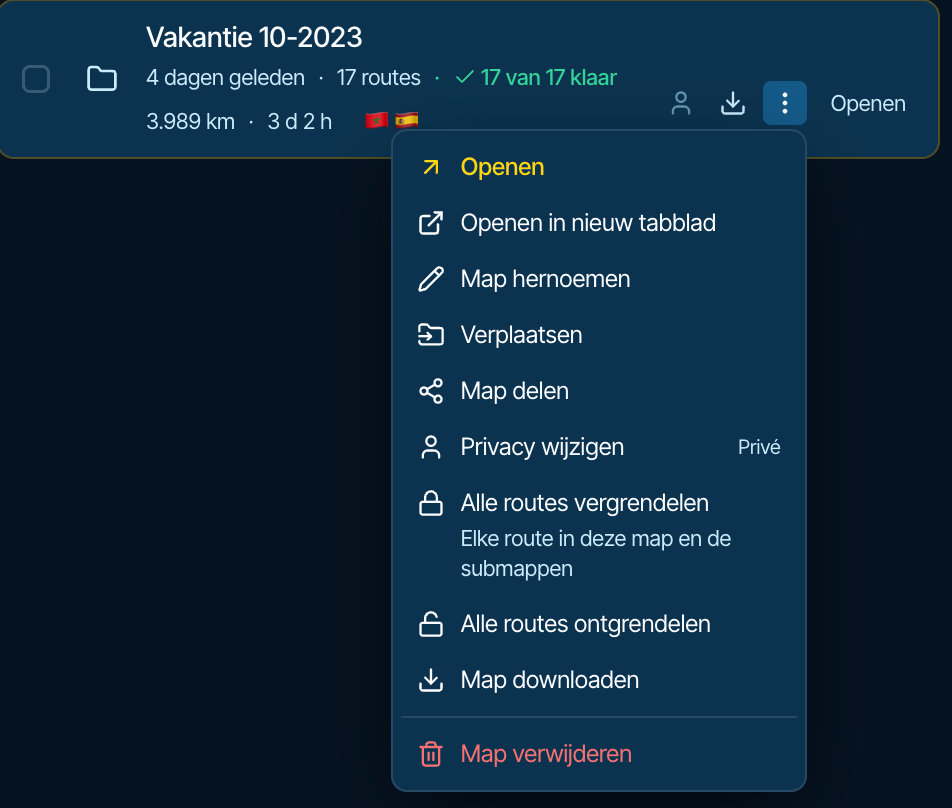
For me, a route is made up of a limited set of route points. You define these waypoints in your preferred planning tool, and the planning tool calculates the path between them. Not everyone may agree with this, but I consider the line drawn between those route points to be a track. If you download a route you created in MRA Routeplanner, you'll see the available options:
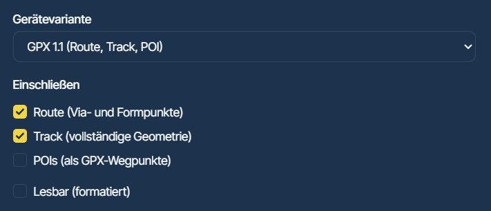
When you load that route into your navigation device or app, it recalculates the path between the route points. That path will often differ from the line you saw in your route planning tool. You may even see differences between two identical navigation devices, such as two Zumo XTs, if their settings are not configured 100% identically.
Any settings related to route recalculation apply to the path that was calculated by the navigation devices when the route was loaded.
However, the GPX file generated by the planning tool usually also contains a track. Some navigation devices, such as the Zumo XT, allow you to display this track as an overlay, so you can see the exact route that was created in the planning tool. The turn-by-turn navigation instructions, however, are still based on the path calculated from the route points, which is very likely different from what the planning tool originally showed. Increasing the number of route points generally reduces these differences.
Some devices and apps can also provide turn-by-turn navigation directly from a track. In that case, you'll follow exactly the route that was created in the planning tool.
The way I see it, the advantage of using a track is that you'll ride exactly the route you planned. The disadvantage is that you'll ride exactly the route you planned.
Choose and use the tools available so it works the way you want.
Personally, I have a very low threshold for changing the plan.

-
I only have experience of the XT.
It's all down to individual preferences and it took me a lot of patience and experimentation to find the sweet spot for my usage.
1.2 will work really well IF you have off route recalculation off and like to find your own way back onto your route if you deviate. For many this is the perfect choice.
I prefer 1.1 because if I go off route I like the XT to re route me. I often ride roads where an unexpected diversion comes into play and I'm not always that bothered if I'm not riding my route inch by inch perfect the way i planned it!
In my experience 1.1 works well for me IF I've used enough shaping points. The logic is the XT will look at all the options it can take to get from each VIA point to the next VIA point. By adding a shaping point you force the XT to use that point to shape the route. The more shaping points you use the less choice the XT has to pick from until you get to a point where the XT only has one choice or that road has the "best" parameters to fit the algorithm - eg shortest distance, fastest etc - whatever your settings are - so it choses that route.
I also mentioned about loading the track and having that visible. There some stuff on the internet about customising the width of tracks visible on the map to make it wider then the route line. So when I'm navigating I have my magenta route line and underneath that the blue line of the track shows. As long as they match up I know I'm following my route. If they deviate then I have the choice to follow what the XT says or manually and visually follow the blue track line - my planned route. In my use having off route recalculation ON usually means that the XT will recalculate and bring my magenta trip line back in sync with my blue track line.
I only have experience of the XT.
It's all down to individual preferences and it took me a lot of patience and experimentation to find the sweet spot for my usage.
1.2 will work really well IF you have off route recalculation off and like to find your own way back onto your route if you deviate. For many this is the perfect choice.
I prefer 1.1 because if I go off route I like the XT to re route me. I often ride roads where an unexpected diversion comes into play and I'm not always that bothered if I'm not riding my route inch by inch perfect the way i planned it!
Will, good overall analysis. The only thing I'd add regarding 1.2 is that (from my testing and experience) you don't necessarily have to find your own way back due to a deviation. With 1.2 if you go off-route with recalculate on, the XT will try to turn you around to the point where you went off-route to continue. It's not a complete route recalculate, just an annoying series of instructions to go back to the deviation point. And if you deviate for the purpose of stopping somewhere not on the route, you can select "Closest Entry Point" when starting things back up. Again, a global recalculation is not triggered.
The problem with 1.2 is performing any action that actually triggers a complete route recalculation. The major trigger I found for complete recalculation is adding a via (stopping) point as part of performing "Search" or "Up Ahead" while the riding. The absence of 1.1 shaping points completely destroys the route.
I go back-and-forth between 1.1 and 1.2 depending on the nature of a specific route. They both have their pros-and-cons. Choice is good.....
Hello! It looks like you're interested in this conversation, but you don't have an account yet.
Getting fed up of having to scroll through the same posts each visit? When you register for an account, you'll always come back to exactly where you were before, and choose to be notified of new replies (either via email, or push notification). You'll also be able to save bookmarks and upvote posts to show your appreciation to other community members.
With your input, this post could be even better 💗
Register Login





-
2493.0k
-
 1012124
-
 5251.1k
-
 0642
-
012313
-
 0511
-
 0550
-
 0538