How to import gpx - via Route or Route-Track?
-

I'm a new user on MRA, but I have many years of experience with BC.
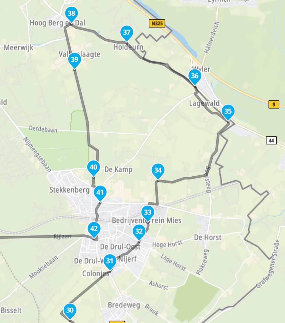
When I import a Google Maps *.gpx file with via points into MRA - what's the best way to do it?- If I import it as a Route-Track and generate a route from the track using MRA:
MRA generates many waypoints but no longer indicates the via points (which isn’t a problem since we can easily convert the few necessary waypoints into via points). - If I import it as a Route:
MRA imports the GPX file correctly and displays the via points correctly, but I don’t see any waypoints that define the exact path of the route.
My question is:
What is the best way to then - safely - follow the route using MRA Navigation Next (on android)?
What happens if the route needs to be recalculated during navigation and there aren’t enough waypoints set?
Will MRA Navigation Next calculate to the next Via point as there are no visible waypoints???
To be on the safe side, should I manually set additional waypoints along the route when importing as a route?Many thanks for your feedback
- If I import it as a Route-Track and generate a route from the track using MRA:
-
I'm a new user on MRA, but I have many years of experience with BC.
When I import a Google Maps *.gpx file with via points into MRA - what's the best way to do it?- If I import it as a Route-Track and generate a route from the track using MRA:
MRA generates many waypoints but no longer indicates the via points (which isn’t a problem since we can easily convert the few necessary waypoints into via points). - If I import it as a Route:
MRA imports the GPX file correctly and displays the via points correctly, but I don’t see any waypoints that define the exact path of the route.
My question is:
What is the best way to then - safely - follow the route using MRA Navigation Next (on android)?
What happens if the route needs to be recalculated during navigation and there aren’t enough waypoints set?
Will MRA Navigation Next calculate to the next Via point as there are no visible waypoints???
To be on the safe side, should I manually set additional waypoints along the route when importing as a route?Many thanks for your feedback

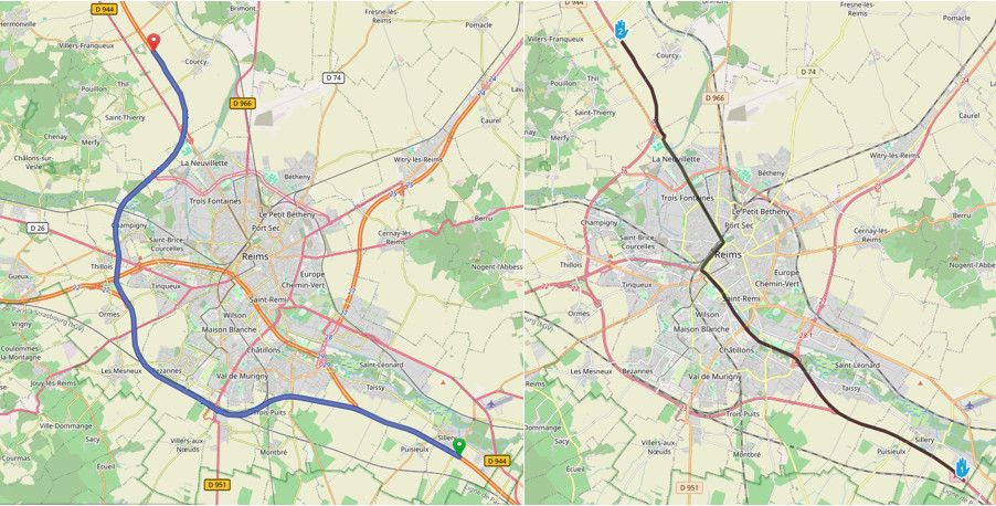
@KaTo6668, Importing as route imports only the routepoints. The actual route is then calculated according to the settings (quickest/shortest, avoid options etc.) so the shape of your route can be different after import.
Importing as route track imports only the track (if available in the sourcefile) so you will lose any route points, but your track is shaped like the original route.
It all depends on your own preferences. I usually import both, and shape the route according to the track manually by adding shaping points. That way you do not lose routepoints, and you can add a lot of information to the route that can be handy while navigating. If you are not interested in such thing, navigating the track is perfectly fine.
I am just an enthusiastic MRA user, and hope you will be one too!
Most motorcycle problems are caused by the nut that connects the handlebar to the saddle.
Check out RideSleepRepeat.eu, a biker community for sharing stays across Europe
- If I import it as a Route-Track and generate a route from the track using MRA:
-
@KaTo6668, Importing as route imports only the routepoints. The actual route is then calculated according to the settings (quickest/shortest, avoid options etc.) so the shape of your route can be different after import.
Importing as route track imports only the track (if available in the sourcefile) so you will lose any route points, but your track is shaped like the original route.
It all depends on your own preferences. I usually import both, and shape the route according to the track manually by adding shaping points. That way you do not lose routepoints, and you can add a lot of information to the route that can be handy while navigating. If you are not interested in such thing, navigating the track is perfectly fine.
@Con-Hennekens Thank you very much for your fast reply.
Your approach is exactly what I had in mind.
Import route and track, compare them, and then finalize/shape the route with additional shaping points.Maybe you can also answer the following question for me:
Unfortunately, shaping points in the MRA Routeplanner are displayed just as large as route points (via points), just with a different marker.
I believe I can hide shaping points during navigation with MRA Navigation Next?
Is that also possible in the MRA Routeplanner, or at least to display the waypoints much smaller? There may be reasons for the size of the waypoints, but for me, their size makes route planning confusing...
Thank you. -
@Con-Hennekens Thank you very much for your fast reply.
Your approach is exactly what I had in mind.
Import route and track, compare them, and then finalize/shape the route with additional shaping points.Maybe you can also answer the following question for me:
Unfortunately, shaping points in the MRA Routeplanner are displayed just as large as route points (via points), just with a different marker.
I believe I can hide shaping points during navigation with MRA Navigation Next?
Is that also possible in the MRA Routeplanner, or at least to display the waypoints much smaller? There may be reasons for the size of the waypoints, but for me, their size makes route planning confusing...
Thank you.
@KaTo6668, No there is no method for differentiating the size of shaping- and via points. Not in the planner and not in the app. To be honest I don't see a reason for them to be different in size. They both have the same purpose: define a route. If it is bothersome for you, you probably use too many routepoints to begin with

Also there is no way of hiding shapingpoints of a route while navigating. In the current public version there is an option to hide shaping points when the feature "navigate route as track" is enabled. But I need to warn you that in the upcoming V6 version things considering track navigation will be different.
Please uphold the the correct terminology:
- Routepoints are waypoints that define a route
- Shaping points are routepoints that can be skipped automatically when missed
- Via points are routepoints that cannot be skipped automatically when missed
-
@KaTo6668, No there is no method for differentiating the size of shaping- and via points. Not in the planner and not in the app. To be honest I don't see a reason for them to be different in size. They both have the same purpose: define a route. If it is bothersome for you, you probably use too many routepoints to begin with
Also there is no way of hiding shapingpoints of a route while navigating. In the current public version there is an option to hide shaping points when the feature "navigate route as track" is enabled. But I need to warn you that in the upcoming V6 version things considering track navigation will be different.
Please uphold the the correct terminology:
- Routepoints are waypoints that define a route
- Shaping points are routepoints that can be skipped automatically when missed
- Via points are routepoints that cannot be skipped automatically when missed
@Con-Hennekens sagte:
in the upcoming V6 version things considering track navigation will be different.In which way?
-
@KaTo6668, No there is no method for differentiating the size of shaping- and via points. Not in the planner and not in the app. To be honest I don't see a reason for them to be different in size. They both have the same purpose: define a route. If it is bothersome for you, you probably use too many routepoints to begin with
Also there is no way of hiding shapingpoints of a route while navigating. In the current public version there is an option to hide shaping points when the feature "navigate route as track" is enabled. But I need to warn you that in the upcoming V6 version things considering track navigation will be different.
Please uphold the the correct terminology:
- Routepoints are waypoints that define a route
- Shaping points are routepoints that can be skipped automatically when missed
- Via points are routepoints that cannot be skipped automatically when missed
@Con-Hennekens Thanks again for your fast reply.
You're absolutely right; shaping points and via points define a route and are equivalent within the route definition.
But beside of the route definition, they are not equivalent.A shaping point should simply defines the route's path. Even though you can add additional information to it in the MRA Routeplanner (color/text/icon, etc.) - for whatever reason. And since it’s really only meant to define the route’s path, there is a reason you can set the option in the MRA Navigator that it can be skipped automatically which -in my opinion- should be the default setting. That’s why I also don’t see a benefit why a shaping point appears at all during MRA navigation in the upper right corner.
A via point must or should be visited because it’s important to the planner for whatever reason (break, coffee, refueling, hotel, etc.).
That’s why I asked about different icon sizes in the MRA Routeplanner - because they aren’t all equally important.And yes, maybe I sometimes use too many shaping points, but sometimes it’s necessary to define the exact route - and then things get confusing.
But that’s just my opinion, and I’d love to learn more about the benefit why you can assign additional information to a shaping point in the MRA Routeplanner - information that, in my opinion, is only relevant for a via point.
Even though I’m new to MRA and certainly don’t know many of its features yet, I really like the program
-
@Con-Hennekens Thanks again for your fast reply.
You're absolutely right; shaping points and via points define a route and are equivalent within the route definition.
But beside of the route definition, they are not equivalent.A shaping point should simply defines the route's path. Even though you can add additional information to it in the MRA Routeplanner (color/text/icon, etc.) - for whatever reason. And since it’s really only meant to define the route’s path, there is a reason you can set the option in the MRA Navigator that it can be skipped automatically which -in my opinion- should be the default setting. That’s why I also don’t see a benefit why a shaping point appears at all during MRA navigation in the upper right corner.
A via point must or should be visited because it’s important to the planner for whatever reason (break, coffee, refueling, hotel, etc.).
That’s why I asked about different icon sizes in the MRA Routeplanner - because they aren’t all equally important.And yes, maybe I sometimes use too many shaping points, but sometimes it’s necessary to define the exact route - and then things get confusing.
But that’s just my opinion, and I’d love to learn more about the benefit why you can assign additional information to a shaping point in the MRA Routeplanner - information that, in my opinion, is only relevant for a via point.
Even though I’m new to MRA and certainly don’t know many of its features yet, I really like the program
I’d love to learn more about the benefit why you can assign additional information to a shaping point in the MRA Routeplanner - information that, in my opinion, is only relevant for a via poin
For instance if you want to add some spoken information about that shapingpoint, or the place where you've placed it. If you add tekst in the textfield of a shapingpoint that will be spoken, if you've activated that in your settings. Like "a beautifull statue on your right"
-
@Con-Hennekens Thanks again for your fast reply.
You're absolutely right; shaping points and via points define a route and are equivalent within the route definition.
But beside of the route definition, they are not equivalent.A shaping point should simply defines the route's path. Even though you can add additional information to it in the MRA Routeplanner (color/text/icon, etc.) - for whatever reason. And since it’s really only meant to define the route’s path, there is a reason you can set the option in the MRA Navigator that it can be skipped automatically which -in my opinion- should be the default setting. That’s why I also don’t see a benefit why a shaping point appears at all during MRA navigation in the upper right corner.
A via point must or should be visited because it’s important to the planner for whatever reason (break, coffee, refueling, hotel, etc.).
That’s why I asked about different icon sizes in the MRA Routeplanner - because they aren’t all equally important.And yes, maybe I sometimes use too many shaping points, but sometimes it’s necessary to define the exact route - and then things get confusing.
But that’s just my opinion, and I’d love to learn more about the benefit why you can assign additional information to a shaping point in the MRA Routeplanner - information that, in my opinion, is only relevant for a via point.
Even though I’m new to MRA and certainly don’t know many of its features yet, I really like the program
@KaTo6668 I think having the shaping point appear in the upper right is excellent, for me it is really useful as I colour code my shaping points
if there is some information about the road ahead I will colour code that shaping point pink & add text either into the point name or notes
it could be something like "Warning tarmac end - road turns to gravel ahead" or "Warning sharp right bend after blind crest"
seeing the colour coded point well in advance means I am well aware of the that a hazard is coming up aheadI don't want these points t be Via points as it is not necessary for me to pass them, but if I am on the correct path I would like the warning
if your only interested in times/distances to Via points just toggle through the 3 settings of the large ETA button at the bottom centre of the screen
-
@marinus-van-deudekom @brian-mcg
Thanks for your input about how you use the additional shaping points features. Never thought about to use them that way and maybe never will, but I understand how you use them and what your benefit is. Right now for me the scenarios you mentioned are still via point topics. But maybe I get it when I use MRA longer -
@marinus-van-deudekom @brian-mcg
Thanks for your input about how you use the additional shaping points features. Never thought about to use them that way and maybe never will, but I understand how you use them and what your benefit is. Right now for me the scenarios you mentioned are still via point topics. But maybe I get it when I use MRA longer
@KaTo6668 I rarely color my shaping points. Just pointed out the possibility
Have fun -
@Con-Hennekens Thanks again for your fast reply.
You're absolutely right; shaping points and via points define a route and are equivalent within the route definition.
But beside of the route definition, they are not equivalent.A shaping point should simply defines the route's path. Even though you can add additional information to it in the MRA Routeplanner (color/text/icon, etc.) - for whatever reason. And since it’s really only meant to define the route’s path, there is a reason you can set the option in the MRA Navigator that it can be skipped automatically which -in my opinion- should be the default setting. That’s why I also don’t see a benefit why a shaping point appears at all during MRA navigation in the upper right corner.
A via point must or should be visited because it’s important to the planner for whatever reason (break, coffee, refueling, hotel, etc.).
That’s why I asked about different icon sizes in the MRA Routeplanner - because they aren’t all equally important.And yes, maybe I sometimes use too many shaping points, but sometimes it’s necessary to define the exact route - and then things get confusing.
But that’s just my opinion, and I’d love to learn more about the benefit why you can assign additional information to a shaping point in the MRA Routeplanner - information that, in my opinion, is only relevant for a via point.
Even though I’m new to MRA and certainly don’t know many of its features yet, I really like the program
@KaTo6668, it's quite funny how you confess to be new to MRA but have nor problem telling them or me how shaping points should or should not work...
Even though you can add additional information to it in the MRA Routeplanner (color/text/icon, etc.) - for whatever reason.
The reason is that it can be very helpful to add information to a route point, even if can be skipped automatically, why not?
there is a reason you can set the option in the MRA Navigator that it can be skipped automatically which -in my opinion- should be the default setting.
It IS the default setting... I am missing the point why that would be a problem.
That’s why I also don’t see a benefit why a shaping point appears at all during MRA navigation in the upper right corner.
I think most users would get mad if it got dropped... Well, to be honest I think you should experience for yourself how MRA works. MRA is not trying to copy your previous method of navigation. Try to be a bit less biased towards that and just learn how MRA works. There are reasons for MRA to work like it does.
I am just an enthusiastic MRA user, and hope you will be one too!
Most motorcycle problems are caused by the nut that connects the handlebar to the saddle.
Check out RideSleepRepeat.eu, a biker community for sharing stays across Europe
-
@KaTo6668, it's quite funny how you confess to be new to MRA but have nor problem telling them or me how shaping points should or should not work...
Even though you can add additional information to it in the MRA Routeplanner (color/text/icon, etc.) - for whatever reason.
The reason is that it can be very helpful to add information to a route point, even if can be skipped automatically, why not?
there is a reason you can set the option in the MRA Navigator that it can be skipped automatically which -in my opinion- should be the default setting.
It IS the default setting... I am missing the point why that would be a problem.
That’s why I also don’t see a benefit why a shaping point appears at all during MRA navigation in the upper right corner.
I think most users would get mad if it got dropped... Well, to be honest I think you should experience for yourself how MRA works. MRA is not trying to copy your previous method of navigation. Try to be a bit less biased towards that and just learn how MRA works. There are reasons for MRA to work like it does.
@Con-Hennekens said:
I think most users would get mad if it got dropped.
I will organize a party when the blue shaping points are dropped in the navigation.
I am glad i can put the same info to a shaping point as is possible with the Via Point. Because in my opinion Via points are the worst type of waypoints. I'se seen this on my last holdiay. Navigation on holidays gives enough food for discussion but due to the Via points in the routes some people almost dump their Zumo into the river.(I use MRA Next only on Android Auto. Every comment, suggestion, etc will be based on my usage with Android Auto)
-
@Con-Hennekens said:
I think most users would get mad if it got dropped.
I will organize a party when the blue shaping points are dropped in the navigation.
I am glad i can put the same info to a shaping point as is possible with the Via Point. Because in my opinion Via points are the worst type of waypoints. I'se seen this on my last holdiay. Navigation on holidays gives enough food for discussion but due to the Via points in the routes some people almost dump their Zumo into the river.
@M.-Schrijver, Your statements are rather contradictive. You would be glad to have no shaping points, but ARE glad you can add info to them... If so I would guess you would be happy about via points, but it makes you throw zumos into the river? That last thing is probably a good idea though
Shaping points are an important thing since they are not only used for shaping a route, but also to create entrypoints to the route, and deducting the closest one to start your route. Also if you want to skip a route point, you need a route point to skip to. I really do not understand some peoples thoughts about shaping points...
-
I referred to the blue shaping points. If i add info to them, in my case, they are not blue anymore. Because then they have a purpose now.
Viapoints are horrible and useless for one reason only. Autoskip does not work. The route is the journey. Not the points. No autoskip is why people on the journeys i was a part of, would through their zumo in the river (TomTom users use the track). The lack of autoskip confuses people enormous.Use a track as the basis for a route and litteraly every random point on the route is an entrypoint for starting and re-joining. Auto-skipping is not and issue anymore. Roadworks can be integrated smoothly into the route when starting the route (or even when riding) without any strange sidestreet loops. And because the route is based on the track it is has by design a pretty fixed shape (map and creator depended).
Then put the interessting waypoints (so not the blue shaping point) as an info layer on top of the route, just like the speedcams and you have everything you need.
You don't understand peoples thoughts about shaping point. I cannot understand peoples urge to plan fuel-stops, coffe-stops, etc, add time for them also and use Viapoints for those stops. Just enjoy the ride and see what happens during the day. A day never goes as planned.
(I use MRA Next only on Android Auto. Every comment, suggestion, etc will be based on my usage with Android Auto)
-
I referred to the blue shaping points. If i add info to them, in my case, they are not blue anymore. Because then they have a purpose now.
Viapoints are horrible and useless for one reason only. Autoskip does not work. The route is the journey. Not the points. No autoskip is why people on the journeys i was a part of, would through their zumo in the river (TomTom users use the track). The lack of autoskip confuses people enormous.Use a track as the basis for a route and litteraly every random point on the route is an entrypoint for starting and re-joining. Auto-skipping is not and issue anymore. Roadworks can be integrated smoothly into the route when starting the route (or even when riding) without any strange sidestreet loops. And because the route is based on the track it is has by design a pretty fixed shape (map and creator depended).
Then put the interessting waypoints (so not the blue shaping point) as an info layer on top of the route, just like the speedcams and you have everything you need.
You don't understand peoples thoughts about shaping point. I cannot understand peoples urge to plan fuel-stops, coffe-stops, etc, add time for them also and use Viapoints for those stops. Just enjoy the ride and see what happens during the day. A day never goes as planned.
@M.-Schrijver said:
A day never goes as planned.Well that may because the planning is poor

I agree with your point about using tracks to navigate, I loved my TomTom 410 as that was how that worked but that is also the beauty of MRA you can choose to ride as Route or Track
I cannot understand peoples urge to plan fuel-stops, coffe-stops, etc, add time for them also and use Viapoints for those stops. Just enjoy the ride and see what happens during the day.
This would be a YOU problem, with only 130 miles fuel range on a sports bike you HAVE to know where the next fuel is when you plan to visit the more interesting out of the way places, avoiding the towns & people so you can have fun.

Likewise in these sparsely populated areas, restaurants & cafes are also few & far between, if you don't plan them your going hungry & thirsty
Serendipity is wonderful when your riding solo, not so great when you have friends pillions desperate for facilitiesWe all do it different, the fact MRA allows this is IMO great, I would hate we all have to do it the same
-
I plan nothing only the shape of the route. So my planning cannot be poor.
For a few years i had also had a bike with a 130 miles real range before the reserves light kicks in. At that time i used the Rider400. Which has a perfect indication for gasstations. I trusted and still trust TomTom info for gasstations for 100%. Even if my reserve light is already on. I am not afraid to pass a gasstation if TomTom tells me there is another one in 5 km's. And a second one shortly after that one. It never lets me down even after 80.000-90.000 km TomTom usage. Sure it shows gasstions not in use. But every navigation app/device has this problem.
I don't know where you're from but my 100.000 km of travels in Europe learned me there are enough places to stop for personal needs. Even in de remote area's of Norway and Scotland. I expect from my friends and pillion that they can ride at least 90 mins between stops. So no planned stops are neseccary for me.
And yes, I agree. It nice MRA offers this functionality. But the simple basic is already to complicated. You see this in this topic but also in many others topics. Planning is something you need to learn. The MRA planner is not that complicated But navigation needs to be as simple as possible. There are much more who use a navigation than people who use a planner to plan routes.
-
Some people don't want to miss certain points where they make arrangements, or where they gather to meet. You are perfectly free to NOT use viapoints of course. But what's the problem with a few blue dots on a map to show how the route is shaped? And while you are happy to navigate tracks, most people aren't.
-
Please don’t let this turn into another endless tyre-or-oil debate.

Hello! It looks like you're interested in this conversation, but you don't have an account yet.
Getting fed up of having to scroll through the same posts each visit? When you register for an account, you'll always come back to exactly where you were before, and choose to be notified of new replies (either via email, or push notification). You'll also be able to save bookmarks and upvote posts to show your appreciation to other community members.
With your input, this post could be even better 💗
Register Login-
06153
-
05131
-
 057
057
-
05157
-
 110452
-
06144
-
0377
-
 07691
07691