Route calculated via blocked road
-

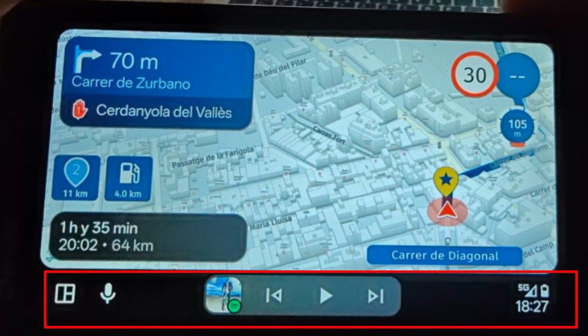
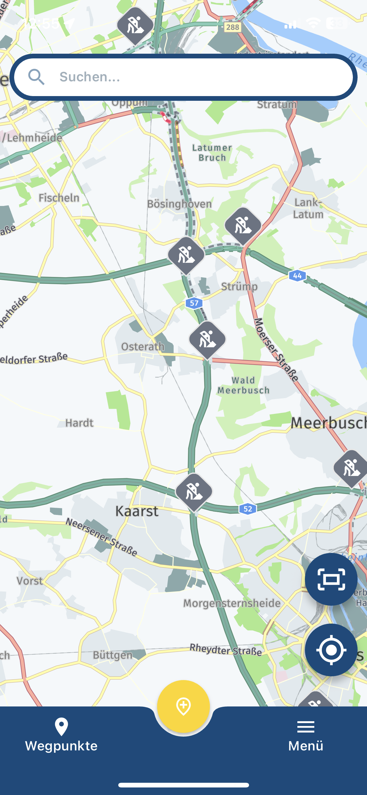
Today I was driving, following a route in the app. The road further ahead to the right was closed because of construction work. The app correctly showed that the road ahead to the right was blocked. To my surprise, the route went through the blocked road, which didn't make sense, and wasn't possible.
Obviously, the route should have been recalculated via other roads.The app was set to "offline navigation", which disables "traffic aware route calculations".
Does this mean that offline use is unable to handle blocked roads?Best regards, Makro
-
Today I was driving, following a route in the app. The road further ahead to the right was closed because of construction work. The app correctly showed that the road ahead to the right was blocked. To my surprise, the route went through the blocked road, which didn't make sense, and wasn't possible.
Obviously, the route should have been recalculated via other roads.The app was set to "offline navigation", which disables "traffic aware route calculations".
Does this mean that offline use is unable to handle blocked roads?
@Makro Unfortunatly: Yes it is... The blocked roads are stored in the mapdata. Mapsupliers are unable to store that data somewhere on your device when you're offline!
-
@Makro Unfortunatly: Yes it is... The blocked roads are stored in the mapdata. Mapsupliers are unable to store that data somewhere on your device when you're offline!

@Rob-Verhoeff Just to be shure. If you navigating online the problem would not have occurred?
Honda Goldwing GL1500,
Honda Silverwing GL 650
DMD2 T865X 8 inch Android tablet using MRA next for navigation
Garmin XT sold
Samsung S24FE mounted on a Quadlock and using Android Auto in my car -
@Rob-Verhoeff Just to be shure. If you navigating online the problem would not have occurred?
@Marinus-van-Deudekom That was not the question. And yes, when navigating online should direct you around.
-

Shouldn't you also consider whether a waypoint is on the closed route? This can sometimes lead to you being sent on such a road.
Hardware
iPhone 12 pro (iOS 26.2.1)
iPad (7.Gen.) 18.7.3
Oukitel RT3 Pro (Andr. 14)
Wireless CarPlay mit (Elebest C650)
Wired CarPlay (SEAT Arona - 2021)
MRA Workshops in Deutsch sind hier zu finden -
@Makro Unfortunatly: Yes it is... The blocked roads are stored in the mapdata. Mapsupliers are unable to store that data somewhere on your device when you're offline!
@Rob-Verhoeff said in Route calculated via blocked road:
The blocked roads are stored in the mapdata. Mapsupliers are unable to store that data somewhere on your device when you're offline!
But when I have downloaded maps for offline use, then road closures are part of those maps, right?
-
Shouldn't you also consider whether a waypoint is on the closed route? This can sometimes lead to you being sent on such a road.
@Jörgen said in Route calculated via blocked road:
Shouldn't you also consider whether a waypoint is on the closed route? This can sometimes lead to you being sent on such a road.
Good point, but I didn't see any road closures when creating the route, earlier the same day. It could be caused by me not zooming in sufficiently on the map, but either way, I would expect the app to recalculate during driving, as needed.
Best regards, Makro
-
@Jörgen said in Route calculated via blocked road:
Shouldn't you also consider whether a waypoint is on the closed route? This can sometimes lead to you being sent on such a road.
Good point, but I didn't see any road closures when creating the route, earlier the same day. It could be caused by me not zooming in sufficiently on the map, but either way, I would expect the app to recalculate during driving, as needed.
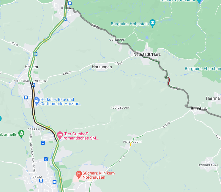
@Makro I guess you have the Gold subscription. Did you activate the TRAFFIC button in the web planner? It will show closures.
-
@Rob-Verhoeff said in Route calculated via blocked road:
The blocked roads are stored in the mapdata. Mapsupliers are unable to store that data somewhere on your device when you're offline!
But when I have downloaded maps for offline use, then road closures are part of those maps, right?

@Makro said in Route calculated via blocked road:
@Rob-Verhoeff said in Route calculated via blocked road:
The blocked roads are stored in the mapdata. Mapsupliers are unable to store that data somewhere on your device when you're offline!
But when I have downloaded maps for offline use, then road closures are part of those maps, right?
Makro
Downloaded maps never contains road closures besides maybe those who are in constructions with no substitute over a long period of min a 1/2 year maybe longer reported with a finish date by legal offices, like e.g. collapsed bridges.
All other closures of short periods are only visible in traffic overlays which be be send by radio data or web online. -
@Jörgen said in Route calculated via blocked road:
@Makro I guess you have the Gold subscription. Did you activate the TRAFFIC button in the web planner? It will show closures.
Yes, I have Gold.
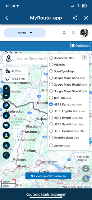
I cannot seem to find a traffic button in my web planner, but I see this support page has such a Screenshot.Or are you referring to some other way of enabling traffic in the web planner?
Best regards, Makro
-
@Jörgen said in Route calculated via blocked road:
@Makro I guess you have the Gold subscription. Did you activate the TRAFFIC button in the web planner? It will show closures.
Yes, I have Gold.
I cannot seem to find a traffic button in my web planner, but I see this support page has such a Screenshot.Or are you referring to some other way of enabling traffic in the web planner?
Hardware
iPhone 12 pro (iOS 26.2.1)
iPad (7.Gen.) 18.7.3
Oukitel RT3 Pro (Andr. 14)
Wireless CarPlay mit (Elebest C650)
Wired CarPlay (SEAT Arona - 2021)
MRA Workshops in Deutsch sind hier zu finden -
@Jörgen
I just realized why we see two different things.I opened https://www.myrouteapp.com/routelab where the map layers button lists no such traffic option.
You must have created a new route. You then get presented with a similar map and button, but now, clicking the map layers button, the optional "Traffic" can be selected (at the button of the list).
I have no idea why there is such a difference.
I did not have the traffic layer/button selected.
-
@Rob-Verhoeff said in Route calculated via blocked road:
The blocked roads are stored in the mapdata. Mapsupliers are unable to store that data somewhere on your device when you're offline!
But when I have downloaded maps for offline use, then road closures are part of those maps, right?
@Makro said in Route calculated via blocked road:
But when I have downloaded maps for offline use, then road closures are part of those maps, right?
No! Road closures can only be found on online maps. What do you think happens if you download the maps now and the map provider has included those closures? If you use them a month from now, those road closures may no longer be up to date. So that kind of information is only available online.
-
@Rob-Verhoeff said in Route calculated via blocked road:
What do you think happens if you download the maps now and the map provider has included those closures? If you use them a month from now, those road closures may no longer be up to date.
I get your point. But I could say the same about offline maps in general, as any type of downloaded and offline data, can get superseded by some change, while offline. So, any road in offline maps, can get changed, like becoming one-way or changed to private use only. Luckily for folks using offline maps, road changes are rare.
So, my point is, that using offline data always come with the risk of its data getting obsolete. I wouldn't mind if road closures were part of the offline maps.
-
@Rob-Verhoeff said in Route calculated via blocked road:
What do you think happens if you download the maps now and the map provider has included those closures? If you use them a month from now, those road closures may no longer be up to date.
I get your point. But I could say the same about offline maps in general, as any type of downloaded and offline data, can get superseded by some change, while offline. So, any road in offline maps, can get changed, like becoming one-way or changed to private use only. Luckily for folks using offline maps, road changes are rare.
So, my point is, that using offline data always come with the risk of its data getting obsolete. I wouldn't mind if road closures were part of the offline maps.

@Makro Sorry to jump in on your conversation with @Rob-Verhoeff
It is because sometimes roads change and new roads are added that the offline maps receive updates. You do not download an offline map and use it forever. -
@Rob-Verhoeff said in Route calculated via blocked road:
What do you think happens if you download the maps now and the map provider has included those closures? If you use them a month from now, those road closures may no longer be up to date.
I get your point. But I could say the same about offline maps in general, as any type of downloaded and offline data, can get superseded by some change, while offline. So, any road in offline maps, can get changed, like becoming one-way or changed to private use only. Luckily for folks using offline maps, road changes are rare.
So, my point is, that using offline data always come with the risk of its data getting obsolete. I wouldn't mind if road closures were part of the offline maps.
Few weeks ago I wrote about HERE and how HERE works.
Please look perhaps under my profile.
in Summary again.
HERE is only data collector and collect attributes of the landscape not limited by those thing you recognize when you driving. They do this and the changes in realtime worldwide when the received valid data.
These datas are collected and sold in packages to NaV-Sat Hard-and (final) Usersoftware manufactuer always with a release date. The manufacturer decide now in which sequence they buy updatepackages to update their software. Usual is a sequence of 4 times a year to ones per year.
Traffic infos are overlays on this maps which need no compilation into the colordesign and other manufacturer requests, like what the manufacturer do with received attribute files from HERE and can be distrubuted over network online. The same with TomTom. -
@Rob-Verhoeff said in Route calculated via blocked road:
What do you think happens if you download the maps now and the map provider has included those closures? If you use them a month from now, those road closures may no longer be up to date.
I get your point. But I could say the same about offline maps in general, as any type of downloaded and offline data, can get superseded by some change, while offline. So, any road in offline maps, can get changed, like becoming one-way or changed to private use only. Luckily for folks using offline maps, road changes are rare.
So, my point is, that using offline data always come with the risk of its data getting obsolete. I wouldn't mind if road closures were part of the offline maps.
@Makro said in Route calculated via blocked road:
But I could say the same about offline maps in general
I don't completely agree with you. Data such as road closures is temporary or short-lived. Roads — especially the roads that we (motorcyclists) enjoy riding on — don't change that often. I'm not talking about new residential areas popping up like mushrooms. But we don't want to be seen there anyway

Hello! It looks like you're interested in this conversation, but you don't have an account yet.
Getting fed up of having to scroll through the same posts each visit? When you register for an account, you'll always come back to exactly where you were before, and choose to be notified of new replies (either via email, or push notification). You'll also be able to save bookmarks and upvote posts to show your appreciation to other community members.
With your input, this post could be even better 💗
Register Login-
 02040
02040
-
013191
-
 0731
0731
-
 011704
-
 15123
15123
-
 08315
08315
-
 0521
0521
-
04113