Saving information for route planning
-
@Jack-van-Tilburg said in Saving information for route planning:
Okay in the planner. But please not during navigation !
@Nick-Carthew said in Saving information for route planning:
Additional information is for the tank bag not the navigation app.
@Dave-J-0 said in Saving information for route planning:
totally agree. Just in planning NOT navigation.
That's the first time I hear a bunch of die-hard navigation fans being afraid of POI's...
Your opinions are clear, I wonder about the reasoning (if any") ).
).@Con-Hennekens I think that there is enough information available as we navigate now. We can already leave quite substantial notes in the route points which will soon be read to us with text to speech.
I don’t think the original post was concerning POIs.
I have no problems with seeing POIs and maybe we could write similar notes in those too. It has already be mentioned that any added URLs or phone numbers to notes could connect directly with a press.Always willing to help if I can.
Triumph Tiger 1200 XRT called Tina.
MRA Navigation Next and SilverFox BJ8 -
@Rob-Verhoeff @Bart-DM I am sure it is representative for the actual size of Mr. Cerne Abbas himself @Nick-Carthew

-
@Rob-Verhoeff @Bart-DM I am sure it is representative for the actual size of Mr. Cerne Abbas himself @Nick-Carthew
-
@Rob-Verhoeff @Bart-DM I am sure it is representative for the actual size of Mr. Cerne Abbas himself @Nick-Carthew
@Corjan-Meijerink, Well, it's... big... but I doubt navigational instructions are needed...

@Rob-Verhoeff and @Bart-DM, I suppose you had to google that as well?
-
@Con-Hennekens I think that there is enough information available as we navigate now. We can already leave quite substantial notes in the route points which will soon be read to us with text to speech.
I don’t think the original post was concerning POIs.
I have no problems with seeing POIs and maybe we could write similar notes in those too. It has already be mentioned that any added URLs or phone numbers to notes could connect directly with a press.@Nick-Carthew said in Saving information for route planning:
I think that there is enough information available as we navigate now. We can already leave quite substantial notes in the route points which will soon be read to us with text to speech.
I know and that's awesome. But if I understand it correctly TS wants exactly that, but not with waypoints. Like a free standing point on the map that is unattached to the route itself. Which sounds like POI to me.
@Nick-Carthew said in Saving information for route planning:
I don’t think the original post was concerning POIs.
Well,
@Don-Stauffer said in Saving information for route planning:
I start collecting information about potential stops. These are usually towns or attractions in the area. We're looking for lunch mid-day, and food and lodging at night. Hopefully with a nice pub within walking distance of our hotel. This information is collected before choosing a particular road and setting a route.
Also this sounds like POI to me.
Or am I completely misinterpreting that post?I am just an enthusiastic MRA user, and hope you will be one too!
Most motorcycle problems are caused by the nut that connects the handlebar to the saddle.
Check out RideSleepRepeat.eu, a biker community for sharing stays across Europe
-
@Nick-Carthew said in Saving information for route planning:
I think that there is enough information available as we navigate now. We can already leave quite substantial notes in the route points which will soon be read to us with text to speech.
I know and that's awesome. But if I understand it correctly TS wants exactly that, but not with waypoints. Like a free standing point on the map that is unattached to the route itself. Which sounds like POI to me.
@Nick-Carthew said in Saving information for route planning:
I don’t think the original post was concerning POIs.
Well,
@Don-Stauffer said in Saving information for route planning:
I start collecting information about potential stops. These are usually towns or attractions in the area. We're looking for lunch mid-day, and food and lodging at night. Hopefully with a nice pub within walking distance of our hotel. This information is collected before choosing a particular road and setting a route.
Also this sounds like POI to me.
Or am I completely misinterpreting that post?@Con-Hennekens To me, the notes would not be about a single point of interest but aspects to consider or be aware of at a location for planning. This may then yield several POIs from the notes and planning for navigation. As @Nick-Carthew said, some of the notes may then find there way into waypoint info notes. I want some information in waypoint notes but not the level that the original suggestion was making as this would be in a separate planning note on the map. That is how I understood it but happy to be corrected.
Kind Regards. Help where I can.
Ducati Multistrada V4 Rally
iPhone 15 Pro
CHIGEE AIO-6 LTE
Google Pixel 6 Pro - mounted on SP Connect Plus
Ex Garmin XT2 and XT1 as well as Ex TomTom Rider User -
@Con-Hennekens To me, the notes would not be about a single point of interest but aspects to consider or be aware of at a location for planning. This may then yield several POIs from the notes and planning for navigation. As @Nick-Carthew said, some of the notes may then find there way into waypoint info notes. I want some information in waypoint notes but not the level that the original suggestion was making as this would be in a separate planning note on the map. That is how I understood it but happy to be corrected.
@Dave-J-0 Thanks for the comments. I think most understand the intent of making notes early in the planning process. These notes are mostly potential spots for lunch, fuel and nightly lodging. The best roads are not much fun if you are running out of daylight in the mountains looking for a place to spend the night.
Even if not initially routed, these locations (call them POI's) can come in very useful if there is a change in plans due to weather or mechanical issues. It also gives a database for future trips in the area. We always try to capture our thought about especially good or bad experiences.
I'm very curious to know how others build their routes. I rely a lot on paper maps, many indicate 'scenic' routes. We always look for the twisty lines. I also search for rider notes from various forums, including BMW and ADV sites. We use a Garmin Zumo and helmet coms, which gives me some help navigating while I focus on the road and traffic.
I am in a good position, my wife and I are both retired, and enjoy traveling the open road. We started an anniversary tradition a few years back of spending 1-2 weeks on a long-distance getaway. Facing a 10 day trip makes planning much more important than it was when I was single, when I would just grab a map and lash a tent and sleeping bag to the bike.
Thanks to all!
-
@Dave-J-0 Thanks for the comments. I think most understand the intent of making notes early in the planning process. These notes are mostly potential spots for lunch, fuel and nightly lodging. The best roads are not much fun if you are running out of daylight in the mountains looking for a place to spend the night.
Even if not initially routed, these locations (call them POI's) can come in very useful if there is a change in plans due to weather or mechanical issues. It also gives a database for future trips in the area. We always try to capture our thought about especially good or bad experiences.
I'm very curious to know how others build their routes. I rely a lot on paper maps, many indicate 'scenic' routes. We always look for the twisty lines. I also search for rider notes from various forums, including BMW and ADV sites. We use a Garmin Zumo and helmet coms, which gives me some help navigating while I focus on the road and traffic.
I am in a good position, my wife and I are both retired, and enjoy traveling the open road. We started an anniversary tradition a few years back of spending 1-2 weeks on a long-distance getaway. Facing a 10 day trip makes planning much more important than it was when I was single, when I would just grab a map and lash a tent and sleeping bag to the bike.
Thanks to all!
@Don-Stauffer said in Saving information for route planning:
I'm very curious to know how others build their routes.
My personal preference is to use the street view within the MRA Planner.
My preference for road types is those narrow country lanes with the grass in the middle.
-
Agree, I use 'street view' often, especially when there is a question regarding the type or or condition of a road.
-
@Don-Stauffer
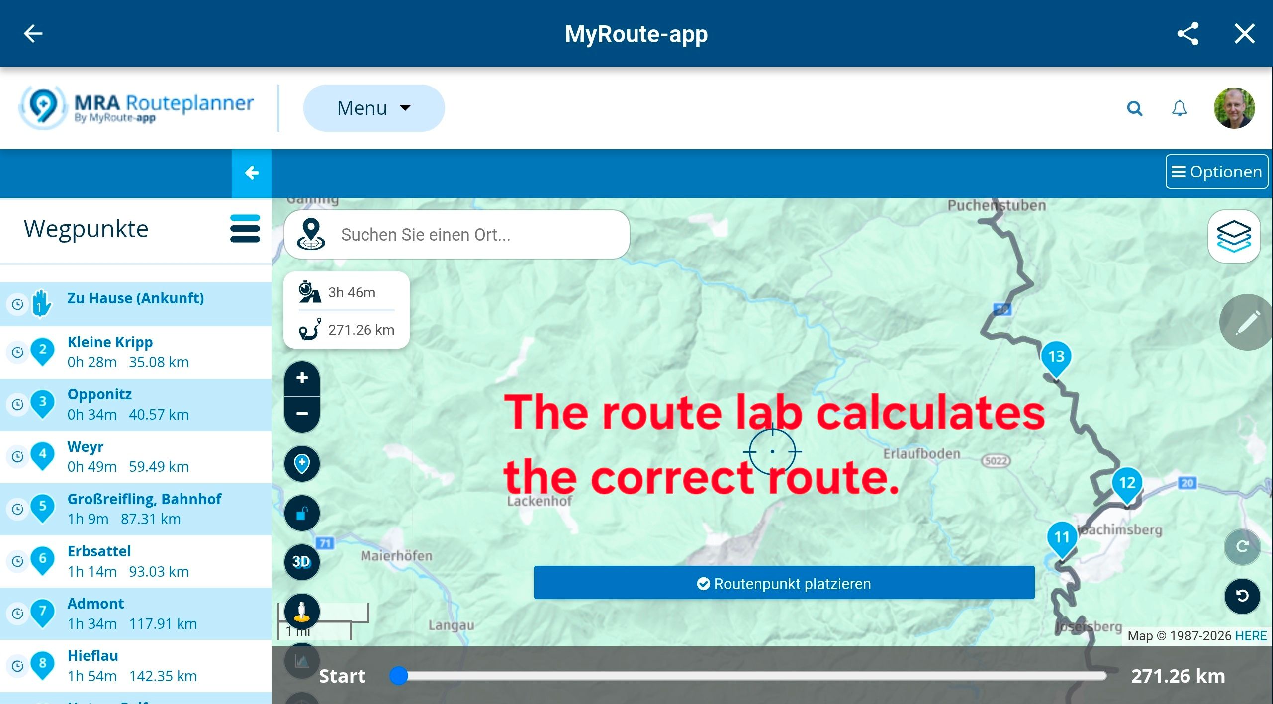
In the formation/via points this is indeed the only option to save this. You can put 512 characters in the note. We are currently working on a TextToSpeech option to speak it out.Of course you can do the planning as you write it in the planner, and make it visible with POIs and then indicate in the training / via points what you want to achieve.
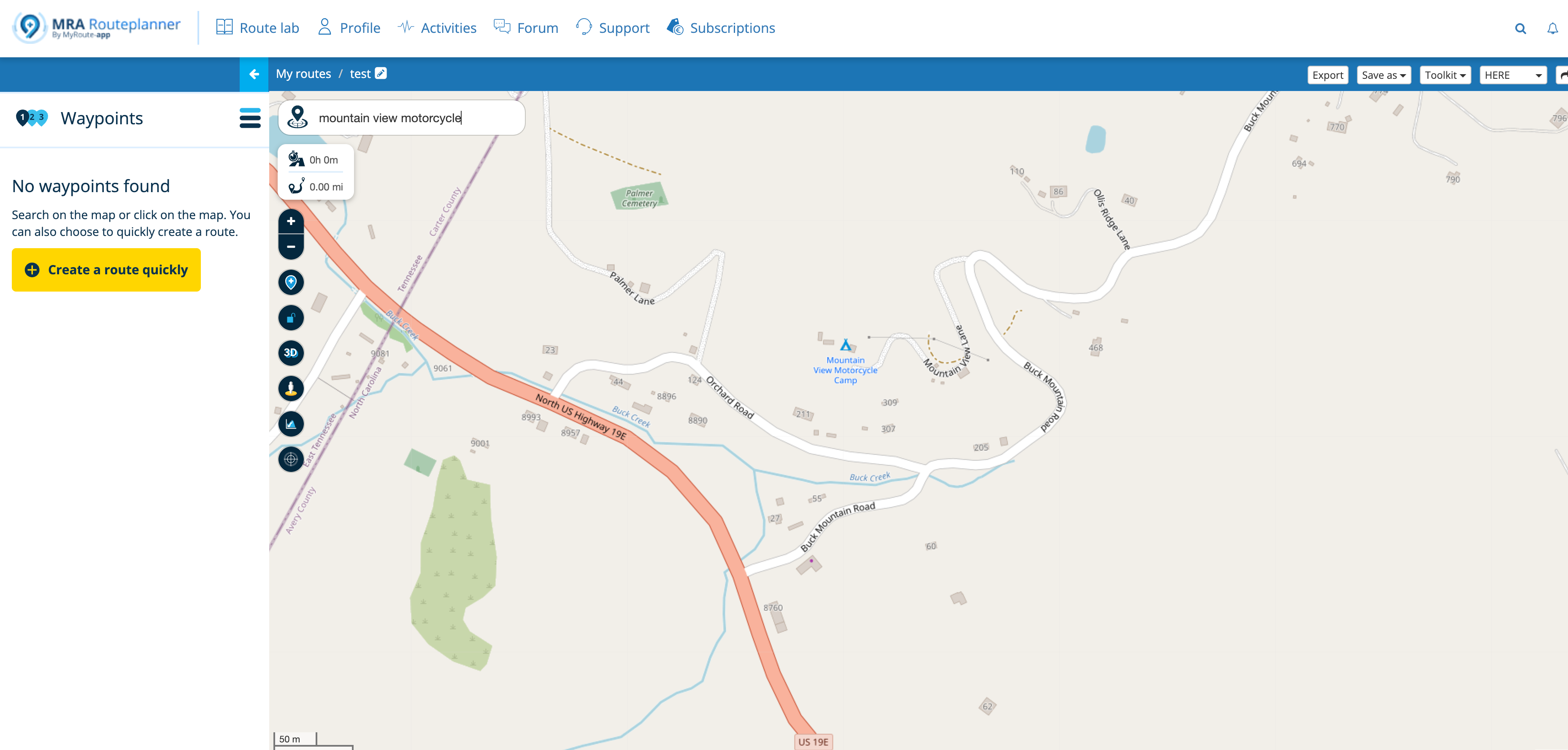
@Hans-van-de-Ven-MRA-Master I am currently routing our next trip. I think being able to save text and hyperlinks to a user-created POI would be a great feature. In external notes, I have now collected contact info on hotels and restaurants for each night along our 12 day route, including cost for lodging. I have included many alternatives that are not considered top choice.
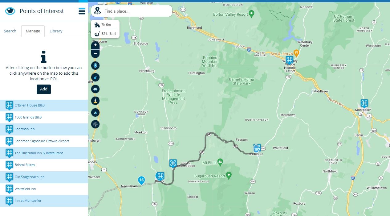
I do have POIs created for the hotels. I just need to be able to add the text. This would be useful in planning new trips as well, using a custom POI library.
For me, the biggest issue with user POIs at this time is that I cannot control which points are shown on the routing map. I would like to be able to hide places that I are not the top choice. Being able to change visibility from the POI menu would be perfect.
These are the POIs that I have created for possible lodging on one particular night. It's much easier to do it ahead of time than it is on the bike!
Typical info for one hotel POI that I have created:
"Montpelier, VT 6 hrs 37 min
The Inn at Montpelier
147 Main Street, Montpelier, VT $200ish per night
https://www.innatmontpelier.com/
Walking distance:
Three penny Taproom, Bent Nails Bistro"Thanks for your consideration!


Hello! It looks like you're interested in this conversation, but you don't have an account yet.
Getting fed up of having to scroll through the same posts each visit? When you register for an account, you'll always come back to exactly where you were before, and choose to be notified of new replies (either via email, or push notification). You'll also be able to save bookmarks and upvote posts to show your appreciation to other community members.
With your input, this post could be even better 💗
Register Login-
0675
-
08173
-
08187
-
07159
-
1575
-
0341.6k
-
09400
-
7221.4k