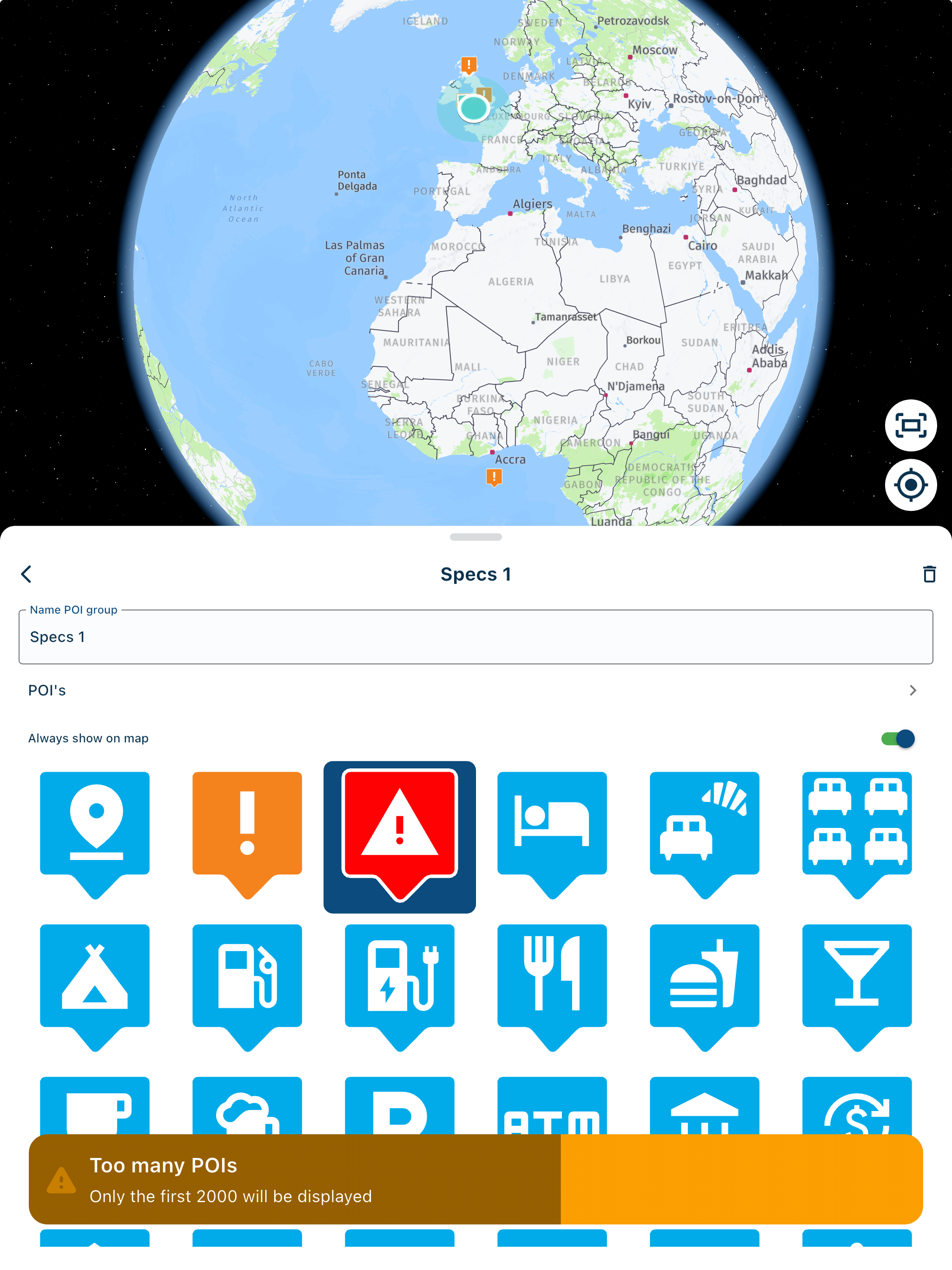
How to do this
-
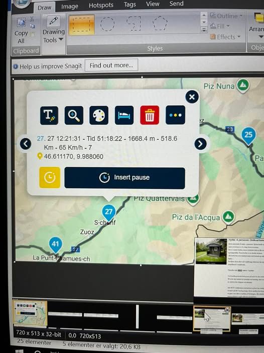
Hi,
just found this picture on the Internet.
I wonder how that Data (time, km, speed etc.) comes into the Waypoint?
Was it a Track with this data converted into a route, or how? It must be a recorded track.
Hardware
iPhone 12 pro (iOS 26.2.1)
iPad (7.Gen.) 18.7.3
Oukitel RT3 Pro (Andr. 14)
Wireless CarPlay mit (Elebest C650)
Wired CarPlay (SEAT Arona - 2021)
MRA Workshops in Deutsch sind hier zu finden -
Hi,
just found this picture on the Internet.
I wonder how that Data (time, km, speed etc.) comes into the Waypoint?
Was it a Track with this data converted into a route, or how? It must be a recorded track.
@Jörgen I am guessing that this has has been manually entered as the name for the waypoint via the "T" button/icon
-
No, I don't think so. It is embedded in the GPX data.
GPX files can contain additional information.*In addition to these main components, GPX files may contain other data embedded in the XML structures:
Time: Timestamps for waypoints and track points indicating the time of recording. This is particularly useful for analysing speed or progress.
Elevation: The exact altitude above sea level for each point.
Speed and heart rate: Certain GPX extensions can store data such as speed, heart rate or cadence recorded by fitness devices or smartwatches.
Name and description: Descriptions or names for waypoints, routes and tracks, which enable better organisation and identification.
Links: References to external websites or files that provide further information about the route or waypoints.*
-
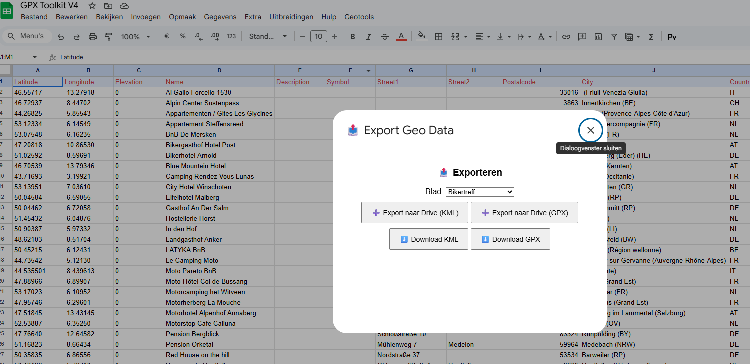
I think it is waypoints from a Basecamp GPX file and exported as a CSV. Someone has then joined the data they wanted from several columns in the CSV into the Waypoint description for MRA (hence the dashes between bits of info to make them intelligible) So they have made a CSV with Long Lat and description with data from a few columns joined into one. The CSV has been imported as a route and when you click on the waypoint all of the information shows up from the description column of the CSV import.
-
@Mzokk
I think you are right, that is the only way to import such data. The only thing is that MRA strangly enough only uses the “Name” datafield for import and export, so all data must be in that field.
As we speak I am fiddeling around with google sheets and java script to make a POI converter that can import/ export GPX and KML and geo-reference data ( get data out of Google).
As MRA only does use the name field I was thinking of making a special script for MRA to add data into the name field of the POI.
If that works it is “easy” to convert the GPX import into a track import and do the same. -
I got this working so far (sorry for the Dutch, but you get the idea.)@Jörgen :
Waht are you plans to do with the data? just info? -
@Jörgen @Mzokk :
MRA does not import the waypoints that are in a Track, they only import the trackdata. Loading a track into MRA as route has the same result: no waypoints transferred.
I took an existing track with way points and put it in Google sheets . then changed some data and exported it as a track again.
the exported track could be imported into Google Maps, Umap and Basecamp but not in MRA.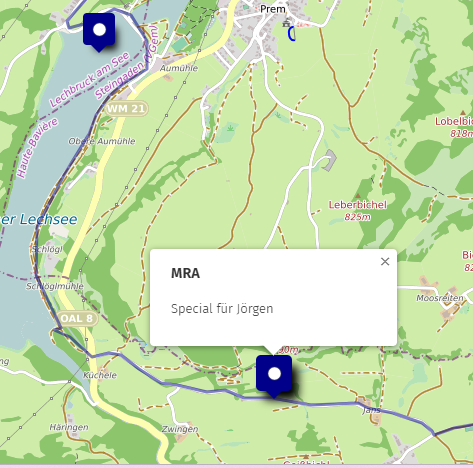
as you can"t import a CSV as route or track in MRA I would say it can only be done by copy-paste. -
@BertM Yes, information. See speed and elevation later on a map.
-
@Jörgen @Mzokk :
MRA does not import the waypoints that are in a Track, they only import the trackdata. Loading a track into MRA as route has the same result: no waypoints transferred.
I took an existing track with way points and put it in Google sheets . then changed some data and exported it as a track again.
the exported track could be imported into Google Maps, Umap and Basecamp but not in MRA.
as you can"t import a CSV as route or track in MRA I would say it can only be done by copy-paste.@BertM Yes the CSV can only be imported into POI's and if all the data required is condensed into one "name" column it will be shown when you use the POI in a route.
If you import a set of waypoints as a GPX file via "route" (even if no route exists) then the route planner will join the waypoints as a route but the enhanced information associated with the waypoints will be preserved. Obviously it must read this data differently than the CSV/POI import hence the need to manipulate data imported as POI's to make it more meaningful. The only reason this is important to me is that I'm trying to move away from Microsoft to Linux and therefore basecamp. MRA satisfies 95% of my navigation needs but basecamp handles POI's and tracks more flexibly and my Garmin Zumo XT's ability to handle POI's (via poi loader) and have proximity alerts means that I keep this as a secondary navigation device. However, I don't expect the developers to do much about my requirements as I expect they are quite niche.

-
@Mzokk
Yes it is a pitty that MRA only uses the name field in the import. If you look at there export of GPX files they reference the garmin extensions but do not use them….
I am also transfering my tools van Excel to java script to not be depending on MS.
I can make my POI and edit tracks in Java script but still need Basecamp to upload them into my garmin devices.
I also expect the connectivity with the garmin devices is going intomthe background as the focus seems to be on the MRA routing app.
Hello! It looks like you're interested in this conversation, but you don't have an account yet.
Getting fed up of having to scroll through the same posts each visit? When you register for an account, you'll always come back to exactly where you were before, and choose to be notified of new replies (either via email, or push notification). You'll also be able to save bookmarks and upvote posts to show your appreciation to other community members.
With your input, this post could be even better 💗
Register Login-
1946.4k
-
09508
-
17538.8k
-
0585
-
0324
-
016237
-
01154
-
013227