Route or Tracklog
-
I'm shortly going on a road trip with a group of friends.
One of the group has planned a route which we want to stick to with no detours.
So that we don't get any detours from the planned route is it best to navigate it as a route but offline or as a tracklog?
@Mark-David-Showell, Enable the white "original" route line in the settings. That way you can see if you go wrong.
-
I'm shortly going on a road trip with a group of friends.
One of the group has planned a route which we want to stick to with no detours.
So that we don't get any detours from the planned route is it best to navigate it as a route but offline or as a tracklog?
@Mark-David-Showell I think this is a great question

My preference has always been to navigate a route in offline mode but recently I have been experimenting with navigating with the "Navigate routes as track" option enabled
Navigating tracks with MRA used to be quite painful but an update earlier this year has made a huge difference/improvment
I have been frankly very impressed with the improvemnts detailed in this videoHaving driven a couple of thousand miles offline in track mode I would really also like to know now what the differences / advantages are between navigating a route or track?
For me with a well designed route they both perform exceptionally well & follow the planned path very accurately
My advice maybe would be to favour track navigation if your not confident of the quality of the planning / design of the routeBlackView BV7100, Android 12
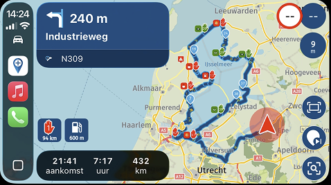
Navigate "Routes as Tracks" in Offline mode with Offline Maps
No Wifi, no internet, no interruptions, works well -
@Mark-David-Showell I think this is a great question
My preference has always been to navigate a route in offline mode but recently I have been experimenting with navigating with the "Navigate routes as track" option enabled
Navigating tracks with MRA used to be quite painful but an update earlier this year has made a huge difference/improvment
I have been frankly very impressed with the improvemnts detailed in this videoHaving driven a couple of thousand miles offline in track mode I would really also like to know now what the differences / advantages are between navigating a route or track?
For me with a well designed route they both perform exceptionally well & follow the planned path very accurately
My advice maybe would be to favour track navigation if your not confident of the quality of the planning / design of the routeI would really also like to know now what the differences / advantages are between navigating a route or track?
Can anyone explain?
-
A route consists of via points and shaping points. Calculations are being done ONLY between those, so when you deviate and a recalculation is being done, it will always redirect you to one of those points.
A track is usually a breadcrumb trail that you follow, but MRA implemented it a bit cleverer. A track is being divided in smaller segments. Therefore you points of reentry after a deviation are much finer grained so it will usually find a clever point for that. Also MRA make sit possible to keep via (or all) waypoints visible in your track, which enables the usual info you set with them.
Track navigating also has some disadvantages. You cannot add a gas station from within navigation for example. Also due to HERE limitations you cannot really do offroad tracks.
I am just an enthusiastic MRA user, and hope you will be one too!
Most motorcycle problems are caused by the nut that connects the handlebar to the saddle.
Check out RideSleepRepeat.eu, a biker community for sharing stays across Europe
-
A well designed route will always stick the original. With no detours, etc.
If a well designed route creates a detour by itself, then there is good reason for it.You can say we want to stick to the route no matter what, but if a road is not possible to use, then you must take a detour also. So what is the problem if the Navigation made this choice already for you?
-
A route consists of via points and shaping points. Calculations are being done ONLY between those, so when you deviate and a recalculation is being done, it will always redirect you to one of those points.
A track is usually a breadcrumb trail that you follow, but MRA implemented it a bit cleverer. A track is being divided in smaller segments. Therefore you points of reentry after a deviation are much finer grained so it will usually find a clever point for that. Also MRA make sit possible to keep via (or all) waypoints visible in your track, which enables the usual info you set with them.
Track navigating also has some disadvantages. You cannot add a gas station from within navigation for example. Also due to HERE limitations you cannot really do offroad tracks.
thanks @Con-Hennekens, it does appear that since the latest updates to the way tracks are navigated the differences between route & track navigation are not that big
very much appreciate the information "reentry after a deviation are much finer grained so it will usually find a clever point for that" & think this may be a huge benifit to those who like to use less points in planning their routes

as for petrol I still find the MRA implementaion poor so pre-plan all my fuel stops or if I need to look for a fuel station I use Osmand to clearly show them, so not being able to add them in track navigation is not an issue for me
BlackView BV7100, Android 12
Navigate "Routes as Tracks" in Offline mode with Offline Maps
No Wifi, no internet, no interruptions, works well -
thanks @Con-Hennekens, it does appear that since the latest updates to the way tracks are navigated the differences between route & track navigation are not that big
very much appreciate the information "reentry after a deviation are much finer grained so it will usually find a clever point for that" & think this may be a huge benifit to those who like to use less points in planning their routes
as for petrol I still find the MRA implementaion poor so pre-plan all my fuel stops or if I need to look for a fuel station I use Osmand to clearly show them, so not being able to add them in track navigation is not an issue for me
@Brian-McG said in Route or Tracklog:
it does appear that since the latest updates to the way tracks are navigated the differences between route & track navigation are not that big
In fact the changes made to the auto-skip algorithm, benefit routes as well as tracks. In an ideal world, if both work as intended, there would be little difference indeed
")
as for petrol I still find the MRA implementaion poor so pre-plan all my fuel stops
I guess you are referring to the absence of the distance to the second next gas station?
Hopefully that will be picked up some time.if I need to look for a fuel station I use Osmand to clearly show them
Why? Navigation also shows them on the map when you search for gas. And to be honest, it is quite easy to quit the route, set a gas station as destination, and afterwards restart the route from any point you like.
-
It is better to show multiple gasstations along the route for the next ..... kilometres. This give you more info to plan while riding.
(I use MRA Next only on Android Auto. Every comment, suggestion, etc will be based on my usage with Android Auto)
-
It is better to show multiple gasstations along the route for the next ..... kilometres. This give you more info to plan while riding.
@M.-Schrijver tip. When I plan the route I’ll always make shure there’s a planned refuel viapoint in the route. Since I know how far my bike can run on a full tank I make shure it’s safely within that range.
-
I don't plan my stops. I let them happen when i ride. I plan only the course of the route nothing more. Gas stations are used by me for stops. That is why i want to know where the gas stations are for the at least the next 30 minutes or so. Cafes/Restaurants along the route are also nice to know for the next 30 minutes or so.
People with more sportier bikes have normaly smaller fuel tanks and higher consumption. For them 200-250 km is often the max. They have a need for gas stations along the way. So that is why they like to know where the gas stations are along the route.
The group op people who plan everything in there route is very small.
A bigger group just plan the course of the route and nothing more (just like me). And the largest group don't plan anything. They just receive a gpx file and drop them in their navigation device without any checks. Or uses utilities like a roundtrip generator or scenic apps like Calimoto.
But info when riding is what everone likes to have.(I use MRA Next only on Android Auto. Every comment, suggestion, etc will be based on my usage with Android Auto)
-
I don't plan my stops. I let them happen when i ride. I plan only the course of the route nothing more. Gas stations are used by me for stops. That is why i want to know where the gas stations are for the at least the next 30 minutes or so. Cafes/Restaurants along the route are also nice to know for the next 30 minutes or so.
People with more sportier bikes have normaly smaller fuel tanks and higher consumption. For them 200-250 km is often the max. They have a need for gas stations along the way. So that is why they like to know where the gas stations are along the route.
The group op people who plan everything in there route is very small.
A bigger group just plan the course of the route and nothing more (just like me). And the largest group don't plan anything. They just receive a gpx file and drop them in their navigation device without any checks. Or uses utilities like a roundtrip generator or scenic apps like Calimoto.
But info when riding is what everone likes to have.@M.-Schrijver interesting to see how you plan your routes, or let things happen. If you like it that way, it’s fine by me but keep in mind that you might get disapointed sometimes if there’s no stop or fuel station on your route.
I don’t where you got your statements of how p use MRA. Seems like a wild guess to me.
Personality I like to use MRA to the max, enjoy my ride whithout having to worry about minor details like gas and food stops since I’ve looked at that during the planning stage. If something unexoected happens, that’s always nice to. Enjoy the rideHonda Goldwing GL1500,
Honda Silverwing GL 650
DMD2 T865X 8 inch Android tablet using MRA next for navigation
Garmin XT sold
Samsung S24FE mounted on a Quadlock and using Android Auto in my car -
@M.-Schrijver interesting to see how you plan your routes, or let things happen. If you like it that way, it’s fine by me but keep in mind that you might get disapointed sometimes if there’s no stop or fuel station on your route.
I don’t where you got your statements of how p use MRA. Seems like a wild guess to me.
Personality I like to use MRA to the max, enjoy my ride whithout having to worry about minor details like gas and food stops since I’ve looked at that during the planning stage. If something unexoected happens, that’s always nice to. Enjoy the ride@Marinus-van-Deudekom said in Route or Tracklog:
I don’t where you got your statements of how p use MRA.
I didn't say MRA in particular. Just how they use navigation device in general on holidays
It is from the many different people i met every year on my motorcycle trips.
Many people use a navigation device nowadays. But not many plan their own routes. There are still even people who just ride in a (small) group without a navigation device. They just rely on other people. Some people feel they are forced to use a navigition device because this is nowadays nearly the only method how routes are distributed.Here in Europe there are fuel stations enough. In my 10-15 years of travel with a motorcycle, i had 2 times where my tank was almost empty. But this was with a sportier bike with a range of 190 kilometres till reserve kicks in and was in my early days of traveling. This was good for my learningcurve.
TomTom Go shows me the fuel stations for the next 50 kilometres along the route. That are the bigger ones. The smaller fuelstations are popping up at around 10-15 kilometers riding. 50 kilometres is roughly 45-60 min riding. There are moments where TomTom doesn't show me any gas station at all. But those moments are very rare.
Hello! It looks like you're interested in this conversation, but you don't have an account yet.
Getting fed up of having to scroll through the same posts each visit? When you register for an account, you'll always come back to exactly where you were before, and choose to be notified of new replies (either via email, or push notification). You'll also be able to save bookmarks and upvote posts to show your appreciation to other community members.
With your input, this post could be even better 💗
Register Login-
0462.0k
-
1845.4k
-
014259
-
0467
-
0349
-
0212
-
0373
-
2010217.2k