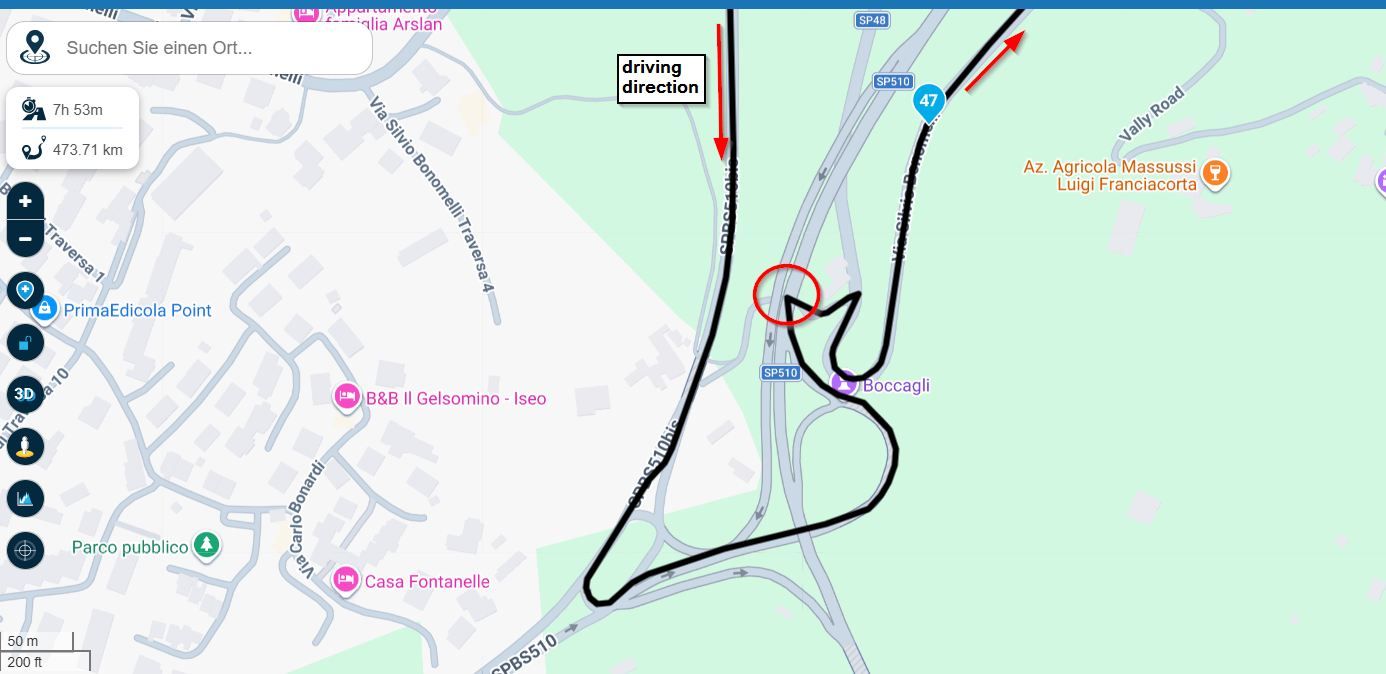
How to incorporate public gravel roads when planning a route
-
@derek-c There's no real fix for this. The TomTom Rider is an excellent device and far more user friendly than the Garmin devices, but the problem is - like I wrote - that it will not take a road that is not in its map, it will recalculate the route and will look for roads on its maps. Normally not a big problem if it's just a matter of taking another street or a nearby side road. But it's a more serious problem if you want to go riding off road. The TomTom Rider will always recalculate another route that it will find on the map that is built in. The software is just designed that way. It's not a device to be used for long distance off roading. What I have done in the past (when I used the TomTom Rider) was the following: I stopped the route, started it again, did not press on the button 'Ride', followed the cursor while riding to a road that is part of the designed route and then press on 'Ride' the moment I had reached the original route. That looks a bit like the Garmin where you can switch off the recalculating (but you can't switch that off in the Rider). But that's not a real option for serious off roading. The limitations are in the software of the TomTom Rider (and at this moment you can't use another map in the Rider than the one that's built in). Being a long distance rider taking all kinds of roads that are not always on the TomTom built in maps I switched to Garmin. For creating routes you can off course use the TomTom map in MRA web planner. Part of the problem is that you are riding with others that still might use a TomTom. They will have to follow the leader.
@Rob-Veerman I will agree. I was having the same problem. Searching for some useful guidance and came to the conclusion you describe here. It is a limitation of the map source in the device.
Hello! It looks like you're interested in this conversation, but you don't have an account yet.
Getting fed up of having to scroll through the same posts each visit? When you register for an account, you'll always come back to exactly where you were before, and choose to be notified of new replies (either via email, or push notification). You'll also be able to save bookmarks and upvote posts to show your appreciation to other community members.
With your input, this post could be even better 💗
Register Login-
022245
-
08118
-
019398
-
5766
-
0368
-
0244
-
0568
-
08175