Just Waypoints with no routes.. possible?
-
Hi
One of the few things I miss from Basecamp is being able to add Waypoints to a map without having a routes joining them together.
Example, I've signed up to a nav challenge where there are about 50 places to visit scattered all over the UK, I'd like to add all of these places to a map and then work out the best way to route between them all using it as a visualtion tool.
I don't think this can be done but thought I'd ask anyway.
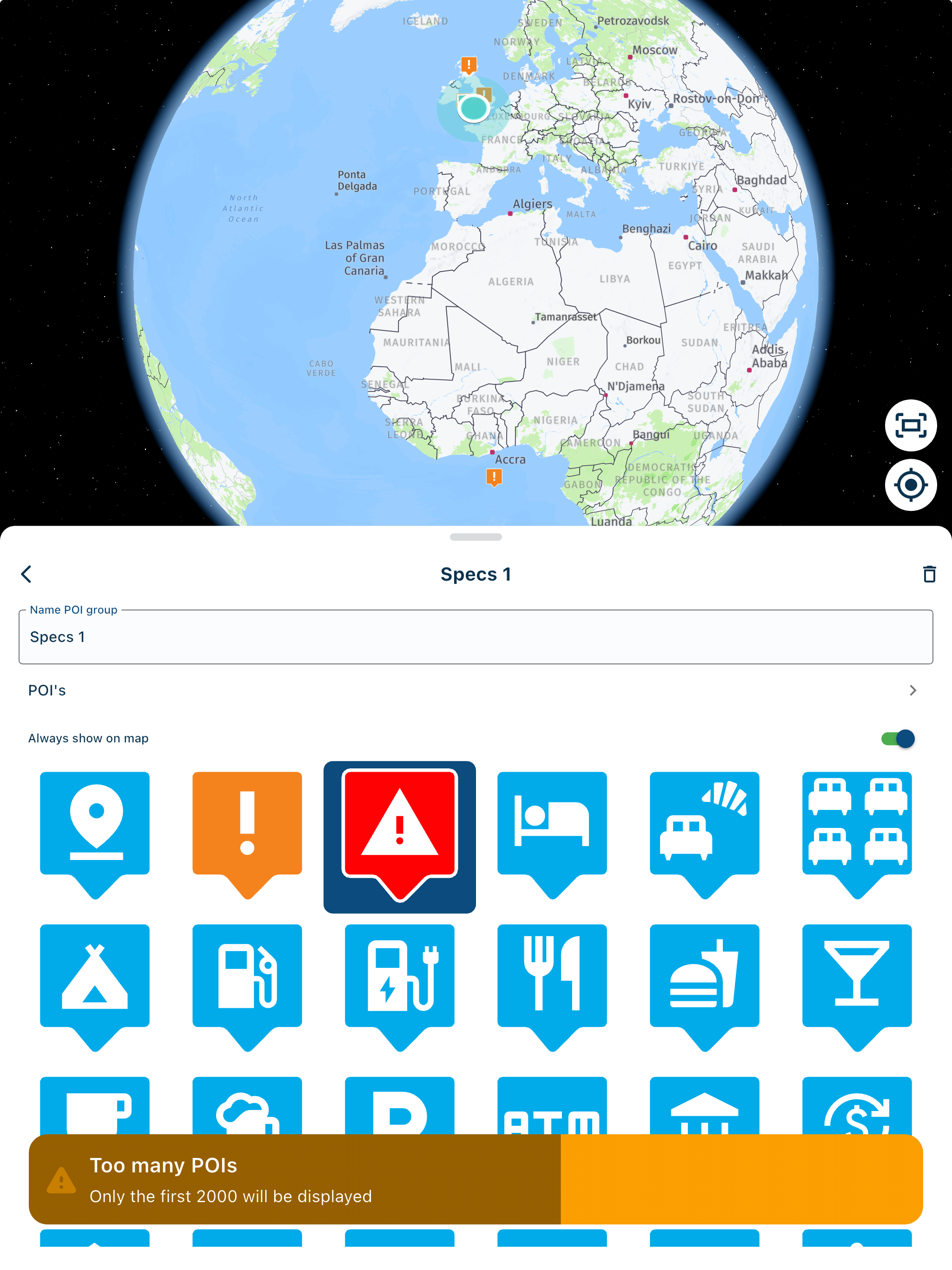
I have considered adding them as POI's but POI's only appear when at a low level zoom, I want to see then regardless of zoom level.GSA1250
HD Street Glide
HD Sport Glide
XT500 x 2 -
Hi
One of the few things I miss from Basecamp is being able to add Waypoints to a map without having a routes joining them together.
Example, I've signed up to a nav challenge where there are about 50 places to visit scattered all over the UK, I'd like to add all of these places to a map and then work out the best way to route between them all using it as a visualtion tool.
I don't think this can be done but thought I'd ask anyway.
I have considered adding them as POI's but POI's only appear when at a low level zoom, I want to see then regardless of zoom level.@Rob-Kelley, Me too thinks POI is the way for this. It would indeed be handy to be able to have a toggle to switch POI to "always on", or make them permanent and independable of zoom factor. Especially for smaller collections that could be helpful.
I am just an enthusiastic MRA user, and hope you will be one too!
Most motorcycle problems are caused by the nut that connects the handlebar to the saddle.
Check out RideSleepRepeat.eu, a biker community for sharing stays across Europe
-
@Rob-Kelley, Me too thinks POI is the way for this. It would indeed be handy to be able to have a toggle to switch POI to "always on", or make them permanent and independable of zoom factor. Especially for smaller collections that could be helpful.
+1
I would love to have this one!
Ideally, a switch/toggle/checkbox separate for each own POI library. Like the existing ones for show/hide "in this route" and "in all routes." -
Maybe a solution could be favorite custom 'Categories', I could add all the hotels for my trip as favorites under a custom category that I can create and then easily delete after the trip, keep them seperate to my regular faves.
-
Hi
One of the few things I miss from Basecamp is being able to add Waypoints to a map without having a routes joining them together.
Example, I've signed up to a nav challenge where there are about 50 places to visit scattered all over the UK, I'd like to add all of these places to a map and then work out the best way to route between them all using it as a visualtion tool.
I don't think this can be done but thought I'd ask anyway.
I have considered adding them as POI's but POI's only appear when at a low level zoom, I want to see then regardless of zoom level.I still use Basecamp for this. I do a 26 point "photographic rally" round Ireland every summer and having the points visible at the full extent of the map of Ireland is very useful. Also I have a database of commonwealth war graves which is about 10,000 points. When stored as waypoints or POI's in basecamp supplementary information such as weblinks is retained whereas all the data for POI's in MRA is stripped out so you have the name and the geolocation information only.
-
I have the same issue. You can add points as POIs, but the zoom level is not very useful for picking points.
I do several scavenger hunt rallies every year where we are given ~150 locations and need to find an optimal route to make it to a final location on time with maximum points. I've been using Google MyMaps for this task. Mike Brookes has a Youtube video tutorial for MyMaps which is pretty good.
-
A small work around is to set the line transparency to 100%, the route is still there but you can't see it.
Hello! It looks like you're interested in this conversation, but you don't have an account yet.
Getting fed up of having to scroll through the same posts each visit? When you register for an account, you'll always come back to exactly where you were before, and choose to be notified of new replies (either via email, or push notification). You'll also be able to save bookmarks and upvote posts to show your appreciation to other community members.
With your input, this post could be even better 💗
Register Login-
1936.3k
-
0468
-
014220
-
0257
-
17438.7k
-
255613.0k
-
0948
-
04155