STILL having issues w/ my Zumo XT not following the route
-
You use the gpx 1.2, which is a route track with via points. So if you deviate from the route and the XT starts calculating, it will, according to the settings of the XT, take you to the next via point, in your case via the highway. When using the gpx 1.2, turn off the recalculation if you use the gpx 1.1 in this gpx there is both the route file and the treack file and you can also make the track visible
gpx 1.2 (with track visible), flags are the via points
gpx 1.1 (with track visible) flags are via points, dots are shaping points.
I hope this helps you understand the difference between gpx 1.1 and gpx 1.2
@Hans-van-de-Ven-MR-MRA
Ok I see the difference. With that being the case why would a person want to use 1.2?
"There is no problem so bad that you can't make it worse"
- Chris Hadfield (NASA Astronaut)
-
@Hans-van-de-Ven-MR-MRA
Ok I see the difference. With that being the case why would a person want to use 1.2?
If they want to see only the via points (flags) on the screen. I personally always use gpx 1.2
-
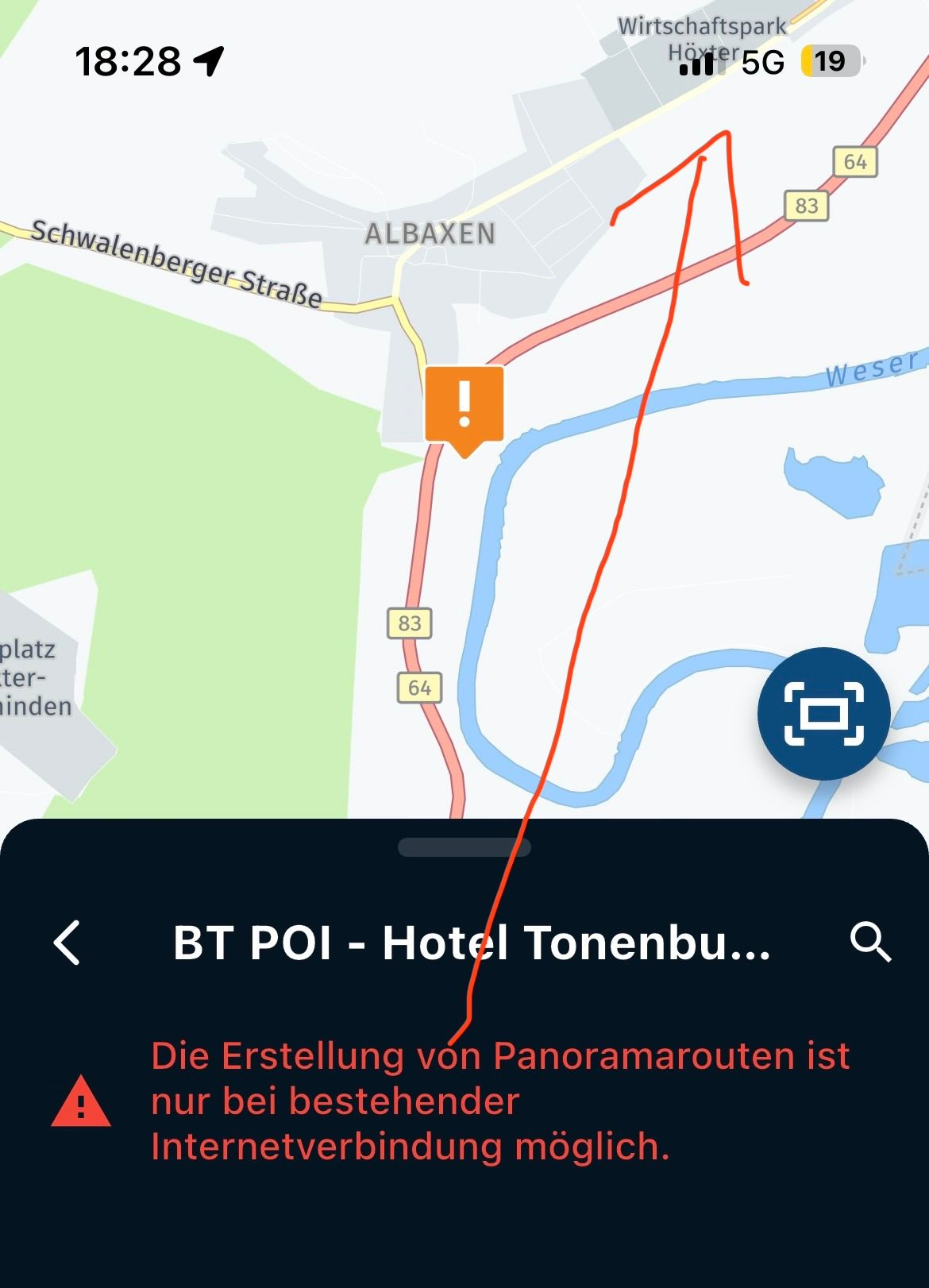
I was on the highlighted route a few miles from the skipped waypoint. I knew something was gonna go wrong when I did it and saw "calculating route"
I have not figured out (haven't looked much either) how to show a track when on a route.
@Greenham of you have recalculating off the XT will not recalculate en of you miss a viapoint.
If you're past the viapoint you can press skip waypoint of you're ON the route the XT will keep you on the route without recalculating -
@Hans-van-de-Ven-MR-MRA
Ok I see the difference. With that being the case why would a person want to use 1.2?
@Greenham The Choice of Gpx1.1 or Gpx 1.2 is a personal one, there is no right or wrong answer. I still use Garmin Basecamp and MRA and use GPX1.1 with the track on the screen (Which provides similar functionality to GPX1.2 without route guidance its only a line on the map.) GPX 1.1 shows the shaping points (in Garmin naming waypoints in MRA naming) and via points which in Garmin are flags and you have to pass through them. Having these allows me to see the the points I've chosen to shape the route on the unit and allows flexibility to deviate from the route and get back to it without having to stop and reinitiate the route.
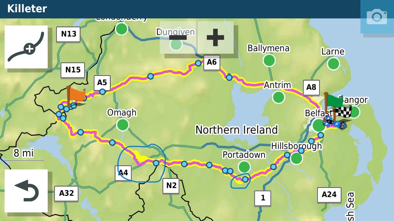
In the picture above the flags are via points and the blue dots are shaping points the yellow line is the track of the intended route enabled on the unit. The circled points are the areas that are off a bit. I might fix these or when I come to that part of the route I follow the track and the Garmin will usually recalculate along the track to the next shaping point. If you look at the picture above with my bike covered in screens I also keep the the skip waypoint button on the screen. This allows me to skip several shaping points to reduce the complexity of the route if I take too long over lunch have a puncture etc. In the example above there is a Motorway north of the intended route. If for some reason I have to shorten the route I can skip about 5-6 shaping points and the Garmin will route me along the Motorway. Also GPX 1.1 is the same as shown on the unit when route planning with Basecamp. I don't even know if I planned the route above on Basecamp or MRA.
The big thing is you don't need to leave the house to test all of this you can set up the routes you want to use and run them as simulations. Try rerouting, find out what the skip button does and how it affects the route etc. all from the comfort of your armchair. You will quickly find out what works for you. Good Luck.
-
I am still having issues with my Zumo XT NOT following the route designed in MRA completely/correctly. I have added a bunch more shaping points, used the export to 1.2 gpx. It didn't take long before it routed me down a DEAD END ROAD.... I knew the area and just drove by it. I then took another road, thus passing a WAYPOINT. I "skipped" the waypoint via Zumo, it then said it was recalculating.
From that point on, it seemed to ignore any shaping points and followed a recalculated fastest route using the few WAYPOINTS left from there on. The route was useless from then on... ( it routed me 16miles down an interstate until the next WAYPOINT) I don't ever route via interstates.
Since getting back:
-
I have gone back in, changed from Google to the HERE map
-
Added a bunch more WAYPOINTS,
-
then did a comparison with TOM TOM and OPEN maps... They all followed the same route...
MY QUESTION:
Is it normal to skip a waypoint and have the Zumo recalculate even though I had recalculation turned off and taking what seemed like the fastest route using the final few WAYPOINTS?I am so losing trust between the MRA and Garmin. I have a 4 day 1,000 mile trip through the NC/VA/WVA mountains planned for this Spring. I don't want to worry about the Zumo randomly changing my route.
I end almost every ride with Garmin XT because the battery capacity of my (new) Samsung is insufficient for the entire trip, I also want to be able to call. Here map problems.
I also see the same problem as you.
The MRA route is almost always a fraction different from the route on the XT, despite using the Here map during MRA route development.
In order to make MRA and Garmin as similar as possible, I use a via point every 2 km, if possible.Even then there will be minimal deviations.
An additional advantage with many via points is that, if you have to take a detour, you can also see when you are back on the original route.It is what it is.
It only creates discussion in groups if the fellow riders think the route is a train track. But that's only when I'm front-rider. -
-
@Hans-van-de-Ven-MR-MRA
Ok I see the difference. With that being the case why would a person want to use 1.2?
@Greenham said in STILL having issues w/ my Zumo XT not following the route:
Ok I see the difference. With that being the case why would a person want to use 1.2?
There are many different answers out there; here is mine:
It all comes down to whether you want to drive with auto-recalc on or not.
If activated (because it is convenient), you need GPX 1.1. You have all your shaping points at hand that help keep the shape of your intended route when it comes to a recalc. No worries about deviating, as your app/device will find the best way to continue. The downside: auto-recalc sounds good in theory but often struggles in reality. And ironically, the more shaping points you add, the worse it gets regarding recalc. My experiences.
If deactivated (because it's confusing or even irritating), GPX 1.2 might be the better choice. You eliminate all these shaping points that are just needed when calculating but not when navigating. You have a cleaner look and a pure focus on your via points. The downside: if you deviate, you have to find your way back on your own, and if you're going to get lost, you need a break to work out a new plan.
I suggest saving GPX 1.1 and GPX 1.2 on your Garmin; then, you can always try out which version you like better in which situation.
-
I end almost every ride with Garmin XT because the battery capacity of my (new) Samsung is insufficient for the entire trip, I also want to be able to call. Here map problems.
I also see the same problem as you.
The MRA route is almost always a fraction different from the route on the XT, despite using the Here map during MRA route development.
In order to make MRA and Garmin as similar as possible, I use a via point every 2 km, if possible.Even then there will be minimal deviations.
An additional advantage with many via points is that, if you have to take a detour, you can also see when you are back on the original route.It is what it is.
It only creates discussion in groups if the fellow riders think the route is a train track. But that's only when I'm front-rider.@Hans-ter-Braak I lead quite a few groups so try to be as accurate as possible. I like to navigate along little roads often with grass growing up the middle. I do go off route quite frequently as sometimes the roads are closed or I spot something interesting. Mostly my riding companions don't notice

-
Excellent replies from all.. I am slowly catching up to you guys on the pros, and cons of 1.1 vs 1.2..
You think having a great tool like MRA and a top notch GPS like the Zumo, you would be in a WYSIWYG type routing. While "somewhat" true the devil lies in the details, and the subtle idiosyncrasies of the technology from 2 different companies, from 2 different parts of the world.
For me I like to use a lot of shaping points because I want a very specific route (anal retentive I suppose). What I have done via this incredibly helpful thread, is 1. Create a lot more shaping points. 2. Created/converted shaping points to Via points. Primarily because I don't like the idea of having to stop a route because I missed a Via point and then restart in again. I'd rather find my way back to the highlighted route via the track.
Thank you all for contributing this has been so helpful
"There is no problem so bad that you can't make it worse"
- Chris Hadfield (NASA Astronaut)
-
Excellent replies from all.. I am slowly catching up to you guys on the pros, and cons of 1.1 vs 1.2..
You think having a great tool like MRA and a top notch GPS like the Zumo, you would be in a WYSIWYG type routing. While "somewhat" true the devil lies in the details, and the subtle idiosyncrasies of the technology from 2 different companies, from 2 different parts of the world.
For me I like to use a lot of shaping points because I want a very specific route (anal retentive I suppose). What I have done via this incredibly helpful thread, is 1. Create a lot more shaping points. 2. Created/converted shaping points to Via points. Primarily because I don't like the idea of having to stop a route because I missed a Via point and then restart in again. I'd rather find my way back to the highlighted route via the track.
Thank you all for contributing this has been so helpful
@Greenham Yes you'd think that the Zumo should be WWYSIWYG. It was with certain of the old Zumo's I have a Zumo 340 and 390 that pretty much replicate the routes I create in Basecamp because the routing algorithm for both matched as long as you had the settings matched in Basecamp and the units. I was totally confused with the Zumo XT when I got it because the routing algorithm changed meaning that Basecamp routes no longer matched what the XT did (as stated faster time now =faster roads) which was not the case with the older Zumo's or basecamp. That's part of the reason I'm thinking of moving to myroute app navigation and relegating my XT to a backup. But I did get the hang of the XT in the end

-
@Greenham Yes you'd think that the Zumo should be WWYSIWYG. It was with certain of the old Zumo's I have a Zumo 340 and 390 that pretty much replicate the routes I create in Basecamp because the routing algorithm for both matched as long as you had the settings matched in Basecamp and the units. I was totally confused with the Zumo XT when I got it because the routing algorithm changed meaning that Basecamp routes no longer matched what the XT did (as stated faster time now =faster roads) which was not the case with the older Zumo's or basecamp. That's part of the reason I'm thinking of moving to myroute app navigation and relegating my XT to a backup. But I did get the hang of the XT in the end
@Mzokk said in STILL having issues w/ my Zumo XT not following the route:
because the routing algorithm changed meaning that Basecamp routes no longer matched what the XT
That was exactly why many Basecamp users went crazy; they didn't understand it. It quickly became clear that Garmin did not want to develop BC further and wanted to push Explore/Tread instead.
And it was at this point that many BC users started looking for alternatives - e.g. MRA
")
Hello! It looks like you're interested in this conversation, but you don't have an account yet.
Getting fed up of having to scroll through the same posts each visit? When you register for an account, you'll always come back to exactly where you were before, and choose to be notified of new replies (either via email, or push notification). You'll also be able to save bookmarks and upvote posts to show your appreciation to other community members.
With your input, this post could be even better 💗
Register Login-
0606.4k
-
010117
-
0661
-
024679
-
0413
-
17238.5k
-
1875.9k
-
07123