Altitude
-
As @Jörgen says, it's just useful and interesting information.
Hi @David-Emmett I will concede it is interesting information but I still don't see how it is a useful piece of when navigating a motorcycle or car
I believe the altitude information may be contained in the recorded logs so it is available to inspect after the trip is completedBlackView BV7100, Android 12
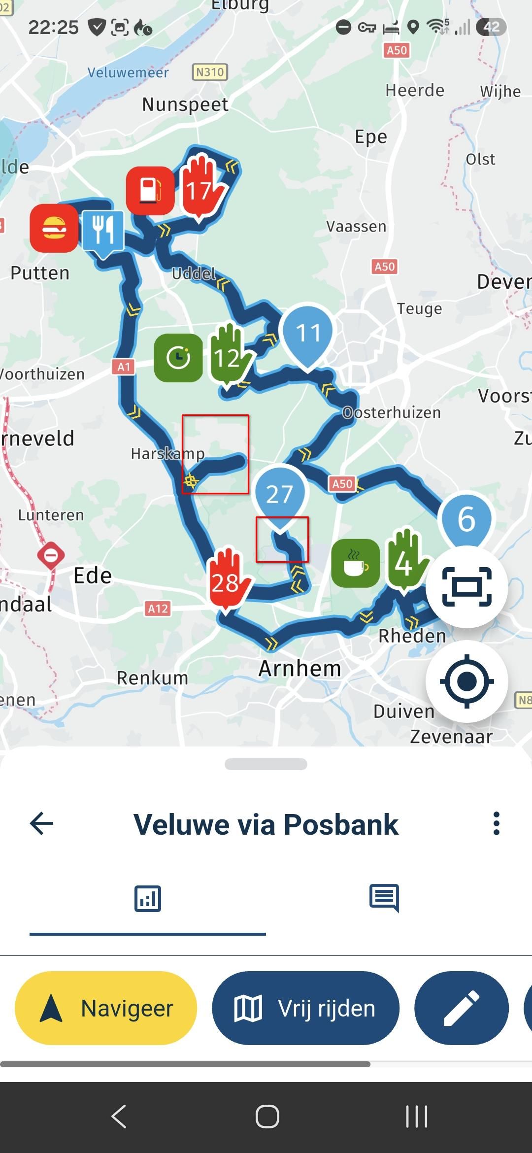
Navigate "Routes as Tracks" in Offline mode with Offline Maps
No Wifi, no internet, no interruptions, works well -
It is in the logs. But where is the fun in digging through the logs? (I mean, there is fun in digging through the logs, but it's an entirely different activity).
I find it interesting, as I ride, to see speed, compass direction (roughly, I don't need bearing) and elevation. My interest is purely fleeting, at the moment of riding, and does not extend beyond "I wonder how high we are now?". I think I am not unique in having this casual curiosity.
This is not information that is absolutely necessary while navigating. It is merely additional information that some of us find interesting while riding. Hence my suggestion to make it a togglable field (in fact, adding a togglable field would also allow that field to be used for a selection of values, such as bearing in degrees, temperature, barometric pressure, GPS accuracy, battery %, or whatever. None of these are necessary, but I can imagine people being interested enough to want to see them.)
It was a feature of Garmin devices to show elevation. Though the worst bug I saw on the last Garmin I used was that elevation would be shown in metres up to 999m, then switch to kilometres. So it would go 997-998-999-1km and then you had to wait for the next 1000 metres of elevation before the display changed to 2km. Which sucked.
Anyway, there are workarounds for this, but they are a pain in the behind. It is just a nice to have feature, which is why I am posting it in this part of the forum
-
Hi @David-Emmett I will concede it is interesting information but I still don't see how it is a useful piece of when navigating a motorcycle or car
I believe the altitude information may be contained in the recorded logs so it is available to inspect after the trip is completed@Brian-McG, it is just fun to know at what altitude you are if you pass a high point. Why is your location considered essential, and your height not? Some people even have motorbike angle info on their display. How non-informative is that...? They just like to know the info
")
Hello! It looks like you're interested in this conversation, but you don't have an account yet.
Getting fed up of having to scroll through the same posts each visit? When you register for an account, you'll always come back to exactly where you were before, and choose to be notified of new replies (either via email, or push notification). You'll also be able to save bookmarks and upvote posts to show your appreciation to other community members.
With your input, this post could be even better 💗
Register Login-
012154
-
-436970
-
010184
-
1313234
-
0101.3k
-
08749
-
03105
-
0499