Invisible Route Wall
-
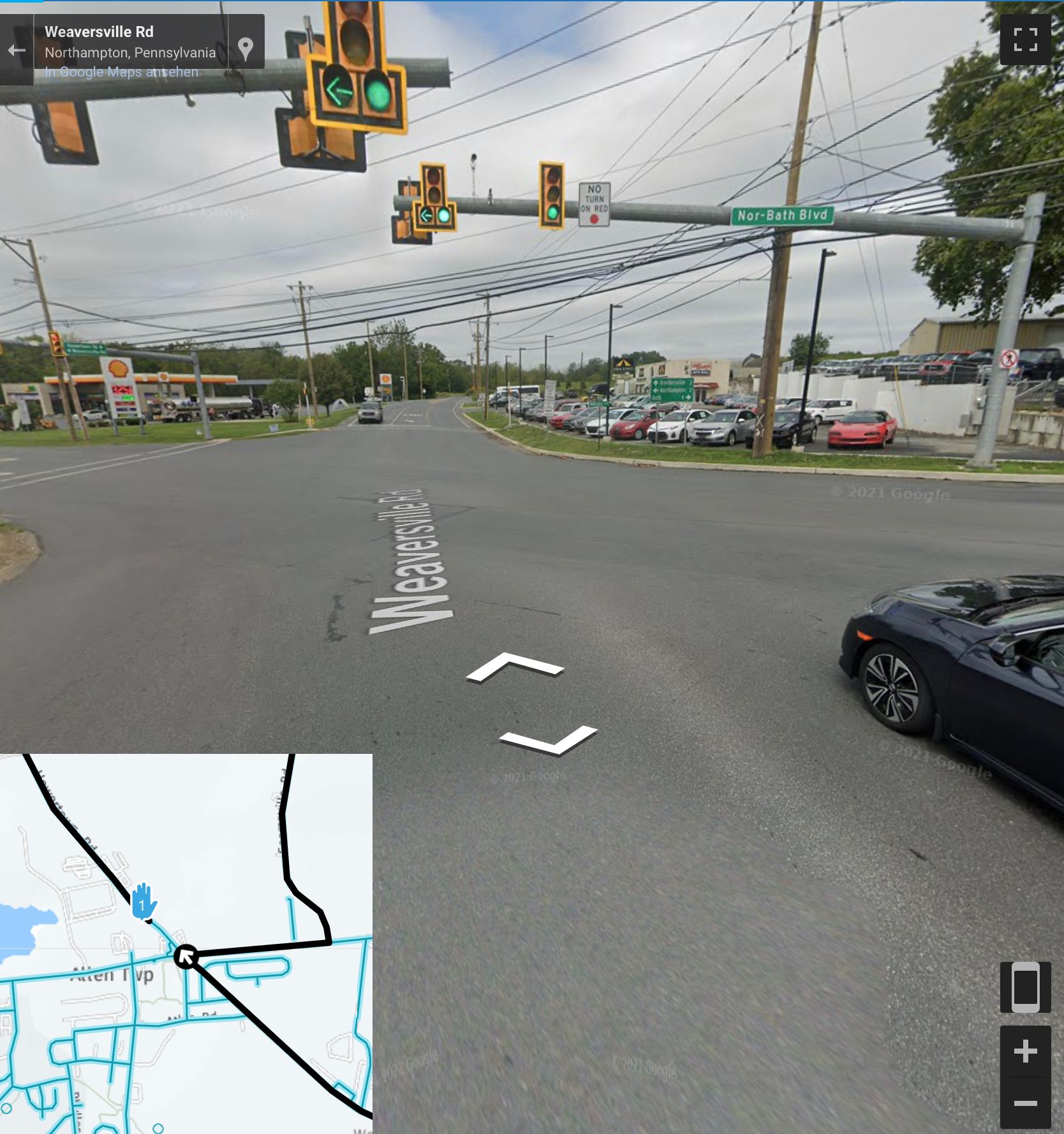
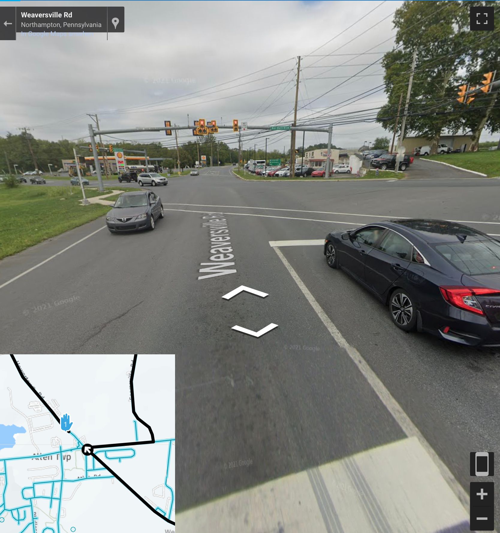
Hello everyone. I am not exactly sure what to call this, but it seems to happen periodically when I create routes online. For some reason, there are certain spots that I cannot route through and no matter how many waypoints I add I am forced to go around sections of road. It is not due to seasonal closure or avoid unpaved road or avoid toll or one way street. I can't seem to figure out why it happens but on my most recent route it happened twice within a few miles of each other. See screen grabs.
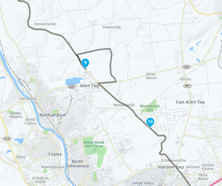
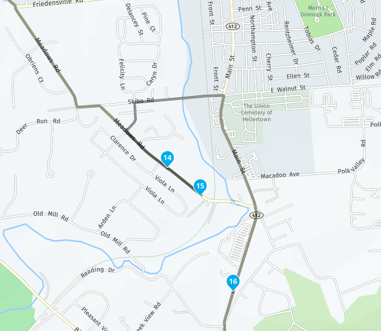
Any suggestions on how to route around issues like this? I'm using the HERE map, Chrome browser, Windows 11 and as mentioned it is not due to a selection within MRA. I plan on using this route the new mobile app beta but this has been happening well before the beta app even launched.
Any suggestions would be appreciated. Thanks.
-
Hello everyone. I am not exactly sure what to call this, but it seems to happen periodically when I create routes online. For some reason, there are certain spots that I cannot route through and no matter how many waypoints I add I am forced to go around sections of road. It is not due to seasonal closure or avoid unpaved road or avoid toll or one way street. I can't seem to figure out why it happens but on my most recent route it happened twice within a few miles of each other. See screen grabs.


Any suggestions on how to route around issues like this? I'm using the HERE map, Chrome browser, Windows 11 and as mentioned it is not due to a selection within MRA. I plan on using this route the new mobile app beta but this has been happening well before the beta app even launched.
Any suggestions would be appreciated. Thanks.
@Tom-Cat Most likely cause for this is a (temporary) road closure on your route (for example due to road works), according to the map provider. Usually, when enabling the "traffic" layer, these closed sections of road will be marked in black.
-
I have had similar issues a number of times in the last few weeks with routes I’ve been planning in the U.K. and Spain.
If it is traffic related then I understand it, but it’s not helpful for routes I’m planning months in advance as the roadworks may not still be there by then
-
I have had similar issues a number of times in the last few weeks with routes I’ve been planning in the U.K. and Spain.
If it is traffic related then I understand it, but it’s not helpful for routes I’m planning months in advance as the roadworks may not still be there by then
@Dae-0 I understand, but sadly, only closures classified as "seasonal closures" (like mountain passes being closed during the winter season) can be turned on or off. Maybe it would be possible to add an option to disregard closures altogether.
It would be even nicer if MRA Routeplanner offered an option to calculate the (expected) route for a certain date (and time) in the future (i.e. the date/time I'm likely to actually drive/ride the route). I've suggested this before, but I think the answer at the time was that the toolkit/SDK MRA is using to provide multiple maps for calculation doesn't offer this functionality.
-
@Dae-0 I understand, but sadly, only closures classified as "seasonal closures" (like mountain passes being closed during the winter season) can be turned on or off. Maybe it would be possible to add an option to disregard closures altogether.
It would be even nicer if MRA Routeplanner offered an option to calculate the (expected) route for a certain date (and time) in the future (i.e. the date/time I'm likely to actually drive/ride the route). I've suggested this before, but I think the answer at the time was that the toolkit/SDK MRA is using to provide multiple maps for calculation doesn't offer this functionality.
I’d even settle for it rendering a no entry sign or something on the map to indicate what’s going on (maybe a roadworks sign).
The first time it happened it took ages to figure out why the route wouldn’t go down a road that I knew the path between my two shaping points should use. A simple indication on the map would have saved lots of time.
-
Some observations:
- if you plot a route on that road in reverse, it works fine
- if you swap to OSM (from HERE) it works fine in both directions
- Tomtom also works fine in both directions
- lastly, Google Map works fine in both directions
That suggests the navigation algorithm is wrong for that area in HERE data only.
I'd report it. That's an exercise for the reader [= I don't know how you do that
 ].
]. -
Some observations:
- if you plot a route on that road in reverse, it works fine
- if you swap to OSM (from HERE) it works fine in both directions
- Tomtom also works fine in both directions
- lastly, Google Map works fine in both directions
That suggests the navigation algorithm is wrong for that area in HERE data only.
I'd report it. That's an exercise for the reader [= I don't know how you do that
 ].
]. -
Fouten in het Here kaartmateriaal kunnen Here (
 ) worden gemeld:
https://mapcreator.here.com/ -
Purely by coincidence, I rode a similar one this morning:
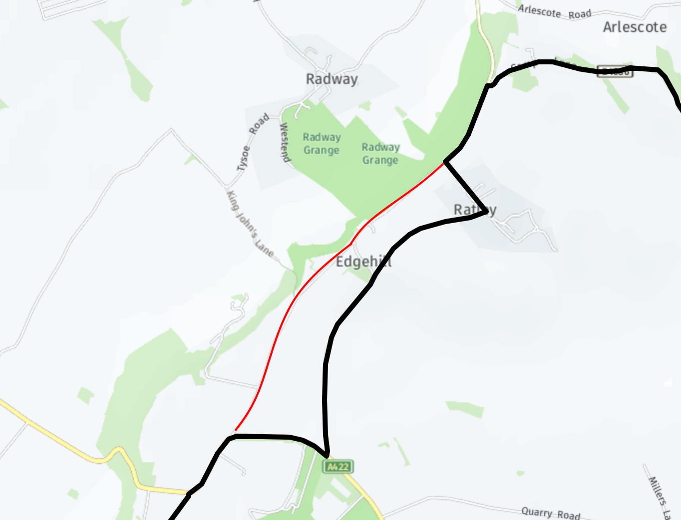
Red = the real road with no deviation needed. The HERE route is just madness - a drunk cyclist.I took Con's advice, created an account on HERE's MapCreator, and registered the fault I found.
I did that with the teeny tiny Feedback button towards the bottom right of their mapcreator website:
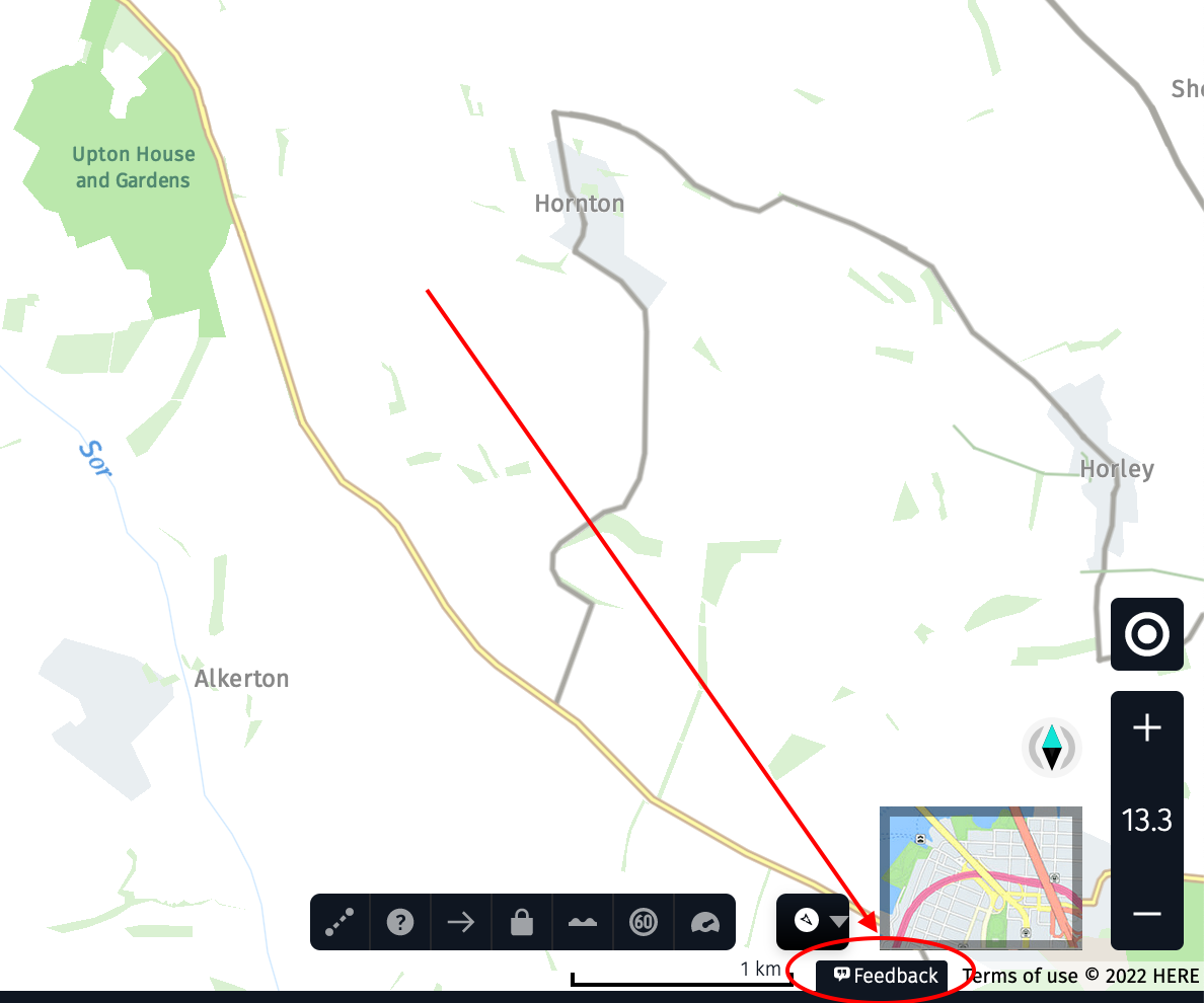
Let's see what happens... [twiddles thumbs]
-
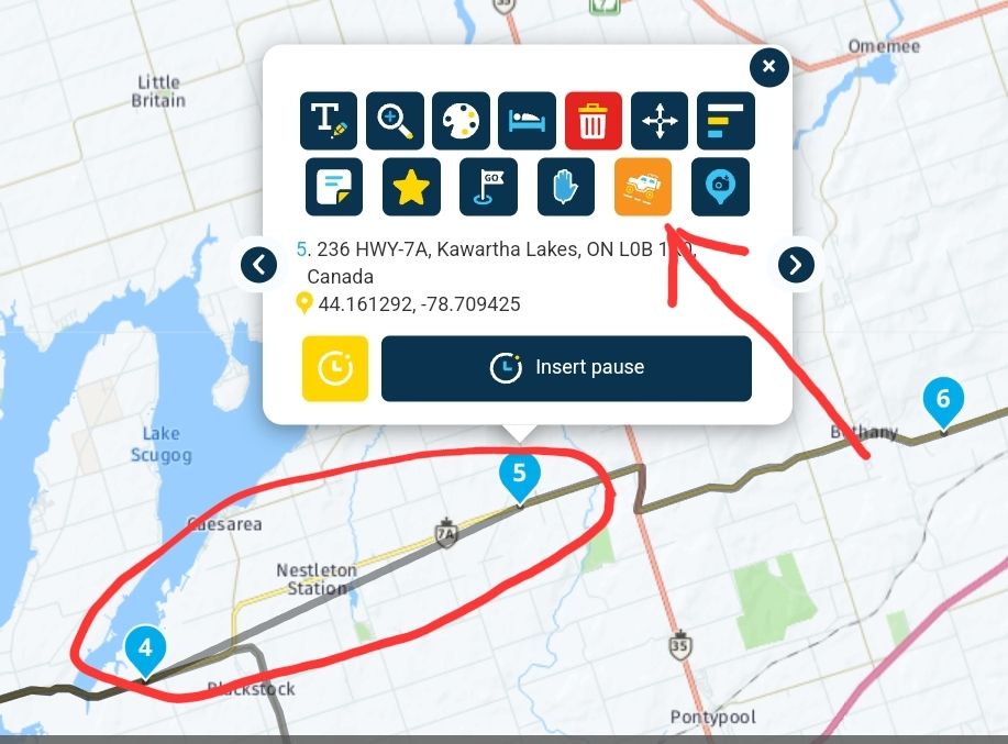
There is a way around the problem. Please a waypoint on either side of the problem area. Click on the higher waypoint and select "skip" and a direct connection will be made between the waypoints.
-
There is a way around the problem. Please a waypoint on either side of the problem area. Click on the higher waypoint and select "skip" and a direct connection will be made between the waypoints.

@Doug-Robinson Thank you for this, it worked for me. Let's see how it tracks in the real world this weekend.

