Hello from London
-
Hi folks, nice to be here.
I'm a new MRA user having always used paper maps for road trips before now. I use Google maps on my phone everyday to get from A to B but have never planned a longer trip this way before.
We are heading to the Balkans in the summer and I've put most of it on the app but have some problems. Would this be the correct place to ask for help?
I'll ask some questions here but if this is not the correct place then I'll try and move them. I very much appreciate you help.
-
I'm getting a ferry from Ancona to Corfu and the app routes to another Italian port before crossing the water. How do I stop this? At the moment I have my trip set up as two trips, one to Ancona and the other from Igoumenitsa in Greece where the main trip will start.
-
Is MRA compatible with Android Auto or will I just run a GPX file through the bikes satnav?
-
What map to use for planning? I use Michelin paper maps because of the green shadowing but am used to Google maps look as I use it everyday.
-
The route chosen in black obscures the road numbers and features, how do I see the detail and type of road?
-
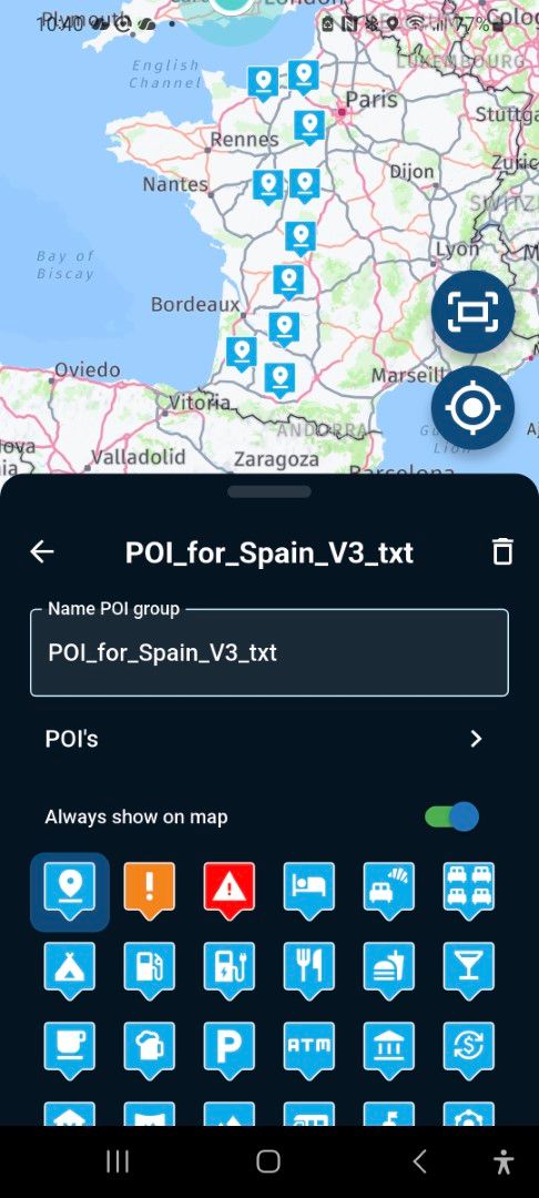
How can I mark what represents a 'day'? Some days have many waypoints, others none. I'd like to see what mileage is for each day, not just a cumulative.
-
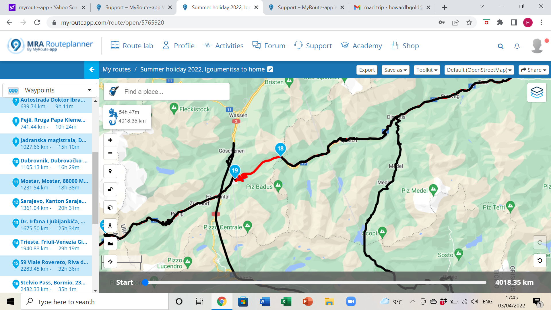
I have a specific problem with my route between Tujetsch and Andermatt. The route isn't taking me direct between my close waypoints, but when I compare with Tom Tom it shows the red route which is what I want. How do I force a change and get rid of the large detour?
I really hope you'll be able to help as I'd like to get this route sorted and then try some simple local routes to figure out the uploading and the re-routing process.
Thanks
Howard
-
-
Hi folks, nice to be here.
I'm a new MRA user having always used paper maps for road trips before now. I use Google maps on my phone everyday to get from A to B but have never planned a longer trip this way before.
We are heading to the Balkans in the summer and I've put most of it on the app but have some problems. Would this be the correct place to ask for help?
I'll ask some questions here but if this is not the correct place then I'll try and move them. I very much appreciate you help.
-
I'm getting a ferry from Ancona to Corfu and the app routes to another Italian port before crossing the water. How do I stop this? At the moment I have my trip set up as two trips, one to Ancona and the other from Igoumenitsa in Greece where the main trip will start.
-
Is MRA compatible with Android Auto or will I just run a GPX file through the bikes satnav?
-
What map to use for planning? I use Michelin paper maps because of the green shadowing but am used to Google maps look as I use it everyday.
-
The route chosen in black obscures the road numbers and features, how do I see the detail and type of road?
-
How can I mark what represents a 'day'? Some days have many waypoints, others none. I'd like to see what mileage is for each day, not just a cumulative.
-
I have a specific problem with my route between Tujetsch and Andermatt. The route isn't taking me direct between my close waypoints, but when I compare with Tom Tom it shows the red route which is what I want. How do I force a change and get rid of the large detour?
I really hope you'll be able to help as I'd like to get this route sorted and then try some simple local routes to figure out the uploading and the re-routing process.
Thanks
Howard
@howard-gold
Welcome Howard.
Have you looked around in the support section of the MRA Planner?
Almost all the answers at your questions will be found in the support section:
Support (click)Not that I don't want to help. But you can find much more information there that will be helpful for a starting user.
-
-
Hi folks, nice to be here.
I'm a new MRA user having always used paper maps for road trips before now. I use Google maps on my phone everyday to get from A to B but have never planned a longer trip this way before.
We are heading to the Balkans in the summer and I've put most of it on the app but have some problems. Would this be the correct place to ask for help?
I'll ask some questions here but if this is not the correct place then I'll try and move them. I very much appreciate you help.
-
I'm getting a ferry from Ancona to Corfu and the app routes to another Italian port before crossing the water. How do I stop this? At the moment I have my trip set up as two trips, one to Ancona and the other from Igoumenitsa in Greece where the main trip will start.
-
Is MRA compatible with Android Auto or will I just run a GPX file through the bikes satnav?
-
What map to use for planning? I use Michelin paper maps because of the green shadowing but am used to Google maps look as I use it everyday.
-
The route chosen in black obscures the road numbers and features, how do I see the detail and type of road?
-
How can I mark what represents a 'day'? Some days have many waypoints, others none. I'd like to see what mileage is for each day, not just a cumulative.
-
I have a specific problem with my route between Tujetsch and Andermatt. The route isn't taking me direct between my close waypoints, but when I compare with Tom Tom it shows the red route which is what I want. How do I force a change and get rid of the large detour?
I really hope you'll be able to help as I'd like to get this route sorted and then try some simple local routes to figure out the uploading and the re-routing process.
Thanks
Howard
@howard-gold said in Hello from London:
Hi folks, nice to be here.
Welcome @Howard-Gold
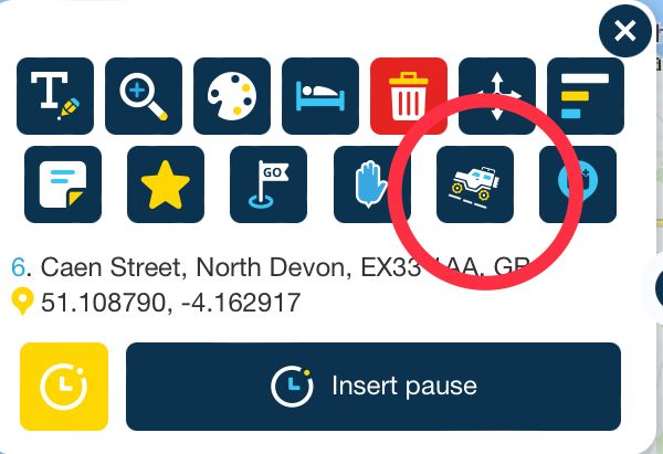
- I'm getting a ferry from Ancona to Corfu and the app routes to another Italian port before crossing the water. How do I stop this? At the moment I have my trip set up as two trips, one to Ancona and the other from Igoumenitsa in Greece where the main trip will start.
Two separate routes is probably the best solution but you could use the skip feature (looks like a 4x4 on the route point pop up). Use the skip function on the route point at the ferry port in Corfu. This effectively switches off routing and will draw a straight line.
- Is MRA compatible with Android Auto or will I just run a GPX file through the bikes satnav?
At the moment, MRA Navigation is not compatible with Android Auto.
- What map to use for planning? I use Michelin paper maps because of the green shadowing but am used to Google maps look as I use it everyday.
MRA Navigation uses the Here map so plan your routes on the Here map but you could use either Michelin or Google overlay maps for information whilst planning.
- The route chosen in black obscures the road numbers and features, how do I see the detail and type of road?
In the toolkit, use Route line transparency to adjust the strength of colour for the line.
- How can I mark what represents a 'day'? Some days have many waypoints, others none. I'd like to see what mileage is for each day, not just a cumulative.
Make separate routes for each day. You’ll find them easier to work on and they’ll load quicker.
Make your route public and share it here would be the easiest way to solve the problem
I have a specific problem with my route between Tujetsch and Andermatt. The route isn't taking me direct between my close waypoints, but when I compare with Tom Tom it shows the red route which is what I want. How do I force a change and get rid of the large detour?
Use the Here map and turn off Seasonal Closures.
Always willing to help if I can.
Triumph Tiger 1200 XRT called Tina.
MRA Navigation Next and SilverFox BJ8 -
-
@howard-gold
Welcome Howard.
Have you looked around in the support section of the MRA Planner?
Almost all the answers at your questions will be found in the support section:
Support (click)Not that I don't want to help. But you can find much more information there that will be helpful for a starting user.
@jack-van-tilburg Thanks Jack. I've spent the afternoon learning how to use the app and have discovered quite a bit but have much more to learn.
Regards
-
@howard-gold said in Hello from London:
Hi folks, nice to be here.
Welcome @Howard-Gold
- I'm getting a ferry from Ancona to Corfu and the app routes to another Italian port before crossing the water. How do I stop this? At the moment I have my trip set up as two trips, one to Ancona and the other from Igoumenitsa in Greece where the main trip will start.
Two separate routes is probably the best solution but you could use the skip feature (looks like a 4x4 on the route point pop up). Use the skip function on the route point at the ferry port in Corfu. This effectively switches off routing and will draw a straight line.
- Is MRA compatible with Android Auto or will I just run a GPX file through the bikes satnav?
At the moment, MRA Navigation is not compatible with Android Auto.
- What map to use for planning? I use Michelin paper maps because of the green shadowing but am used to Google maps look as I use it everyday.
MRA Navigation uses the Here map so plan your routes on the Here map but you could use either Michelin or Google overlay maps for information whilst planning.
- The route chosen in black obscures the road numbers and features, how do I see the detail and type of road?
In the toolkit, use Route line transparency to adjust the strength of colour for the line.
- How can I mark what represents a 'day'? Some days have many waypoints, others none. I'd like to see what mileage is for each day, not just a cumulative.
Make separate routes for each day. You’ll find them easier to work on and they’ll load quicker.
Make your route public and share it here would be the easiest way to solve the problem
I have a specific problem with my route between Tujetsch and Andermatt. The route isn't taking me direct between my close waypoints, but when I compare with Tom Tom it shows the red route which is what I want. How do I force a change and get rid of the large detour?
Use the Here map and turn off Seasonal Closures.
@nick-carthew said in Hello from London:
d of the large detour?
Use the Here map and turn off Seasonal Closures.
Hi Nick,
Thanks for your detailed help, some good tips there which have helped me greatly.
I'm trying to understand shaping points and it seems they are the same as Via points, is this correct? I like the idea of having way points at the start and finish of each day with shaping points inbetween so I can see the day's mileage. I take your point though about each day being a route of its own.
Think I'll make a local loop with many points to see how the satnav responds.
Also, to email the route to myself and my girlfriend I had to make the route public. I was then concerned that my start point/ address was on it so made it private again. Any way around this?
Thanks very much for your help.
Howard
-
@nick-carthew said in Hello from London:
d of the large detour?
Use the Here map and turn off Seasonal Closures.
Hi Nick,
Thanks for your detailed help, some good tips there which have helped me greatly.
I'm trying to understand shaping points and it seems they are the same as Via points, is this correct? I like the idea of having way points at the start and finish of each day with shaping points inbetween so I can see the day's mileage. I take your point though about each day being a route of its own.
Think I'll make a local loop with many points to see how the satnav responds.
Also, to email the route to myself and my girlfriend I had to make the route public. I was then concerned that my start point/ address was on it so made it private again. Any way around this?
Thanks very much for your help.
Howard
@howard-gold said in Hello from London:
@nick-carthew said in Hello from London:
d of the large detour?
Use the Here map and turn off Seasonal Closures.
Hi Nick,
Thanks for your detailed help, some good tips there which have helped me greatly.
You’re welcome
I'm trying to understand shaping points and it seems they are the same as Via points, is this correct? I like the idea of having way points at the start and finish of each day with shaping points inbetween so I can see the day's mileage. I take your point though about each day being a route of its own.
Shaping points (hand shape) are different from shaping points and must be visited. MRA Navigation can automatically skip one shaping point if it is missed. The app will re-route when you are closer to the next route point.
Think I'll make a local loop with many points to see how the satnav responds.
Also, to email the route to myself and my girlfriend I had to make the route public. I was then concerned that my start point/ address was on it so made it private again. Any way around this?
Set your start and finish point away from your address.
-
Hi folks, nice to be here.
I'm a new MRA user having always used paper maps for road trips before now. I use Google maps on my phone everyday to get from A to B but have never planned a longer trip this way before.
We are heading to the Balkans in the summer and I've put most of it on the app but have some problems. Would this be the correct place to ask for help?
I'll ask some questions here but if this is not the correct place then I'll try and move them. I very much appreciate you help.
-
I'm getting a ferry from Ancona to Corfu and the app routes to another Italian port before crossing the water. How do I stop this? At the moment I have my trip set up as two trips, one to Ancona and the other from Igoumenitsa in Greece where the main trip will start.
-
Is MRA compatible with Android Auto or will I just run a GPX file through the bikes satnav?
-
What map to use for planning? I use Michelin paper maps because of the green shadowing but am used to Google maps look as I use it everyday.
-
The route chosen in black obscures the road numbers and features, how do I see the detail and type of road?
-
How can I mark what represents a 'day'? Some days have many waypoints, others none. I'd like to see what mileage is for each day, not just a cumulative.
-
I have a specific problem with my route between Tujetsch and Andermatt. The route isn't taking me direct between my close waypoints, but when I compare with Tom Tom it shows the red route which is what I want. How do I force a change and get rid of the large detour?
I really hope you'll be able to help as I'd like to get this route sorted and then try some simple local routes to figure out the uploading and the re-routing process.
Thanks
Howard
Hello Howard, the road between Tujetsch and Andermatt is closed, see the black lines on the road. You can make the traffic layer visible via the maplayers
If you use the season closures option, the route will go over this stretch, as @Nick indicated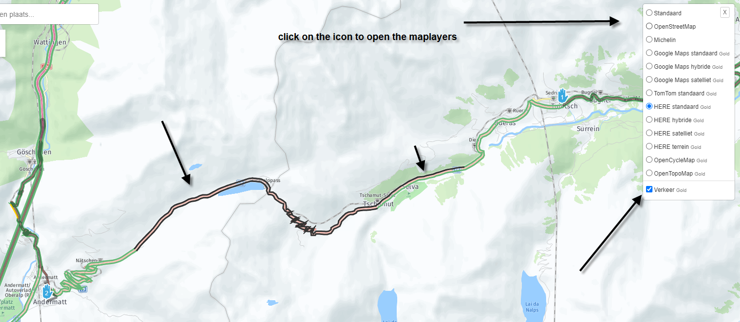
-
Hello! It looks like you're interested in this conversation, but you don't have an account yet.
Getting fed up of having to scroll through the same posts each visit? When you register for an account, you'll always come back to exactly where you were before, and choose to be notified of new replies (either via email, or push notification). You'll also be able to save bookmarks and upvote posts to show your appreciation to other community members.
With your input, this post could be even better 💗
Register Login-
115127
-
027744
-
36101
-
111222
-
0439
-
0462
-
07204
-
0358