Export 1.2 gpx
-
@Hans-van-de-Ven-MRA-Master
It's not the right solution for Garmin XT users
The beta version of the 1.2, respected start, via and stop points
The releasede 1.2 version, remove the via points, only showing the start and stop points.The 1.1 version, do not support the stop points, they are showed as a Via point, so this suggestion is also a step back.
So the Beta version of the 1.2 export worked better
")
Link to my short test route:
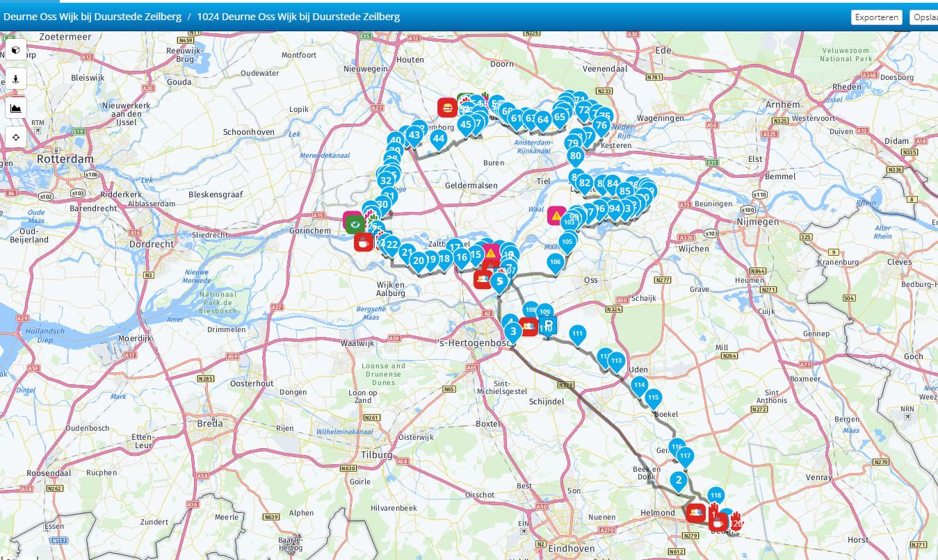
https://www.myrouteapp.com/en/social/route/5379044?mode=share@Henrik-Müller @Hans-van-de-Ven-MRA-Master I have found the same problem too. Only showing stop points and no via points. I agree with Henrik that the beta version was just what Zumo XT users needed. Something has changed with the released 1.2 version and this version, with no via points, is not what I expected given the previous beta.
Kind Regards. Help where I can.
Ducati Multistrada V4 Rally
iPhone 15 Pro
CHIGEE AIO-6 LTE
Google Pixel 6 Pro - mounted on SP Connect Plus
Ex Garmin XT2 and XT1 as well as Ex TomTom Rider User -
@Henrik-Müller @Hans-van-de-Ven-MRA-Master I have found the same problem too. Only showing stop points and no via points. I agree with Henrik that the beta version was just what Zumo XT users needed. Something has changed with the released 1.2 version and this version, with no via points, is not what I expected given the previous beta.
@Dave-J-0 and @Henrik-Müller and @Guzt
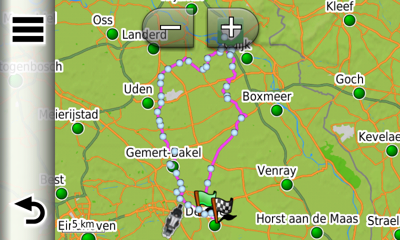
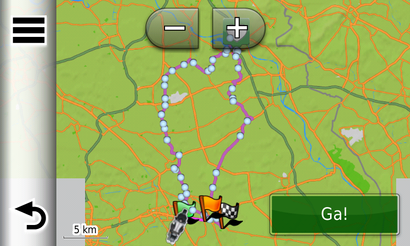
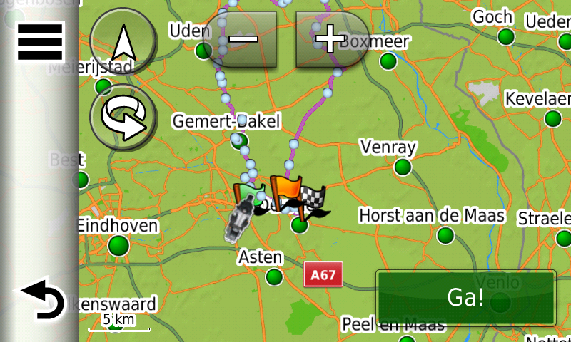
Take a look at my track and route.
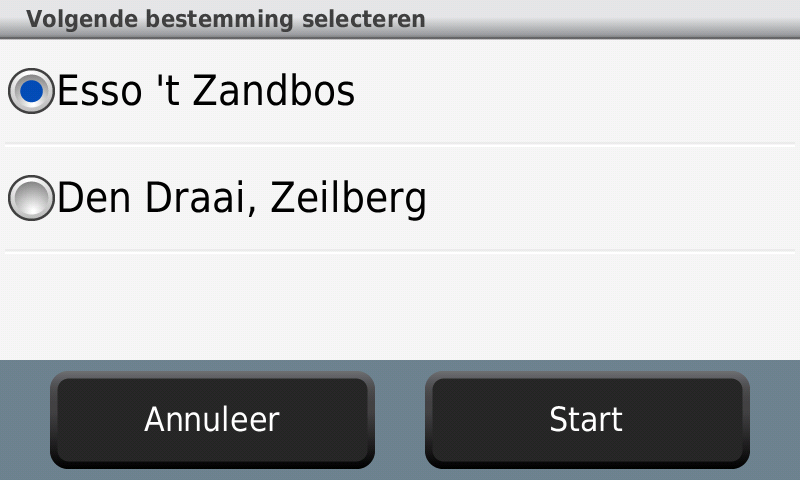
Route via connector to my XT
Route with via points:
Track with only start and finish
Route in MRA planner:
As you can see, it works fine
Garmin Zumo XT3/XT2/XT/BMW Connected Ride Navigator/Tourstart/ MyRouteapp (The App)/...
Een dag niet gelachen is een dag niet geleefd / Een route is net zo goed als deze uitgezet is. -
@Dave-J-0 and @Henrik-Müller and @Guzt
Take a look at my track and route.
Route via connector to my XT
Route with via points:
Track with only start and finish
Route in MRA planner:
As you can see, it works fine
@Hans-van-de-Ven-MRA-Master
@Guzt @Dave-J-0Hi Hans
I can do the same, place a lot of stop flags, but via/sharping points are "MRA" way to do the planning, and add stop points a lunch stops etc.
Again, the BETA version did it "right", the released dont, so I think it's a step back in the export function
/ Henrik
-
@Hans-van-de-Ven-MRA-Master
@Guzt @Dave-J-0Hi Hans
I can do the same, place a lot of stop flags, but via/sharping points are "MRA" way to do the planning, and add stop points a lunch stops etc.
Again, the BETA version did it "right", the released dont, so I think it's a step back in the export function
/ Henrik
This export works for a the Zumo / BMW navigator with the NTU map, Zumo’s / BMW Navigator with the NT map needs a bit more investigation.
Why do you want shapingpoints in the XT or other Zumo’s?Garmin Zumo XT3/XT2/XT/BMW Connected Ride Navigator/Tourstart/ MyRouteapp (The App)/...
Een dag niet gelachen is een dag niet geleefd / Een route is net zo goed als deze uitgezet is. -
This export works for a the Zumo / BMW navigator with the NTU map, Zumo’s / BMW Navigator with the NT map needs a bit more investigation.
Why do you want shapingpoints in the XT or other Zumo’s?@Hans-van-de-Ven-MRA-Master
I dont know the terms NTU or NT maps?
Why:
-
Looking at the XT screen the small dots (Via points) are more discrete than the orange pole and flag
-
As I remember, my XT will give me a verbal notifikation when I use stop points, and having a route with a lot points will give a lot useless information,
3, The shaping point is the standard point at MRA, changing them into Stop point are not preferable.
Again, it worked in the Beta version
My question is why have the MRA team changed it?
/ Henrik
-
-
@Hans-van-de-Ven-MRA-Master
I dont know the terms NTU or NT maps?
Why:
-
Looking at the XT screen the small dots (Via points) are more discrete than the orange pole and flag
-
As I remember, my XT will give me a verbal notifikation when I use stop points, and having a route with a lot points will give a lot useless information,
3, The shaping point is the standard point at MRA, changing them into Stop point are not preferable.
Again, it worked in the Beta version
My question is why have the MRA team changed it?
/ Henrik
The flags are the viapoints and they are called by your XT, the small dots are shapingpoints and they where only visible in the XT
-
-
@Hans-van-de-Ven-MRA-Master
I dont know the terms NTU or NT maps?
Why:
-
Looking at the XT screen the small dots (Via points) are more discrete than the orange pole and flag
-
As I remember, my XT will give me a verbal notifikation when I use stop points, and having a route with a lot points will give a lot useless information,
3, The shaping point is the standard point at MRA, changing them into Stop point are not preferable.
Again, it worked in the Beta version
My question is why have the MRA team changed it?
/ Henrik
You can create your route as usual, with shaping and viapoints, only the viapoints are visible on the XT.
You can see it as a track with viapoints , but the shapingpoints shape the route.Garmin Zumo XT3/XT2/XT/BMW Connected Ride Navigator/Tourstart/ MyRouteapp (The App)/...
Een dag niet gelachen is een dag niet geleefd / Een route is net zo goed als deze uitgezet is. -
-
You can create your route as usual, with shaping and viapoints, only the viapoints are visible on the XT.
You can see it as a track with viapoints , but the shapingpoints shape the route.@Hans-van-de-Ven-MRA-Master
I have to agree with all the other users who are saying that we want to actually see the shaping points (Blue Dots) on the XT map.
As we could on the XT with the previous Beta version.
My personal preference is to never use Via Points.
When I create a new route I don’t know at what point I might need a coffee or at what point in time I am going to get hungry.
I like to make those decisions whilst actually riding the route.
What do i do if I want to skip part of the of the route for some reason?
If we can’t see the shaping points how can we skip them?You don’t stop riding when you get old, you get old when you stop riding.
-
@Hans-van-de-Ven-MRA-Master
I have to agree with all the other users who are saying that we want to actually see the shaping points (Blue Dots) on the XT map.
As we could on the XT with the previous Beta version.
My personal preference is to never use Via Points.
When I create a new route I don’t know at what point I might need a coffee or at what point in time I am going to get hungry.
I like to make those decisions whilst actually riding the route.
What do i do if I want to skip part of the of the route for some reason?
If we can’t see the shaping points how can we skip them?@Steve-Lynch
Hi @Steve,If you never use waypoints in your route, you can simply use the track gpx 1.1 (Track and POI) or the track sent with the gpx 1.2 and have your Navigati convert it into a journey. Make the track visible and, if you want to skip a part of the route, you can drive back to the planned route.
The formation points are no longer visible and have already been skipped automatically.Garmin Zumo XT3/XT2/XT/BMW Connected Ride Navigator/Tourstart/ MyRouteapp (The App)/...
Een dag niet gelachen is een dag niet geleefd / Een route is net zo goed als deze uitgezet is. -
@Steve-Lynch
Hi @Steve,If you never use waypoints in your route, you can simply use the track gpx 1.1 (Track and POI) or the track sent with the gpx 1.2 and have your Navigati convert it into a journey. Make the track visible and, if you want to skip a part of the route, you can drive back to the planned route.
The formation points are no longer visible and have already been skipped automatically.@Hans-van-de-Ven-MRA-Master
Hi Hans
Just for clarity it is just Via Points that I never use for the reasons stated above.
I can still get my shaping points visible by using the 1.0 export and selecting the convert option as below.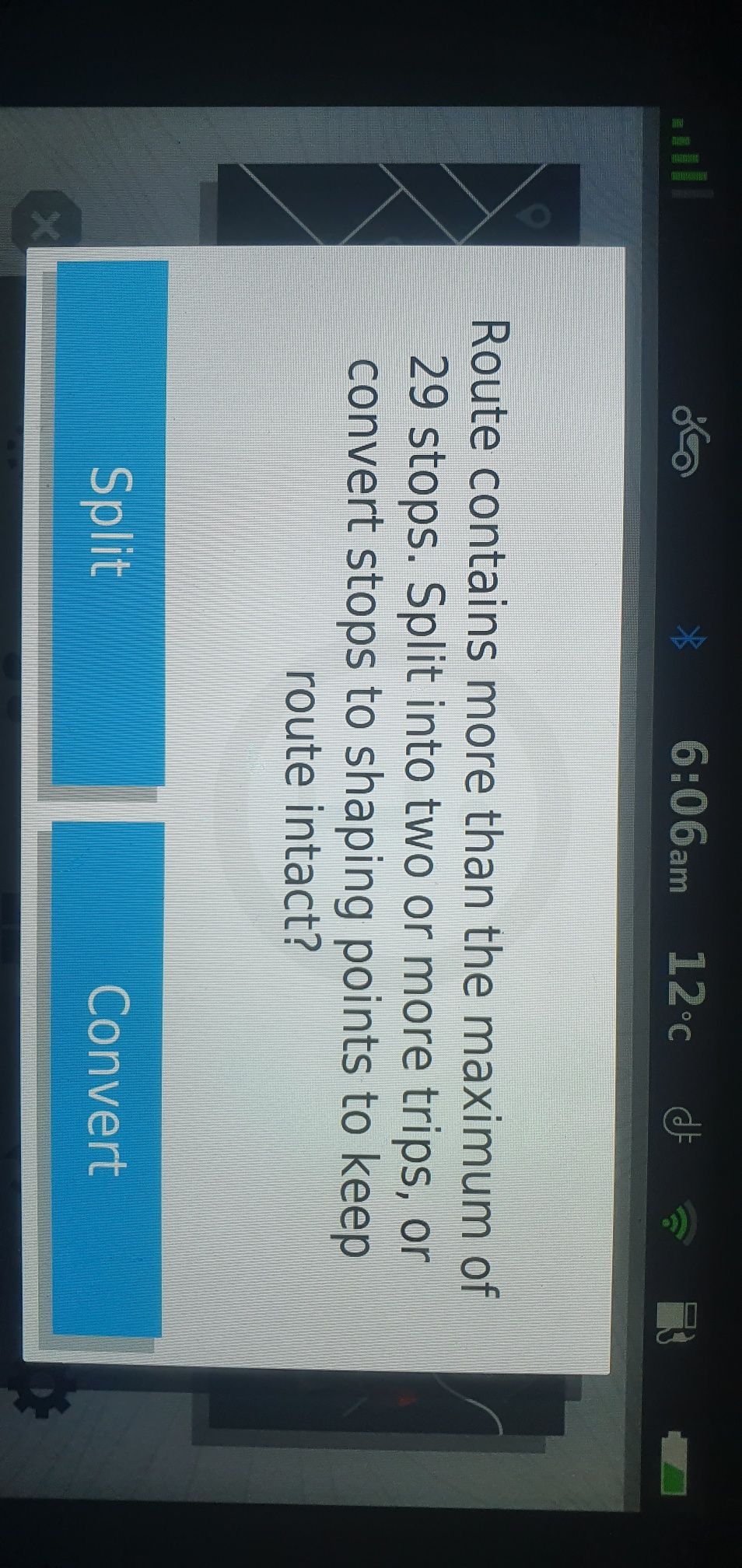
-
@Steve-Lynch
Hi @Steve,If you never use waypoints in your route, you can simply use the track gpx 1.1 (Track and POI) or the track sent with the gpx 1.2 and have your Navigati convert it into a journey. Make the track visible and, if you want to skip a part of the route, you can drive back to the planned route.
The formation points are no longer visible and have already been skipped automatically.@Hans-van-de-Ven-MRA-Master I think you are missing the point that we liked how the beta version worked and the change with the released version is not what we expected. Why can we not have back the previous beta export functionality (blue dots on my XT as well as via/waypoints)? You may not agree but a lot of us liked having these exported and visible for our own different reasons and different nav use.
Kind Regards. Help where I can.
Ducati Multistrada V4 Rally
iPhone 15 Pro
CHIGEE AIO-6 LTE
Google Pixel 6 Pro - mounted on SP Connect Plus
Ex Garmin XT2 and XT1 as well as Ex TomTom Rider User -
@Hans-van-de-Ven-MRA-Master I think you are missing the point that we liked how the beta version worked and the change with the released version is not what we expected. Why can we not have back the previous beta export functionality (blue dots on my XT as well as via/waypoints)? You may not agree but a lot of us liked having these exported and visible for our own different reasons and different nav use.
I understand the question about the formation points, but the choice to change the gpx 1.1 (Beta) is that it can now be used for all Zumo devices with the NTU card (XT, 590, 346, BMW Navigator 6), and there is no need to create a separate gpx file for each Zumo.
You can only put 29 waypoints in a route today without the Zumo splitting them.
What do you use the formation points for if I may ask Dave?Garmin Zumo XT3/XT2/XT/BMW Connected Ride Navigator/Tourstart/ MyRouteapp (The App)/...
Een dag niet gelachen is een dag niet geleefd / Een route is net zo goed als deze uitgezet is. -
@Hans-van-de-Ven-MRA-Master I think you are missing the point that we liked how the beta version worked and the change with the released version is not what we expected. Why can we not have back the previous beta export functionality (blue dots on my XT as well as via/waypoints)? You may not agree but a lot of us liked having these exported and visible for our own different reasons and different nav use.
@Dave-J-0
Hi Dave,If you use / import route from the gpx 1.0 and gpx 1.1 into your Zumo, all formation points are seen as waypoints, therefore you will get the message that the route is being split.
The advice was always to use the Track. With the release of the XT, the Beta version of the gpx 1.1 was used to test whether
the via points could be worked. So the waypoints only worked on the XT, but not on the older Zumos because all formation points were seen as waypoints, and you don't want that either. How Garmin handles this is Garmin's secret and they won't reveal it.I will submit the request for Beta version for the XT to MRA.
Garmin Zumo XT3/XT2/XT/BMW Connected Ride Navigator/Tourstart/ MyRouteapp (The App)/...
Een dag niet gelachen is een dag niet geleefd / Een route is net zo goed als deze uitgezet is. -
I understand the question about the formation points, but the choice to change the gpx 1.1 (Beta) is that it can now be used for all Zumo devices with the NTU card (XT, 590, 346, BMW Navigator 6), and there is no need to create a separate gpx file for each Zumo.
You can only put 29 waypoints in a route today without the Zumo splitting them.
What do you use the formation points for if I may ask Dave?@Hans-van-de-Ven-MRA-Master I use via/flag points as definite stops that I must get too for facilities and RV. The formation/shaping allows me to see the points that I had planned to ‘go through’ but I can skip one or more of these on the device if I need/want with the device then recalculating to the next formation point - I can also see the points on the map overview if I am looking on how many I need/want to skip. Having just a track showing in the background means I have to manually route back to the track further along with the device trying to route me back to the original track and/or next via (not sure as I have not tried live yet). I do have the track on in the background as a safeguard against strange routing calculation that devices can do ‘on the day’ but, for me, a whole level of functionality has been removed by not having the formation/shaping points included in the ‘trip’. I am aware that there is a limit to via/waypoints on Zumo but you can have a large number of formation/shaping points between these via points. I have also had a TomTom previously where track was king but the Zumo works differently and it took me a while to get used to this different approach but I now like it. I hope this all makes sense.
I understand that you want a common export for Zumo models but this change from the beta is forcing me to use my device in a backward step way. I am somewhat disappointed with what was released from what I had come to expect from the beta. MRA was my Basecamp(yuk) alternative and it worked well, please find a way to re-implement what we had in the beta.
-
@Dave-J-0
Hi Dave,If you use / import route from the gpx 1.0 and gpx 1.1 into your Zumo, all formation points are seen as waypoints, therefore you will get the message that the route is being split.
The advice was always to use the Track. With the release of the XT, the Beta version of the gpx 1.1 was used to test whether
the via points could be worked. So the waypoints only worked on the XT, but not on the older Zumos because all formation points were seen as waypoints, and you don't want that either. How Garmin handles this is Garmin's secret and they won't reveal it.I will submit the request for Beta version for the XT to MRA.
@Hans-van-de-Ven-MRA-Master said in Export 1.2 gpx:
I will submit the request for Beta version for the XT to MRA.
Thank you Hans.

-
Today I have tested the new GPX 1.2 format with my ZumoXT. If you use this format, the newcalculation must swiched off. Otherwise the route will be destroyed.
I have created a route only with shaping point ( points without alarm). After the import into my ZumoXT via Garmin Drive app the route was exactly the same as planned in MRA. Everything looks good. Then I forces the ZumoXT to a new calculation. This ends up with a route from start to destination. In my case from home start to home. The route was only 100 m long.
When I use a route in the older beta formart then a new calculation follows the shaping points.
Conclusion: MRA shold use the shapingpoints in the GPX 1.2 format.Kindly regards
ReinhardMontana 700i and Mac
-
Today I have tested the new GPX 1.2 format with my ZumoXT. If you use this format, the newcalculation must swiched off. Otherwise the route will be destroyed.
I have created a route only with shaping point ( points without alarm). After the import into my ZumoXT via Garmin Drive app the route was exactly the same as planned in MRA. Everything looks good. Then I forces the ZumoXT to a new calculation. This ends up with a route from start to destination. In my case from home start to home. The route was only 100 m long.
When I use a route in the older beta formart then a new calculation follows the shaping points.
Conclusion: MRA shold use the shapingpoints in the GPX 1.2 format.Thanks for the reply. If you don't use via-points (point with alarm) then it is better to use the track.
-
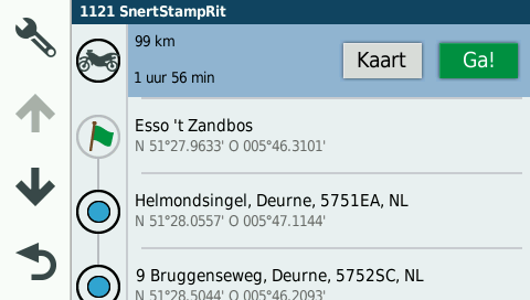
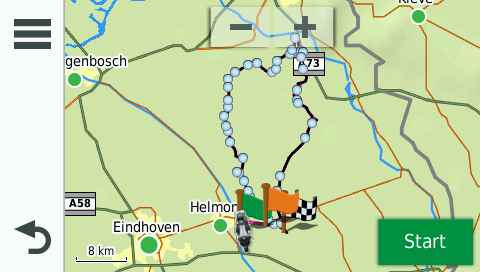
Hi all,
From the developers, if you don't use via-points, you can use the gpx 1.1 file.
I did a small test with a route, starting from home to the first point of the route, with recalculation ON.
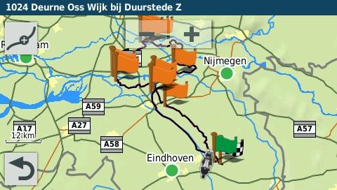
The route is NOT distroyed, see pictures below: (tack is black in the background)Route exported as Garmin Zumo gpx 1.1, all the shaping points are there.
The route in my XT.
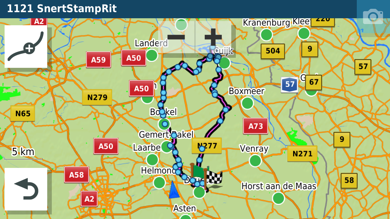
The route, recalculated from my home to the first point on the route:
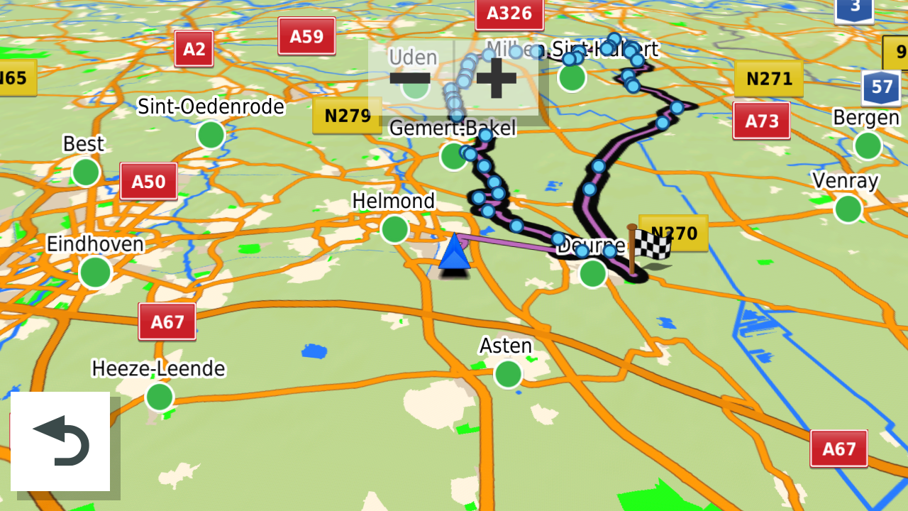
Only the via-points are not in this file,
Special for the users who want via-points (places where you will sop or drive by) is the Garmin Zumo gpx 1.2 file
The gpx 1.2 is basicly an Unflagged routeHope this wil help?
-
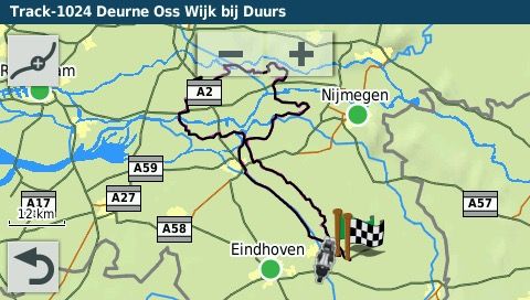
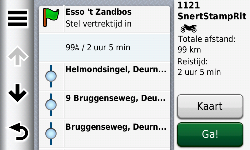
Hi all, test in the Zumo 346 gpx 1.1
The route with shaping points:
Route as picture:
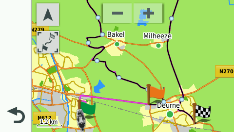
Option to start the route, DO NOT CHOOSE THE END POINT!, because you wil be directed to the end point.
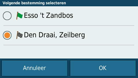
Choose the starting point of the route!
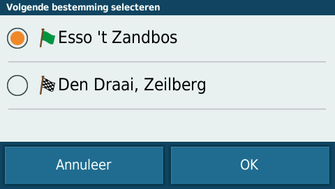
Directed to the startpoint and the route is not destroyed.
-
Hi all, test in de BMW Navigator 6 with the gpx 1.1 file
Route with shaping points:
Route as picture
Start option, choose the start location
route = OK
Directed to the start location and route is not destroyed.
Hello! It looks like you're interested in this conversation, but you don't have an account yet.
Getting fed up of having to scroll through the same posts each visit? When you register for an account, you'll always come back to exactly where you were before, and choose to be notified of new replies (either via email, or push notification). You'll also be able to save bookmarks and upvote posts to show your appreciation to other community members.
With your input, this post could be even better 💗
Register Login-
7723.3k
-
09135
-
120546
-
316924
-
04114
-
05170
-
04106
-
-15208