help with Garmin Zumo XT
-
@Marinus-van-Deudekom VICTORY!!!
I got it to work. I'm not sure how do delete Garmin explore from the xt. I deleted it from my phone though. I reset the xt but not sure if it was a factory reset or not. But, I got the route to go over to the xt and when it worked as it should it was fast. It imported tracks and a route. I assume that I would use the route in trip planner to navigate for turn by turn directions? Thanks again for your help.@Mike-wiruth said in help with Garmin Zumo XT:
I'm not sure how do delete Garmin explore from the xt.
hi,
i seem to rmemeber when i used an XT the explore did create problems, but you now know this.
it has been quite a while since i owned an XT, but off memory, you have to reset the drive app and when you get to the explore part it ask do you want install explore, i think there was was a box for "maybe later", click on this box.
i did write an explanation of how to do this but can't remember if it was on here or the zumo forum, which has a link above, i will have look and post the thread -
hi @Mike-wiruth
just found this which was written by the font of knowledge on the zumo forum explaining how to get rid of explore.
https://www.zumouserforums.co.uk/app.php/ZXT-P56
this is also has an effect on viewing the routes/tracks in the XT menus, but thankfully i do not have to put up with the nuances of the XT any longer thanks to MRA
-
hi @Mike-wiruth
just found this which was written by the font of knowledge on the zumo forum explaining how to get rid of explore.
https://www.zumouserforums.co.uk/app.php/ZXT-P56
this is also has an effect on viewing the routes/tracks in the XT menus, but thankfully i do not have to put up with the nuances of the XT any longer thanks to MRA
@paul69 have had similar problems to you with an XT2 and the awful Tread App changing routes and points as a result of the app and device sync. Garmin have really not done a good job with the software for a very good device.
XT2 is a backup now with me relying on MRA on a CarPlay display. Working a treat and the new changes are brilliant.
-
@paul69 have had similar problems to you with an XT2 and the awful Tread App changing routes and points as a result of the app and device sync. Garmin have really not done a good job with the software for a very good device.
XT2 is a backup now with me relying on MRA on a CarPlay display. Working a treat and the new changes are brilliant.
@Dave-J-0 said in help with Garmin Zumo XT:
XT2 is a backup now with me relying on MRA on a CarPlay display. Working a treat and the new changes are brilliant.
i took this route too a couple of years ago, but the XT has long gone now.
I believe that MRA is a really good piece of software and once oyu get used to using it ther are very little if any issues.
recently did a 2000m tour of Scottish Highland and Lake district, without a hitch, all pre planned routes worked as they should, i also had to use the in app route planner due to road closure and this also worked superbly, and this was only in beta stage at that point. -
@Marinus-van-Deudekom I deleted Garmin Explore from my phone. I then went to my navigator and am in the process of wirelessly sending the file to my xp via Garmin Drive. It takes forever. This is a simple route that I created to test it. Seems to be hung up.
@Mike-wiruth The transfer from Garmin Drive to the XT should be almost instant.
-
@Mzokk Great information, can you post the link for the Garmin forum that you use? I got the XT because my other garmin kept changing my custom route if I took a wrong turn or stopped for gas. Very frustrating. I'm excited about making custom routes in MRA. I just have to get it all figured out on the best method to import it to my XT. Right now I just plug in my xt and drop the file into the gpx folder. Garmin explore doesn't seem to work with the xp. It says that the xt in not a supported device. I have some confusion on what file type to download is as. 1.1 gpx route, track, poi????? And when I open it on the XT if I need to open it in the trip planner or track or what. Can you help with that explaining the method you use? Thanks very much for taking the time to reply and thanks in advance for any help you can give me.
@Mike-wiruth the method I use to transfer routes and navigate using the XT are as follows.
I usually plot my routes on the computer screen (unless I'm on tour) as its easier to work with a 27" screen that a phone. I transfer my routes from the phone to the XT via the App.
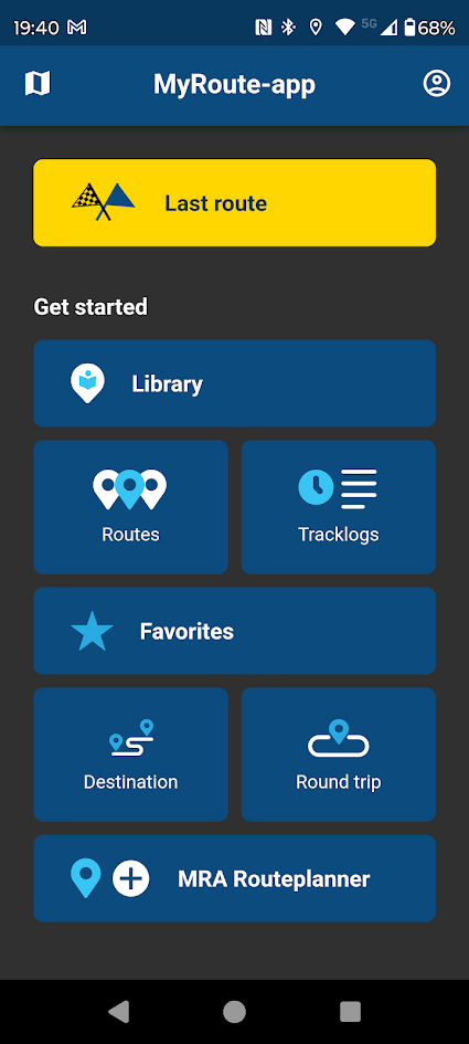
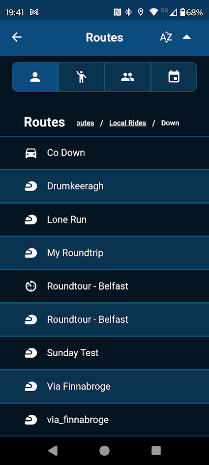
This is not an ideal route but will illustrate some issues that can arise with the XT
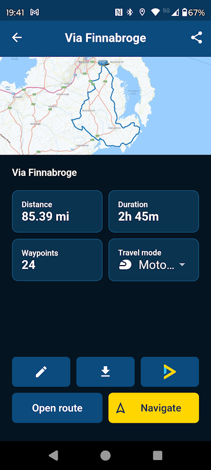
I download using GPX1.1 because this shows how you shaped the route using MRA and allows you to fix a route that does not go where you want on the XT. I also download the track of the route which will be as planned in MRA.
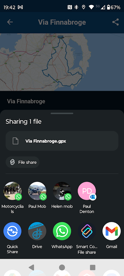
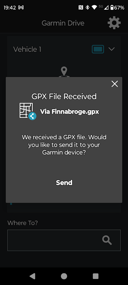
Route Received
![c7acc4d1-fc0d-43dc-ab25-19170a267ed7-17707[1].png](/assets/uploads/files/1724509876255-c7acc4d1-fc0d-43dc-ab25-19170a267ed7-17707-1.png)
Track Received
![e4f6a43b-a21c-4d68-826f-a95d84e17ce2-17294[2].png](/assets/uploads/files/1724509970280-e4f6a43b-a21c-4d68-826f-a95d84e17ce2-17294-2.png)
![3fc9385f-e0f3-468a-b15c-2c9dadf17506-20128[1].png](/assets/uploads/files/1724510168363-3fc9385f-e0f3-468a-b15c-2c9dadf17506-20128-1.png)
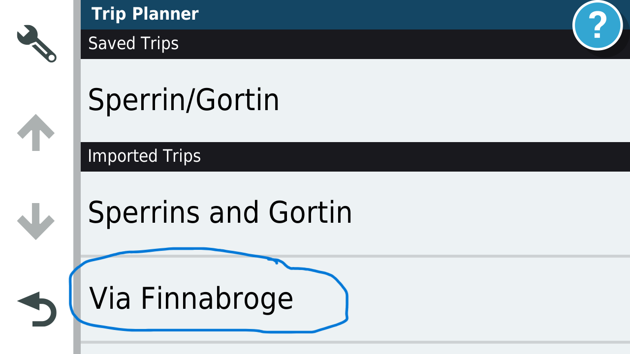
Open Trip planner route will be in list.
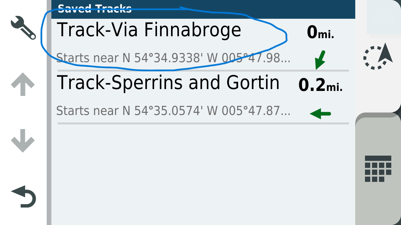
Track is in list.
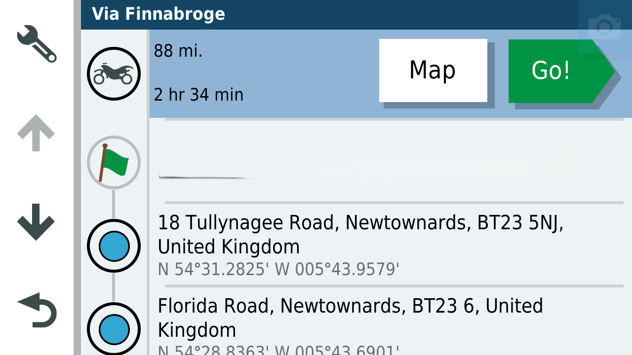
Open Route (Address near my house removed)
Open Track Default is blue but I change the colour to yellow.
![ba1b8f79-1756-4191-a27d-aca5296c87b1-31106[1].png](/assets/uploads/files/1724510507396-ba1b8f79-1756-4191-a27d-aca5296c87b1-31106-1.png)
Open the route and Track and make the track visible on the XT
![401edf8a-d088-40ed-b251-c9b2aa2188cc-36293[1].png](/assets/uploads/files/1724510639932-401edf8a-d088-40ed-b251-c9b2aa2188cc-36293-1.png)
You can see that I wanted to go along the coast but the XT's routing logic is taking me back to a town and then back to the intended route as designed. This can be fixed by putting in an extra shaping point in the XT.
![1f227e02-3dfa-4225-80c1-d45a27ea51ea-40542[1].png](/assets/uploads/files/1724510785674-1f227e02-3dfa-4225-80c1-d45a27ea51ea-40542-1.png)
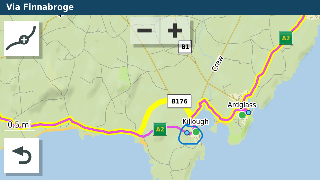
Or by ensuring there are enough waypoints in the route you designed in MRA.
I created a bespoke map theme for my XT that makes the Track line thicker and this can be seen below the route line even when navigating. It gives a heads up if the XT is going away from your intended route. I keep recalculate on the unit as "Prompted" and only use recalculate if I can't navigate back to my intended route using the screen. -
@Mike-wiruth the method I use to transfer routes and navigate using the XT are as follows.
I usually plot my routes on the computer screen (unless I'm on tour) as its easier to work with a 27" screen that a phone. I transfer my routes from the phone to the XT via the App.


This is not an ideal route but will illustrate some issues that can arise with the XT

I download using GPX1.1 because this shows how you shaped the route using MRA and allows you to fix a route that does not go where you want on the XT. I also download the track of the route which will be as planned in MRA.


Route Received
![c7acc4d1-fc0d-43dc-ab25-19170a267ed7-17707[1].png](/assets/uploads/files/1724509876255-c7acc4d1-fc0d-43dc-ab25-19170a267ed7-17707-1.png)
Track Received
![e4f6a43b-a21c-4d68-826f-a95d84e17ce2-17294[2].png](/assets/uploads/files/1724509970280-e4f6a43b-a21c-4d68-826f-a95d84e17ce2-17294-2.png)
![3fc9385f-e0f3-468a-b15c-2c9dadf17506-20128[1].png](/assets/uploads/files/1724510168363-3fc9385f-e0f3-468a-b15c-2c9dadf17506-20128-1.png)
Open Trip planner route will be in list.

Track is in list.

Open Route (Address near my house removed)

Open Track Default is blue but I change the colour to yellow.
![ba1b8f79-1756-4191-a27d-aca5296c87b1-31106[1].png](/assets/uploads/files/1724510507396-ba1b8f79-1756-4191-a27d-aca5296c87b1-31106-1.png)
Open the route and Track and make the track visible on the XT
![401edf8a-d088-40ed-b251-c9b2aa2188cc-36293[1].png](/assets/uploads/files/1724510639932-401edf8a-d088-40ed-b251-c9b2aa2188cc-36293-1.png)
You can see that I wanted to go along the coast but the XT's routing logic is taking me back to a town and then back to the intended route as designed. This can be fixed by putting in an extra shaping point in the XT.
![1f227e02-3dfa-4225-80c1-d45a27ea51ea-40542[1].png](/assets/uploads/files/1724510785674-1f227e02-3dfa-4225-80c1-d45a27ea51ea-40542-1.png)

Or by ensuring there are enough waypoints in the route you designed in MRA.
I created a bespoke map theme for my XT that makes the Track line thicker and this can be seen below the route line even when navigating. It gives a heads up if the XT is going away from your intended route. I keep recalculate on the unit as "Prompted" and only use recalculate if I can't navigate back to my intended route using the screen.@Mzokk said in help with Garmin Zumo XT:
Track is in list.
please correct me if i am wrong, as i have not had an XT for some time now
but off memory, you would not be able to see the track in the tracks menu if explore was running, hence why i posted the link to thread explaining how to remove explore.but I am only guessing from memeory as I do not have an XT, so maybe my input is pointless
-
hi,
the above wording does not make my query clearIf explore is running and you send track and routes as either 1.2 or 1.1 to the XT using drive app, am i correct in thinking the tracks cannot be seen in the tracks menu.
yes that makes more sense
-
@Mike-wiruth the method I use to transfer routes and navigate using the XT are as follows.
I usually plot my routes on the computer screen (unless I'm on tour) as its easier to work with a 27" screen that a phone. I transfer my routes from the phone to the XT via the App.


This is not an ideal route but will illustrate some issues that can arise with the XT

I download using GPX1.1 because this shows how you shaped the route using MRA and allows you to fix a route that does not go where you want on the XT. I also download the track of the route which will be as planned in MRA.


Route Received
![c7acc4d1-fc0d-43dc-ab25-19170a267ed7-17707[1].png](/assets/uploads/files/1724509876255-c7acc4d1-fc0d-43dc-ab25-19170a267ed7-17707-1.png)
Track Received
![e4f6a43b-a21c-4d68-826f-a95d84e17ce2-17294[2].png](/assets/uploads/files/1724509970280-e4f6a43b-a21c-4d68-826f-a95d84e17ce2-17294-2.png)
![3fc9385f-e0f3-468a-b15c-2c9dadf17506-20128[1].png](/assets/uploads/files/1724510168363-3fc9385f-e0f3-468a-b15c-2c9dadf17506-20128-1.png)
Open Trip planner route will be in list.

Track is in list.

Open Route (Address near my house removed)

Open Track Default is blue but I change the colour to yellow.
![ba1b8f79-1756-4191-a27d-aca5296c87b1-31106[1].png](/assets/uploads/files/1724510507396-ba1b8f79-1756-4191-a27d-aca5296c87b1-31106-1.png)
Open the route and Track and make the track visible on the XT
![401edf8a-d088-40ed-b251-c9b2aa2188cc-36293[1].png](/assets/uploads/files/1724510639932-401edf8a-d088-40ed-b251-c9b2aa2188cc-36293-1.png)
You can see that I wanted to go along the coast but the XT's routing logic is taking me back to a town and then back to the intended route as designed. This can be fixed by putting in an extra shaping point in the XT.
![1f227e02-3dfa-4225-80c1-d45a27ea51ea-40542[1].png](/assets/uploads/files/1724510785674-1f227e02-3dfa-4225-80c1-d45a27ea51ea-40542-1.png)

Or by ensuring there are enough waypoints in the route you designed in MRA.
I created a bespoke map theme for my XT that makes the Track line thicker and this can be seen below the route line even when navigating. It gives a heads up if the XT is going away from your intended route. I keep recalculate on the unit as "Prompted" and only use recalculate if I can't navigate back to my intended route using the screen.@Mzokk I do so in the same manner and it works fine.
-
@Mike-wiruth the method I use to transfer routes and navigate using the XT are as follows.
I usually plot my routes on the computer screen (unless I'm on tour) as its easier to work with a 27" screen that a phone. I transfer my routes from the phone to the XT via the App.


This is not an ideal route but will illustrate some issues that can arise with the XT

I download using GPX1.1 because this shows how you shaped the route using MRA and allows you to fix a route that does not go where you want on the XT. I also download the track of the route which will be as planned in MRA.


Route Received
![c7acc4d1-fc0d-43dc-ab25-19170a267ed7-17707[1].png](/assets/uploads/files/1724509876255-c7acc4d1-fc0d-43dc-ab25-19170a267ed7-17707-1.png)
Track Received
![e4f6a43b-a21c-4d68-826f-a95d84e17ce2-17294[2].png](/assets/uploads/files/1724509970280-e4f6a43b-a21c-4d68-826f-a95d84e17ce2-17294-2.png)
![3fc9385f-e0f3-468a-b15c-2c9dadf17506-20128[1].png](/assets/uploads/files/1724510168363-3fc9385f-e0f3-468a-b15c-2c9dadf17506-20128-1.png)
Open Trip planner route will be in list.

Track is in list.

Open Route (Address near my house removed)

Open Track Default is blue but I change the colour to yellow.
![ba1b8f79-1756-4191-a27d-aca5296c87b1-31106[1].png](/assets/uploads/files/1724510507396-ba1b8f79-1756-4191-a27d-aca5296c87b1-31106-1.png)
Open the route and Track and make the track visible on the XT
![401edf8a-d088-40ed-b251-c9b2aa2188cc-36293[1].png](/assets/uploads/files/1724510639932-401edf8a-d088-40ed-b251-c9b2aa2188cc-36293-1.png)
You can see that I wanted to go along the coast but the XT's routing logic is taking me back to a town and then back to the intended route as designed. This can be fixed by putting in an extra shaping point in the XT.
![1f227e02-3dfa-4225-80c1-d45a27ea51ea-40542[1].png](/assets/uploads/files/1724510785674-1f227e02-3dfa-4225-80c1-d45a27ea51ea-40542-1.png)

Or by ensuring there are enough waypoints in the route you designed in MRA.
I created a bespoke map theme for my XT that makes the Track line thicker and this can be seen below the route line even when navigating. It gives a heads up if the XT is going away from your intended route. I keep recalculate on the unit as "Prompted" and only use recalculate if I can't navigate back to my intended route using the screen.@Mzokk said in help with Garmin Zumo XT:
I created a bespoke map theme for my XT that makes the Track line thicker and this can be seen below the route line
i did this too, it was brilliant way to see if the route had gone off somewhere else, instantly noticeable
-
@Mzokk said in help with Garmin Zumo XT:
Track is in list.
please correct me if i am wrong, as i have not had an XT for some time now
but off memory, you would not be able to see the track in the tracks menu if explore was running, hence why i posted the link to thread explaining how to remove explore.but I am only guessing from memeory as I do not have an XT, so maybe my input is pointless
@paul69 I don't use explore so the XT reverts to the old Garmin method of displaying a track by ticking it in the menu. The Drive app works fine without explore being installed on your phone or linked to your XT unit.
![04524e83-328d-485e-89f2-0d7231c0ff0c-7452[1].png](/assets/uploads/files/1724530710144-04524e83-328d-485e-89f2-0d7231c0ff0c-7452-1.png)
You obviously have to manually untick the track when you have finished using it.
-
@Mzokk said in help with Garmin Zumo XT:
Track is in list.
please correct me if i am wrong, as i have not had an XT for some time now
but off memory, you would not be able to see the track in the tracks menu if explore was running, hence why i posted the link to thread explaining how to remove explore.but I am only guessing from memeory as I do not have an XT, so maybe my input is pointless
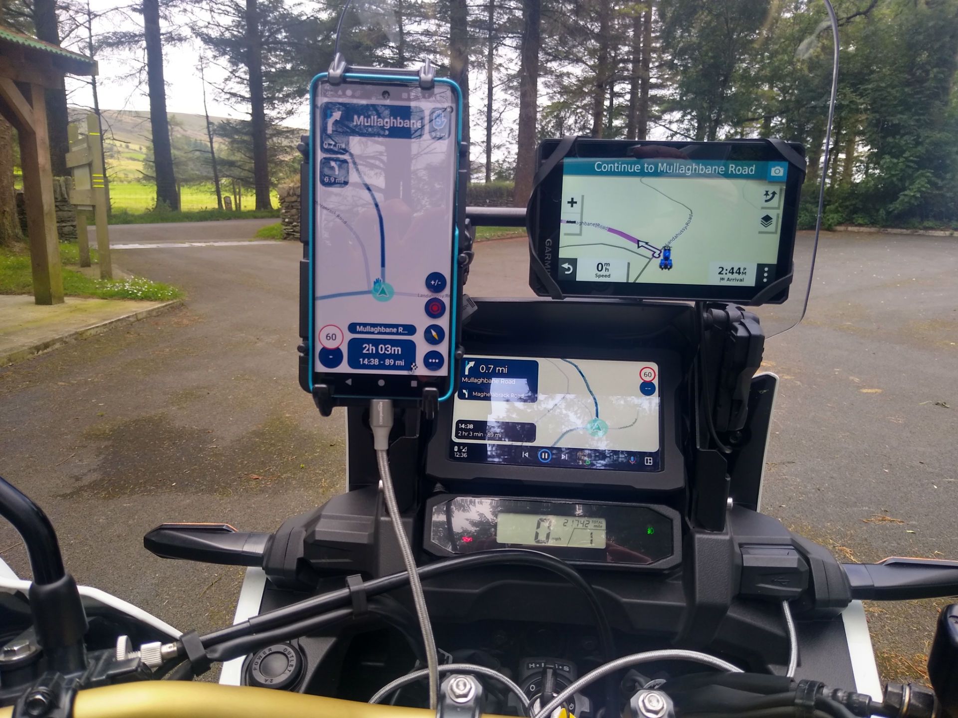
@paul69 I am thinking of going down the route of using MRA for navigation as well as route planning. Sometimes the testing gets a bit ridiculous.
-
@paul69 I am thinking of going down the route of using MRA for navigation as well as route planning. Sometimes the testing gets a bit ridiculous.

-
@paul69 I don't use explore so the XT reverts to the old Garmin method of displaying a track by ticking it in the menu. The Drive app works fine without explore being installed on your phone or linked to your XT unit.
![04524e83-328d-485e-89f2-0d7231c0ff0c-7452[1].png](/assets/uploads/files/1724530710144-04524e83-328d-485e-89f2-0d7231c0ff0c-7452-1.png)
You obviously have to manually untick the track when you have finished using it.
@Mzokk
this is what i have been trying to explain to people, you do not get this option with explore activated.replied to this a bit late, but never mind
for those looking in, this refers to 3 posts above this one
-
hi @Mike-wiruth
just found this which was written by the font of knowledge on the zumo forum explaining how to get rid of explore.
https://www.zumouserforums.co.uk/app.php/ZXT-P56
this is also has an effect on viewing the routes/tracks in the XT menus, but thankfully i do not have to put up with the nuances of the XT any longer thanks to MRA
@paul69 Paul, thanks very much. I went to the link and followed the instructions and got rid of explore on my xt. I also signed up for the zumo forum. This should be a great place to get more zumo related answers. Thanks again for your help.
-
@Mike-wiruth the method I use to transfer routes and navigate using the XT are as follows.
I usually plot my routes on the computer screen (unless I'm on tour) as its easier to work with a 27" screen that a phone. I transfer my routes from the phone to the XT via the App.


This is not an ideal route but will illustrate some issues that can arise with the XT

I download using GPX1.1 because this shows how you shaped the route using MRA and allows you to fix a route that does not go where you want on the XT. I also download the track of the route which will be as planned in MRA.


Route Received
![c7acc4d1-fc0d-43dc-ab25-19170a267ed7-17707[1].png](/assets/uploads/files/1724509876255-c7acc4d1-fc0d-43dc-ab25-19170a267ed7-17707-1.png)
Track Received
![e4f6a43b-a21c-4d68-826f-a95d84e17ce2-17294[2].png](/assets/uploads/files/1724509970280-e4f6a43b-a21c-4d68-826f-a95d84e17ce2-17294-2.png)
![3fc9385f-e0f3-468a-b15c-2c9dadf17506-20128[1].png](/assets/uploads/files/1724510168363-3fc9385f-e0f3-468a-b15c-2c9dadf17506-20128-1.png)
Open Trip planner route will be in list.

Track is in list.

Open Route (Address near my house removed)

Open Track Default is blue but I change the colour to yellow.
![ba1b8f79-1756-4191-a27d-aca5296c87b1-31106[1].png](/assets/uploads/files/1724510507396-ba1b8f79-1756-4191-a27d-aca5296c87b1-31106-1.png)
Open the route and Track and make the track visible on the XT
![401edf8a-d088-40ed-b251-c9b2aa2188cc-36293[1].png](/assets/uploads/files/1724510639932-401edf8a-d088-40ed-b251-c9b2aa2188cc-36293-1.png)
You can see that I wanted to go along the coast but the XT's routing logic is taking me back to a town and then back to the intended route as designed. This can be fixed by putting in an extra shaping point in the XT.
![1f227e02-3dfa-4225-80c1-d45a27ea51ea-40542[1].png](/assets/uploads/files/1724510785674-1f227e02-3dfa-4225-80c1-d45a27ea51ea-40542-1.png)

Or by ensuring there are enough waypoints in the route you designed in MRA.
I created a bespoke map theme for my XT that makes the Track line thicker and this can be seen below the route line even when navigating. It gives a heads up if the XT is going away from your intended route. I keep recalculate on the unit as "Prompted" and only use recalculate if I can't navigate back to my intended route using the screen.@Mzokk So how do you display both the track and the route? I checked my xt and went to trip planner and opened up the trip I designed. Then what do you do? Go back and open the track too? When I downloaded it I chose gpx 1.2 route, track, poi
-
@Mike-wiruth the method I use to transfer routes and navigate using the XT are as follows.
I usually plot my routes on the computer screen (unless I'm on tour) as its easier to work with a 27" screen that a phone. I transfer my routes from the phone to the XT via the App.


This is not an ideal route but will illustrate some issues that can arise with the XT

I download using GPX1.1 because this shows how you shaped the route using MRA and allows you to fix a route that does not go where you want on the XT. I also download the track of the route which will be as planned in MRA.


Route Received
![c7acc4d1-fc0d-43dc-ab25-19170a267ed7-17707[1].png](/assets/uploads/files/1724509876255-c7acc4d1-fc0d-43dc-ab25-19170a267ed7-17707-1.png)
Track Received
![e4f6a43b-a21c-4d68-826f-a95d84e17ce2-17294[2].png](/assets/uploads/files/1724509970280-e4f6a43b-a21c-4d68-826f-a95d84e17ce2-17294-2.png)
![3fc9385f-e0f3-468a-b15c-2c9dadf17506-20128[1].png](/assets/uploads/files/1724510168363-3fc9385f-e0f3-468a-b15c-2c9dadf17506-20128-1.png)
Open Trip planner route will be in list.

Track is in list.

Open Route (Address near my house removed)

Open Track Default is blue but I change the colour to yellow.
![ba1b8f79-1756-4191-a27d-aca5296c87b1-31106[1].png](/assets/uploads/files/1724510507396-ba1b8f79-1756-4191-a27d-aca5296c87b1-31106-1.png)
Open the route and Track and make the track visible on the XT
![401edf8a-d088-40ed-b251-c9b2aa2188cc-36293[1].png](/assets/uploads/files/1724510639932-401edf8a-d088-40ed-b251-c9b2aa2188cc-36293-1.png)
You can see that I wanted to go along the coast but the XT's routing logic is taking me back to a town and then back to the intended route as designed. This can be fixed by putting in an extra shaping point in the XT.
![1f227e02-3dfa-4225-80c1-d45a27ea51ea-40542[1].png](/assets/uploads/files/1724510785674-1f227e02-3dfa-4225-80c1-d45a27ea51ea-40542-1.png)

Or by ensuring there are enough waypoints in the route you designed in MRA.
I created a bespoke map theme for my XT that makes the Track line thicker and this can be seen below the route line even when navigating. It gives a heads up if the XT is going away from your intended route. I keep recalculate on the unit as "Prompted" and only use recalculate if I can't navigate back to my intended route using the screen.@Mzokk Also where in settings do you change the color of routes and tracks? Also, how did you get those great screen shots of your xt screen? Thanks for all your hard work of posting this reply. Great work. I was a great help. You might regret it though, I'm a learner, always wanting to learn more and I might burden you with questions. LOL
-
@Mzokk Also where in settings do you change the color of routes and tracks? Also, how did you get those great screen shots of your xt screen? Thanks for all your hard work of posting this reply. Great work. I was a great help. You might regret it though, I'm a learner, always wanting to learn more and I might burden you with questions. LOL
@Mike-wiruth of you got rid of explore in your XT in the settings you can choose to display any track and choose the with and color.
They are display under your route so is you go of route it's instantly visible -
@Mike-wiruth of you got rid of explore in your XT in the settings you can choose to display any track and choose the with and color.
They are display under your route so is you go of route it's instantly visible@Marinus-van-Deudekom How do you do it? I can't seem to open them both up at the same time. Also, need to know where to go to change the color of the track. Thanks for any help you can give me.
-
@Marinus-van-Deudekom How do you do it? I can't seem to open them both up at the same time. Also, need to know where to go to change the color of the track. Thanks for any help you can give me.
@Mike-wiruth Hi Mike if you go into tracks this is the sequence.
![19366[1].png](/assets/uploads/files/1724593449518-19366-1.png)
Open Tracks
![20875[1].png](/assets/uploads/files/1724593535281-20875-1.png)
Click on the spanner to show the track on the map. This stays on until you unclick it even if you are not navigating.
![24913[1].png](/assets/uploads/files/1724593726417-24913-1.png)
To change colour and width of the track you click on the spanner and scroll to the menu Item![21880[1].png](/assets/uploads/files/1724593848656-21880-1.png)
![22384[2].png](/assets/uploads/files/1724594138125-22384-2.png)
![23694[1].png](/assets/uploads/files/1724594271522-23694-1.png)
So you can set up the track of the route you intend to run at any time and the track will stay until you untick it.

