Navigating a track
-
I am going next week to countries where the Here map does not work properly a.o. Iran. I also want to drive some dirt roads in Armenia.
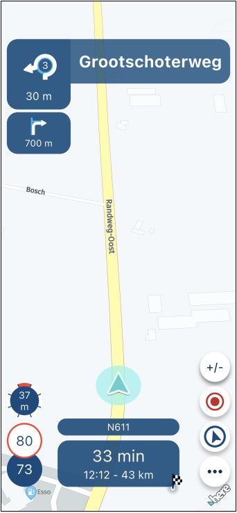
It is clear that Here does not have good maps for Iran. I have planned the route with the OSM maps and OSM route calculations. Now I don't feel like using an other navigation app. I am used to the MRA app. My idea was to write out the route as a GPX 1.2 file and then start driving the track in the MRA app. Now I drove a GPX track with the MRA app last week, but really got the impression that the app doesn't follow the track, but rather keeps the roads (from the Here map) as close to the track as possible. So that's not going to work for me in Iran and offroad in other countries aswell. Am I doing something wrong, does a setting need to be changed? How do I make the MRA navigation app really follow the track and not nearby roads. -
I am going next week to countries where the Here map does not work properly a.o. Iran. I also want to drive some dirt roads in Armenia.
It is clear that Here does not have good maps for Iran. I have planned the route with the OSM maps and OSM route calculations. Now I don't feel like using an other navigation app. I am used to the MRA app. My idea was to write out the route as a GPX 1.2 file and then start driving the track in the MRA app. Now I drove a GPX track with the MRA app last week, but really got the impression that the app doesn't follow the track, but rather keeps the roads (from the Here map) as close to the track as possible. So that's not going to work for me in Iran and offroad in other countries aswell. Am I doing something wrong, does a setting need to be changed? How do I make the MRA navigation app really follow the track and not nearby roads.@C-A-Kielen may other high professionals will have better explanation. But let me try for an answer:
At first: if you have planned a route at MRA-Rputeplanner, it's not necessary to export it as gpx file - and import it in MyRoute-App afterwards for navigation. In MyRoute-App, you can switch on auto sync of all. Then routes and tracks are on both, simultaneously!
At second: if you open a synced route (or open an imported gpx file) you can select in MyRoute-App, to navigate this route as a track.
BUT, to do the navigation, MyRoute-App is using always HERE map! Independent if you have planned this route in MRA-Routeplanner by another map. That's the issue you have seen.The point is: both - HERE map and MRA-Routplanner are not (yet) designed to operate offroad routes.
My suggestion: do it as it is usually of offroad riding; plan it by OpenStreetMap, and open it in MyRoute-App on the bike, only to view it (don't start navigation). Then follow the line and compare by yourself, if you are riding still the same path in reality, as the line on the screen determines.Nothing is impossible ;-)
In past: GARMIN Zumo 210->GARMIN Zumo 395->GARMIN XT=> now: DMD T865-X + MyRoute-App, LocusMaps, OsmAnd.
In past: GARMIN MapSource ->GARMIN BaseCamp->Tyre->Kurviger->Calimoto=> now: MRA-Routplanner. -
@C-A-Kielen may other high professionals will have better explanation. But let me try for an answer:
At first: if you have planned a route at MRA-Rputeplanner, it's not necessary to export it as gpx file - and import it in MyRoute-App afterwards for navigation. In MyRoute-App, you can switch on auto sync of all. Then routes and tracks are on both, simultaneously!
At second: if you open a synced route (or open an imported gpx file) you can select in MyRoute-App, to navigate this route as a track.
BUT, to do the navigation, MyRoute-App is using always HERE map! Independent if you have planned this route in MRA-Routeplanner by another map. That's the issue you have seen.The point is: both - HERE map and MRA-Routplanner are not (yet) designed to operate offroad routes.
My suggestion: do it as it is usually of offroad riding; plan it by OpenStreetMap, and open it in MyRoute-App on the bike, only to view it (don't start navigation). Then follow the line and compare by yourself, if you are riding still the same path in reality, as the line on the screen determines.I also hope to see true track navigation at some point, when navigating as track. My scenario is a different one but has the same problem. I drive a bus and drive sometimes on roads which are closed for normal cars. HERE sends me around these roads, which is confusing especially when recalculation is disabled. Marking points as off-road/skip doesn't help.
-
@C-A-Kielen may other high professionals will have better explanation. But let me try for an answer:
At first: if you have planned a route at MRA-Rputeplanner, it's not necessary to export it as gpx file - and import it in MyRoute-App afterwards for navigation. In MyRoute-App, you can switch on auto sync of all. Then routes and tracks are on both, simultaneously!
At second: if you open a synced route (or open an imported gpx file) you can select in MyRoute-App, to navigate this route as a track.
BUT, to do the navigation, MyRoute-App is using always HERE map! Independent if you have planned this route in MRA-Routeplanner by another map. That's the issue you have seen.The point is: both - HERE map and MRA-Routplanner are not (yet) designed to operate offroad routes.
My suggestion: do it as it is usually of offroad riding; plan it by OpenStreetMap, and open it in MyRoute-App on the bike, only to view it (don't start navigation). Then follow the line and compare by yourself, if you are riding still the same path in reality, as the line on the screen determines.@Guzzist said in Navigating a track:
BUT, to do the navigation, MyRoute-App is using always HERE map! Independent if you have planned this route in MRA-Routeplanner by another map. That's the issue you have seen.
So yes, that is the problem, and if I understand you correctly, there is no solution for that within the MRA navigation have. I'm going to try your suggestion: Open the track, but not start navigating. Then follow the line on the screen myself. That won't make it any easier unfortunately.
-
@Guzzist said in Navigating a track:
BUT, to do the navigation, MyRoute-App is using always HERE map! Independent if you have planned this route in MRA-Routeplanner by another map. That's the issue you have seen.
So yes, that is the problem, and if I understand you correctly, there is no solution for that within the MRA navigation have. I'm going to try your suggestion: Open the track, but not start navigating. Then follow the line on the screen myself. That won't make it any easier unfortunately.
@C-A-Kielen if you change the travel mode to by foot or by bicycle then you can open the route/track an then tap the compass to follow the route.
2010 GL1800 Goldwing using Samsung Galaxy S20 5G Android 13.
-
@Guzzist said in Navigating a track:
BUT, to do the navigation, MyRoute-App is using always HERE map! Independent if you have planned this route in MRA-Routeplanner by another map. That's the issue you have seen.
So yes, that is the problem, and if I understand you correctly, there is no solution for that within the MRA navigation have. I'm going to try your suggestion: Open the track, but not start navigating. Then follow the line on the screen myself. That won't make it any easier unfortunately.
@C-A-Kielen said in Navigating a track:
@Guzzist said in Navigating a track:
BUT, to do the navigation, MyRoute-App is using always HERE map! Independent if you have planned this route in MRA-Routeplanner by another map. That's the issue you have seen.
So yes, that is the problem, and if I understand you correctly, there is no solution for that within the MRA navigation have. I'm going to try your suggestion: Open the track, but not start navigating. Then follow the line on the screen myself. That won't make it any easier unfortunately.
try it - it only sounds more complicated as it is. It's most common for all offroad riders. You only need a little practice to get used to it.
Nothing is impossible ;-)
In past: GARMIN Zumo 210->GARMIN Zumo 395->GARMIN XT=> now: DMD T865-X + MyRoute-App, LocusMaps, OsmAnd.
In past: GARMIN MapSource ->GARMIN BaseCamp->Tyre->Kurviger->Calimoto=> now: MRA-Routplanner. -
@C-A-Kielen said in Navigating a track:
@Guzzist said in Navigating a track:
BUT, to do the navigation, MyRoute-App is using always HERE map! Independent if you have planned this route in MRA-Routeplanner by another map. That's the issue you have seen.
So yes, that is the problem, and if I understand you correctly, there is no solution for that within the MRA navigation have. I'm going to try your suggestion: Open the track, but not start navigating. Then follow the line on the screen myself. That won't make it any easier unfortunately.
try it - it only sounds more complicated as it is. It's most common for all offroad riders. You only need a little practice to get used to it.
@Guzzist Iast week I tryed a route and a track. It worked suprisingly good. Only you lost al your information from your waypoints.
But this could be a good workaround. -
@C-A-Kielen if you change the travel mode to by foot or by bicycle then you can open the route/track an then tap the compass to follow the route.
@RetiredWingMan that is an interesting option. For now: my bike and I are on the train to Turkey. For sure I will try this option there
-
I am going next week to countries where the Here map does not work properly a.o. Iran. I also want to drive some dirt roads in Armenia.
It is clear that Here does not have good maps for Iran. I have planned the route with the OSM maps and OSM route calculations. Now I don't feel like using an other navigation app. I am used to the MRA app. My idea was to write out the route as a GPX 1.2 file and then start driving the track in the MRA app. Now I drove a GPX track with the MRA app last week, but really got the impression that the app doesn't follow the track, but rather keeps the roads (from the Here map) as close to the track as possible. So that's not going to work for me in Iran and offroad in other countries aswell. Am I doing something wrong, does a setting need to be changed? How do I make the MRA navigation app really follow the track and not nearby roads. -
@Rob-Veerman Ik heb het al jaren op de telefoon, maar nog ooit gebruikt. Ga ik ook zeker proberen. Dank voor de tip.
Hello! It looks like you're interested in this conversation, but you don't have an account yet.
Getting fed up of having to scroll through the same posts each visit? When you register for an account, you'll always come back to exactly where you were before, and choose to be notified of new replies (either via email, or push notification). You'll also be able to save bookmarks and upvote posts to show your appreciation to other community members.
With your input, this post could be even better 💗
Register Login-
010155
-
0393
-
316585
-
09258
-
015348
-
05250
-
0149
-
12205.1k