Route closed but accessible anyway
-
Hi,
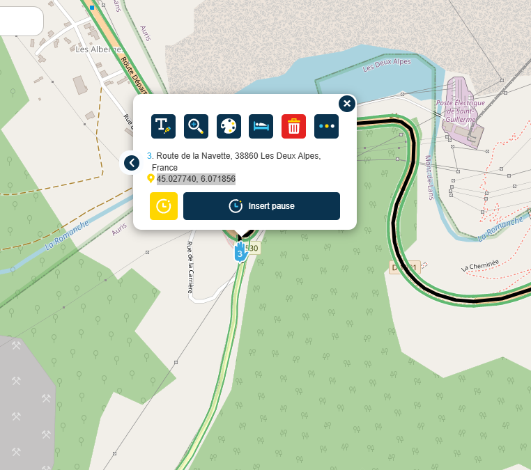
It would be very useful to have a message when you position a waypoint on a closed road. Example: the village of La Berarde in France has been inaccessible for several months from point 45.027740, 6.071856. If I want to go there by putting an arrival point in this village, nothing tells me that it is inaccessible. -
Hi,
It would be very useful to have a message when you position a waypoint on a closed road. Example: the village of La Berarde in France has been inaccessible for several months from point 45.027740, 6.071856. If I want to go there by putting an arrival point in this village, nothing tells me that it is inaccessible.@Pascal-Balmey
When I use your coordinates I can only see that Google shows a road closure on the D530 Until 16:00hrs.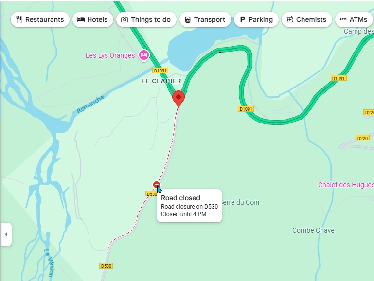
The HERE map from MRA with traffic layer turned on and the TomTom route planner do not show a closed road.
TomTom route planner:
Always willing to help if I can.
Triumph Tiger 1200 XRT called Tina.
MRA Navigation Next and SilverFox BJ8 -
@Pascal-Balmey
When I use your coordinates I can only see that Google shows a road closure on the D530 Until 16:00hrs.The HERE map from MRA with traffic layer turned on and the TomTom route planner do not show a closed road.
TomTom route planner:
@Nick-Carthew Thank you Nick
I will check on Googlemaps tomorrow as it is 16:26hrs.
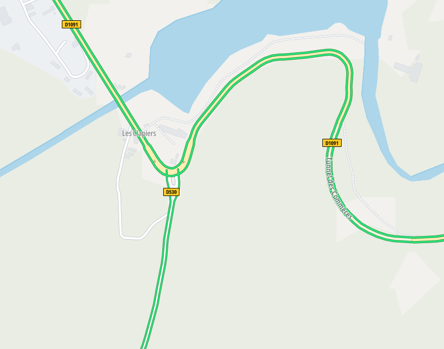
Anyway, as an example, what i see with Kurvinger using OpenStreetMap is very useful.
 image url)
Hello! It looks like you're interested in this conversation, but you don't have an account yet.
Getting fed up of having to scroll through the same posts each visit? When you register for an account, you'll always come back to exactly where you were before, and choose to be notified of new replies (either via email, or push notification). You'll also be able to save bookmarks and upvote posts to show your appreciation to other community members.
With your input, this post could be even better 💗
Register Login-
014197
-
0606.5k
-
1906.2k
-
0540
-
011185
-
024740
-
0356
-
255613.0k